
|
|
Mountain/Rock |
|---|---|
|
|
37.98980°N / 119.2235°W |
|
|
Mono |
|
|
Hiking |
|
|
Summer, Fall |
|
|
12327 ft / 3757 m |
|
|
Overview

Mount Warren rises high above Mono Lake and stands as the gatekeeper to the eastern edge of Yosemite National Park. The mountain itself is located to the east of the YNP boundary. Instead, Mount Warren is considered part of the Hoover Wilderness in the Inyo National Forest. It is just north of Hwy 120, west of Lee Vining, and east of Tioga Pass.
At this time there is no day hiking quota for the Hoover Wilderness for trailhead hiking on any designated trail, including Mount Warren. Despite that fact, Mount Warren isn't necessarily that popular a mountain because it does not have a dedicated summit trail. Therefore, a visit to the summit isn't typically a crowded affair.
Nevertheless, Mount Warren is not a technical hike unless you want to visit the area in the winter. From November through June the area is usually snow-covered and is only accessible by snowshoe or cross-country skis. There are no snowmobiles allowed.
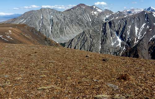
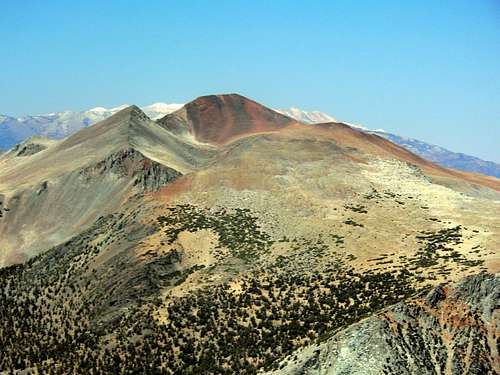
Mount Warren ranks at #162 on the California top prominence peaks with 2,007' of prominence. Via the shortest route from Highway 120, there is a trail only about ¼ of the way to the summit and then it is a Class 2 scramble from there. A hike from Lundy Canyon has a longer approach trail, but eventually leaves the large majority of the hike to route-finding and a Class 2 scramble.
It is easy to combine Mount Warren with nearby Warren Fin 12,177'. Although Warren Fin only has a prominence of about 200'.
Appreciation is owed to Dennis Poulin who created this page, and who passed away in 2018.
Getting There

There are a two primary routes to the summit of Mount Warren, along with other options. This page will focus on the two primary routes.
The primary route is the Warren Fork trailhead located next to Highway 120/Tioga Pass Road. The area is located east of Yosemite National Park and west of Hwy 395 at Lee Vining. 1.4 miles east of Ellery Dam there is a big “U” shaped turn in the highway at an elevation of about 9,000 ft. This is where the trailhead is located. There is parking on the south side of the road. The trail starts on the north side of the road. Be careful parking and re-entering the highway because it is kind of a blind turn getting back on the highway.
The secondary route is via the Lake Canyon Trail from the north. It is a bit longer of a hike, but still a day hike, and it can be done as a loop, albeit almost completely off-trail on the descent. The Lake Canyon Trail is accessed via Lundy Canyon. The turn off from 395 is 7 miles north of Lee Vining. See the route page for the Lake Canyon Trail for more details.
Mount Warren and nearby Lee Vining Peak 11,690' can be approached from the Log Cabin Wilderness Camp, which can be reached from a dirt road on the right about a mile up Highway 120 that leads up into the forest to the Camp.
Red Tape

Camping overnight in the Hoover Wilderness requires an overnight backpacking permit which can be picked up at the Mono Basin Scenic Area Visitor Center. Also, check with the Ranger Station for the use of bear canisters in the wilderness. Dogs must be under control at all times and pack goats are prohibited in the Hoover Wilderness.
Mono Basin Scenic Area Visitor Center
P.O. Box 429 (North of Lee Vining on Hwy 395)
Lee Vining, CA 93541
(760) 647-3044 or TDD (760) 647-3045
Camping

There are lots of camping areas within a few miles of either trailhead.
Highway 120 is lined with campgrounds from Lee Vining to YNP. Some people car camp in the large parking area on the south side of Highway 120 at the trailhead. Many of these campgrounds are closed in the winter, so call ahead to the Forest Service to find out about access in the winter or see this link for campground status.
There are several walk-in tent camping spots within a few hundred yards of the trailhead near Warren Fork, which would be open on a first come, first served basis. They are located along the trail between Highway 120 and the Hoover Wilderness Boundary.
For those hiking from Lundy Lake, there is the Lundy Lake Campground: https://www.monocounty.org/listing/lundy-lake-resort/730/
Once off the trail there are plenty of places to camp, particularly higher on the trail from Lundy Lake.
Mountain Conditions
The mountain is not accessible in the winter and spring unless you are in to winter sports (ski/snowshoe). During the mid-summer and fall, the area is subject to thunderstorms, so be mindful of the weather forecast. Review fire conditions before visiting to determine if there will be smoke in the area. While there are rarely fires in this part of the Sierra Nevada, fires in other parts of California can make hiking unbearable.
The closest town is Lee Vining, California.