
-
 13698 Hits
-
 81.84% Score
-
 14 Votes
|
|
Mountain/Rock |
|---|---|
|
|
48.90606°N / 113.67367°W |
|
|
Glacier |
|
|
Hiking, Mountaineering, Scrambling |
|
|
Summer, Fall |
|
|
9262 ft / 2823 m |
|
|
Overview
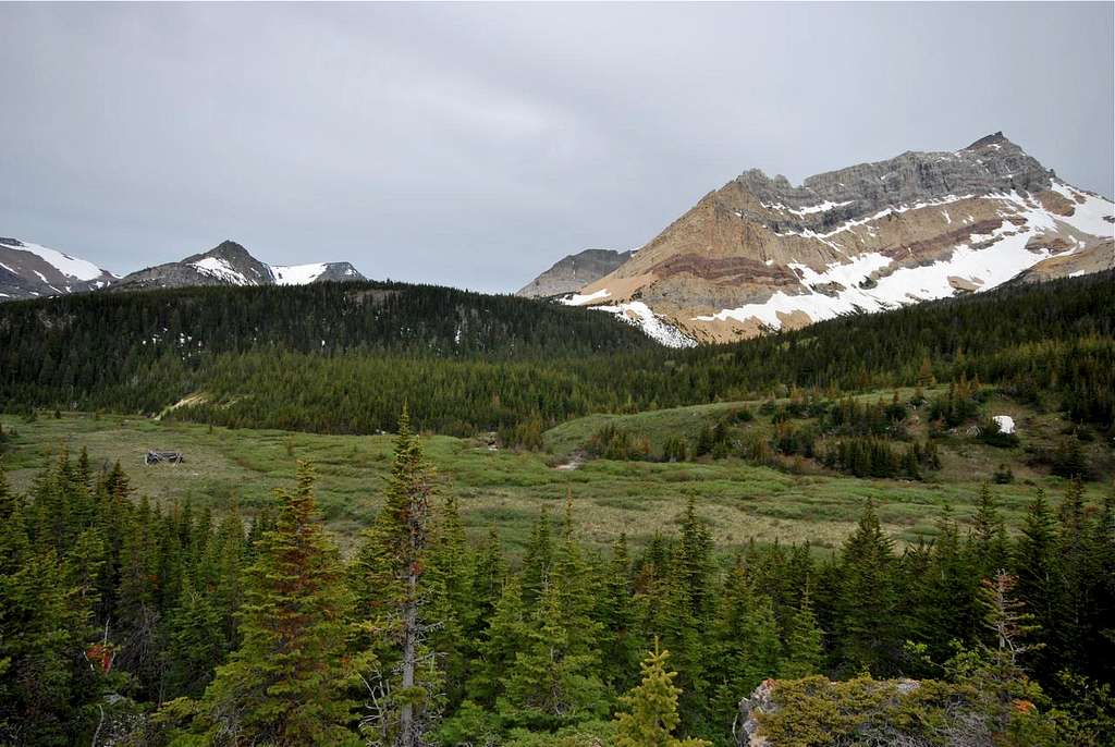
To the east, famed Chief Mountain rises behind the saddle at Gable Pass. Although it is over 100 feet taller, Gable Mountain sees essentially no traffic in comparison to its culturally and aesthetically prominent neighbor. Chief holds a special place in the Blackfeet tradition, and with relatively easy and well-documented access from several directions, makes for a straightforward, albeit long, day climb for most parties. Gable is an entirely different story. Access is much more difficult, due to formidable cliffs and rotten rock that encircle the mountain. The easiest route is from beautiful Slide Lake , and it involves a little bit of everything: creek crossings, talus fields, massive waterfalls, extensive bushwhacking, a maze of game trails and mixed class II/III climbing on loose rock. Reaching the top is not easy, but those who do will be rewarded with an incredible summit view that is likely experienced by only a handful of folks every year.
Getting There
Gable Mountain from Lee Ridge. The sharp summit is visible at center.
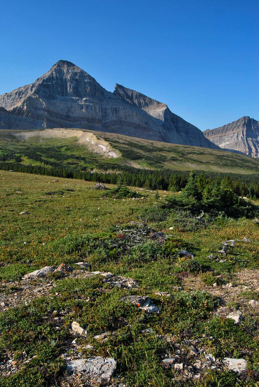
1) Lee Ridge Trail - Trailhead is located approximately 1/2 mile south of the international border crossing on Chief Mountain Highway (MT 17). Look closely for an orange blaze and a brown NPS sign denoting the start. There is no parking at the trailhead, but there are a few pullouts within 1/2 mile of the trailhead with enough space for a car or two. Otherwise, one can utilize the very large parking area at Chief Mountain Customs. The trail spends the first three miles in a lush old growth forest before emerging on top of the windswept open slopes of spectacular Lee Ridge. Follow cairns and climb over Gable Pass, where a steep trail descends to Slide Lake. This is an absolutely incredible hike with sweeping views and solitude. It's approximately 8.5 miles from the Lee Ridge Trailhead to Slide Lake Campground. 2,200 feet of elevation is gained over 6+ miles to Gable Pass, with 1,400 feet of elevation lost over 2.5 miles to Slide Lake.
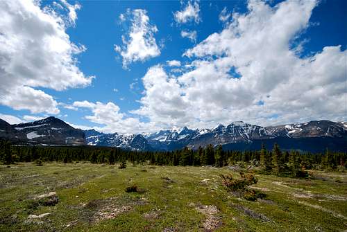
Incredible views to the west from the upper portion of the Lee Ridge Trail. Mount Cleveland, tallest peak in all of Glacier National Park, is visible at center.
2) Blackfeet Reservation Road - A short trail leads 1.4 miles to Slide Lake from the park boundary adjacent to the Blackfeet Indian Reservation. The trail passes the historic Slide Lake-Otatso Creek Patrol Cabin along the way. The gravel reservation road is reported to be horribly washed out and challenging for even four-wheel drive high clearance automobiles. I have no personal experience with this road; please inquire locally at the Many Glacier Ranger Station for more information. The following information is taking directly from the NPS's trail status report page for Glacier:
NOTE - A $10.00 Blackfeet Tribal Conservation Permit is required by each person(regardless of age) to cross reservation land. All hikers or riders using this road to access Slide Lake cross the reservation. Author's note: Permits can be obtained at Duck Lake Lodge, East Glacier Park, and Browning.
VEHICLES NOT RECOMMENDED. The normal entry to the Slide Lake area is by way of an unmarked road across Blackfeet Indian Nation land. Road into boundary is very muddy, rutted and rocky, and there is significant damage due to flooding. Also, the road is used heavily by cattle.
The road is not marked by a sign and is reached by leaving US Hwy #89 at Chief Mtn Jct. and going 4.3 miles on the Chief Mtn. Hwy (Route #17). Look for a dirt road heading west/southwest and skirting just south of Chief Mtn. If hikers are unsure about locating the road, tell them to look for Chief Mtn. overlook, which is a signed pullout 0.3 miles northwest of the Slide Lake road at a point 4.5 mi. from Chief Mtn. Jct. This overlook is known locally as Crusher Hill. The distance from the Chief Mtn. Highway (paved) going west on the Slide Lake Road (dirt road) to the trailhead at the Park Boundary is approximately 6.0 miles. We do not recommend driving this road as it is extremely rutted and in poor condition. There is one major fork in the road a couple miles in, the left fork that leads down towards Otatso Creek is the way to Slide.
Route
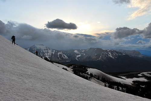
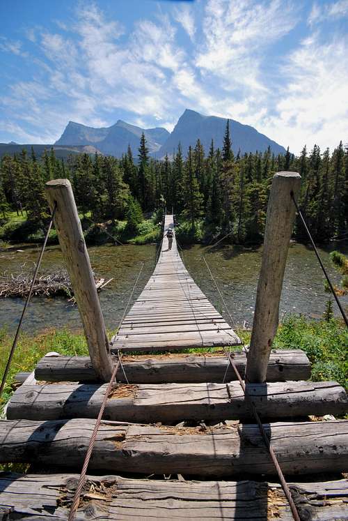
This route starts from the backcountry site at Slide Lake. I should note that I do not have many photos that help illustrate the route. Our summit day was very long and arduous, and my camera spent more time packed away than usual. I will attempt to make up for the lack of photos with a detailed route description and some topographic maps. Also, even with a base camp at Slide Lake, climbing Gable Mountain is a very long outing. Our group took about 11 hours round-trip from the backcountry site. Plan for an early start!
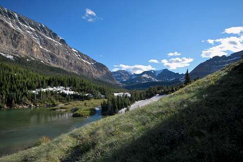
Follow a well-worn trail along the north shore of Slide Lake all the way to the inlet of Otatso Creek. The creek is shallow and mellow at this point (it was no more than 2 feet deep in June 2012), so look for an easy place to cross to the opposite bank. Follow the creek west until a broad meadow is encountered. An old mining cabin (marked "Runis" on the Nat Geo Many Glacier topo map) located in the middle of the meadow is definitely worth a stop. From my research, it appears that the area around Otatso Creek was mined extensively by a man named John Van Pelt sometime in the late 1800's/early 1900's (1). Until recently, an open mine shaft could be found less than a mile west of the ruins just north of the unnamed creek that drains from Seward Mountain. However, the NPS opted to close the shaft in 2010 due to safety concerns.
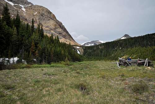
 Van Pelt mining cabin ruins in the beautiful meadow west of Slide Lake. Gable Mountain is on the right.
A massive waterfall on Otatso Creek is clearly visible just to the southwest of the cabin. The route detours up and around the falls to the south. Simply follow the meadow toward the falls, and pick a spot to head uphill into the broken forest. After a short bushwhack, a large talus field is encountered in the area above the falls. In June 2012, there was a large, steep snowfield that ran out towards the waterfall. Please note that at the very least, an ice axe should be utilized here in the event of a fall. After crossing above the falls, one simply needs to traverse above Otatso Creek across talus fields and grassy slopes. Ultimately, Otatso Creek will have to be crossed, and there are multiple places to do so. Descend to the creek and try to identify a place where a safe crossing can be made. Shoes and socks will almost certainly have to be removed for what should be a very brief ford.
|
|
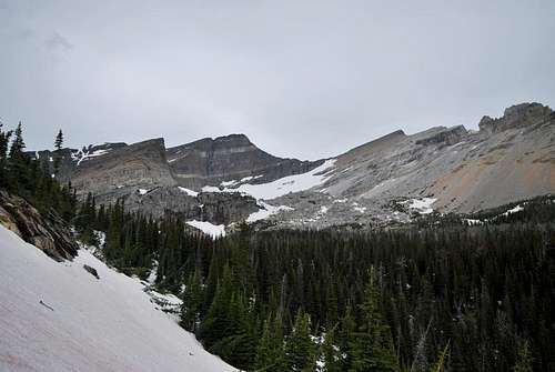
The summit is just left of center atop the rock face with two distinct light bands. Aim for the pointed ridgetop below and to the left. The remainder of the route becomes obvious from there.
Sean Doyle (ManyGlacierMountaineer), a trusted hiking companion of mine, stayed well north of Otatso Creek on his descent in July 2010. He reports that his group traversed the massive boulder field that spills south of Gable's summit, and from there an "elk super highway" provided easy access back to the meadows west of Slide Lake. From what I understand, this route did not involving fording Otatso Creek on their return trip. I have no experience with this route, but it would be much shorter than the route on the south side of Otatso Creek.
Summit Views
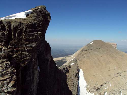
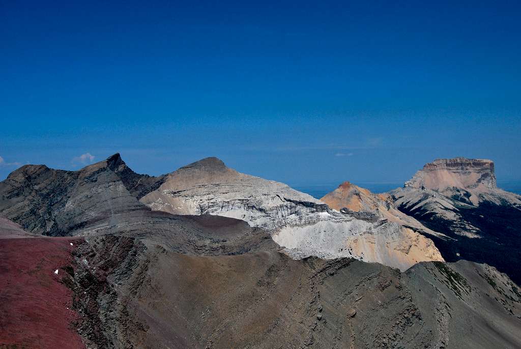
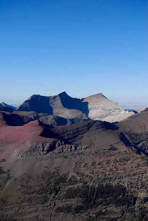
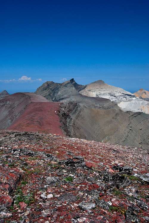
Perhaps my favorite aspect of the grand view from the top of Gable Mountain is down into the wild Otatso Lake area immediately to the south. A series of serene tarns are perched on a broad bench beneath a sheer cliff face, making for a spectacular scene. The slightly overhanging summit and gigantic boulder field directly below give one an up-close-and-personal look at how the terrain of Glacier National Park is always changing. To the north, the wonderful Belly River snakes its way towards Alberta, Canada. Mount Merritt and Mount Cleveland are visible to the west, and on a clear day the Sweet Grass Hills, anomalies rising high above the Great Plains, are visible nearly 100 miles to the east.
When to Climb
Due to extreme winters along the Continental Divide, problematic snow can linger on trails and mountain slopes well into July and August. Hence, the climbing season in Glacier is rather short, and often begins in June and can last into October, weather permitting. However, some lower peaks and southern facing slopes can be safely attempted much earlier in the season. Your best bet is to inquire locally about snowpack and weather conditions. I use the NOAA for detailed weather forecasts for the greater Glacier area; check out the website here.
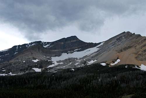
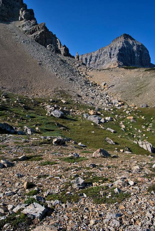
On June 16, 2012, ice axes were essential items. Steep snow can linger at Gable Pass well into July; check the NPS trail status report page or inquire locally at St. Mary or Many Glacier for conditions. The route to Gable Mountain may also involve a steep snow crossing while detouring around the large waterfall on Otatso Creek. Definitely not a spot where you would want to take a tumble, especially when considering the remoteness of the area. Help is a LONG ways away back in this neck of the woods. Lots of snow was encountered in the forest along Otatso Creek as we approached the mountain, but it was very hard packed and actually made the bushwhacking quite a bit easier.
 Gable Pass, June
Where to Stay
Near the Slide Lake backcountry campsite
Car camping can be found in the park at Many Glacier and St. Mary, and there are a variety of campgrounds, cabins, and motels on the Blackfeet Reservation off US-89 around Babb and St. Mary.
Red Tape, Safety, Wildlife, etc.
Entrance Fees
A fee is required for all persons entering Glacier National Park. As of April 2020, single vehicle rates are $35 for a seven day pass, or $25 in the winter. Glacier National Parks’ annual pass is $70 and provides valid entry for the purchaser and private vehicle passengers for one year. Lower entrance fees are charged for motorcycles, bicyclists, and hikers; please visit the NPS website for a full explanation of entrance fees: NPS fees webpage
Seasonal Closures
Glacier is subject to extreme winter weather conditions, and as such, much of the park is virtually inaccessible for the majority of the year. The Going-to-the-Sun Road is typically open in its entirety from mid-June to mid-September, and many of the developed areas of the park (including the historic lodges and most of the campgrounds) operate for a short window as well. Information on the operational status of front country campgrounds and park roads can be found by clicking on the hyperlinks.
Glacier Rock Grading
Due to the sedimentary nature of the rock in Glacier National Park, unique rock grading systems have been established by both Gordon Edwards and the Glacier Mountaineering Society. Please refer to the Glacier National Park Rock & Grading Systems Summitpost page (authored by Fred Spicker and Saintgrizzly) or the website of the Glacier Mountaineering Society for detailed information. If you are new to climbing in Glacier, I highly recommend checking out this info before attempting any climbs in the park. Oh, and don't forget to wear your climbing helmet!A Climber's Guide to Glacier National Park
Pick up a copy of Gordon Edwards' classic A Climber's Guide to Glacier National Park. It's an absolute must for anyone who wants to safely venture to one of the park's many accessible mountain summits. Edwards spent many years as a seasonal ranger in Glacier, where he developed a deep passion for exploring the park's mountains and sharing its splendors with others. The book provides a fantastic history of climbing in Glacier, and his detailed and colorful route descriptions are a fantastic introduction to off-trail hiking and climbing in the park.
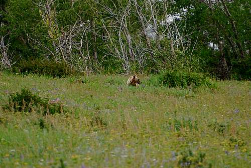
The park is home to lots of potentially dangerous wildlife, including moose, black bear, grizzly bear, and mountain lion. Hike loud, carry bear deterrent spray (and know how to use it!), check local trail postings (for area warnings/closures) and let someone know your itinerary before heading out into the park. Also, note that special precautions are in place in all front and back country campgrounds to limit human-bear encounters. Regulations are posted everywhere (picnic tables, ranger stations, bathrooms) and it is every visitor's responsibility to take them seriously. Remember, a FED BEAR IS A DEAD BEAR! Please visit the NPS camping webpage for more detailed information.
References
(1) Bucholtz, C.W. (1976). Man in Glacier. Bozeman, Montana: Artcraft Printers.
Special Thanks
Kudos to Chris Dickson and Summitpost member Brooks McClintock (brooksmcclintock) for an amazing two days spent exploring the wonderful Slide Lake/Gable Mountain area. Thanks to Summitpost member Sean Doyle (ManyGlacierMountaineer) for providing me with photos and route information that helped round out the page.Parting Shots
|
|
|
|
 |
 |
 |
 |
|---|