
|
|
Mountain/Rock |
|---|---|
|
|
54.18020°N / 5.92138°W |
|
|
Hiking |
|
|
Spring, Summer, Fall, Winter |
|
|
2789 ft / 850 m |
|
|
Overview
 Slieve Donard & Newcastle | 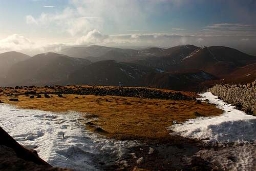 Summit view by Tomek Lodowy |
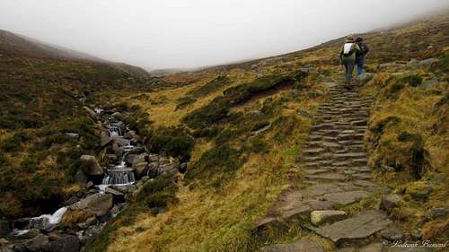
Slieve Donard is the highest peak in Northern Ireland and is part of the Mourne Mountains, a mountain range in the Southeast of Northern Ireland. Slieve Donard is only 850 meters (2,790 ft.) high, but for climbing the peak you need to climb every single vertical meter, since the ascent starts literally at sea level: at Newcastle Beach. Climbing Slieve Donard is rather easy, a well-marked trail leads all the way to the summit from the starting point in Newcastle. The route is graded T2 with a few passages of T3. The trail leads through dense forests and along many small streams. About halfway up, the dense forest makes place for the typical Irish Highlands: wet, grassy slopes with boulders covered by mosses; a sign of the wet climate.
 On Slieve Donard by Tomek Lodowy | 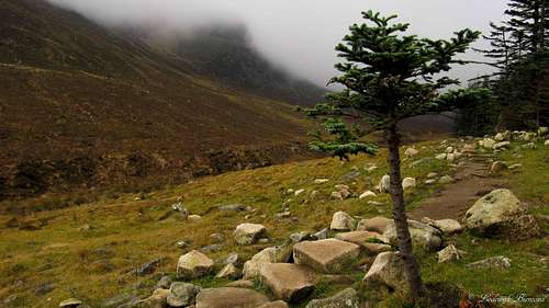 Glen River Path with Slieve Donard |
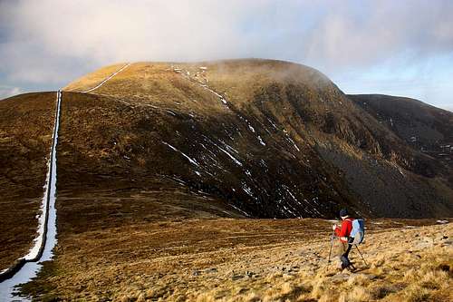
Slieve Donard is a very popular mountain for local people as well as tourists. The views from the summit are great. On clear days you can see as far as Belfast (30 miles to the North) as well as Dublin (55 miles to the south). Towards the east you have tremendous views over the Irish Sea, which is only a couple of miles away from the summit. Towards the West you can see all of the other rugged peaks of the Mourne mountains, with Slieve Commedagh (767 m. /2,516 ft.), the second highest peak in Northern Ireland, dominating the view. Slieve Donard has three subsidiary peaks on the seaward side: Millstone Mountain, Thomas's Mountain and Crossone.
 View towards the Irish Sea | 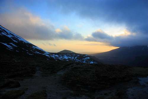 Evening time @ Donard Saddle by Tomek Lodowy |
Route
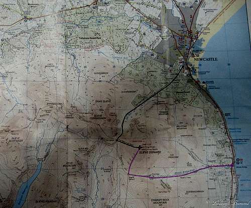 Route Map Slieve Donard (Click for details) |
The Glen River Route
The most common route to the summit of Slieve Donard starts at Newcastle. To be more exact: There is a parking place directly west to the point where the Glen river flows into the Irish Sea. This is along the Newcastle Boulevard. At this parking place the trail starts. It is named the Glen river path, because it follows the river up the mountain. You keep heading up the valley trough the dense forest. At about 350 meters above sea level the forest abruptly stops and the landscape immediately changes into the typical Irish Highlands. Without the cover of the trees, you are exposed to the elements: Strong winds and/or heavy rain are very common here. Keep heading up the mountain along the Glen River. Eventually you will reach the saddle between Slieve Commedagh and Slieve Donard. At this point you have reached the famous Mourne Wall. Follow the wall towards the east up to the summit of Slieve Donard.The Bloody Bridge River Route
The bloody bridge parking lot is the starting point for this route. Head towards the west. The trail follows the bloody bridge river up the eastern slopes of Slieve Donard. Keep heading west until you reach Crannoge, a very small village consisting of a couple of houses only. After passing Crannoge, you will soon arrive at the ‘’Bog of Donard’’, the saddle between Slieve Donard and Rocky Mountain. From this point, the route follows the Mourne Wall, a large stone wall built in the early 20th century, to the summit.
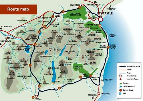 Mourne Mountains Map |
History
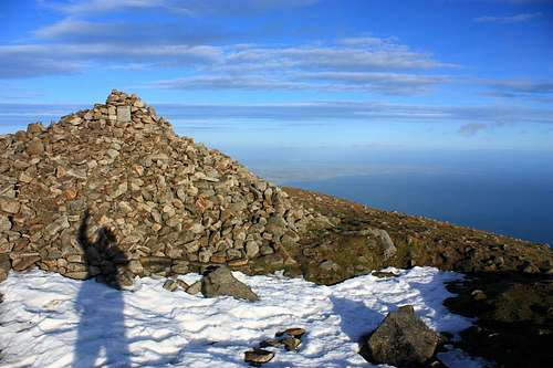
On the summit are the remains of two prehistoric cairns. The Cairn on the actual summit measures 36.5 metres from north to south, 43m from east to west, and is 1m high. It appears to have been a Neolithic passage tomb, dating to a stunning 3000 B.C. It is the highest known passage tomb in Britain and Ireland. The other Cairn lies 210 metres to the northeast. It measures 18m from north to south, 16m from east to west, and is 4.5m high. It appears to have been an Early Bronze Age cairn, dating to 2000.B.C.Irish mythology suggests the Cairn on the summit as being the tomb of mythical figures, and an entrance to the ‘’Other world’’ The earliest sources give two names for the mountain: Benn Boirchi (modern spelling: Beann Boirche) and Sliab Slánga (modern spelling: Sliabh Slángha). Beann Boirche means "Boirche's peak", referring to a mythical king who was believed to have had supernatural powers.
 The Mourne Wall | 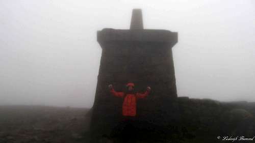 Stone Tower @ the summit |
From the 5th to 8th centuries, Ireland was Christianized. A local Christian missionary, Saint Donard (known in Irish as Domhanghairt), became associated with the mountain. According to tradition, he was a follower of Saint Patrick. Donard made the Great Cairn into a hermit'cell. It is believed that Donard was blessed by Saint Patrick: Donard would not die but live on inside the mountain as a perpetual guardian. The writings of Gerald de Barri indicate that in the late 12th century the old names of the mountain were going out of use and were replaced by Sliabh Domhanghairt, Slieve Donard.
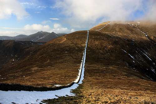
The Mourne Wall passes over fifteen mountains, including Slieve Donard, and was built in the early 20th century. The wall goes up the southern slope to a stone tower and then down the western slope towards Slieve Commedagh. It took almost 18 years to build, from 1904 to 1922, with stonemasons working in the mountains from March to October each year. Some stones from the summit cairns were used for the construction.
Getting There
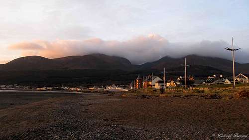
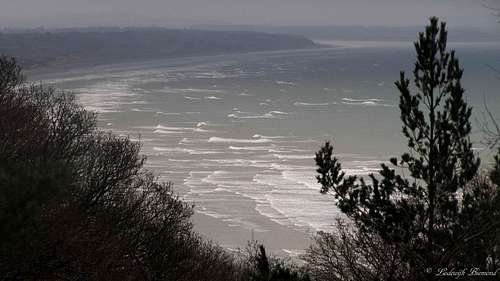
 Slieve Donard from Newcastle Beach |  Belfast |
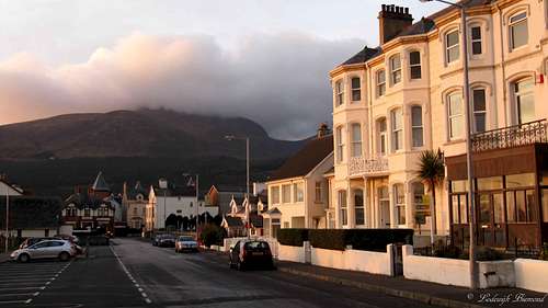
In Newcastle head towards the Town Centre. At this point the Glen River enters the Irish Sea. Leave the Boulevard at this point, you will enter a large Parking lot, the starting point for Slieve Donard. There are signposts present in Newcastle as well, so it’s easy to find.
Slieve Donard can be climbed all year long, depending on the conditions. If there is snow present, route finding can be difficult. With bad weather it also not advised to go up. In 2006, a person was killed being hit by lightning on the mountain. Besides the snow and weather conditions you are good to go in any season to climb Slieve Donard.
Newcastle:
What Gear & When to Climb
 On the Trail to Slieve Donard | 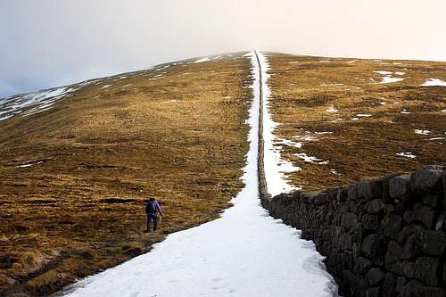 Follow the wall to Slieve Donard |
Use good hiking shoes. Hiking poles can be useful. Use warm and waterproof clothing. The weather can change rapidly here and strong winds and rain are very common in the area.
Hotel & Camping
 Hiking in the Mournes | 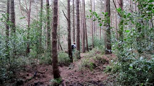 The Forest; Lower part of the trail |
Belfast: (Slieve Donard can be climbed as a daytrip from Belfast)