|
|
Mountain/Rock |
|---|---|
|
|
50.73600°N / 15.74000°E |
|
|
Hiking |
|
|
Spring, Summer, Fall, Winter |
|
|
5259 ft / 1603 m |
|
|
This page was created anew in October 2016.
![Digitalis purpurea from Obri Dul]() The area is part of a national park (or rather two parks: Karkonoski Park Narodowy in Poland and Krkonošský národní park in the Czech Republic. You are not allowed to camp/bivouac or stray from the waymarked trails. In Poland there is an entrance fee - an equivalent of approx. €2.00 for a day pass in 2023. In Czechia there is no entrance fee, but be ready to pay for parking, e.g. in Pec pod Sněžkou about €6 per day. In winter (sometimes also in autumn) and the first half of spring, the sections of trails that run through valley heads (Łomniczka Valley, Obří důl, Biały Jar just west of Strzecha Akademicka hut) and the road that traverses the north face of Śnieżka (blue marks) are closed due to the avalanche risk. In summer the last stretch of the red trail that climbs the summit from the west (along the international border) is one way – you can only walk up there.
The area is part of a national park (or rather two parks: Karkonoski Park Narodowy in Poland and Krkonošský národní park in the Czech Republic. You are not allowed to camp/bivouac or stray from the waymarked trails. In Poland there is an entrance fee - an equivalent of approx. €2.00 for a day pass in 2023. In Czechia there is no entrance fee, but be ready to pay for parking, e.g. in Pec pod Sněžkou about €6 per day. In winter (sometimes also in autumn) and the first half of spring, the sections of trails that run through valley heads (Łomniczka Valley, Obří důl, Biały Jar just west of Strzecha Akademicka hut) and the road that traverses the north face of Śnieżka (blue marks) are closed due to the avalanche risk. In summer the last stretch of the red trail that climbs the summit from the west (along the international border) is one way – you can only walk up there.
Overview
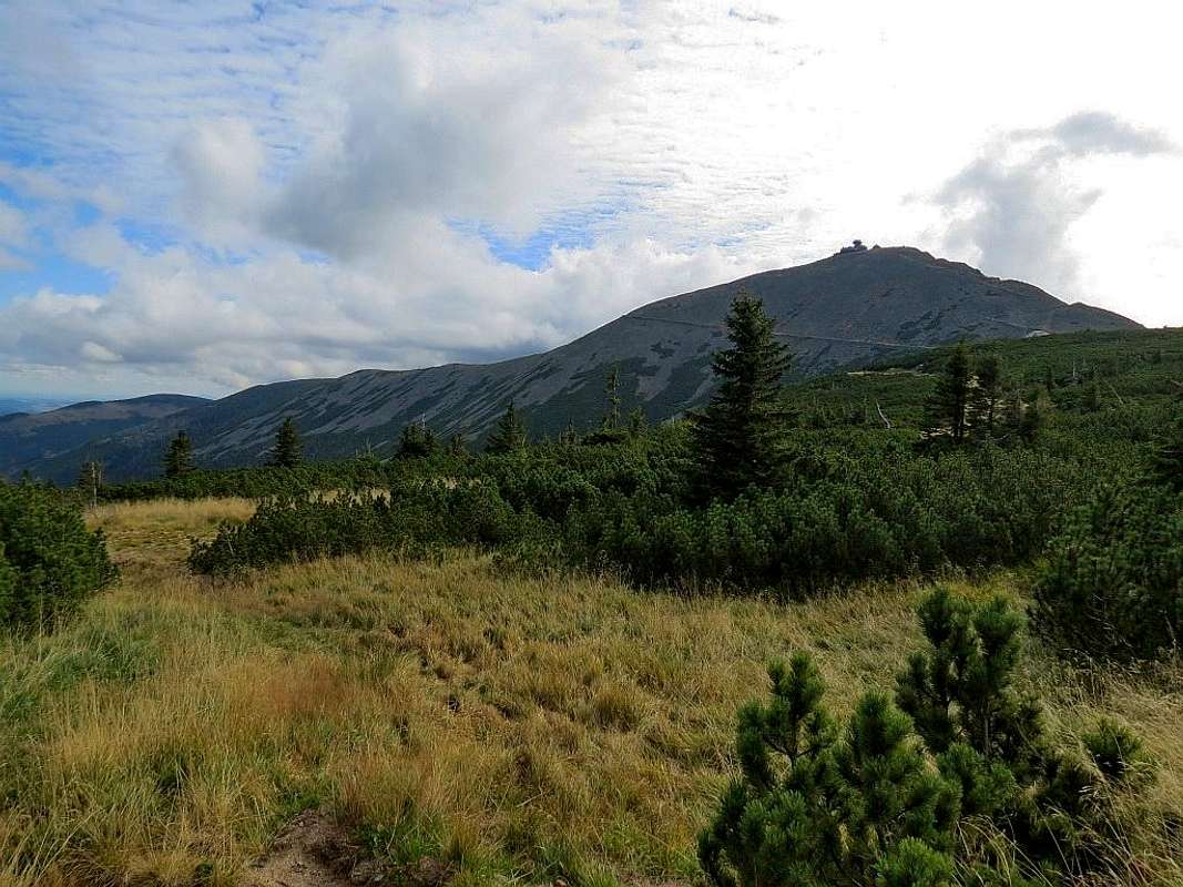
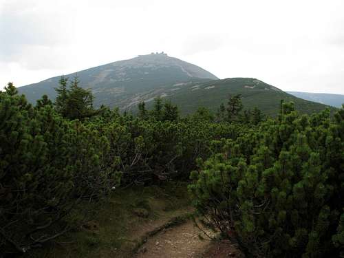
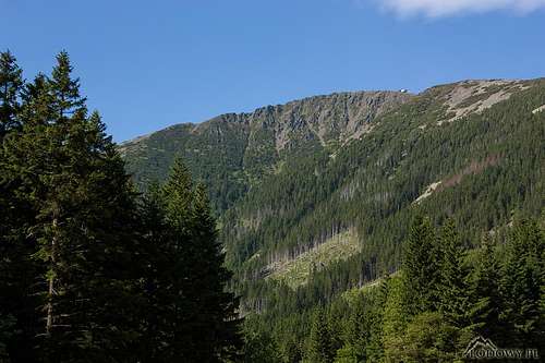
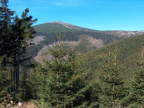
Sněžka/Śnieżka (a feminine noun in both Czech and Polish, which can be translated as the Snowy One or Snow White; Schneekoppe in German) at an elevation of 1602 or – according to the latest Czech measurement – 1603m, is the highest summit in the Giant Mountains, in all of the Sudetes as well as Czechia. It has 1203m of prominence and, standing on the border between Czechia and Poland, rises nearly 200m above the main ridge of the Giant Mountains. This is due to the mountain's geologic make-up: unlike its surroundings, it is formed of hornfels, which is extremely resistant to erosion. Until the 19th century Śnieżka was also known as Rieseberg, that is the Giant Mountain. 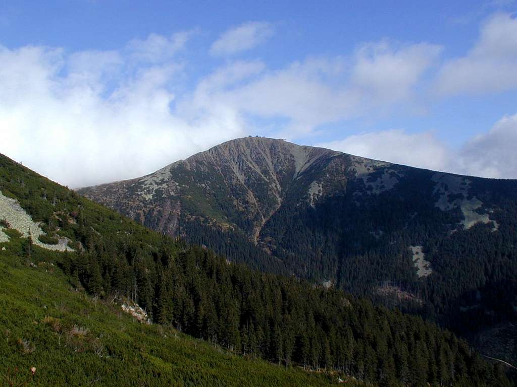
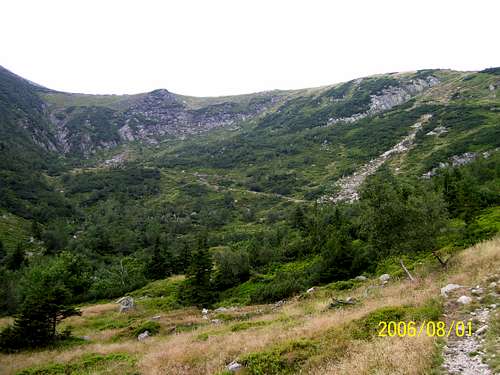
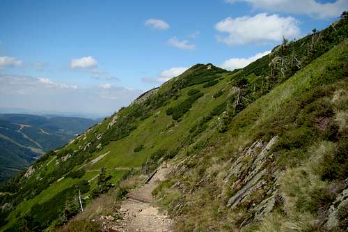
Sněžka's north and southwest sides are quite high and steep. They descend over 500m to the bottoms of the valleys of, respectively, Łomniczka and Úpa brooks. The gentler side is the southeast side. To the south Śnieżka sends out a lateral ridge which is named after Růžová hora (1390m), its first summit south of Sněžka. At the west foot of Śnieżka extends the undulating plateau – an ancient peneplain raised by tectonic forces - that forms what we call the main ridge of the Giant Mountains west from Sněžka. The main ridge of the Giant Mountains east of Śnieżka is much narrower and does look like a ridge. Between Sněžka and Svorová hora/Czarna Kopa at 1407m, the ridge - clad in dwarf mountain pine and talus - is called Obří hřeben (Giant Ridge)/Czarny Grzbiet (Black Ridge).
In the Ice Age, the upper parts of the valleys that begin at Sněžka cradled glaciers, which results in a couple of fine, albeit lakeless, corries sitting below Śnieżka on either side of the international border. These corries are notorious for avalanches.
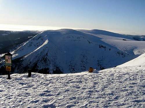 Studniční hora at 1554m across a corrie - photo by Tomas Kristofory Studniční hora at 1554m across a corrie - photo by Tomas Kristofory 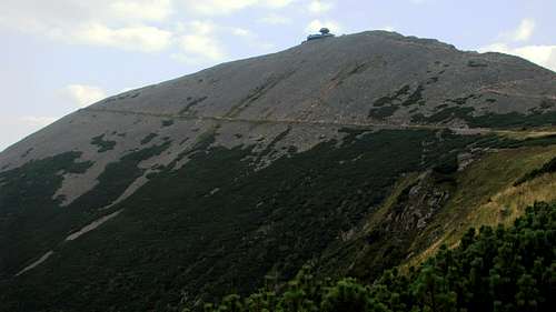 The north face of Śnieżka The north face of Śnieżka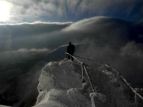 On the western trail in winter - photo by Dziku On the western trail in winter - photo by Dziku 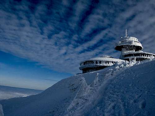 The UFOs - photo by Dziku The UFOs - photo by Dziku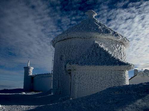 Chapel of St. Lawrence - photo by Dziku Chapel of St. Lawrence - photo by Dziku |
Trails


Maps
|
Nearby Huts
NB There are plenty of guesthouses and hotels as well as a few campsites on either side of the Giant Mountains.
 No accommodation here No accommodation here |


Getting To Nearby Resorts
Czechia


|
Red Tape

When To Climb & Mountain Conditions
- If possible, do not go in high season or at a weekend unless you like being part of a crowd. On a sunny day in July or August the summit can be visited by more than ten thousand people!
- Under winter conditions crampons can be a must. (For example, in January 2024 two hikers died after slipping at the very top of the mountain and falling down its north side.)
- Mountain rescue phone numbers: Czechia +420 1210, Poland +48 601100300
- Current mountain conditions in Polish
- Weather forecast for Luční hora on meteoblue.com
- Webcams
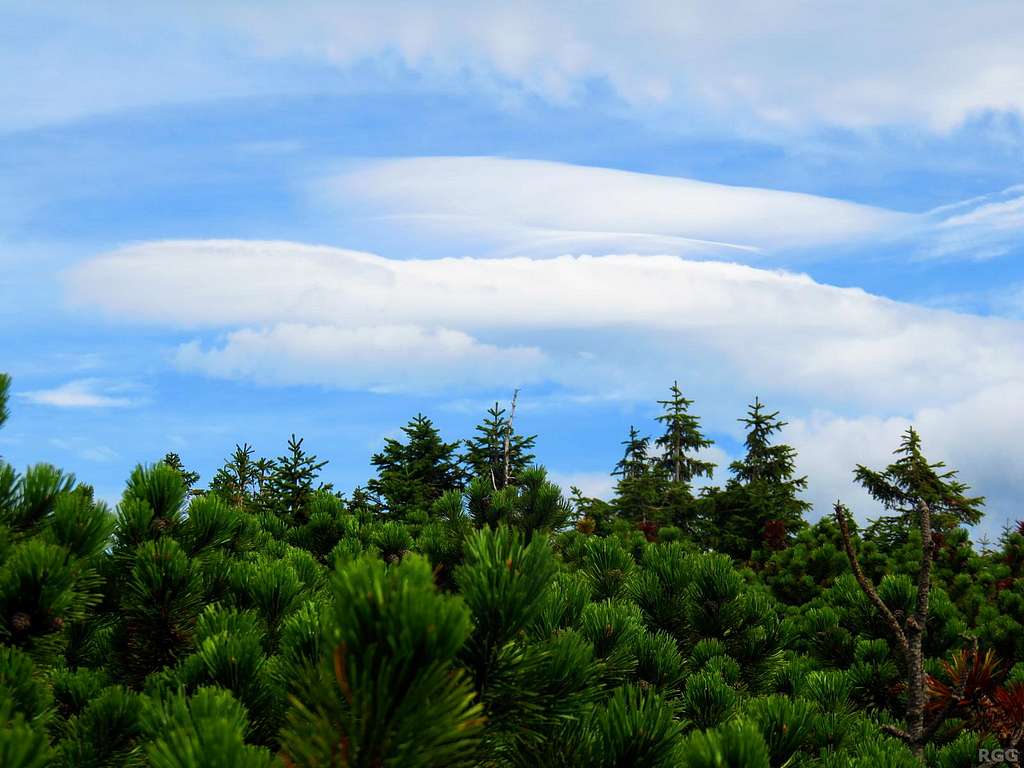
![Funny clouds over the Karkonosze Mountains]()
The wind of change - photo by rgg