
-
 13769 Hits
-
 87.31% Score
-
 24 Votes
|
|
Mountain/Rock |
|---|---|
|
|
46.52370°N / 11.79450°E |
|
|
9724 ft / 2964 m |
|
|
Overview
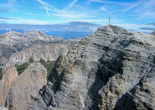 Piz Miara from the south |
Ever climbed a summit without realizing it? A summit famous for its large wooden hand carved cross? Well I must confess I did and I also confess in not having seen the cross but from afar. The picture above is linked from another page, shot by someone who was more lucky than I was...
Yes, it was a weird day, that July 26th of the year 2005. 'T was very cloudy and there was no reason whatsoever why we went up by cablecar to Sass Pordoi to explore the Sella Group. Everywhere else the weather was worse so maybe this is the reason...
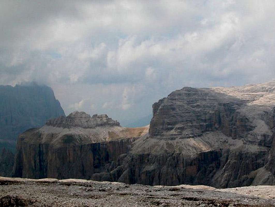
Piz Miara is one of the summits which stand out of the large summit plain of the Sella Group, the Altipiano delle Meisules. All these summits are located at the edge of the plain, Piz Miara on the western side. But here I realize that people who don't know the Sella Group might be at a loss so let me explain:
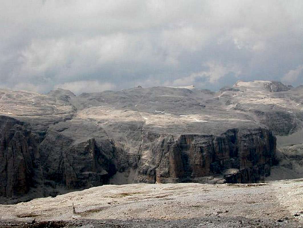
The Sella Group is a large fortress-like block of Dolomite Rock, almost rectangular in shape with a large flat summit plateau. You might think of two upturned shoe boxes, the smaller one placed on the upper one and you get a good notion of what Sella looks like. Add two large cuts (valleys) both cutting in from the northern and southern sides (Val Lasties in the south and Val di Mesdi in the north) but missing each other by a few hundred yards. A large ledge surrounds the group (remember the small and large shoe box?) and here you have the regular ascent routes: two through the two valleys, two through shorter and steeper valleys and a couple of vertical climbs, cut in half by this large ledge. Of course the image is a bit simplified and doesn't account for the many impressive rock towers you find all over the group but still for an idea it might suffice.
Back to Piz Miara: the summit is part of the Altipiano, the high plain, and as mentioned above is located on the western rim of the plain. It is reknowned for the cross and the fine view of the Sas Lonch / Langofel / Sassolungo Group neither of which we could see during our ill-fated visit to the summit.
Starting from Sass Pordoi as we did the ascent of Piz Miara is easy but very long. You need to negotiate the whole Altipiano circling around the deep cut of Val Lasties. Once in the west of the Altipiano you climb the summit ridge starting at Piz Rotic and hike across Piz Beguz to Piz Miara. On a good day you are rewarded with impresse views down from these summits into the valleys and high plains below. Several couloirs open up and let you catch your breath.
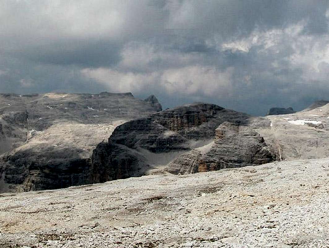
We climbed Piz Miara (for those who might doubt) - my GPS receiver recorded the track and we neatly followed the route even a bit further than Miara but we couldn't see anything since clouds obstructed the view. From the track we missed the summit by a mere 30m (100ft). Needless to say that once back on Piz Rotic the cross on Miara was clearly visible and remained so during the long way back to Sass Pordoi.
By far most of the summiters of Piz Miara take our route only for descent. From Passo Sella there is the well known Pößnecker Klettersteig / Ferrata delle Meisules which heads up the vertical western Sella faces to Piz Selva. From there across Piz Gralba the descent trail leads to Piz Miara and the other ring mountains of the Altopiano delle Meisules.
And yes, Piz Miara actually can be climbed (see next section).
Climbing Piz Miara
Sas LonchPiz CiavazesPiz SelvaPiz GralbaPiz MiaraPiz BeguzPiz RoticBec de MesdiL'AntersassCresta StrentaPiz Boè
 |
 |
 |
 |
Piz Miara certainly is not one of the major climbing destinations in the Sella Group. Yet there are a small number of routes on its north-west face ranging up to an impressive UIAA VIII!.
- Santner Gorge
First Climbed: 1885, J. Santner, G. Merzbacher
Rated: III
Length: 1100m - Hainz / Pardeller: "Haar im Arsch"
First climbed: 1990, Ch. Hainz, V. Pardeller
Rated: VIII
Length: 350m - Leonardi / Tanesi
First climbed: 1934, V Leonardi, A. Tanesi
Rated: IV
Length: 750m! - Pinroth / Stuflesser
First Climbed: 1965, F. Pinroth, E. Stuflesser
Rated: IV
Length: 500m
 |
 |
 |
 |
Getting There
There are two possible trailheads: Passo Sella and Passo Pordoi. The easiest one is Passo Pordoi if you take the cable car.
- From the North (Brenner / Brennero)
Follow motorway A22 down to Cornedo (north of Bozen / Bolzano). There turn east on SS241 (Dolomite Highway) across Karerpass / Passo Carezza to Vigo di Fassa. At Vigo turn northward on SS48 which leads you to Canazei. In the centre of the town SS48 turns off northward for both passes. After a couple of km you need to decide wether to head for Passo Sella or Passo Pordoi. - From Verona
Take A22 north until the exit Ora / Auer. There turn east on SS48 direction Val die Fiemme which in the end will take you to Predazzo, Moena and Canazei. For the remainder follow the instructions above.
<td <td
<td <td
<td
Red Tape
There is no red tape to speak of. On both trailheads parking is free and the Altipiano can be traversed freely. But the moonscape of the Altipiano is a fragile ecosystem. Don't take any flowers with you - it might take years until they regrow.
When To Climb
Piz Miara is an all year destination. Actually it might be much more popular with tour skiers than it is with climbers/hikers. The winter ascent follows Val Lasties from Passo Sella and then follows the Altipiano to the summit (among others). Summer season is June through October. I have experienced snow on the Altipiano in late August which makes climbing Miara a quite dangerous feat. Better do it in dry conditions.
Accommodation
Camping
- Marmolada
via Pareda
Canazei
Tel.: +39 0462.601660
Fax: +39 0462.601722
- Catinaccio
via Avisio 15
Pozza di Fassa
Tel.: +39 0462.763305
Fax: +39 0462.763501
- Soal
via Dolomiti 32
Pera di Fassa
Tel.: +39 0462.764519
Fax: +39 0462.764609
- Vidor
Località Vidor
Pozza di Fassa
Tel.: +39 0462.763247
Fax: +39 0462.764780
Other Accommodation
The best information on boarding houses and hotels can be found on www.dolomiti.it. The site is not complete – you might find more information on local tourist web sites, but it already offers an impressive list. The following listing gives you an overview for the larger towns and villages surrounding the Marmolada Group.
Val di Fassa
- valdifassa.it
- dolomitibooking.com
- fassa.com
- Moena
- Vigo di Fassa
- Campitello di Fassa
- Canazei
Weather Conditions
Weather conditions in South Tyrol: www.meteoalpin.com. For the english text you have to scroll down the right frame.
Weather and avalanche conditions in Trentino: www.meteotrentino.it
Weather conditions Dolomites:www.dolomitimeteo.com
Maps & Books
Books:
- Climbing
- Classic Dolomite Climbs: 102 High Quality Rock-Climbs Between the Uiaa Grades III and VII (also available on CD)
Anette Kohler, Norbert Memmel
Mountaineers Books
ISBN: 0 8988 6693 6
- Classic Dolomite Climbs: 102 High Quality Rock-Climbs Between the Uiaa Grades III and VII (also available on CD)
- Vie Ferrate
- Klettersteige Dolomiten
H. Höfler, P. Werner
Rother Verlag
ISBN: 3 7633 3096 8 - Hülslers Klettersteigführer
E.E.Hülsler
Bruckmann Verlag
ISBN: 3 7654 4161 9
- Klettersteige Dolomiten
- Hiking and Trecking
- Höhenwege in den Dolomiten
H. Dumler
Bruckmann Verlag
ISBN: 3 7654 3860 X - Dolomiten
P. Fleischmann
Kompass Verlag
ISBN: 3 8705 1409 4 - Dolomiten 4
F. Hauleitner
Rother Verlag
ISBN: 3-7633-4061-0
Maps:
I have been using the maps by Kompass Verlag. There are two which differ in scale:- Val di Fassa, Marmolada, Gruppo di Sella
Kompass Map WK 686
ISBN: 3 8549 1768 6
Scale: 1:25000 - Sellagruppe / Gruppo di Sella
Kompass Map WK 59
ISBN: 3 8549 1066 5
Scale: 1:50000
- Höhenwege in den Dolomiten
- Marmolada
 <td
<td <td
<td