
-
 13297 Hits
-
 79.04% Score
-
 10 Votes
|
|
Mountain/Rock |
|---|---|
|
|
46.29643°N / 9.66849°E |
|
|
10239 ft / 3121 m |
|
|
Overview
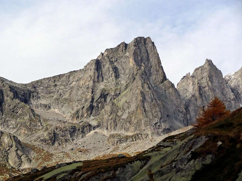
Beautiful rocky peak if seen from the south (Italian) side, ice dome if seen from the north (Swiss) side.Probably the most impressive mountain, together with the Cima di Zocca, in the whole Val di Zocca area.
Due to its nearness to the "Cima di Castello", which is the highest point of ValMasino section, this nice mountains is not so famous as it deserves: some guidebook simply name it "point 3121m".
It offers fine difficult routes on the south face. Its normal route is common with the Cima di Castello normal route so that you can climb two summits in the same day.
Punta Allievi south face
Getting there
To get there you must drive along the SS38 starting from Milano or from Sondrio.Just few km before Sondrio (coming from Milan), on the right side (N) of Adda river, the small town of "Ardenno" is the starting point for the road 404 that leads to S.Martino Val Masino.
Once in S.Martino follow the road on the right (East - Val di Mello) and try to find a car parking site (best one is near the "Baita del Gigiat" (1000m).
Here you must start walking following the marks to Refuge Allievi (2387m - about 3.30 hours walk - 1400m difference in elevation): this is the best place for rests.
As you can check on the related page, this refuge is placed on the Sentiero Roma, and many people use to come here for a stage, from East (bivouac Manzi - 2/3 hours), or from West (Bivouac Molteni/Valsecchi - 3/4 hours).
Coming here from swiss Valle Albigna is a long and not so easy walk that requires the crossing of the Passo di Zocca (2749m) along the glacier de la Albigna (Val Albigna).
 |  |
Italian normal route
The Italian normal route follows the border ridge starting from point 2967m.Actually the lower part of the border is the "Passo di Zocca", but from there the route could be too long.
So, from ref. Allievi start walking toward north (a red stripe, not always easy to find, marks the route).
The path goes steep quickly on a flank, placed between the Punta Allievi on the right and an acuminate peak (point 3061 m) on the left.
My photos can show exactly where is at. The route is not so evident, so you only have to follow the most logical sequence of slopes.
Usually you have to cross the slopes from right to left till the ridge, wherefrom you can see the summit toward east.
Straight on, easy climb on snow, towards the highest point, where few timbers indicate the summit of Punta Allievi.(3/4 hours from the hut - F+)
 |  |  |  |
Other routes
South-West WallOn the SW wall rock is not so fine so that the 2 routes are almost forgotten.
South-East Wall
On the SE wall one very often climbed route (Erba-Fumagalli) difficulties up to 6° (5.9)
South Edge
The S edge, climbed by Gervasutti, is the most classic and perhaps the finest.Related Page
East-South-East Pillar
(Via dei Camosci)(Nardella,Parolo,Piasini 30/07/1967)(VI°/A3).
South-West-Pillar
(Via Inglese)(Meldrum,Rogers 30/08/1967)(IV°+/V°)

The "Gervasutti" route.
Refuges
Ref. AlbignaFrom cable car station of Pranzaira(30 min. E).90 places,open summer.

Ref. Albigna.
Ref. Allievi
From S.Martino Val Masino(3/4 hours E).100 places,open summer.

Ref. Allievi.