
-
 1541 Hits
-
 81.18% Score
-
 13 Votes
|
|
Mountain/Rock |
|---|---|
|
|
41.78559°N / 9.24224°E |
|
|
Corsica |
|
|
Trad Climbing |
|
|
Spring, Summer, Fall |
|
|
4183 ft / 1275 m |
|
|
Overview
Punta Ciaccianu 1275 m
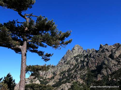
The rough granite with its incredible “tafoni”, the lush forests of "pino laricio", the wilderness surrounded by a vivid blue sea: the superb beauty of the Bavella landscape, regarded by many people as the most astonishing amongst the Mediterranean countries, is out of discussion. Everything is wonderful and also a small peak may give an intense emotion: it’s the case of Punta Ciaccianu, a nice summit belonging together with Punta Aracale and Punta Caletta to a set of peaks in the Velacu Group.
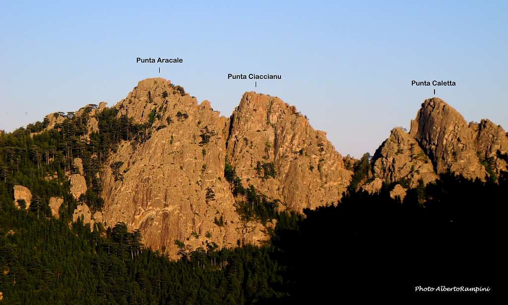
The Velacu group is an important extension of the Paliri chain located SW to Foce Finosa and finishing with Punta Velacu. It’s lying east to Col de Bavella, the entry point to the wild Bavella range, and it’s well visible on the left of the road D268 rising from Zonza to Bavella Col. This sector covers the Southern Group ridge from Foce Finosa in the North to Punta Velacu in the South, offering interesting climbing objectives such as Punta Aracale, Punta Ciaccianu, Punta Caletta, Calanca Murata, Punta Compulellu and Punta Velacu, with routes mainly on the NW side, which is a definite asset in the summer when you can climb in the shade for the main part of the day. The peak extends towards North-West a beautiful and interesting wall, offering some classic climbs with moderate difficulty.
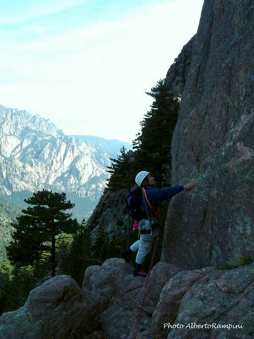
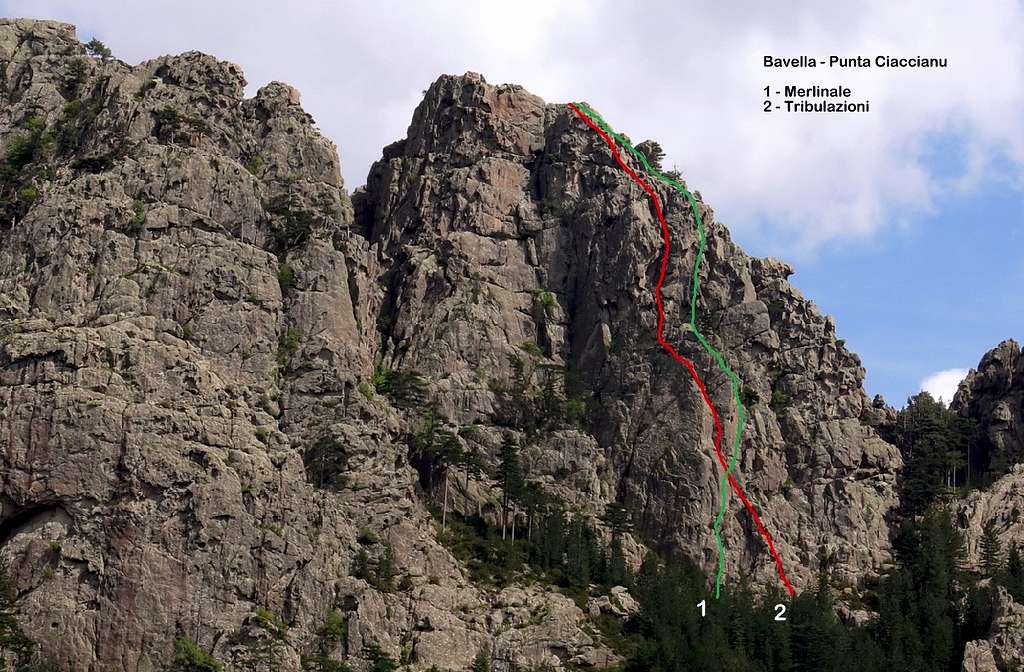
Punta Ciaccianu is considered by someone to be a SW fore-summit of the nearby Punta Aracale with an altitude of 1275 meters, actually this tip is a summit in its own right with a very interesting NW wall for climbing, offering three medium level routes including Tribulazioni, route of level D+ and 6 pitches.
Getting There
Access to Corsica
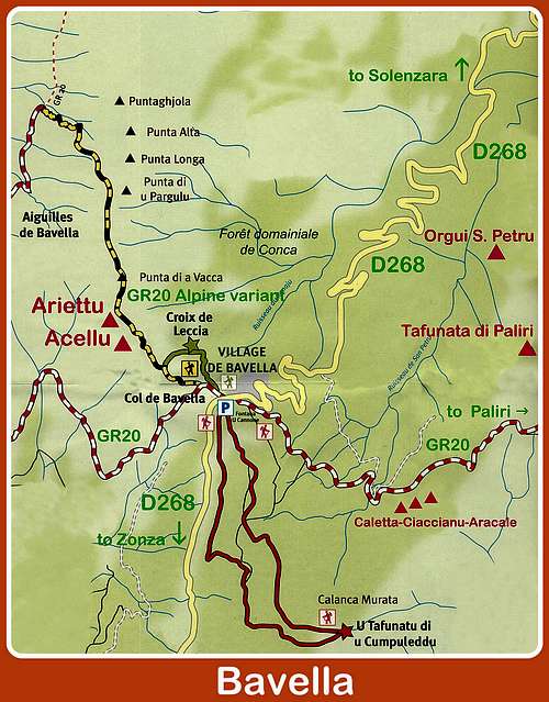
Corsica, l'Ile de Beauté (the Island of Beauty), belonging to France but much closer to Italy, can be easily approached by plane (airports both in Bastia on the Eastern coast and Ajaccio on the Western coast) and by ferry-boat from Livorno and Savona italian ports. The most convenient destination in Corsica to visit the Bavella area, one of the wildest region of the island, is the airport of Bastia if you’re getting there by plane; the same Bastia port if you’re getting there by ferry-boat. The main entrance to Bavella Massif is Col de Bavella m. 1211.
Road approach to Col de Bavella
- From Bastia (Corsica Eastern coast) follow the road RN 198 towards Solenzara; a few kilometers before getting there, turn to right following D268 to Col de Bavella (km. 130 from Bastia).
- From Aiaccio (Corsica Western coast) follow the road RN 196 to Petreto, then N852 to Aullene, Quenza and Zonza (km. 90 from Aiaccio). From Zonza follow the road D268 to Col de Bavella.dd Getting There text here.
Route Tribulazioni
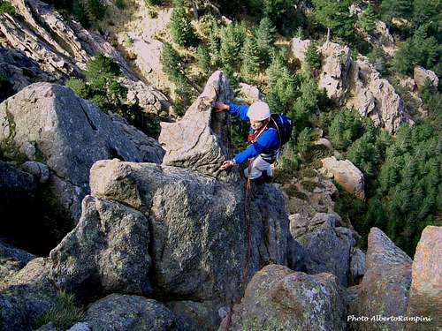
Punta Ciaccianu Tribulazioni report
Summit altitude: m 1275
Difficulty: 6a max, 5c obbl
Equipment: few equipped (some fix), necessary friends and slings
Route length: 150 m
Exposure: NW
First ascent: F Mestre et Jean-Paul Quilici, 1983 June 17th
Starting point: Route D268 or Gite d'etape Col de Bavella
Approach: there are two possibilities:
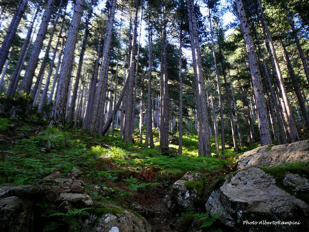
A - From the Bavella Pass follow the road D268 towards Solenzara for 1.8 km, park the car and take an unsurfaced forest road on the right. Follow it for about 2,5 km., joining the GR20 trail coming from Col de Bavella. The forest road cross the stream Volpajola (San Petru). Immediately after the ford take the GR20 and follow it about 30 m, then leave it to the right and take a well-cairn path in the pino-laricio forest that climbs directly to the walls. It ends in the vegetation between Punta Ciaccianu on the left and Punta Caletta on the right. Follow the tracks that go to the left (looking at the walls) along the bottom of the peaks. Easily fall on the start of Tribulazioni (2 spits in the L1, very visible). 40 minutes.
B - From the Auberge–Gite d’Etape “du Col de Bavella”, situated 500 m. down Bavella Pass along the Solenzara (NE) side of the road D268, follow the forest road starting just behind the hut and joining the GR20 trail; the path descents to reach another forest road, crossing the stream Volpajola (San Petru). After the ford carry on as described in the previous point.
L1 - Pass the steep starting slab (V + / 6a, 2 spits), cross frankly to the left towards a chute (which can be wet), V, go up (quotation?). Relay on a spit with link, to complete, 6a 35 m.
L2 - Climb to the left on "tafoni" (IV), then cross on the right towards a beautiful dihedron (V then V + for the dihedron). Exit on a grassy terrace provided with a relay (not to use), continue through the cracks that go to the left of the terrace to climb a beautiful slab 25 m which is the left flank of the pillar. IV + from the terrace, 2 spits. Make a suspended relay (spit + lunula) at the end, V + 45 m.
L3 - Pass the 2 terraces overlooking the relay (III / III +) and completely lift the left edge of the pillar / ridge wire by tafoni. Very nice passages of V / V +. Several relays possible in different conches (lunules + fissures), V+ 40 m
L4 - Get out by the tafonis on the left (lunules in place, IV) and relay to a pine tree, on a terrace, IV 20/25 m
L5 - Complete climbing with playful jumps, looking for the most climbing passages (III / IV, generally to the left). Relay on a big pine, IV 25 m. The summit, 50 m away, is easily accessible.
Descent
From the very top, a 25 m (1 spit) booster leads to the end of the SE slabs. A second vertical lift of 45 m (2 spits) drops to the ground. A path goes towards the E along the walls and passes to the pass between the Ciaccianu puntas and Caletta. From the pass, descend directly to find the cairns of the approach trail.
Red Tape
Bavella is a fantastic place, a preserved milieu situated inside the Parc Naturel Régional de Corse - Parcu di Corsica. Free camping and bivouac are not allowed. Fires are strictly forbidden. Maximum care is required to keep for the future this extraordinary environment.
When to climb
The NW orientation of the walls advises to climb in the period going from late April to middle October
Where to stay
Col de Bavella
- Auberge du Col de Bavella Hotel and Gite d’Etape
- Gite d'Etape Les Aiguilles de Bavella Gite d’Etape
- Auberge du Col de Bavella Hotel and Gite d’Etape
- Gite d'Etape Les Aiguilles de Bavella Gite d’Etape
Zonza
– Hotel L’Aiglon, Hotel de la Terrasse, Hotel Incudine
- Residence Le Mouflon d'Or
– Hotel L’Aiglon, Hotel de la Terrasse, Hotel Incudine
- Residence Le Mouflon d'Or
Main Campsites
- Municipal Camping of Zonza, Camping La Riviere (Road to Quenza), Camping Bavella Vista (Road to Quenza). There are also two equipped campsites along the road D 268 between Solenzara and Bocca di Larone:
- Camping U Ponte Grossu
- Camping U Rosmarinu
- Camping U Rosmarinu
Nature and climate
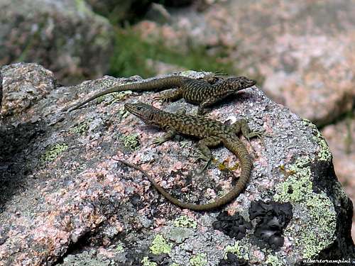
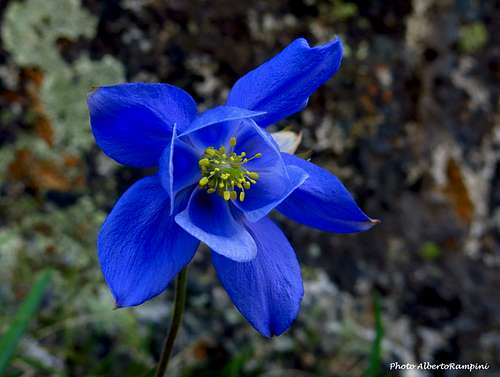
Nature is wild and peculiar; in Corsica we can find more than the 5% of authoctonous kinds of flower and plants, in addition to authoctonous fauna. On the contrary, several kinds of animal current inside Mediterranean countries are away from Corsica, like squirrels and vipers.
Climate is the typical one of the mediterranean middle-mountain areas situated at these latitudes: often very hot in summer and with cold and snowy winters; early and middle Spring and early Fall are the better seasons to climb. Due to Bavella closeness to the sea, winds are often stronger how much they are at the same height in the Alps. Rainfall sometimes are important and dangerous when joined with strong winds. On the contrary, sometimes we can find some long periods of drought.
Meteo
Guidebooks and maps
“Bavedda – Aiguilles entre ciel et torrents: Escalade, Rando, Canyon” by Jean Louis Fenouil and Jean Paul Quilici - FFME
“Guide d’escalade en Corse” Vol. I Massif de Bavella by Jean Paul Quilici – Bernard Vaucher
Map IGN 4253 ET “Aiguilles de Bavella – Solenzara”