
-
 10333 Hits
-
 76.89% Score
-
 8 Votes
|
|
Mountain/Rock |
|---|---|
|
|
44.05050°N / 114.99°W |
|
|
Custer |
|
|
Hiking, Mountaineering, Scrambling |
|
|
Summer, Fall |
|
|
10212 ft / 3113 m |
|
|
Overview
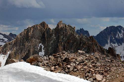
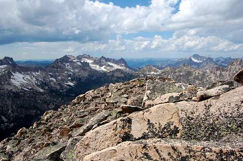
Location: East-Central section in the heart of the Sawtooths, off of perhaps the busiest trail in the region.
Nearby Peaks: Redfish Point, Chockstone Peak, Decker Peak, The Arrowhead, Mt. Sevy
Linkups: Chockstone Peak, Redfish Point
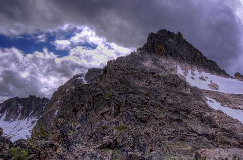
Difficulty: Moderate scrambling (Class 3) if sticking to route, easily becomes Class 4+ just off route
Usage: Hiking, nearby moderate technical climbs all around
Terrain: steep and rugged broken rock interspersed with solid granite
Traffic: virtually nonexistent off trail, realtively busy on trail
Summit Register: Yes
History / Etymology: Named after nearby Redfish Lake, which is named after the Sockeye Salmon that once returned to Redfish lake
Getting There
Nearest Dirt Roads / Conditions: None
Approach Trails / Conditions: Redfish Creek Trail (Good), Saddleback Lakes Climbers Trail (Good)
Routes
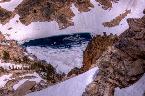
Main Route: West Slopes- From the Redfish Camp Inlet, follow the trail roughly 2.4 miles, leave the main trail and cross Redfish Creek (difficult early season). Follow the climbers trail under the Elephant's Perch and past Saddleback Lakes (Shang-Gri-La). From the lakes, climb SW into a bowl under the peak and scramble up the open slopes to the summit
Main Route Stats: 11.1miles / 5115 (round trip utilizing Shuttle Boat)
Average RT Time: 5-7 hours
Other Routes: Northwest Ridge- This route has the advantage of passing right over Redfish Point and under Chockstone Peak. Follow the Redfish Creek Trail past Flatrock Junction. Just past the junction, leave the trail and climb into the bowl that separates Chockstone Peak (9320) from Redfish Point (10095). Contour on thin ledges west of Redfish Point and follow the ridge SE to the summit. This route is considerably more challenging than the main route, but offers close up views of vertical towers.
Route Stats: 11.5 miles / 4785 (round trip utilizing Shuttle Boat)
Average RT Time: 7-9 hours

Red Tape
Jurisdiction: Sawtooth National Recreation Area (Forest Service)
Permit: No
Other Users / Issues: Shuttle Boat is expensive and can be unreliable
Maps: USGS Quad- Mt. Cramer
Guide Book: Tom Lopez, Idaho: A Climbing Guide

When To Climb
Climbing Season: June through October (past October there is no shuttle)
Ideal Climbing Time: June-Oct
Nearest Weather Station: Stanley
Weather Relative to Region: Very average to region- cold "dry" winters, warm dry summers
Camping
Car Camping Sites: Redfish lake Area offers plenty
Backpacking Sites: Flatrock Junction area, Saddleback Lakes, Cramer Lakes
Flora & Fauna
Potential Wildlife: Badger, Beaver, Black Bear, Mule Deer, Pronghorn, Cougar, Coyote, Elk, Marmot, Marten, Moose, Mountain Goat, Rainbow Trout, Brook Trout
Confirmed Wildlife: B Black Bear, Coyote, Elk, Marmot, Moose, Mountain Goat, Rainbow Trout
Vegetation: Lodgepole Pine
