
-
 3291 Hits
-
 80.49% Score
-
 12 Votes
|
|
Mountain/Rock |
|---|---|
|
|
45.73118°N / 11.17322°E |
|
|
Veneto |
|
|
Hiking, Trad Climbing, Sport Climbing, Scrambling, Via Ferrata |
|
|
Spring, Summer, Fall |
|
|
5318 ft / 1621 m |
|
|
Overview
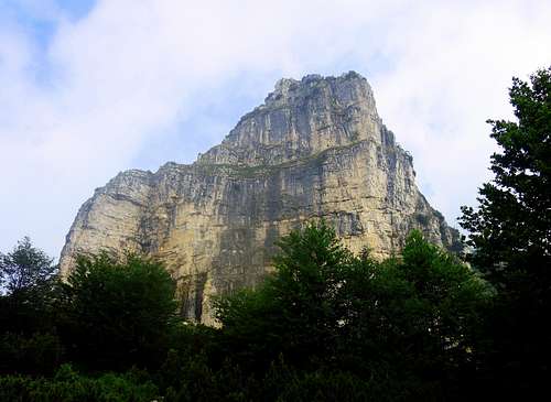
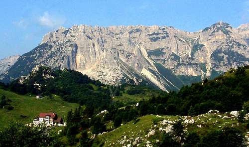
Sisilla (Sengio della Sisilla) 1621 m
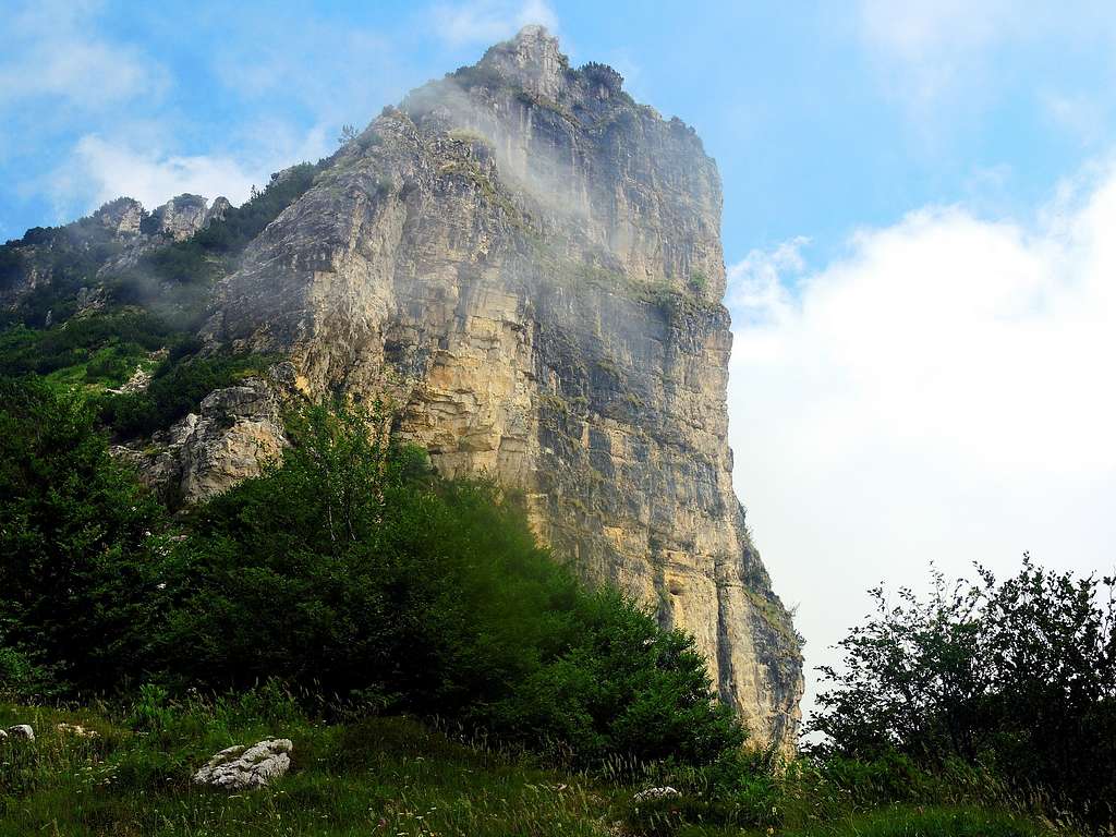
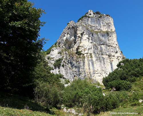
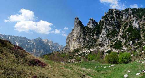
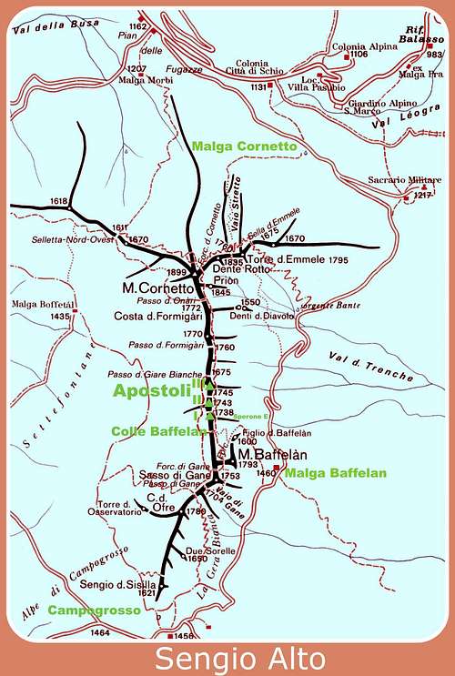
The Sengio della Sisilla, more briefly called Sisilla, is an impressive tower belonging to the Piccole Dolomiti (Little Dolomites), Sengio Alto Subgroup, with vertical and somewhere overhanging walls overhelming the Passo di Campogrosso and the nearby Rifugio Toni Giuriolo. The tower marks the Southern extremity of the Sengio Alto chain, a short mountain range composed by fine towers and pinnacles of dolomitic appearance, as Torre d’Émmele and Baffelan, located between Passo Pian delle Fugazze to the North and Passo di Campogrosso to the South. The Eastern side of the chain (Vicenza province) is more vertical and rocky, while the Western one (Trento province) has shorter rocky walls and less steep slopes, descending to the woods and the meadows below.
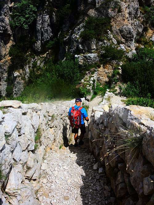
The Sengio Alto is crossed by a panoramic path, called Sentiero di Arroccamento, dating back to the First World War. This is an extraordinary old military path, winding between the peaks of Sengio Alto Subgroup and crossing it from Malga Cornetto m. 1220 to the Refuge Toni Giuriolo on Passo di Campogrosso m. 1456. The path was realized by the Italian Military Engineers Corp during the First World War.
The Sisilla marks to the South the beginning of the Sengio Alto chain and strongly characterizes this sector. The yellow-gray South-East wall of Sisilla, the one facing the Passo Campogrosso, rises for about 120 meters at its highest point, but it's very impressive and cut by two equidistant grassy ledges that divide the wall into three portions. Several difficult climbing routes run on this wall.
Getting There
Road access
– From the SE side (Vicenza province): follow A4 Motorway, exit Montecchio Maggiore and take the road to Valdagno, Recoaro and Passo di Campogrosso (47 km. from Montecchio Maggiore).
Climbing routes
On the steep and impressive SE wall of Sisilla there are various multipitches including some historic classic routes dating back from the 1930s.
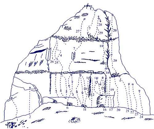
- Via Diretta Soldà VII-, 145 m Route re-equipped
- Via Carlesso VIII- (or VI+ e A0), 165 m Re-equipped, exit Soldà
- Direttissima Magrin-Perlotto VI, A1, A2,
- Via Dal Bianco
- Via Esperus VII+, 120 m
Sport routes
Currently on the South-East wall of the Sisilla there are about 45 routes, among which there are numerous sports routes mainly realized by Gianni Bisson in the cliff sector, added in the last decades to the historic classic routes. On the sport routes the difficulty varies from 5c to 8a, while the 5 classic multipitch routes has a difficulty level never lower than VI+ UIAA.
The crag of the Sisilla is never very frequented due to the rather difficult level of the routes and the rock towards which it must be paid attention, although the routes have been cleaned. Recommended the helmet also in the sport sector.
Access: from the Refuge Giuriolo on Campogrosso in 5 minutes reach the base of the wall. Pegs: fix, bolts and resinated on the sport routes. Normal pegs an some resinated on the classic routes.
Best period: from March to October
More info about the Sisilla sport cliff here: Sisilla sport routes
Normal Route
Sisilla Normal route from Passo Campogrosso
Difficulty: EEA
Difference in level: 150 m. from Passo Campogrosso
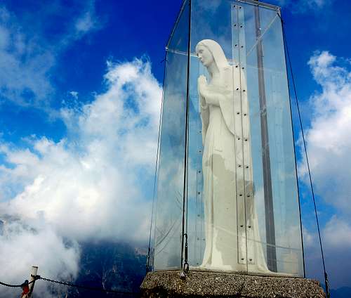
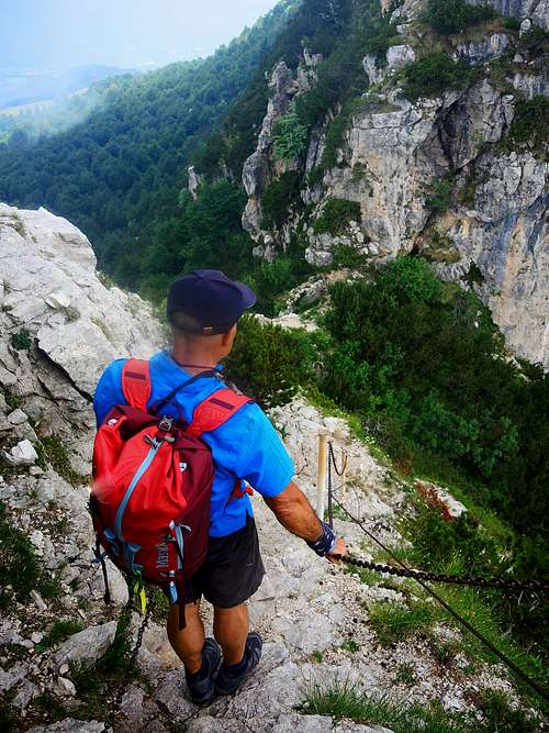
The Normal route to the summit of Sisilla is a walk plus an easy scramble up the summit rock, equipped with some iron chains. The itinerary is exciting and quite interesting in reason of the WWI remains. The summit is absolutely airy but protected with a railing.
Route description
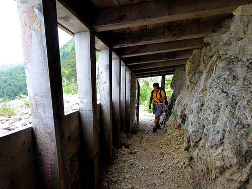
From the Refuge Campogrosso, take the path 170-E5 in front of the building in the direction of Malga Boffetal (signposted). After about 300 meters leave the main path and take a marked track on the right signposted "Caposaldo Sisilla". The trail soon climbs to a saddle from where to the right a well-preserved trench leads uphill to the entrance of a wooden war tunnel (open to visitors). On the left of the tunnel it starts the summit rock well equipped with metal chains leading quickly to the aerial summit with a statue of the Madonna. Aerial and extended panorama.
Descent: reversing the same route. After the summit rocks a brief variant is possible following on the left a path (before getting to the junction with the path 170) which descends directly to Passo Campogrosso.
Red Tape
No fees no permits required
Climate and nature
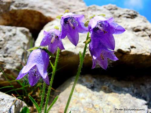
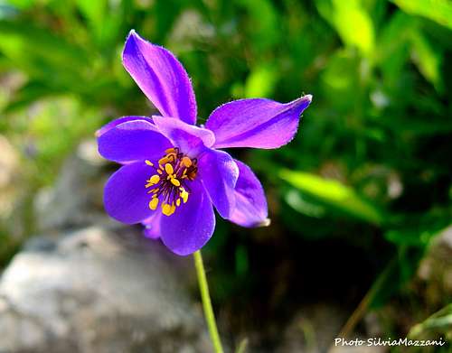
The Piccole Dolomiti show a local micro-climate due to the high contrast between the NW side, colder and dry, and the SE side, warmer and wet. this situation is the cause, especially in the summer time, of frequent fogs along the East sides. In Spring we can observe a wonderful flowering of many species, some of which autocthon.
Fall is a wonderful season to climb and hike, in reason of the presence of a mixed wood, surroundings the Sengio Alto Subgroup, giving an amazing look to the landscape.
When to Climb
From May to October/November
Huts
On CAMPOGROSSO:
- Rifugio Toni Giuriolo m. 1456 - Passo Campogrosso m. 1456 - Phone +39044575030
- Rifugio alla Guardia Phone +39044575257
Guidebooks and maps
- Guidebooks"


"Piccole Dolomiti e dintorni - Arrampicate scelte" by Guido Casarotto - Un updated complete selection of climbing routes in Piccole Dolomiti, Ed. Cierre 2015
“Piccole Dolomiti – Pasubio” by Gianni Pieropan - Collana Guide dei Monti d’Italia, CAI TCI
“Arrampicate nelle Piccole Dolomiti” by Guido Casarotto