
|
|
Area/Range |
|---|---|
|
|
45.72490°N / 11.13260°E |
|
|
Hiking, Mountaineering, Bouldering, Ice Climbing, Scrambling, Via Ferrata, Skiing |
|
|
Spring, Summer, Fall, Winter |
|
|
7411 ft / 2259 m |
|
|
Overview
Piccole Dolomiti: the door of the Alps.
 Cima Carega 2215m
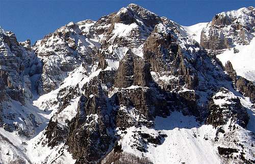
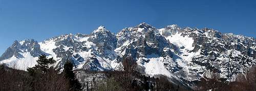
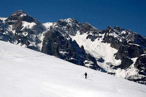
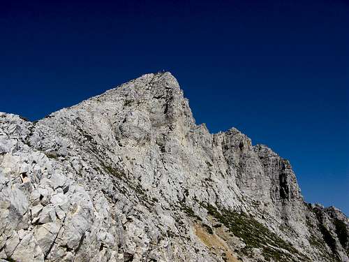
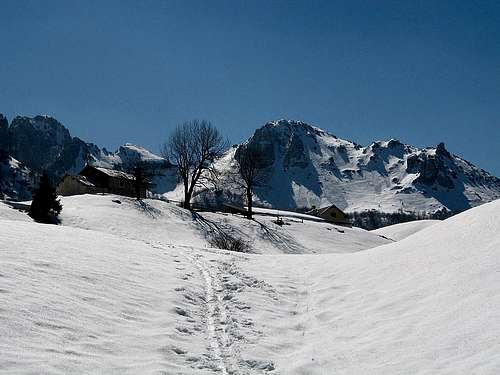
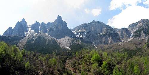
This interesting and beautiful range belongs to the Prealpi Venete and lies from the Adige river to the Piave river between Trento, Verona and Vicenza provinces. All its mountains are very particular: dolomite rock characterized by pinnacles, ravines, hard slopes. The highest summit is Cima Carega 2259 m.

Leontopodium alpinum
The range is made of the Carega Group, the Sengio Alto Group and the 3 Croci (crosses) chain.
These groups have one side full of very steep walls, channels and slopes with big differences in elevation, while on the opposite one the slopes are a little sweeter. Their ridges are broken in sharp towers and spires that give them a typical Dolomiti look. Their walls and ridges are cut by steep rocky channels, here named "Vaj", due to the heavy rainfalls that cause a big soil erosion .
The relief and the complex structure of the ridges and chains are a big obstacle to wind flowing so that the fogs and clouds coming from surrounding valleys usually stop here bringing a very fickle weather. The severe look, the big walls and the steep paths normally descourage the medium hiker but allow this area to keep its historical and environmental prerogatives
Borders
 Carega group
North
Adige river, Leno torrent from Vallarsa, Speccheri lake,Pian delle Fugazze Pass. Leogra valley, Leogra torrent.
East
Pasubio valley, Sterpa valley, Recoaro Terme, Agno torrent
South
Chiampo torrent, Campofontane tableland, Progno Illàsi, Rèvolto valley,
West
Monti Lessini, Pertica Pass, Ronchi valley, S.Valentino valley, Zugna range.
 Carega group Carega group |
 Cima Carega Cima Carega |
 Malga Boffetal Malga Boffetal |
Orography
CAREGA GROUP
TRE CROCI CHAIN
SENGIO ALTO GROUP
Summits
 |
 |
 |
 |
 |
 |
 |
 |
 |
 |
Access
| VALLARSA ( Trentino Alto Adige)SS 46 del Pasubio - Pian delle FugazzeRovereto (201m.) - Vallarsa - Anghébeni - Foxi - Raossi - Pian delle Fugazze ( 1162m.) |
| VALLE DEI RONCHI ( Trentino Alto Adige) SS del Brennero 12 - Ala ( 183m.) - val dei Ronchi - Maso Michéi ( 813m.) - Pertica Pass |
| VAL D'ILLASI ( Veneto )SS 11 Caldiero - Giazza ( 759m.) - Val Revolto - Revolto Refuge ( 1336m.) - Lessini tableland - Pertica Pass |
| VAL DI CHIAMPO ( Veneto ) SS 246 Valdagno Recoaro - Arzignano -Chiampo - Ferrazza ( 361m.) - Ponte del diavolo - Bertagnoli Refuge (1225m.) |
| VALLE DELL'AGNO ( Veneto )SS 11 Recoaro terme - Val dell'Agno di Lora - Cesare Battisti refuge ( 1265m.) |
| VALLE DEL LEOGRA ( Veneto )SS 46 MALO - SCHIO - S Antonio ( 567m.) - Balasso Refuge - Pian delle Fugazze (1162m.) |
Summits
 |
 |
 |
 |
 |
 |
 |
 |
 |
 |
Refuges
- Val Chiampo : Bepi Bertagnolli refuge 1125m.
- Val dell'Agno : Cesare Battisti refuge 1265m.
- Alpe Campogrosso : Campogrosso refuge 1456m.
- Pian delle Fugazze : Balasso refuge 983m.
- Val Revolto : Revolto refuge 1136m.
- Val d'Illasi : Passo Pertica refuge 1152m.
- Passo Pelagatta : Scalorbi refuge 1767m.
- Cima Carega : M.Fraccaroli refuge 2230m.
![Piccole Dolomiti]()
Cymbr
- Cimbri. This is the self-denomination of little minorities scattered throughout Northern Italy and coming from Austria or Southern Bavaria (XII-XIV centuries): the major Cimbre communities are the ones of the 13 Communes ("13 Comuni") on the mounts over Verona, the 7 Communes ("7 Comuni") in the mountains N of Vicenza, and a few villages in the Provinces of Trento (Luserna), Belluno (Sappada/Ploden), Udine (Sauris and Timau). Their peculiar dialects - directly deriving from Middle German are still preserved in some of the villages.
The name "Cimbri" has nothing to do with the Cimbri and Theutones defeated by Marius in North Germany in the first Century BC. It is, on the contrary, to be tied with modern German Zimmer (room < hut made of wood) or with English Timber (wood for construction). These Germanic peoples were called to Italy because they were good wood-cutters and carpenters and especially because they knew how to obtain coal from wood and therefore how to get the high temperatures that were needed for smelting metals. As a consequence when a North Italian Lord wanted to open a mine almost always called Cimbri settlers.
They call themselves Tzimbar, and they speak a Germanic language called "Tauch". The modern version of the origin of this mysterious people could be this: in 1287 Bartolomeo della Scala, bishop of Verona asked some families of woodcutter, "tzimberer" in german, to work in a wide forest, Lessinia. So They settled in this area, the so-called "die Dreizehn Gemeinden/Tredici Comuni".
Alberto M. Mioni, 13 April 2000
Maps
Monte Cornetto
Monte Cornetto
Monte Cornetto
Pasubio- Carega
Sezioni vicentine del CAI 1:25.000
Books
" Guida alle Alpi" - John Ball 1867 / 1868
" Schio Alpina" - Francesco Rossi 1878
" Guida del Trentino" - Ottone Brentari 1890
" Guida Storico alpina di Valdagno, Recoaro, Schio, Arsiero " - Carlo Fontana 1898
" Guida delle Piccole Dolomiti e Pasubio " - 1978 CAI
" Guida alle Piccole Dolomiti" - Baldi ,Pieropan 1986
" Escursioni nel gruppo del Carega" - Roberto Chiej Gamacchio Cierre edizioni 1993
"Itinerari sui Lessini e Piccole Dolomiti" - Manfrini Editori 1995
Links
Weather
For weather and avalanche conditions in Trentino look at this pages:
wetterzentrale
Meteotrentino
Meteo Alpin
Società Meteorologica Italiana