
-
 101743 Hits
-
 85.86% Score
-
 21 Votes
|
|
Mountain/Rock |
|---|---|
|
|
47.44520°N / 121.4549°W |
|
|
5604 ft / 1708 m |
|
|
Overview
The Tooth (AKA "Das Toof") is a very popular peak in the Snoqualmie Pass area near Seattle. With a combination of the close proximity to Seattle, the easy approach, and fun moderate climbing, expect lots of company on a nice summer weekend. The South Face route is considered a local classic climbing the 400 foot steep but blocky Andesite face above Pineapple Pass. The summit views offer an excellent panorama of the Stuart Range, nearby peaks like Snoqualmie and Chair, and Mount Rainier to the south.
The first ascent of The Tooth was on June 25, 1916 by Charles Hazelhurst and C. G. Morrison.
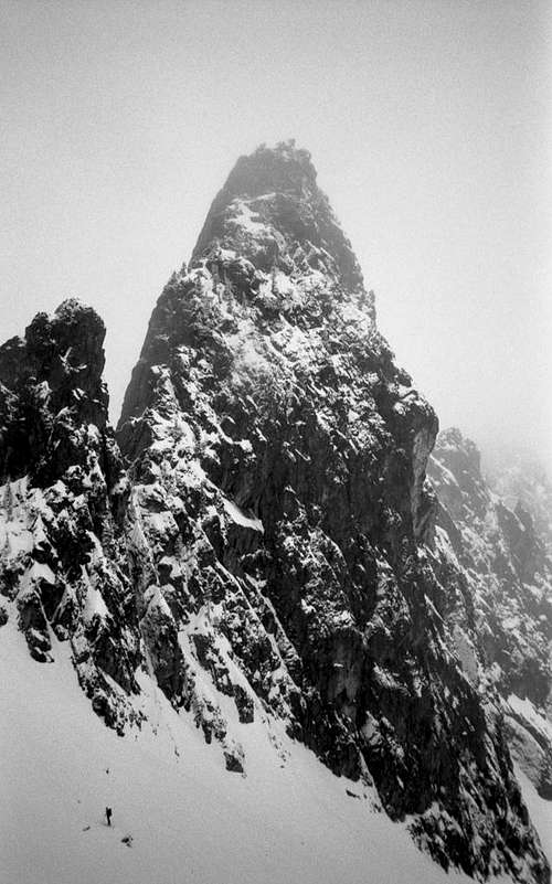
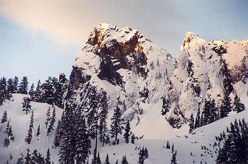 Das Toof from the north on the approach
Getting There
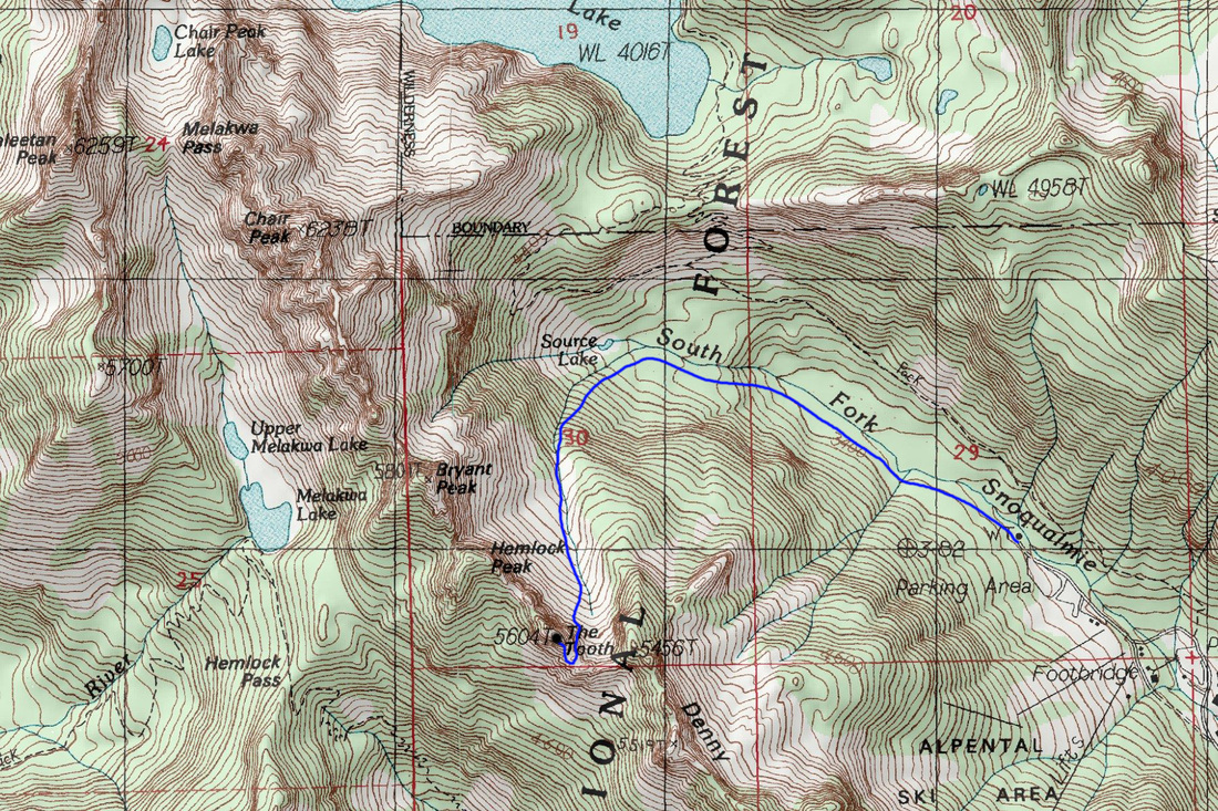
Take I-90 to the West Summit Exit for Snoqualmie Pass. Turn right towards the Snoqualmie Pass ski resort (lots of signs), then park at the end lot (if you have a parking pass) or the lot before that.
Summer - Hike just over a mile up the main trail towards Chair Peak, as it ascends the north side of the valley, about 200 feet above the creek draining Source Lake. At the first switchback to the right, leave this main trail and continue west on a smaller, but good trail contouring above Source Lake. As the trail curves around the lake, a group of 30+ foot high vertical cliffs is visible roughly 500 feet away on your left (south) at about the same elevation as the trail you're on. Just as the trail emerges out from the bushes, leave it and head south, traversing across the large scree and talus slopes and pass below these cliffs, aiming for a wooded area below the left-most cliff. The trail starts in that wooded area, 30-50' below the bottom of the left-most cliff. You will have to lose 100 feet of elevation to get to those trees. In theory, you could get off the main trail early enough to avoid gaining the unnecessary 100 feet to begin with, but with the vegetation, it would entail a considerable bushwhack.
Once through the first group of trees below the cliffs, continue traversing south and cross a 100 foot boulder field and look for a trail heading straight up the hill to climbers left of the talus, near the boundary between the boulder field and the next group of trees.
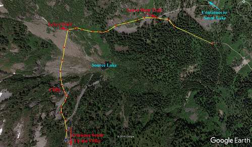 The Tooth Summer Approach Diagram
Winter - Hike up the main trail near the valley bottom along the creek all the way to Source Lake, then turn south in the valley. Hike up the valley until below the east face of The Tooth. Do not follow the summer path, since there is significant avalanche danger there. The trail in the valley to Source Lake is groomed for cross country skiers every winter, but the hike south towards Pineapple Pass up the valley from the lake will usually require deep snow trudging.
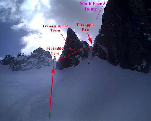
The final approach involves scrambling up to the next notch just south of Pineapple Pass, then contouring around clockwise to get to the start of the climb. A direct scramble up to Pineapple Pass is not recommended, as this is the rappel route. The final portion of the contour around involves some class 3 to 4 scrambling, but it is short and unexposed. Some parties have elected to do a running belay here, but it is not necessary.
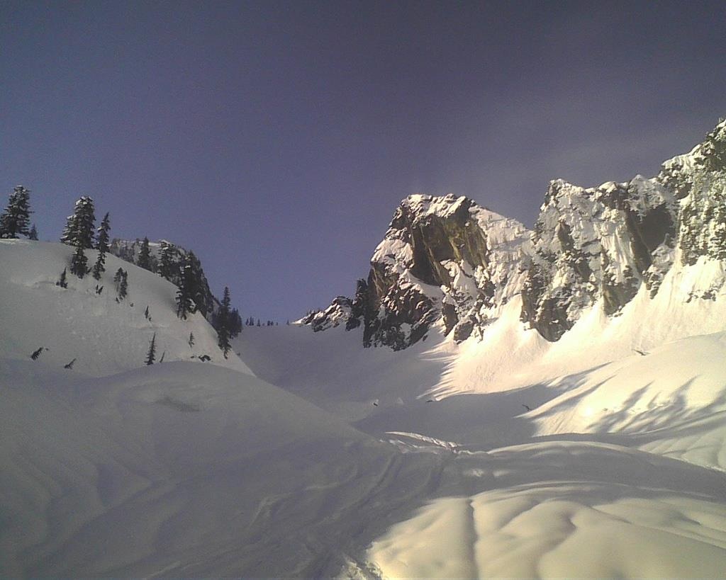 Approaching The Tooth in late winter Approaching The Tooth in late winter |
 The Tooth Approach Diagram The Tooth Approach Diagram |
Routes Overview
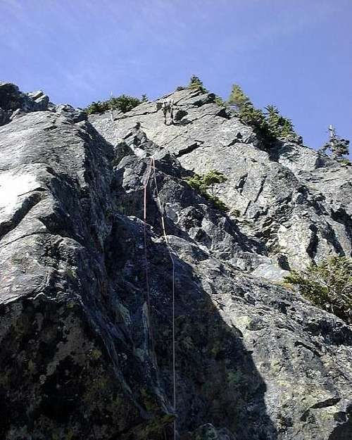
South Face - One of the most popular routes in the entire state. 2 to 4 pitches of steep blocky climbing on sound rock. II 5.4
North Ridge - A class 4 scramble accessed from the west side of the mountain.
East Face - The steepest face on The Tooth offering many variations. Most climbs are 4 to 5 pitches up to class 5.7.
Southwest Face - A straightforward climb of dihedrals accessed from Pineapple Pass. Class 5.5
West Face - Many variations are possible. Most routes are 4th class to low 5th class.
Northeast Slabs - An excellent winter alpine ice route climbing the steep dihedral system up the North Ridge, then continuing on to the summit. See Selected Climbs by Jim Nelson for a route description.
Camping/Red Tape
A Northwest Forest Pass is "required" to park at the trailhead. I put that in quotes because it isn't really required. If you want more information regarding this you can do your own research. In addition, during the winter you can only park at the highest lot if you have an Alpental skiing tag on your car. You will have to park at a lower lot and walk up, if you don't have the tag. An Alpine Lakes Wilderness camping permit is required if you wish to camp. The best spot would be Source Lake, however since the summer trail doesn't pass right by the lake, camping there doesn't make much sense. Also, since the approach is short, most people treat this as a day-climb. Other hikers will camp at Snow or Gem Lakes further up the main trail.
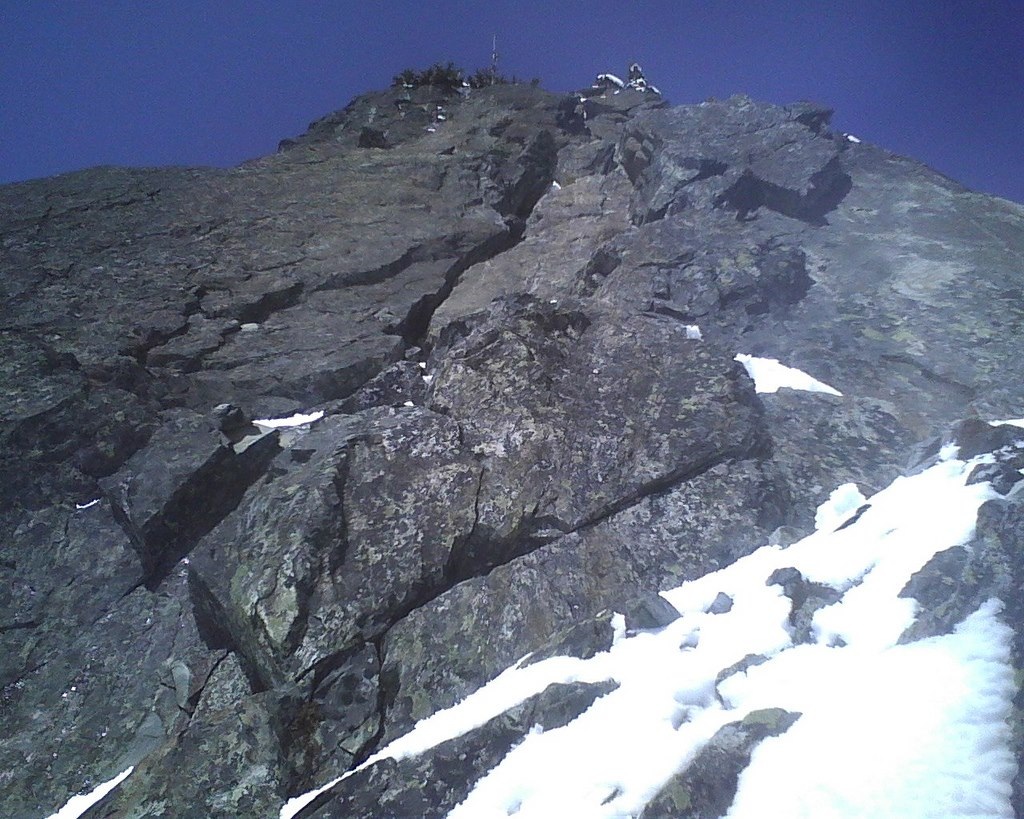 Looking up the south face
When To Climb
The Tooth sees ascents during the entire year. From January to April, the popular South Face route can get moderately snow free on a nice sunny day. During May and early June, the rock is usually dry, but the approach will have quite a bit of snow. Mid summer and fall is the most popular time for this climb. Expect to find lots of company for the South Face. During the winter, a climb of the Northeast Slabs has become quite popular.
Winter Route Map
 Winter Approach Map
Mountain Conditions
The south face (most popular) route is nearly vertical, albeit with ledges that can get snow covered, so if you can make it to Pineapple Pass, the rock on The Tooth will be mostly clear, if cold in winter.
 The Tooth in winter conditions The Tooth in winter conditions |
 The Tooth in summer conditions The Tooth in summer conditions |
External Links
My TR of the South Face in Late Winter