
-
 10652 Hits
-
 90.13% Score
-
 31 Votes
|
|
Mountain/Rock |
|---|---|
|
|
46.90759°N / 11.59607°E |
|
|
Hiking, Mountaineering, Scrambling, Skiing |
|
|
Spring, Summer, Fall, Winter |
|
|
10276 ft / 3132 m |
|
|
Overview
 Wilde Kreuzspitze south face Wilde Kreuzspitze south face |
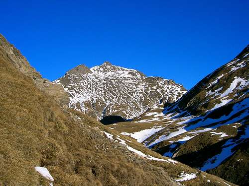
Wilde Kreuzspitze is the highest summits of the Pfunderer Berge / Monti di Fundres Subgroup of the Zillertal Alps. It is one of only a handful of 3000ers in that large subrange and thus is one of the best lookout summits in the area. However, it is buried deep inside the range and access routes cover more than 1900m in elevation. Thus it generally is climbed during two days, with an overnight stay at one of the nearby huts. Wilde Kreuzspitze has two summits, the western of which is the popular climbing summit, while the eastern one is rarely climbed. The two summits make the mountain stand out among its neighbours, an easy task given the fact that it is also the highest one of the whole area.
There are two principal ascent routes to the mountain, both of which are rather longish and offer several variations. The northern route, which is the shorter one has its trailhead in Pfitscher Tal / Val di Vizze and uses either the Burgumer Tal or the Großbergtal to reach the summit. Burgumer Tal is the more popular of the two routes as Sterzinger Hütte is located above its end and thus the access is easier. Consequently, the ascent along Großbergtal is more solitary and since it climbs the Wildes Kar cirque, which is lined by the wild towers of the Fackenzähne, it is the more beautiful. Both approaches combine in the Karjöchl Saddle from where a scree traverse leads to the south-west ridge of the mountain.
The southern ascent equally knows two approaches. One starts in Maulser Tal to the south-west of Wilde Kreuzspitze and heads up the slopes along Gansöralm, avoiding Dreiländerspitze to its east. It ends at Wilder See, from where several routes lead up to the Kreuzspitze south-west ridge. The other approach starts at the end of Valser Tal / Valle di Valles at the end of which Brixner Hütte is located. A wide circle along Rauhtal leads to the Rauhtaljoch Saddle, from which the Kreuzspitze summit can be reached directly.
Wilde Kreuzspitze is a quite popular mountain, since the Pfunderer Höhenweg trekking trail leads close by (Wilder See and Brixner Hütte are touched by it) and it is only a short (but steep) sidestep to reach the mountain.
|


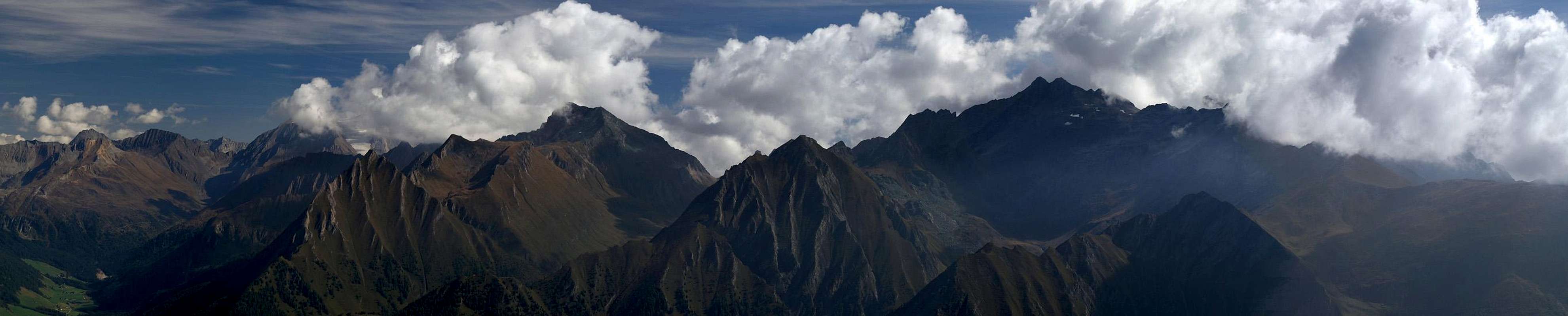
Pfunderer Berge / Monti di Fundres Panorama
  |
Getting There
 Wilde Kreuzspitze and Wurmaulspitze seen from Sulzspitze
The trailheads at Mauls and in Pfitscher Tal are most easily reached from the Brenner Motorway A22 by leaving it at the exit Sterzing / Vipiteno.
Pfitscher Tal is located to the east and you have to follow SS508 until you reach the villages of Burgum or Fußendross.
For the Mauls / Mules trailhead turn onto SS12 south, which takes you through Freienfeld / Campo di Trens to Mauls / Mules. Here leave onto a mountain road which leads to Ritzail / Rizzolo.
The Vals / Valles trailhead can be reached by leaving A22 at the exit Brixen / Bressanone - Pustertal / Val Pusteria. Take SS49 eastward until you reach Mühlbach / Rio di Pusteria. Here a side road turns off north into Valser Tal / Valle di Valles, which you need to follow to its end.
Red Tape
I'm not aware of any red tape in the Pfunderer Berge / Monti di Fundres area.Accommodation
 Grabspitze and Wilde Kreuzspitze seen from Bairnockspitze
The best places to stay are the areas around Sterzing / Vipiteno and Brixen / Bressanone. Here are the links to the respective accommodation sites.
Weather Conditions
Maps & Books
Maps
- Digital Maps
- Regular Maps
- Sterzing / Vipiteno
Kompass Map WK 44
1:50.000
ISBN: 3-85491-050-9
- Brixen / Bressanone
Kompass Map WK 56
1:50.000
ISBN: 3-85491-063-0
- Sterzing / Vipiteno
Books
- Rund um Sterzing
Henriette Klier / Walter Klier
Rother Verlag
ISBN: 3-7633-4167-6
- Pustertal / Tauferer Tal Ahrntal
Kompass Wanderbuch 955
Kompass Verlag
ISBN: 3-87051-408-6
- Zillertaler Alpen
H. Klier / W. Klier
Alpenvereinsführer
Rother Verlag
ISBN: 3-7633-1269-2
- Guida dei Monti d'Italia - Alpi Aurine, Brennero-Gran Pilastro-Vetta d'Italia
F. Cammelli, W. Beikircher
Ed. CAI-Touring Club Italiano, Milano, 2002
ISBN 88-365-2603-9