
-
 58658 Hits
-
 98.72% Score
-
 88 Votes
|
|
Area/Range |
|---|---|
|
|
47.09000°N / 11.96000°E |
|
|
Hiking, Mountaineering, Trad Climbing, Sport Climbing, Toprope, Bouldering, Ice Climbing, Mixed, Scrambling, Via Ferrata, Skiing |
|
|
Spring, Summer, Fall, Winter |
|
|
11517 ft / 3510 m |
|
|
Overview
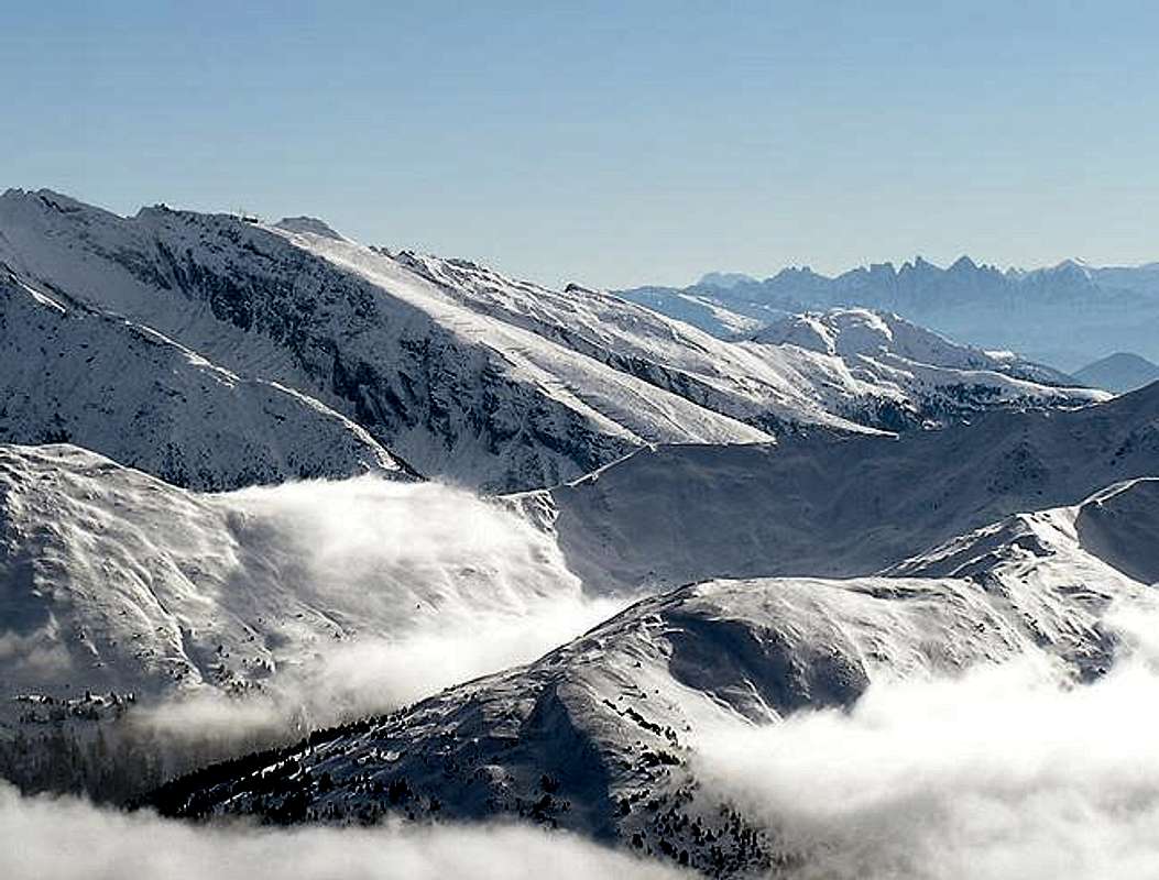
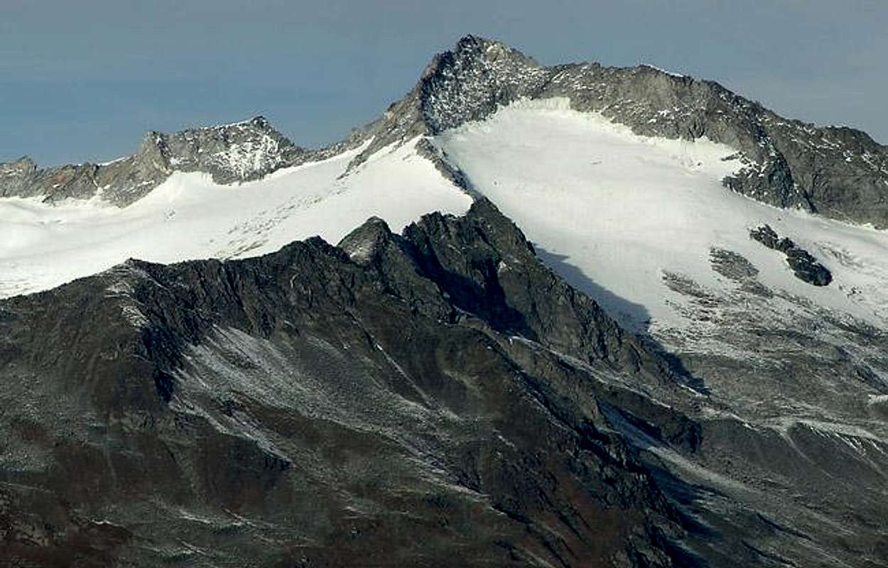
The Zillertal Alps (Italian: Alpi Aurine) are part of the Eastern Alps Main Ridge and quite similar to the neighbouring Ötztal Alps and Stubai Alps they form part of the border between Austria and Italy. To the east the huge mountain range of Hohe Tauern follows with the Venediger and Rieserferner Groups. The Zillertal Alps are less glaciated (meaning that you don't find the large consecutive glaciated areas) than their neighbours though you can find huge glaciers on the northern side of the main Ridge and around Olperer, the highest summit on the Tux Crest (Tuxer Hauptkamm / Alpi Breonie di Levante). Global warming has taken its toll on the south face glaciers, however. The summits reach elevations way over 3000m. The tallest mountain, Hochfeiler / Gran Pilastro measures 3510m.
The boundaries of the Zillertal Alps are the Wipp- and Eisack / Isarco Valleys in the West, the Pustertal / Val Pusteria, Tauferer Tal / Valle di Tures and Ahrntal / Valle Aurina Valleys in the south, the Krimmltal Valley to the east and the Schmirn, Tux and Gerlos Valleys to the north The mountains of the Zillertal Alps are either composed of gneiss (Tuxer Kamm, Main Ridge, Reichenspitze Group) or schist (Pfunderer Berge). Consequently the appearance differs between these two regions which much more eroded summits wherever you find schist.
The mountain range can be easily reached either from Austria or Italy but apart from Brenner Pass there is no north-south road connection between the two countries. The main ridge constitutes a formidable boundary so that you will find few passes even for hikers. While the part of the range around Olperer has been heavily developed for downhill skiing the remainder of the range is still comparatively untouched. In the Austrian part only a handful of hiking trails heads out towards the highest mountains of the Group. In the south things are different, especially in Ahrntal / Valle Aurina and among the summits of Pfunderer Berge / Monti di Fundres.
To reach the summits on the main ridge you need alpinist experience and with the exception of one or two you will never encounter crowds. There are two trekking trails on either side of the border: Berliner Höhenweg in the north, Pfunderer Höhenweg in the south. Both stay shy of the main ridge but offer great views nevertheless. In winter the whole range is a tour skier’s paradise with hundreds of possible ascent routes. The northern routes can be very long thanks to the long side valleys which are closed for traffic at all times of the year.
The Subgroups – the Zillertal Alps on SP
Some notes concerning names and lists:
- Generally I followed the classification as given in the Alpenvereinsführer of the German Alpine Club (see Maps & Books below). However I split the main ridge in two parts, west and east, with the separating line being Stillupgrund Valley in the north of the ridge. The eastern part has been combined with Klockerkarstock, which is the far east of the Zillertal Alps. The Alpenvereinsführer associates the eastern main ridge summits with the respective northern side ridges which start at the summits. I associate them with the main ridge, starting the side ridges from the next summit to the north.
- For the listings I used the map Zillertaler Alpen (WK28 by Kompass Verlag) (see Maps & Books below). It is an excellent overview map (one of their best maps) which shows virtually all summits of the Zillertal Alps / Alpi Aurine. For elevations I have chosen the values given by the Alpenvereinsführer Zillertaler Alpen (also see Maps & Books) not because it is more accurate but because it is much easier to read. I used the Kompass elevations wherever the book wouldn’t give any. Italian names have been determined either by the Alpenvereinsführer book or by www.atlanteitaliano.it.
- Speaking of names – for this page I decided to use the original German names for the several sub and sub-sub-groups. Kamm means ridge or crest and I think the names are easily translated. Most ridges are named by their principal summits; sometimes this is a group of summits. Wherever the need arose I put the English translation in parentheses (). Wherever I could I also noted the Italian names. Not all are used south of the border so that I am confident that I managed to find the most important ones
- Tuxer Kamm / Alpi Breonie di Levante
- Zillertaler Hauptkamm (West)
- Zillertaler Hauptkamm (East)
- Reichenspitze Group
- Pfunderer Berge / Monti di Fundres
- Wilde Kreuzspitze / Picco della Croce
- Napfspitz / Cima Cadini
- Schaflahnernock / Cima delle Pecore
1 – Tuxer Kamm
Lizumer RecknerGamskarsp.Schafseitensp.ReisenschuhOfnerHornsp.Weiße Wand / FrauenwandSchönlahnersp.LärmstangeSchobersp.Grierer Karsp.Kl. KasererHoher RifflerVord. HöllwandHint. HöllwandGr. KasererFalscher KasererOlpererFußsteinKahlwandsp.Hohe WarteSchrammacherSagwandsp.Hohe Wand Sp.KraxentragerHochfeilerHint. Weißsp.Vord. Weißsp.Wildseesp.Rotes BeilWolfendornFelbeGrabsp.Flatschsp.Wurmaulsp.Wilde Kreuzsp.Burgumsp.Großbergsp.Daxsp.Rollsp.HühnerspielGeisler/Odle Group
 |
 |
 |
 |
 |
 |
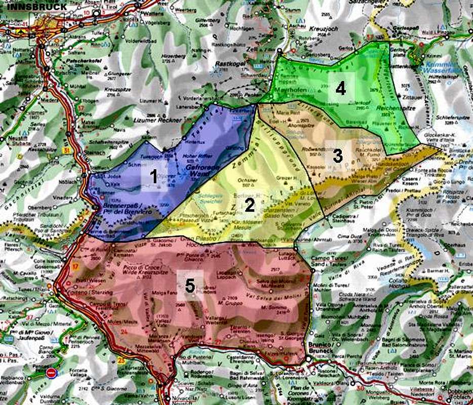
Panorama of the Tuxer Kamm / Alpi Breonie di Levante from Rötenspitze in the west, also sent to me by Viktor Stuffer: Hide / Show annotations (still to come)
Tuxer Kamm (Alpi Breonie di Levante, Tux Ridge) is located in the north-west of the Zillertal Alps. It is bounded by the Schmirntal and Tuxer Tal Valleys to the north, Wipptal Valley to the east, Pfitschtal / Val di Vizze Valley to the south and Zemmtal Valley to the east. The main ridge runs from south-west to north-east with three side ridges turning off northwards. Tuxer Kamm is home to the only summer ski area of the Zillertal Alps, located around Olperer and Gefrorene Wand Spitzen. The summits are listed south-west to north-east.
1.1 - Tuxer Hauptkamm
- Saun / Monte Sommo (2085m)
- Riedspitze / Cima di Novale (2490m)
- Bairnockspitze / Punta del Dosso (2623m)
- Weißspitze / Punta Bianca (2714m)
- Hühnerspiel / Cima Gallina (2748m)
- Rollspitze / Cima Rolle (2806m)
- Daxspitze / Punta del Tasso (2645m)
- Kalkwandstange / Cima della Stanga (2388m)
![]()
- Flatschspitze / Cima Vallaccia (2566m)
- Wolfendorn / Spina del Lupo (2774m)
![]()
- Wildseespitze / Punta del Lago Romito (2733m)
![]()
- Kuhberg (1992m)
- Griesberg (2241m)
- Kraxentrager / La Gerla (2999m)
![]()
- Hohe Wand / Croda Alta (3289m)
![]()
- Sagwandspitze (3224m)
- Schrammacher (3411m)
![]()
- Fußstein (3381m)
- Olperer (3476m)
See the Olperer Page for more information
![]()
- Gefrorene Wand Spitzen (3286m, 3270m)
![]()
- Hoher Riffler (3228m)
![]()
- Kleiner Riffler (2835m)
- Schönlahnerkopf (2707m)
- Grierer Karspitze (2952m)
- Napfspitze (2925m)
- Realspitze (3038m)
- Rosskopf (2957m)
- Mitterschneidkogel (2853m)
- Nestspitze (2965m)
- Hintere Grinbergspitze (2886m)
- Mittlere Grinbergspitze (2867m)
- Vordere Grinbergspitze (2765m)
1.2 - Padauner Kamm
- Saxalmwand (2635m)
- Padauner Berg (2230m)
- Vennspitze (2390m)
- Roßgrubenkofel (2450m)
- Silleskogel (2418m)
1.3 - Valser Kamm
- Kastenwand (2533m)
- Kahlwand (2544m)
- Hohe Warte (2687m)
![]()
- Gampesspitze (2624m)
- Gammerspitze (2537m)
- Riepenspitze (2460m)
- Windbühel (2283m)
- Ottenspitze (2179m)
1.4 - Wildlahner Kamm
- Falscher Kaserer (3255m)
- Großer Kaserer (3266m)
- Kleiner Kaserer (3090m)
- Lärmstange (2684m)
- Frauenwand (2537m)
![]()
- Schoberspitzen (2600m, 2580m)
![]()
- Innere Schönlahnerspitze (2411m)
- Riepenkopf (2420m)
- Jochgrubenkopf (2453m)


2 – Zillertaler Hauptkamm / Alpi Aurine (West)
Niederer WeißzintHochfeilerHoher WeißzintBreitnockMuttnockMöselerkopfMöselenockGroßer MöselerKleiner MöselerMöselenockRoßruggspitzeTurnerkampSattelschneideInnerer SattelnockÄußerer SattelnockPfaffennockWeiße WandGamslahnernockV. HornspitzeGelenknock
 |
 |
 |
 |
 |
 |
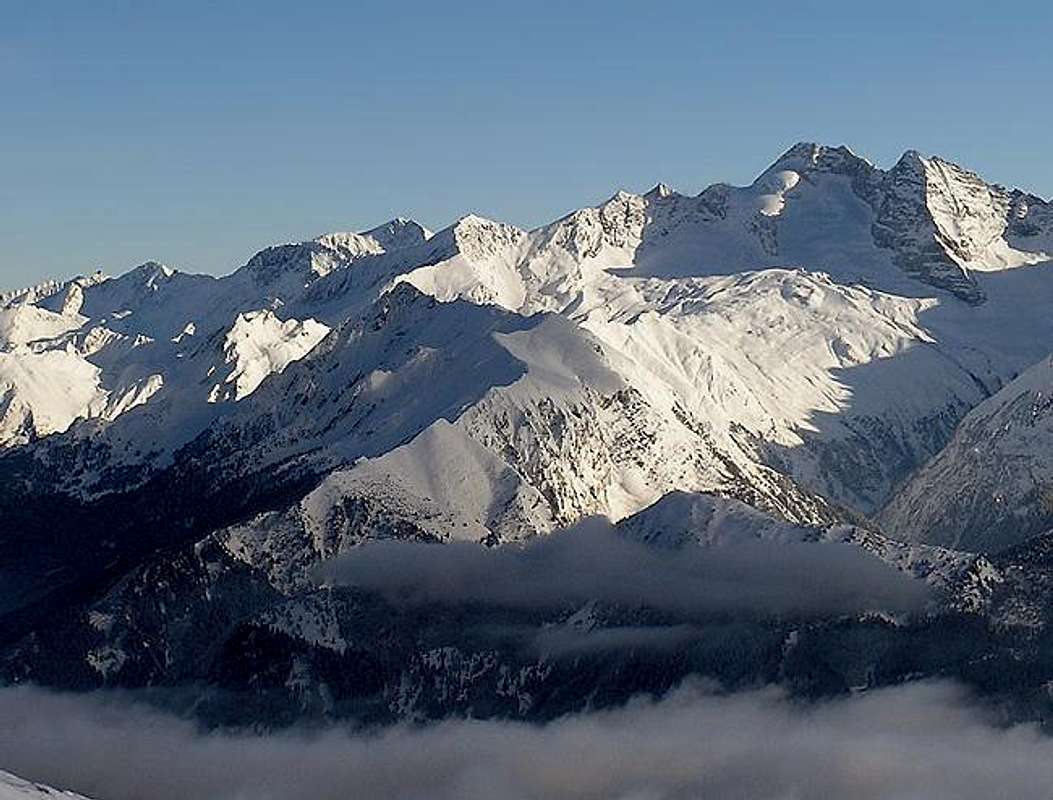
Panorama of the Zillertal Alps Main Ridge / Alpi Aurine, sent to me by Viktor Stuffer. Picture taken from Putzenhöhe in the south. Hide / Show annotations
Zillertaler Hauptkamm (Zillertal Alps Main Ridge / Alpi Aurine) is part of the Alpine Main Ridge and runs roughly from west to east. There are long side ridges to the north (listed separately on this page) and short side ridges to the south (the summits of which are listed together with the main ridge summits. To the south of the main ridge you find Ahrntal / Valle Aurina, a long stretched valley following the main ridge almost completely. Some passes cross over the eastern part of ridge from north to south 
2.1 - Zillertaler Hauptkamm / Alpi Aurine (West)
- Blauer Kofel / Cima di Sottomonte (2860m)
- Filtuidenkopf (3006m)
- Vordere Weißspitze / Cima di Sopramonte Bassa (3276m)
- Hintere Weißspitze / Cima di Sopramonte Alta (3431m)
- Hochfernerspitze / Cima Grava (3463m)
- Haupenhöhe (3041m)
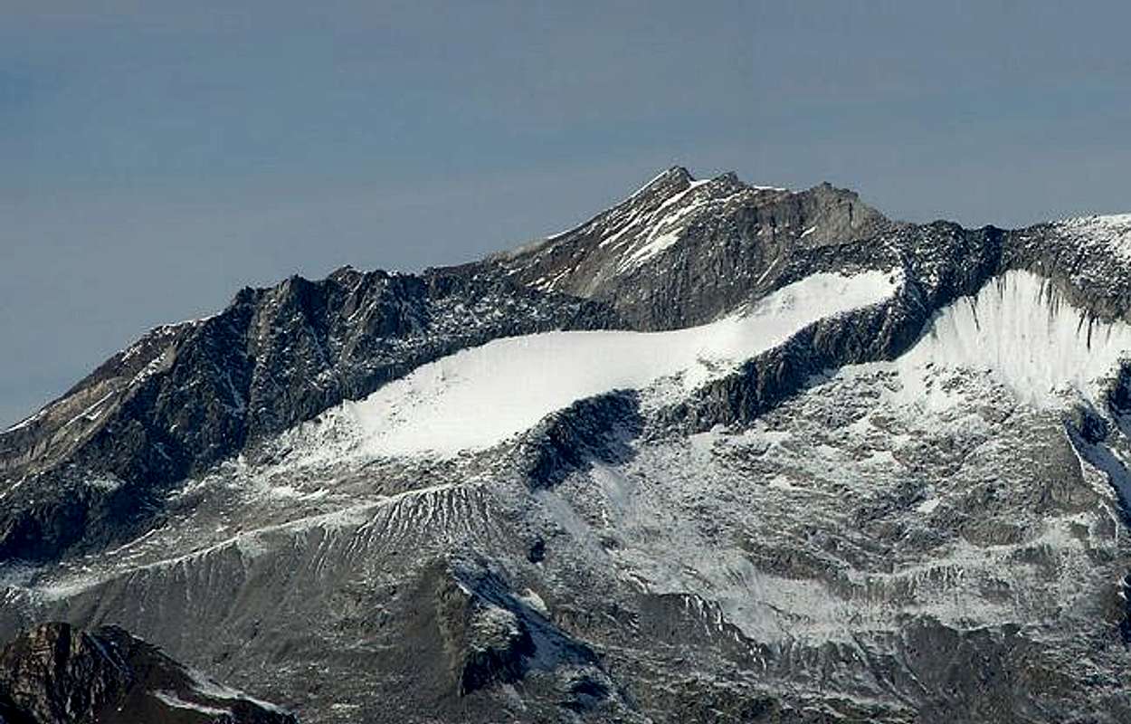
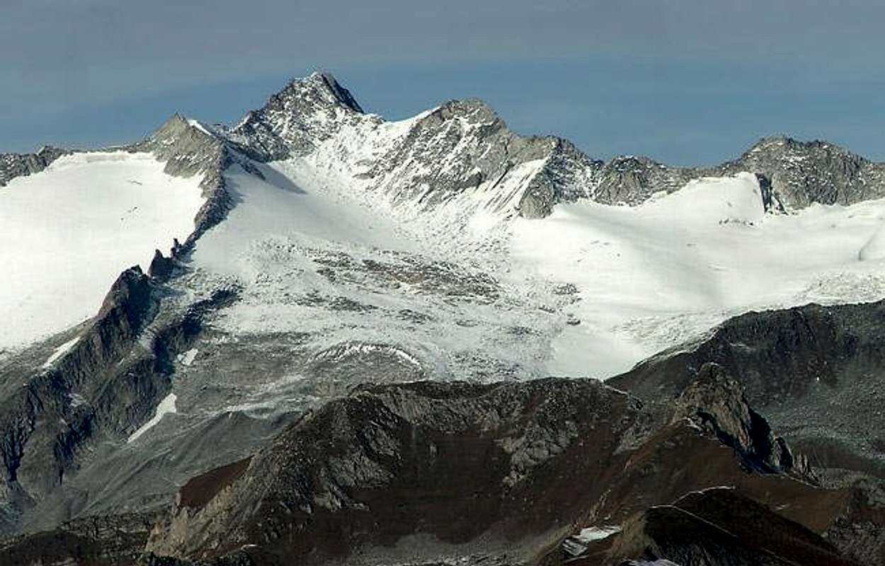
- Hochfeiler / Gran Pilastro (3510m)
See the Hochfeiler Page for more information


- Hoher Weißzint / Punta Bianca (3371m, 3380m)

- Niederer Weißzint / Punta Bianca Bassa (3271m, 3264m)
- Breitnock / Dosso Largo (3215m)
- Muttennock / Monte Mutta (3072m)
- Großer Möseler / Mèsule (3478m)


- Kleiner Möseler / Piccolo Mèsule (3405m)
- Roßruggspitze / Dosso di Cavallo (3304m)
- Turnerkamp / Cima di Campo (3418m)
See the Turnerkamp Page for more information


- Innere Sattelnock / Cima di Sella Alta (3048m)
- Äußere Sattelnock / Cima di Sella Bassa (3084m)
- Pfaffennock / Cima del Prete (2973m)
- Möselenock (2712m)
- Gelenknock / Cima della Costa (2882m)
- Äußere Grüne Platte (2800m)
- Innere Grüne Platte (2911m)
- V. Hornspitze / V Corno di Ghega (3146m)
- VI. Hornspitze / IV Corno di Ghega (3197m)
- III. Hornspitze / III Corno di Ghega (3253m)
- II. Hornspitze / II Corno di Ghega (3199m)
- I. Hornspitze / I Corno di Ghega (3170m)
- Äußerer Schwarzbachkopf (2831m)
- Innerer Schwarzbachkopf (2897m)
- Scharhaggen / Cima della Gola (2649m)
- Hantigenklamm Spitze (2574m)
- Schafbretterspitze / Lastè delle Peccore (2520m)
- Schönberg / Montebello (2278m)
- Schwarzenstein / Sasso Nero (3368m)
See the Schwarzenstein Page for more information


- Schwarzenbachspitze / Monte Rio Nero (3254m)
- Eisenburg (2967m)
- Zwilcher (2728m)
- Großfädenler / Cima Fädenler Grande (2764m)
- Goleitkopf (2510m)
- Kleinfädenler / Cima Fädenler Piccola (2302m)
- Wolfskofel / Monte Lupo (2040m)
- Tribbachkopf / Testa Riotorbo (3112m)
- Kreuzkofel / Sasso della Croce (2420m)
- Rohrberg / Monte Rosso (2003m)
- Westliche Floitenspitze / Cima di Floite Ovest (3194m)
- Östliche Floitenspitze / Cima di Floite Est (3154m)

- Tribbachspitze / Punta Riotorbo (3267m)
- Großer Löffler / Monte Lovello (3376m)


- Kleiner Löffler (3224m)
- Schneeschneide (3048m)
- Speikofel (2910m, 2762m)
- Wagnerspitze (2644m)
2.2 - Hochstellerkamm
(starting at Haupenhöhe) - Hochsteller (3097m)
![]()
- Kälberlahnerspitze (2929m)
- Kleiner Hochsteller (2860m)
- Rotbachlspitze / Croda Rossa (2897m)

2.3 - Greinerkamm
(starting at Großer Möseler) - Furtschaglspitze (3190m)
See the Furtschaglspitze Page for more information. - Schönbichler Horn (3133m)
![]()
- Talggenköpfe (3114m, 3176m, 3138m)
- Großer Greiner (3199m)
- Kleiner Greiner (2958m)
- Greinermauer (2885m)
- Spiegelkamp (2762m, 2875m)
- Spitzeggkopf (2619m)
- Zwiselkopf (2584m)
- Spiegelkopf (2102m)
2.4 - Mörchenkamm
(starting between Schwarzenstein and Floitenspitzen) - Großer Mörchner (3283m)

- Mörchenschneide (3230m)
- Kleiner Mörchner (3197m)
- Roßköpfe (3028m, 3031m, 2968m, 2961m)
- Zsigmondyspitze (3087m)
- Tiefenkarspitze (2699m)
- Kellerkopf (2720m)
- Lappenkopf (2712m)
- Friderich (2634m)
- Gaulspitze (2411m)
2.5 - Ingentkamm
(starting at Kleiner Mörchner) - Plattenkopf (2899m)
- Rotkopf (2986m)
- Ochsner (3108m)
- Hennstiegenspitze (3002m)
- Hennsteigenkamp (2606m)
- Großer Ingent (1926m)
- Kleiner Ingent (2840m)
- Kellerspitzen (2712m)
- Trenker (2399m)
2.6 - Floitenkamm
(starting at Großer Löffler) - Greitzer Spitze (3007m)
- Lapenspitze (2992)
- Gigalitzturm (2978m)
- Gigalitz (3002m)
- Kreuzspitze (2896m)
- Birbergspitze (2847m)
- Zaunköpfe (2760m, 2772m, 2746m)
- Toifler (2727m)
- Drei Könige (2686m, 2675m, 2650m)
- Floitenturm (2805m)
- Schliererspitze (2688m)
- Roflspitze (2712m)
- Blaser (2695m)
- Dristner (2765m)


3 - Zillertaler Hauptkamm / Alpi Aurine (East)

See description of the western part of the main ridge which applies here too.
3.1 - Zillertaler Hauptkamm / Alpi Aurine (East)
- Sonntaggabel (3052m)
- Keilbachspitze / Punta del Conio (3093m)
- Oberwasserer (2910m)
- Kasseler Spitze (2957m)
- Grüne Wand Spitze / Croda Verde (2946m)
- Gfallenspitze / Punta del Cavallo (2966m)
- Keilbachbretter / Monte Bel Prato (2376m)
- Wollbachspitze / Punta di Valle (3210m)
- Hollenzkopf / Testa di Landro (3193m)
- Rotwandspitze / Cima di Croda Rossa (3050m)
- Moosköpfe (2262m, 2214m)
- Hollenzkofel / Cima di Ladro (2852m)
- Speikofel (2591m)
- Napf (2734m)
- Sonnwand (2837m)
- Napfspitze / Cima Cadini (3144m)
- Löffelspitze (3009m)
- Wagnerschneidspitze / Cima Triangolo (2897m)
- Rauchkofel / Monte Fumo (3251m)

- Winkelkopf (2858m)
- Windbachspitze / Punta Val del Vento (2878m)
- Dreiecker / Cima di Campo (2892m)
- Schüttalkopf / Punta Val di Frane (2773m)
![]()
- Tauernkogel / Testa dei Tauri (2872m)
- Klockerkarkopf / Vetta d’Italia (2911m)
See the Klockerkarkopf Page for more information - Zwillingsköpfe (2835m, 2841m)
- Steinkarspitze / Cima Quaira (2869m)
3.2 - Ahornkamm
(starting at Wollbachspitze) - Hintere Stangenspitze (3227m)
- Vordere Stangenspitze (3120m)
- Roßwandspitze (3158m)
- Maderegglespitze (3050m)
- Grundschartner (3064m)
- Mugler (2958m)
- Wilhelmer (2938m)
- Popbergspitze (2889m)
- Ahornspitze (2976m)
- Filzenkogel (2227m)
- Trenkner (2668m)
- Mullner (2818m)
- Gfallschneid (2732m, 2763m)
3.3 - Riblerkamm
(starting at Napfspitze) - Hohe Warte (3097m)
- Hoher Ribler (2974m)
- Hohe Gaulschneide (2824m)
- Hahn (2453m)
3.4 - Magnerkamm
(starting at Rauchkofel) - Kleinspitze (3170m)
- Magnerkarköpfe (2877m, 2893m)
- Großer Magner (2874m)
- Kleiner Magner (2589m)


4 – Reichenspitze Group

The Reichenspitze Group (also called Gerlos Group) is located to the north-east of the Zillertal Alps. It is bounded by Gerlostal Valley to the north, Zillergrund Valley to the west and south and Krimmler Achental Valley to the east. It is composed of several ridges, all running south to north with glaciation mainly around the principal summits Reichenspitze and Wildkarspitze.
4.1 - Reichenspitzkamm
- Zillerplattenspitze (3147m)

- Warze (2802m)
- Windbachtalkopf (2844m)
- Windbachkarkopf (2765m)
- Graukarkopf (2663m)
- Gamsbichlkopf (2644m)
- Rainbachspitze (3129m)
- Nadelspitzen (2975m, 2955m)
- Spaten (2956m)
- Schwarzkopf (3042m, 3079m)
- Richterspitze (3054m)
- Zillerspitze (3091m)
- Reichenspitze (3303m)

- Gabler (3260m)
![]()
- Mannlkarkopf (2870m)
- Hahnenkamm (3206m)
- Wildgerlosspitze (3280m)
4.2 - Gerloskamm
Roßkopf (2845m)
![]()
- Rainbachegg (2530m)
- Rainbachkopf (2669m)
- Rettenkarkopf (2968m)
- Hinterer Schaflkopf (3057m)
- Wildkarspitze (3073m)
- Seekarspitze (2914m)
- Trisslkopf (2694m)
- Arbeskopf (2400m)
- Rosskopf (2606m)
- Steinkarkopf (2475m)
- Rauher Kopf (2055m)
- Plattenkogel (2039m)
4.3 - Schönachkamm
- Schneekarspitze (3209m)
- Sichelkopf (2962m)
- Sehndlspitze (2885m)
- Weißkarkopf (2850m)
- Ankenkopf (2700m)
- Gamsspitzl (2440m)
- Hanger (2473m)
- Pfannkogel (2310m)
- Schönbichl (2049m)
4.4 - Wimmerskamm
- Plattkopf (2594m)
- Schönachschneid (2991m)
- Zillerkopf (2997m)
- Steinkarkopf (2740m)
- Schwarzer Kogel (2777m)
- Stange (2714m)
- Kuglater Hauer (2610m)
- Hauerspitzen (2660m)
- Wechselspitze (2637m)
- Kirchspitze (2312m)
- Brunellköpfe (2158m)
- Arbiskögel (2049m)
4.5 - Schwarzachkamm
- Aukarkopf (2736m)
- Schneekarkopf (2843m)
- Rotkopf (2819m)
- Gamskarkopf (2790m)
- Höhenbergkarkopf (2791m)
- Rötenköpfe (2705m)
- Pfannstielkopf (2528m)
- Kehlkopf (2230m)
- Schafkogel (2097m)
4.6 - Zillerkamm
- Hochsteinfläche (2769m)
- Hinterer Falk (2669m)
- Äußerer Falk (2668m)
- Gamskopf (2643m)
- Brandberger Kolm (2701m)
- Torhelm (2452m)
- Geißkopf (2227m)
- Hochfeld (2350m)
- Gerlossteinwand (2166m)


5 – Pfunderer Berge
The Pfunderer Berge Group (Monti di Fundres, Pfunders Mountains) occupies the whole area of the Zillertal Alps south of the Austrian – Italian border. The group is bounded by Eisacktal Valley / Val Isarco to the west, Pustertal Valley / Val Pusteria to the south and Tauferer Tal Valley / Val di Tures to the east. The natural northern boundary is the Zillertal Alps Main Ridge. This part of the range offers the best hiking possibilities with a six day trekking trail, Pfunderer Höhenweg, leading all the way from Sterzing / Vipteno to Buneck / Brunico.
5.1 - Kreuzspitzkamm
Höllenkragen / Giogo di Trens (2387m)
- Sengesspitze / Cima di Sengas (2368m)
- Finsterstern / Cima Stella (2514m)
- Wilde Kreuzspitze / Picco della Croce (3132m)
- Großbergspitze / Monte Grande (2701m)
![]()
- Burgumspitze / Monte di Bargone (2581m)
- Glatte Wand / Croda Liscia (2708m)
- Blickenspitze / Cima di Vista (2988m)
- Ehrenpolspitze / Cima d’Era (2774m)
- Sandjochturm / Torre Rena (2700m)
- Sandjochspitze / Cima Rena (2755m)
- Grabspitze / Cima Grava (3059m)
![]()
- Torwand / Croda della Porta (2640m)
- Felbesspitze / Cima Felbes (2849m)
![]()
- Hochsäge / Monte Sega (2778m)
- Rotes Beil / Punta Rossa (2949m)
- Engbergspitze / Monte Stretto (2816m)
- Röteck / Cima Rossa (2930m)
- Dannelspitze / Punta di Dan (2806m)
- Weißensteinspitzen (2524m, 2550m)
- Faßnachtspitze / Monte Botte (2537m)
- Weißwand / Croda Bianca (2497m)
- Hochwartspitzen / Monti Guardia Alta (3045m, 3068m)
- Magsteinwipfel / Picco del Sasso (2775m)
5.2 - Plattspitzkamm
- Seespitze / Cima del Lago (2740m)
- Sattelspitze / Cima Sella (2650m)
- Domenarspitze / Monte Domenar (2718m)
- Dreihornspitze / Cima Tre Corni (2696m)
- Plattspitze / Cima Piatta (2669m)
- Rensenspitze (2473m)
- Steinermanndl (2118m)
- Kampelesspitze / Cima di Campo (2088m)
- Altes Karl / Monte Campo Quaira (2031m)
5.3 - Wurmaulkamm
- Rübesspitze / Punta Riva (2787m)
- Pfannespitze / Cima di Fane (2709m)
- Eselskopf / Testa d’Asino (2839m)
- Wurmaulspitze / Cima di Valmala (3022m)

- Rotwand / Croda Rossa (2928m, 2930m)
- Seefeldspitze / Cima di Lago (2715m)
- Fensterlekofel / Cima di Finestra (2564m)
- Gurnatschspitze (2581m)
- Gaisjochspitz / Cima della Carpa (2641m)
- Bretterspitze / Cima di Paolo (2695m)
- Korsspitze / Punta Corno (2610m)
- Nock / Monte Campanella (2531m)
- Fallmetzer / Monte Val di Mezzo (2568m)
- Gitsch / Monte Cuzzo (2510m)
5.4 - Grubbachkamm
- Napfspitze / Cima Cadini (2888m)
![]()
- Eisbruggspitze / Cima Ponte di Ghiaccio (2887m)


- Roter Riffl / Scoglio Rosso (2874m)
- Schwarzer Riffl / Scoglio Nero (2752m)
- Dengelstein / Monte Dengolo (2698m)
- Neblnock / Dosso Malo (2615m)
- Flemmberg / Monte Flemm (2696m)
- Hochgrubbachspitze / Monte Gruppo (2809m)
- Gamsburg / Rocca die Camosci (2756m)
- Eidechsspitze / Cima di Terento (2738m)
- Steinspitz / Punta del Sasso (2509m)
- Rotwand / Croda Rossa (2774m)
- Graunock / Monte Grigio (2827m)
- Kempspitze / Monte Pausa (2704m)
- Reisnock / Monte Stipa (2663m)
- Mutenock / Monte Mutta (2484m)
- Hohe Spitze / Punta Alta (2410m)
- Zwölferspitze / Cima Dodici (2351m)
- Putzenhöhe / Cime di Pozzo (2438m)
- Knaphenne / Dosso sei Canopi (2132m)
- Perntalerspitze / Cima Valperna (2450m)
- Plattnerjochspitze (2435m)
- Westliche Bruggerspitze (2428m)
- Windeck / Cima del Vento (2418m)
- Östliche Bruggerspitze (2357m)
- Sambock / Monte Sommo (2396m)
5.5 - Mühlwalder Kamm
- Schaflahnernock / Cima delle Peccore (2703m)
- Weiße Wand / Croda Bianca (2717m)
- Tristenspitze / Cima dei Covoni (2716m)
- Ringelstein / Sasso Tondo (2451m)
- Zinnsnock (2459m)
- Gornerberg / Monte Corno (2475m)
- Fadner (2457m)
- Stoßkofl (2474m)
- Seewassernock (2433m)
- Speikboden / Monte Spico (2517m)

- Großer Nock / Il Dosso Grande (2400m)
- Kleiner Nock / Il Dosso Piccolo (2227m)


Getting There
The Zillertal Alps / Alpi Aurine can be reached easily from three sides: Zillertal to the north, Wipp- / Eisacktal / Val di Isarca to the west and Ahrntal / Valle Aurina to the south. There are no road passes in the range, which leaves the exploration to us pedestrians.Since the closest airport is at Innsbruck the following itineraries presume that you are starting there.
- Zillertal
There are two acess possibilities, the more direct of which is taking Inntalautobahn (motorway A12) from Innsbruck east towards Kufstein. At the exit Jenbach turn off onto B160 which leads directly into Zillertal Valley. The other access road leads from Kitzbühel along B161 south to Mittersill. Here turn west onto B165 into Pinzgau and onwards across Gerlos Pass into Zillertal Valley. - Wipptal / Eisacktal
Take Brenner Motorway (A13 / A22) from Innsbruck direction south. Depending on your final destination chose one of the side valleys to the east of the Brenner Route. - Pustertal / Tauferer Tal / Ahrntal
Again take Brenner Motorway (A13 / A22) towards Brixen / Bressanone. There turn off onto SS49 through Pustertal / Val Pusteria. At Vandoies / Vintl you can turn onto SP153 north into Pfunderer Tal or you can turn north at Bruneck / Brunico into Tauferer Tal / Val di Tures. SS621 will take you onward to Ahrntal / Valle Aurina.
Alternatively you can take B161 from Kitzbühel to Lienz, where you can turn west into Pustertal Valley.
Red Tape
Most of the Austrian part of the Zillertal Alps has been declared Natural Park (Naturpark Zillertaler Alpen). The easternmost part of the Zillertal Alps already belongs to Naturpark Hohe Tauern and along the main ridge a "Ruhezone" (sanctuary) has been established. All this mainly restricts development in these areas but also protects many of the plants and flowers of the area. Restrictions are rarely enforced but can be.
Mountain Huts and Refuges
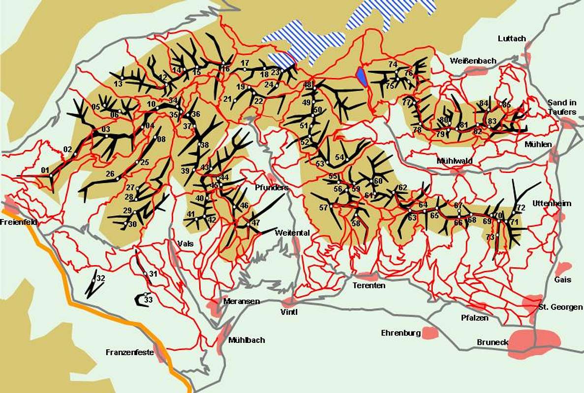
The Zillertal Alps are home to a great many mountain huts. Almost any summit can be reached in a day from one of these refuges. Most of the huts close for winter while some (mainly deeper down in the valleys) remain open for the winter. In November and May almost all huts are closed. The following table lists the refuges according to the valleys through which they can be reached.
Neugersdorfer Hütte / Rifugio Vetta d'Italia(2568mm)n.a.n.a.n.a.
| Refuge / Hut | Height | Summer | Winter | Tel. | Thumbnails |
| Zillertal Valley | |||||
| Gerlossteinhaus | (1620m) | Mid June – beg. Oct | Christmas – beg. April | +43 5282 2419 | |
| Edelhütte | (2237m) | Mid June – end Sept | Depends on the cable car schedule | +43 664 9154851 | |
| Gerlostal Valley | |||||
| Zittauer Hütte | (2329m) | Mid June – mid Oct. | closed | +43 676 6331745 | |
| Zillergrund Valley | |||||
| Brandbergkolmhaus | (1842m) | n.a. | n.a. | +43 5285 3175 | |
| Plauener Hütte | (2362m) | Mid June – mid Sept. | closed | +43 650 2250370 | |
| Stilluppgrund Valley | |||||
| Grüne Wand Hütte | (1438m) | May – Oct | closed | +43 664 4332107 | |
| Kasseler Hütte | (2177m) | Mid June – end Sept. | closed | +43 664 1323514 | |
| Zemmtal Valley | |||||
| Friesenberghaus | (2498m) | Mid June – end Sept. | closed | +43 676 7497550 | |
| Dominikushütte | (1805m) | Mid May – end Oct. | closed | +43 5286 5216 | |
| Olpererhütte | (2389m) | Beg June – end Sept. | closed | +43 664 3706709 | |
| Furtschaglhaus | (2295m) | Mid June – end Sept. | closed | +43 676 9579818 |  |
| Grawandhütte | (1640m) | Beg. May – beg. Oct. | closed | +43 5286 5213 | |
| Wirtshaus Alpenrose | (1875m) | Beg May – beg. Oct | closed | +43 5286 5222 | |
| Berliner Hütte | (2040m) | Mid June – end Sept | closed | +43 5286 5223 |  |
| Greizer Hütte | (2226m) | End July – beg. Oct. | closed | +43 664 1405003 | |
| Tuxer Tal Valley | |||||
| Gamshütte | (1916m) | Mid June – end Sept. | closed | +43 676 3437741 | |
| Höllensteinhütte | (1740m) | n.a. | n.a. | +43 5287 87696 | |
| Spannagelhaus | (2528m) | n.a. | n.a. | +43 5287 87707 | |
| Tuxer Joch Haus | (2313m) | Mid June – beg Oct | Dec - April | +43 5287 87216 | |
| Schmirntal, Valser Tal Valleys | |||||
| Bergrestaurant Jochtal | (2006m) | all summer | closed | +39 0472 547039 | |
| Geraer Hütte | (2324m) | End June – mid Sept | closed | +43 676 9610303 | |
| Eisacktal Valley | |||||
| Enzianhütte / Rif. Genziana | (1903m) | n.a. | n.a. | +39 0472 631224 | |
| Hühnerspielhütte / Rifugio Malga Gallina | (1868m) | Mid June – end Sept. | closed | +39 0472 62398 | |
| Landshuter Europahütte / Rif. Europa | (2693m) | Mid June – end Sept. | closed | +39 0472 646076 | |
| Pfitscher Joch Haus / Rif. Passo di Vizze | (2248m) | Beg. July – end Sept. | closed | +39 0472 630119 | |
| Hochfeilerhütte / Rif. Gran Pilastro | (2710m) | Beg June – end Oct. | closed | +39 0472 646071 | |
| Sterzinger Hütte / Rif. Vipiteno | (2444m) | All summer | closed | +39 0472 646074 | |
| Pustertal Valley | |||||
| Brixner Hütte / Rif. Bressanone | (2300m) | Mid June – mid Oct | closed | +39 0472 547131 | |
| Tiefrastenhütte / Rif. Lago di Pausa | (2312m) | Beg. June – mid Oct. | closed | +39 0474 554999 |  |
| Tauferer Tal, Ahrntal Valleys | |||||
| Eisbruggjochhütte (Edelrautehütte) / Rif. Ponte di Ghiaccio | (2545m) | end June - end Sept. | closed | +39 0474 653230 |  |
| Nevesjochhütte / Rif. Giovanni Porro | (2416m) | Mid June – beg. Oct | closed | +39 0474 653244 |  |
| Schwarzensteinhütte / Rif. Vittorio Veneto | (2923m) | End June – mid Sept. | Beg. March – beg. May | +39 0474 671160 |  |
| Birnlückenhütte / Rif. Brigata Tridentina | (2440m) | Mid June – beg. Oct. | closed | +39 0474 654140 |  |
| Pinzgau, Krimmler Achental Valleys | |||||
| Krimmler Tauernhaus | (1622m) | All summer | All winter | +43 6564 8327 | |
| Richterhütte | (2374m) | Mid June – end Sept. | closed | n.a. | |
Additionally there are a handful of Bivouacs in the range:
| Bivouac | Height | Thumbnails |
| Weißkarjöchl Biwak | 2120m | |
| G. Messner Biwak | 2429m |  |
| W. Brenninger Biwak | 2157m | |
| Bivacco E. Miglioranza | 2545m |
Accommodation
On both sides of the border you have the choice among a lot of hotel rooms and apartments. Here is a selection of links:
- Zillertal
- Wipptal
- Eisacktal / Valle Isarco
- Lower Pustertal / Val Pusteria Bassa
- Ahrntal / Valle Aurina
Weather Conditions
Look for the actual weather conditions, using one of the links below:
- Zillertal weather information
- Tyrol weather information
- South Tyrol / Alto Adige weather information
Maps & Books
- Maps
Kompass has some very good overview maps, scaled 1:50000 which show all the necessary trails but don't go into too much detail:- Zillertaler Alpen / Tuxer Alpen
Kompass Map WK37
1:50000
ISBN: 3-85491-042 - 8 - Taufers-Ahrntal / Tures-Valle Aurina
Kompass Map WK82
1:50000
ISBN: 3-87051-091-9 - Sterzing / Vipiteno
Kompass Map WK44
1:50000
ISBN: 3-85491-050-9
Better are the maps by the German Alpine Club, available for the nothern (Austrian) part of the range. They are scaled 1:25000 and can be obtained by The DAV-Shop (look under "Zentralalpen"). Both hiking and ski-touring trails are marked on these maps. There are three maps:- 35/1 Zillertaler Alpen, westl. Blatt
- 35/2 Zillertaler Alpen, mittl. Blatt
- 35/3 Zillertaler Alpen, östl. Blatt
The southern part of the Stubai Alps is covered by the following Tabacco Maps, all also scaled 1:25000:- 35: Campo Tures / Sand in Taufers
- 36: Gran Pilastro/Hochfeiler – Monti di Funders/Pfunderer Berge
- 37: Vipiteno-Alpi Breonie / Sterzing – Stubaier Alpen
- Zillertaler Alpen / Tuxer Alpen
- Maps Online
- Books
- Zillertaler Alpen
H. Klier / W. Klier
Alpenvereinsführer
Rother Verlag
ISBN: 3-7633-1269-2 - Zillertal
W. Klier
Rother Verlag
ISBN: 3-7633-4175-7 - Pustertal, Tauferer Tal, Ahrntal
Kompass Wanderbuch 955
KompassVerlag
ISBN: 3-87051-408-6 - Guida dei Monti d'Italia - Alpi Aurine, Brennero-Gran Pilastro-Vetta d'Italia
F. Cammelli, W. Beikircher,
Ed. CAI-Touring Club Italiano, Milano, 2002
ISBN 88-365-2603-9 - 100 scalate su ghiaccio e misto
W. Pause
Ed. Goerlich-Istituto Geograqfico de Agostini S.p.A., Novara, 1978; - I monti della Valle Aurina
L.A. Fincato, M. Galli
Ed. Industria Grafica Pusteria (1985); - Monti Rifugi Paesi delle Valli Aurina e Pusteria
L.A. Fincato
Ed. DIP-Druck, Brunico (2000)
- Zillertaler Alpen