
-
 16186 Hits
-
 77.48% Score
-
 8 Votes
|
|
Mountain/Rock |
|---|---|
|
|
39.28340°N / 105.1302°W |
|
|
Download GPX » View Route on Map |
|
|
Douglas |
|
|
Hiking |
|
|
Spring, Summer, Fall, Winter |
|
|
8894 ft / 2711 m |
|
|
Overview
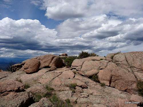
Campbell Mountain summit area
Campbell Mountain is a small peak, but it offers plenty of adventure, requiring off-trail navigation and easy scampering to reach the top. The views from the top of this petite little beauty more than justify the effort to gain the summit.
Rank: 2999th highest peak in Colorado
Prominence: 394 feet
USGS Quad: Deckers
Planning Map: Trails Illustrated #135 Deckers | Rampart Range
Rank & Prominence: Lists of John
![Heavily eroded trail]()
Heavily eroded trail![Rock outcrop en route]()
Rock outcrop en route
Most visitors to this peak will access the mountain via from Cabin Ridge Trailhead off of Rampart Range Road. The Cabin Ridge Trailhead is roughly 9 (8.5 per my odometer) miles south of CO Hwy 67.
Cabin Ridge Trailhead
From Denver:
•Travel south on Highway 85 (also called Santa Fe) 10 miles to the small town of Sedalia.
•Head west on Highway 67 and drive westward 10 miles.
•Head south on Rampart Range Road for roughly 9 miles to the Cabin Ridge Trailhead.
This route leverages multi-use (open to foot traffic, ATVs, horses, etc.) trails for much of its distance. It is capped by a brief bushwhack and an easy scamper/scramble to the lovely summit of Campbell Mountain.
•Roundtrip Distance: 6 miles
•Net Elevation Gain: Net elevation gain is approximately 160 feet; cumulative gain will be higher
•YDS Glass: 2
•Time Allowance: 2 hours at a moderate pace
Of critical note is that an old (decommissioned) roadbed/trail will take you to the southeast shoulder of this peak. Locating this decommissioned passageway will safe you much un-needed cross-country travel and make for an efficient, mostly-on-trail trip.
I encourage other site members to add a detailed route page for this route or for an alternate/winter route to the top of this peak.
![Summit pano east]()
Summit pano east
![Multi-use trail indicator]()
Multi-use trail indicator
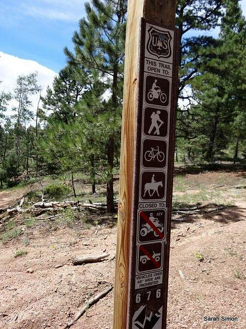
There are no user fees to access this area andno permits are required. Note, however, that there is a large parcel of privateproperty to the west of Dakan Mountain. Save yourself the hassle and approachthe peak from the east, south or north.
• Do not litter and dispose properly of humanwaste.
• Much of Rampart Range Road is a “no shoot”zone. That means: Shoot only in designated target ranges.
• Operate motor vehicles only on designatedroadways.
• For everyone’s safety, the National Forestofficials segregate street legal, licensed motor vehicle traffic from OHVtraffic. Adhere to posted placards managing this traffic. (In plain English: Keep your Jeep off the trails and keep your dirt bike / quad runner off the roads.)
![Summit pano west]()
Summit pano west
![Fairy Trumpet]()
Fairy Trumpet ![Butterfly on flower]()
Butterfly on flower
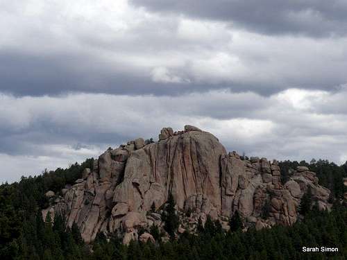
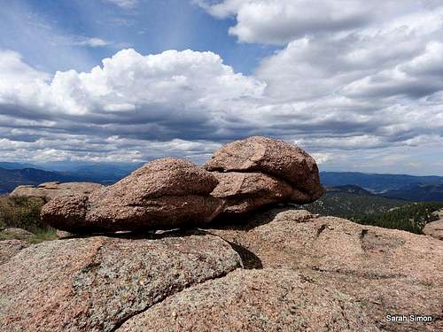
![Boulders on the summit]()
Boulders on the summit ![Boulder jumble]()
Boulder jumble ![Rampart Range views]()
Rampart Range views ![Views from the summit area]()
Devils Head views
CAMPING
Rustic camping in “unofficial” campsites is available throughout the Rampart Range Road area, right off the main road and spur dirt roads off of it. These campsites are available on a first-come, first served basis and provide no services (they are entirely rustic). Most are dry campsites and will require water to be hauled in for cooking and bathing.
Be forewarned that the proximity of this area to the urban I-25 corridor means that crowding can be an issue, especially in the summer, and that unsavory characters are known to frequent this area. Be prepared for heavy ATV use, large crowds, drunkenness and casual firearms usage.
The National Forest Service operates three general-use campgrounds in its Manitou Park Recreation Area. The Manitou Park Recreation Area is located about 5 miles north of Woodland Park along Hwy 67. Below is information about these campgrounds as provided by the Forest Service.
South Meadows Campground: Site has 64 camp sites with parking areas up to 30' long within the 8,000' elevation. Camping season is year round with a user fee of $15.00/per night/per site. The camp-ground has paved roads. Limited sites are reserved by calling 1-877-444-6777. Reservations may be made 240 days prior to arrival and there is a reservation fee. There is also a 2-night minimum stay if your reservation is for Friday or Saturday nights.
Colorado Campground: Site has 81 campsites with parking areas up to 30' long within the 7800' elevation. Camping season usually begins late May and runs until early September. The user fee is $15.00 per night/per site. This campground has paved roads. Limited site reservations can be made 240 days prior to arrival by calling 1-877-444-6777. There is a reservation fee. There is also a 2-night minimum stay if your reservations are for Friday or Saturday night.
Painted Rocks Campground: Area has 18 campsites with parking areas up to 30' long within the 7800' elevation. Camping season usually begins in May and runs through early September. A user fee of $13.00 per night/per site is charged. Limited sites are reserved by calling 1-877-444-6777 and can be made 240 days prior to arrival. There is a reservation fee.
HOTELS
A few simple hotels (many family-run) are available in Woodland Park (elevation 8,465 feet) along with several RV sites and cabins. For more information visit The Greater Woodland Park Chamber of Commerce Visitor Information page.
![Summit register]()
Summit register
Please bring to my attention any external trip reports or other valuable information to include in this page.
Rank: 2999th highest peak in Colorado
Prominence: 394 feet
USGS Quad: Deckers
Planning Map: Trails Illustrated #135 Deckers | Rampart Range
Rank & Prominence: Lists of John
Getting There
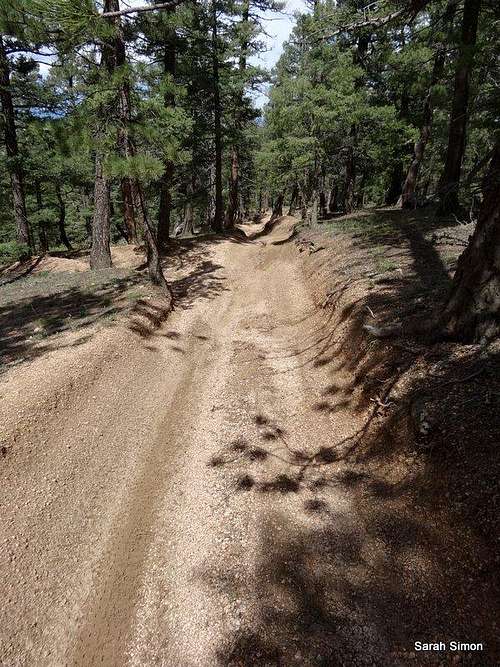
Heavily eroded trail
Rock outcrop en route
Cabin Ridge Trailhead
From Denver:
•Travel south on Highway 85 (also called Santa Fe) 10 miles to the small town of Sedalia.
•Head west on Highway 67 and drive westward 10 miles.
•Head south on Rampart Range Road for roughly 9 miles to the Cabin Ridge Trailhead.
Route
See the attached GPX file for a detailed map/graphical depiction of the standard/summer route to the summit of Campbell Mountain. Decommissioned trail/roadbed | 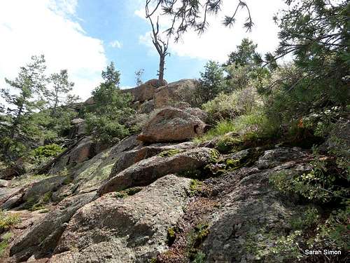 Easy scamper to the top | 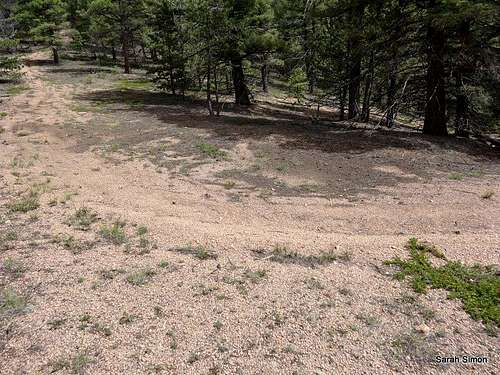 Re-gaining the decommissioned path |
This route leverages multi-use (open to foot traffic, ATVs, horses, etc.) trails for much of its distance. It is capped by a brief bushwhack and an easy scamper/scramble to the lovely summit of Campbell Mountain.
•Roundtrip Distance: 6 miles
•Net Elevation Gain: Net elevation gain is approximately 160 feet; cumulative gain will be higher
•YDS Glass: 2
•Time Allowance: 2 hours at a moderate pace
Of critical note is that an old (decommissioned) roadbed/trail will take you to the southeast shoulder of this peak. Locating this decommissioned passageway will safe you much un-needed cross-country travel and make for an efficient, mostly-on-trail trip.
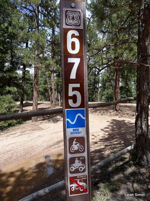 Follow FS Trail 675 much of the way | 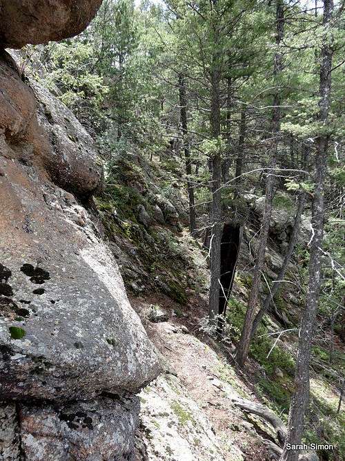 Rounding the corner | 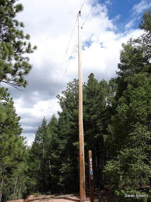 Trail junction |
I encourage other site members to add a detailed route page for this route or for an alternate/winter route to the top of this peak.
Red Tape
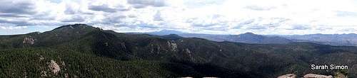
Summit pano east
Multi-use trail indicator
• Do not litter and dispose properly of humanwaste.
• Much of Rampart Range Road is a “no shoot”zone. That means: Shoot only in designated target ranges.
• Operate motor vehicles only on designatedroadways.
• For everyone’s safety, the National Forestofficials segregate street legal, licensed motor vehicle traffic from OHVtraffic. Adhere to posted placards managing this traffic. (In plain English: Keep your Jeep off the trails and keep your dirt bike / quad runner off the roads.)
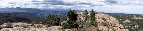
Summit pano west
Weather and Seasons

Fairy Trumpet

Butterfly on flower
 Click for weather forecast | • IMPORTANT: This section of FS 300 (Rampart Range Road) is closed from roughly 1 December through 1 April annually. Exact closure dates can vary year-to-year, so please check with the Forest Service (Pike National Forest) prior to heading toward Turtle Mountain during the transition period. • During the summer months and into early fall, the Rampart Range Road area is very, very busy. It is a popular area for OHV enthusiasts and target shooters. While Turtle Mountain is relatively secluded in its own little nook, expect to climb with the background noise of ATVs and live fire. • In the fall, the days would be cooler and crisp, the aspen turning golden and the likelihood of afternoon thundershowers decreased significantly. |  Click for weather forecast |
Camping and Lodging
Boulders on the summit

Boulder jumble

Rampart Range views

Devils Head views
CAMPING
Rustic camping in “unofficial” campsites is available throughout the Rampart Range Road area, right off the main road and spur dirt roads off of it. These campsites are available on a first-come, first served basis and provide no services (they are entirely rustic). Most are dry campsites and will require water to be hauled in for cooking and bathing.
Be forewarned that the proximity of this area to the urban I-25 corridor means that crowding can be an issue, especially in the summer, and that unsavory characters are known to frequent this area. Be prepared for heavy ATV use, large crowds, drunkenness and casual firearms usage.
The National Forest Service operates three general-use campgrounds in its Manitou Park Recreation Area. The Manitou Park Recreation Area is located about 5 miles north of Woodland Park along Hwy 67. Below is information about these campgrounds as provided by the Forest Service.
South Meadows Campground: Site has 64 camp sites with parking areas up to 30' long within the 8,000' elevation. Camping season is year round with a user fee of $15.00/per night/per site. The camp-ground has paved roads. Limited sites are reserved by calling 1-877-444-6777. Reservations may be made 240 days prior to arrival and there is a reservation fee. There is also a 2-night minimum stay if your reservation is for Friday or Saturday nights.
Colorado Campground: Site has 81 campsites with parking areas up to 30' long within the 7800' elevation. Camping season usually begins late May and runs until early September. The user fee is $15.00 per night/per site. This campground has paved roads. Limited site reservations can be made 240 days prior to arrival by calling 1-877-444-6777. There is a reservation fee. There is also a 2-night minimum stay if your reservations are for Friday or Saturday night.
Painted Rocks Campground: Area has 18 campsites with parking areas up to 30' long within the 7800' elevation. Camping season usually begins in May and runs through early September. A user fee of $13.00 per night/per site is charged. Limited sites are reserved by calling 1-877-444-6777 and can be made 240 days prior to arrival. There is a reservation fee.
HOTELS
A few simple hotels (many family-run) are available in Woodland Park (elevation 8,465 feet) along with several RV sites and cabins. For more information visit The Greater Woodland Park Chamber of Commerce Visitor Information page.
External Links

Summit register
Please bring to my attention any external trip reports or other valuable information to include in this page.