

|
|
Area/Range |
|---|---|
|
|
15.55161°S / 72.65121°W |
|
|
Hiking, Mountaineering |
|
|
Spring, Summer, Fall, Winter |
|
|
21079 ft / 6425 m |
|
|
Overview
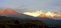
Often mistakenly referred to as “Cordillera Volcanica” (which geologically speaking is only the 50 km range linking Chachani to Ubinas), this Area also includes 2 other ranges: Cordillera de Ampato and Cordillera de Chila, the common denominator being a mountainous landscape dominated by volcanoes most of which are found within the boundaries of “Departamento” of Arequipa. As a matter of fact, mountain logistic services for the entire area are concentrated in the city of Arequipa as it’s the case with Huaraz for Cordillera Blanca.
The volcanoes of the area have huge archeological interest as many where climbed and used by Incas as sanctuaries to perform rituals. Many Inca sites have been discovered, yet may be not all. The famous “Juanita” was discovered on Ampato, not sooner than 1995 and other mummies on Misti in 1998. The geography of the area gives easy access to summits of 5000m and 6000m (many rarely climbed) dispatched within a unique Pampa landscape that also features 2 of the deepest world canyons, those of Colca and Cotahuasi.
Mountain Ranges
Volcanoes of Arequipa are all part of the main Andean ply of Cordillera Occidental. They also characterize the northernmost extremity of Andean Central Volcanic Zone, a zone that at its southernmost extremity includes the very high volcanoes of Atacama.
Map of the Southern Andes of Peru
Within this area there are 3 distinct ranges:

Solimana Group & Cotahuasi Canyon
Cordillera de Ampato
the mountain range that establishes the eastern edge of Cotahuasi canyon and the southern edge of Colca canyon consists, west to east, of four different mountain groups:
- Sarasara (5522 m), a lone volcano actually located in "Departamento" de Ayacucho some 10 kilometers W of Pausa town.
Map of Sarasara group
- Solimana, an eroded jagged-peaked volcano has some very technical routes. The highest Southern Peak (6093m), last unclimbed 6000 meter peak in southern Peru, was only climbed in 1970 by Mario Bignami and Julian Blanco. Herrera.
Map of Solimana group
Nevado Hualca Hualca
- Coropuna, a volcano with a huge horseshoe-shaped crater, features a group of several 6000m summits (including the highest of the whole Area at 6425m) and glaciated terrain.
Map of Coropuna group
- Ampato, a group comprising the less technical cone-shaped Nevado Ampato (6288m), the three-headed active Sabancaya (highest summit is 5976m) that last erupted in 1998, and Huallca-Huallca or Hualca-Hualca (6025m).
Map of Ampato group
Cerro de Chila
Cordillera de Chila
the mountain range that establishes the northern edge of Colca canyon consists, west to east, of three different mountain groups:
- Chila group, formed by wide volcanic craters interfering with each other and broken through by other cone-shaped volcanoes, this group comprises Aseruta (-15.3144444, -72.2188889) 5447m (?),Cerro de Chila (-15.4063889, -72.1675) 5654m, and Casiri ridge of which Cerro Casiri itself (-15.4619444, -72.1713889) 5647m.
Map of Chila group
 |
 |
- Minaspata - Ccacsata group, formed by wide volcanic craters interfering with each other in a puzzle comprising Minaspata cirque, Ccacsata ridge, Culluncuya ridge, Cerro Ticllasi, and Anchaca ridge. Minaspata cirque is a semi-circle of peaks facing northeast featuring 5 main summits including Minaspata (-15.43667, -71.87472) 5555m and Surihuiri (-15.4605556, -71.8680556) 5506m. Ccacsata ridge, east of the Minaspata cirque, is a 8 km north to south ridge on which the main peaks are Ccacsata (-15.4402778, -71.8269444) 5515m and Jatunpila (-15.4758333, -71.8291667) 5450m. Culluncuya ridge is a junction southeast of Ccacsata featuring Culluncuya Oeste 5350m, Culluncuya Central 5370m, Culluncuya Este (-15.4527778, -71.8094444 ) 5360m. Ticllasi (-15.4333333, -71.8138889) 5210m lies just northeast of Cerro Ccacsata. Anchaca ridge 5 km east of Ccacsata ridge, features a dozen peaks of which Teclla (-15.4536111, -71.7741667) 5230m, Anchaca (-15.4569444, -71.7697222) 5360m and Mamacanca (-15.4708333, -71.7661111) 5280m.
Map of Minaspata group
 |
 |
- Mismi group, located at extreme southeast end of range, is also formed by wide volcanic craters interfering with each other in a puzzle of cirques and ridges. This group features, west to east, the assumed source of Rio Amazonas, Nevado Quehuisha (-15.5261111, -71.7594444) and the assumed highest summit of Cordillera de Chila: Nevado Mismi (5597m).
Map of Mismi group
 |
 |
Pichupichu group from Misti
First recorded ascents of most of this range were accomplished in 1972.
Volcan Ubinas
Cordillera Volcánica
contouring the city Arequipa on its north and east, consists, from west to east, of 4 groups:
- Chachani group, comprising Chachani 6075m, Fatima 6002m, Angel 5852m, Coronado 5800m.
Map of Chachani group
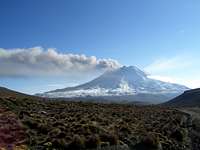
- Misti with its almost perfect cone rising at 5821m.
- Pichupichu group, a very eroded volcano with 7 summits of which the highest is at 5664m.
Map of Misti and Pichupichu groups
- Ubinas group, the most active volcano of Peru with 3 peaks of which the southern one is the highest at 5672m. This group is actually situated in "Departamento" de Moquegua.
Map of Ubinas group
Classic climbs
| Peaks | Duration (Days) | Altitude(m) | Climbing period |
| Coropuna | 5 | 6,425 | Year round |
| Solimana | 5 | 6,093 | Year round |
| Ampato | 3 | 6,288 | Year round |
| Chachani | 1 or 2 | 6,075 | Year round |
| Hualca-Hualca | 3 | 6,025 | Year round |
| Misti | 1 or 2 | 5,821 | Year round |
| Sabancaya | 3 | 5,976 | Year round |
| Ubinas | 1 or 2 | 5,672 | Year round |
| Pichu-Pichu | 1 or 2 | 5,664 | Year round |
| Mismi | 3 or 4 | 5,597 | Year round |
Getting There
To and from Arequipa,
By plane:
- Lima (85 min) with Lan Peru, Aero Condor, Star Peru
- Cuzco (50 min) with Lan Peru
- Juliaca - Puno (30 min) with Lan Peru
Misti from Arequipa
By bus:
- Lima (1009 km), first-class service or "cama" with Cruz del Sur, Ormeno and Oltursa in 13h to 14h.
- Cuzco (518 km), "semi-cama" with Cruz del Sur, Ormeno, Turismo Puma and San Cristobl del Sur in 12h or more...
- Juliaca (278 km) with Ormeno, Julsa and Civa in 4h.
- Puno (323 km) with Ormeno, Julsa and Civa in 5h.
- Tacna (368 km) with Cruz del Sur, Ormeno and Flores Hermanos in 5h.
By train:
Arrival by train from Cusco or Puno is no longer possible...
Red Tape
No permit required so far !
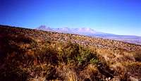
The Pampa around Arequipa
External Links
Climbing Peru Cordillera Volcanica page
Volcanology of Southern Peru by Instituto Geofisico del Peru
Peru Chapter of “Mountaineering in the Andes” (Jill Neate) as displayed on the site of Royal Geographical Society / Institute of British Geographers
Peruvian Cordilleras by U.S. Geological Survey
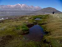
Laguna Salinas
"All the Mountains", a site built to show maps and photos of the highest ranges in Peru
Camping
Camping is permitted everywhere. However, for safety reasons, avoid camping at a walking distance of Arequipa suburbs and other big towns.
Miscellaneous
Altitude of towns and villages of interest, and the road distance between them:
- North of Arequipa (2360m)
From Arequipa 156 km to the north by Pan-American and then paved road is Chivay (3660m), the gateway to Colca canyon.

Patapampa pass (4890 m)
- West and Northwest of Arequipa (2360m)
From Arequipa 178 km to the west by Pan-American and then paved road is Aplao (617m).
Continuing from Aplao 162 km to the north on non-paved road is Andagua or Andahua (3850m), the gateway to "Valle de los Volcanes".
Continuing from Aplao 56 km to the north-west on paved road is Chuquibamba (2945m).
Continuing from Chuquibamba 145 to north-west on non-paved road is Cotahuasi (2685m), the gateway to Cotahuasi canyon.
- Southwest of Arequipa (2360m)
From Arequipa 175 km to the south-west by Pan-American road is Camana (12m), beach !