
|
|
Mountain/Rock |
|---|---|
|
|
43.10000°N / 19.00000°E |
|
|
7375 ft / 2248 m |
|
|
Overview

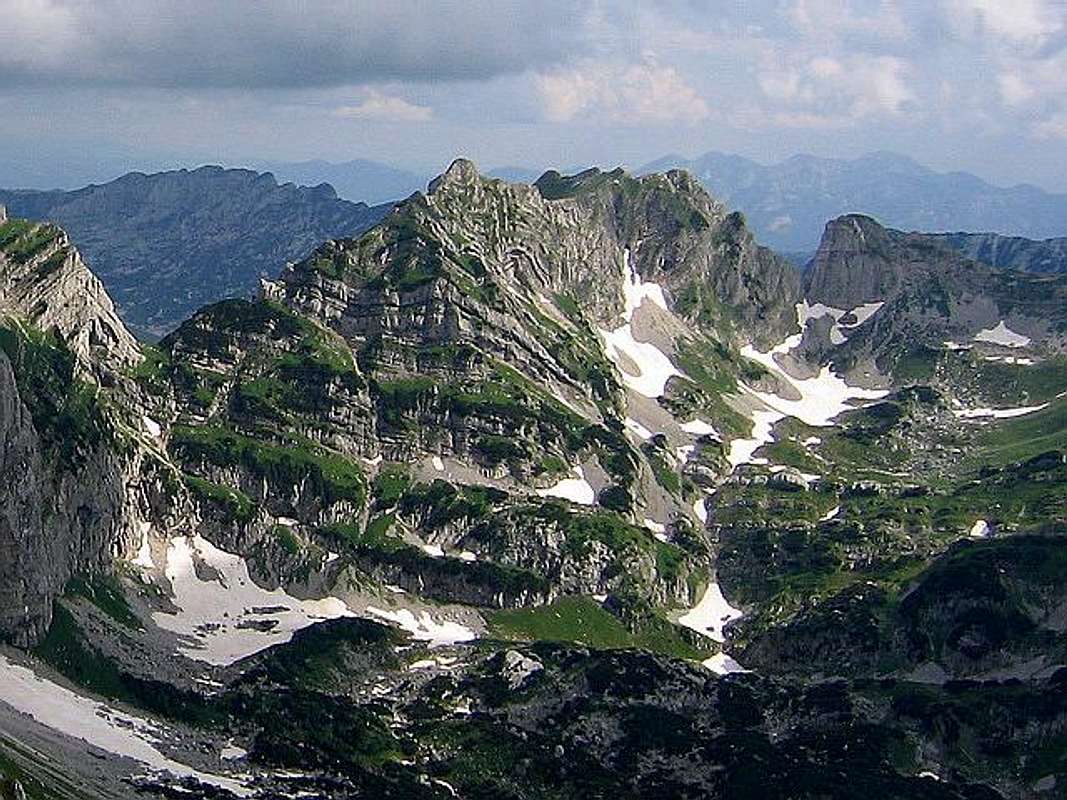
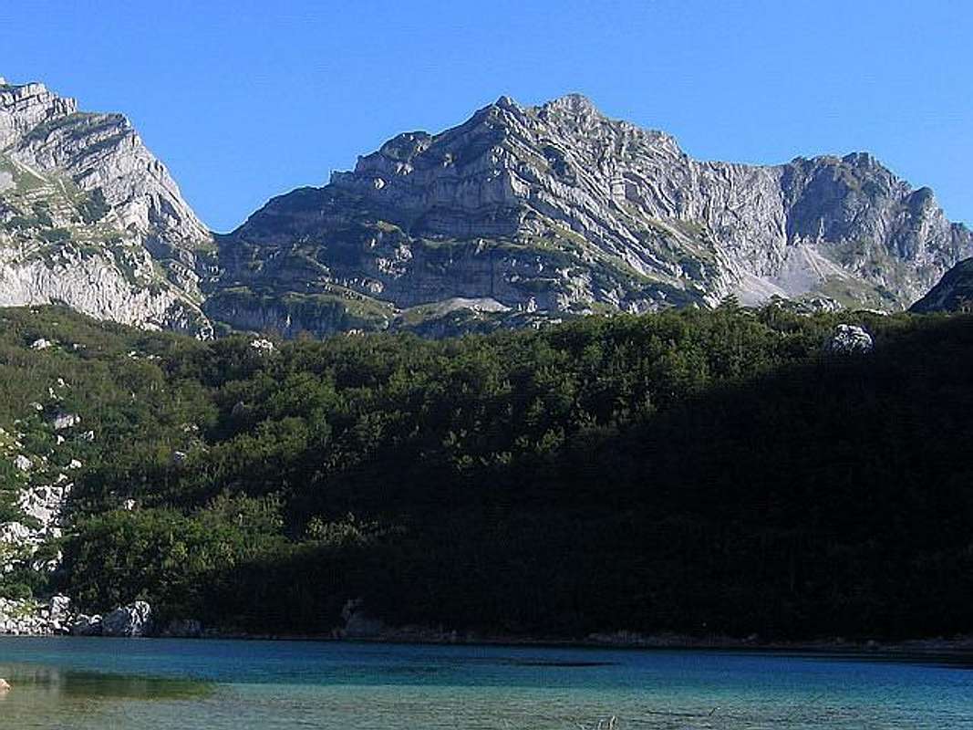
Western side of Šareni Pasovi (Stit, 2248 m)
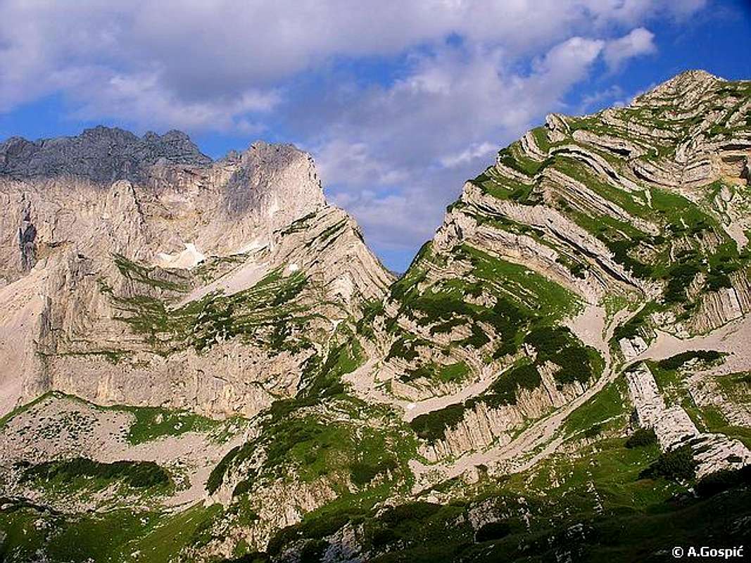
 Stit cliffs
 Sedimentary layers
Šareni Pasovi (Colorful Layers, 2248 m) or Stit (Umbel) (read "Shareni Pasovi" and "Shtit") is together with Prutaš (2393 m) and Zupci (2309 m), for sure one of most specific peaks of DURMITOR. This beautiful peak is wide known as "The Trademark" of Durmitor. Šareni Pasovi (Stit) was created from sedimentary crests. It's beautiful and impressive outlook attrack year by year many mountaineers to climb it. The summit of this peak is very impressive viewpoint to Bobotov Kuk (2523 m), Bezimeni Vrh (2487 m), Djevojka (2440 m) and Prutas (2393), specially to Bobotov Kuk and Bezimeni Vrh.
Actually, the massif of Šareni Pasovi has two summits - Sareni Pasovi (2248 m) and Štit (2236 m).
Šareni Pasovi is one of 6 peaks which surround the heart of Durmitor and it's most beautiful corner - Dolina Škrckih Jezera (Škrka Lakes Valley, 1723 m). Together with Bobotov Kuk (2523 m), Bezimeni Vrh (2487 m), Djevojka (2440 m), Prutas (2393 m) and Planinica (2330 m), Sareni Pasovi (Stit) dominate above beautifully Skrka Lakes.
Šareni Pasovi (Štit) are placed between two peaks, Djevojka (2240 m) on N, and Prutas (2393 m) on S-SW. On N side, Šareni Pasovi (Štit) is separate from Djevojka by impressive and beautiful Samar (2075 m) pass, which is impressive and natural door to Skrka Lakes Valley and it's entrance from eastern side.
LOCATION:
Šareni Pasovi (Stit, 2248 m) peak is situated in the area of highest peaks of Durmitor's massif.
Šareni Pasovi (Stit, 2248 m) is placed on SW from Minin Bogaz (2387 m), Medjed (2287 m), Terzin Bogaz (2303 m) and Savin Kuk (2313 m), on S from Djevojka (2440 m), Rbatina (2401 m), Obla Glava (2303 m), Cvorov Bogaz (2152 m) and Samar Pass (2075 m), on SE from Bobotov Kuk (2523 m) and Bezimeni Vrh (2487 m), on E from Planinica (2330 m) and Susica Cannyon, on W from Sljeme (2455 m), Milosev Tok (2426 m), Bandijerna (2409 m), Zupci (2309 m) and Sedlena Greda (2227 m), Mt Sinjajevina (2277 m), Moracke Planine (Moraca Mountains, 2226 m).
on NEfrom Prutas (2393 m).
Sareni Pasovi (Stit, 2248 m) and Samar (2075 m) pass from Planinica (2330 m) summit (zoom)
Eastern face of Sareni Pasovi stay above area of Zeleni Vir (Green Vortex, 2028 m) glacial lake, while it's W face dominate above Veliko Skrcko Jezero (Large Skrka Lake, 1686 m) and entire Skrka Lakes Valley.
SUMMIT VIEW:
NW: Bobotov Kuk (2523 m), Bezimeni Vrh (2487 m), Planinica (2330 m).
W: Mt Bioc (2397 m), Mt Maglic (2386 m), Mt Volujak (2336 m), Skrka Lakes Valley and Susica Cannyon.
E: Sljeme (2455 m), Milosev Tok (2426 m), Bandijerna (2409 m), Sedlena Greda (2227 m) and Mt Sinjajevina (2277 m), Moracke Planine (Moraca Mountains, 2226 m).
N-NE: Djevojka (2440 m) and Zupci (2309 m).
S: Prutas (2393 m)
 |  |  |  |  |
Routes Overview
SARENI PASOVI (STIT, 2248 m)Dobri Do (1722 m) valley is optimal starting point for Sareni Pasovi (Stit, 2248 m) climbing. This route start from the Zabljak-Virak-Sedlo-Trsa road, about 3 km belowe the Sedlo (1907 m) pass, near Urdeni Do. That's about 20 km from Zabljak (1456 m) town.
1. Dobri Do (classical) approach: Dobri Do valley (1722 m) - Urdeni Do - Stit (2236 m) - Sareni Pasovi (2248 m): 1.30h - 2h
2. Sedlo approach: Sedlo Pass (1907 m) - Uvito Zdrijelo - Surutka (2082 m) - Zeleni Vir (2028 m) lake - Mlijecni Do - Stit (2236 m) - Sareni Pasovi (2248 m): 2.30h
3. Skrka Lakes Valley approach: Skrka Hut (1723 m) - Samar (2075 m) pass - Mlijecni Do - Stit (2236 m) - Sareni Pasovi (2248 m): 2h - 2.30h
 |  |  |  |
Getting There
Bobotov Kuk (2523 m), Djevojka (2440 m) and Sareni Pasovi (Stit, 2248 m) from Skrka Valley
Gateway to Durmitor National Park and Sareni Pasovi (Stit, 2248 m) peak is Zabljak (1456 m) town. Information how to get there:
By Plane
~To Beograd (Belgrade, Serbia&Montenegro capital) airport. Than with plane to Podgorica, capital of Montenegro, or with bus or car to Zabljak town.
~To Podgorica airport. Than with bus or car to Zabljak town.
Information about flights find on the sites of JAT Airways, a former Yugoslav airlines, or on Montenegro Airlines.
By Bus
~Beograd (Belgrade)-Zabljak
~Podgorica-Zabljak
~Niksic-Zabljak
~Pljevlja-Zabljak
Buses go to Zabljak from Beograd (Belgrade) twice a day and from Podgorica, Niksic, Pljevlja and Mojkovac several times per day.
By Car
~Beograd (Belgrade)-Zlatibor-Nova Varos-Prijepolje-Pljevlja-Zabljak
~Niksic - Savnik (47km) - Zabljak (37km): 84km; Niksic to Zabljak approach from south.
~Niksic - Savnik (35km) - Zabljak (37km): 72km;
~Podgorica - Niksic (55 km)-Savnik (47 km)-Zabljak (37 km): 139 km; Add this length if you are going to Zabljak from Podgorica via Niksic. Road to Niksic from Podgorica is good.
~Podgorica - Kolasin (71km) - Mojkovac (21km) - Zabljak (67km): 159km; road is good all the way to Zabljak. Behind Podgorica (56m) you go inside Moraca River canyon (one of spectacular Montenegrin canyons). It is up to 1000 m deep and has wild sides. That's spectacular drive. After that, from "Djurdjevica Tara" bridge to Zabljak - 23 km.
 |  |  |  |  |
When To Climb
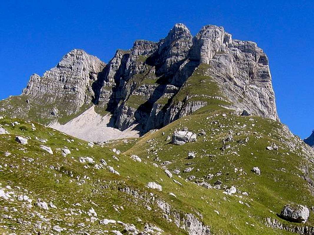
Southern side of Stit (2248 m) from the way to Skrcko Zdrijelo (2114 m) pass
 View to Stit
In Mt Durmitor you can climb during all year seasons, but ideal period for climbing of Sareni Pasovi (Stit, 2248 m) peak is mid June - mid September.
During the winter, Durmitor usually switches into ski resort. Under Savin Kuk peak (2313 m) is Durmitor Ski Center. (gondolas, ski lifts, chair lifts, restorants and their customers).
Dobri Do valley is a common starting point for climbing of Sareni Pasovi (Stit, 2248 m). The marks for that climbing route you will find on macadam road Zabljak-Virak-Sedlo-Trsa, 3-4 km belowe the Sedlo (1907 m) pass. All major trails further uphill are well marked with white circle/red border marks.
Generally, the whole Durmitor mountain is very good marked. Thanks to Branislav Cerovic, greatest knower and devoter of Durmitor National Park, who marked all routes in Durmitor's massif.


Camping
Camping permitted on camping dedicated spots only.Major huts are in good condition, but with no service. Still, open to the general public. Hikers/climbers are supposed to bring all the jummy stuff with them.
Optimal camping place for Sareni Pasovi (2248 m) climbing is Skrka Hut (1723 m) in Dolina Skrckih Jezera (Skrka Lakes Valley). Also, as i saw, many people using Zeleni Vir lake (Green Vortex, 2028 m) area like practical camping place, to stay there in their's own bivouacs.
 |
Mountain Conditions
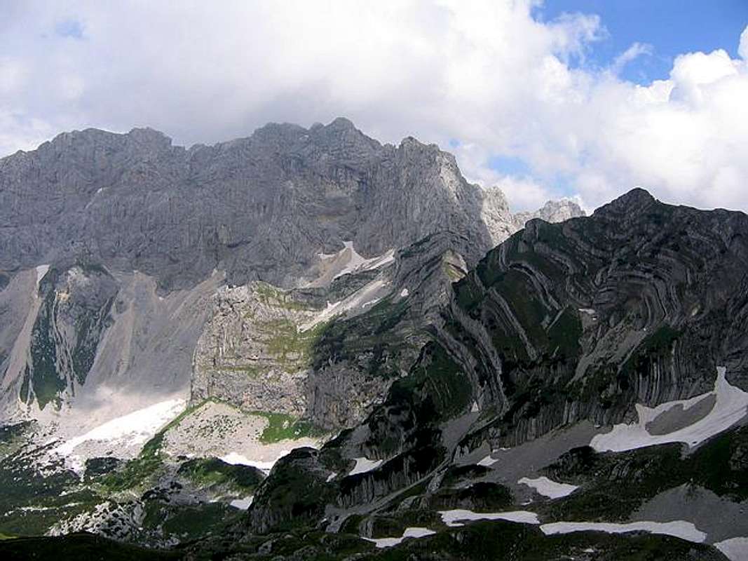
Sareni Pasovi (Stit, 2248 m) & Soa Nebeska (2487 m, 2523 m, 2440 m) wall from Prutas (2393 m)
The best weather forecast on Internet for Durmitor (Zabljak town) is VREME YUBC NET site. You can see 5 days forecast for Durmitor area, 4-times-daily forecast.
 |
Red Tape
No fees or extra fees for entering the National Park.No permits needed either.
Usual rules of behaviour for NPs do apply.
 |
Miscellaneous Info
Sareni Pasovi (2248 m) & Samar pass (2075 m) from Veliko Skrcko Jezero (Large Skrka Lake, 1686 m)
If you have information about this mountain that doesn't pertain to any of the other sections, please add it here.