|
|
Mountain/Rock |
|---|---|
|
|
52.72828°N / 4.04583°W |
|
|
Gwynedd |
|
|
Trad Climbing, Toprope |
|
|
Spring, Summer, Fall, Winter |
|
|
820 ft / 250 m |
|
|
Overview
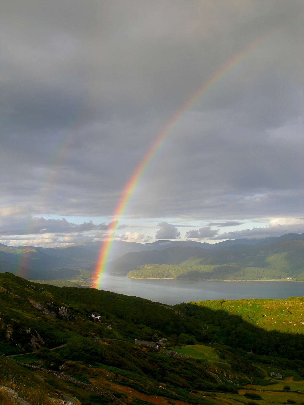
When one thinks of climbing in the Rhinogydd, thoughts of arduous approaches and unfriendly, uncompromising routes abound. This however, needn’t be the case, because hidden right under North Wales’ climbing communities proverbial nose is a crag that offers a most satisfying combination of easy access and easy climbing. The crag is Barmouth Slabs, an outcrop of some 20 metres height, located just above the seaside town of the same name (minus the slabs bit of course). The crag occupies a glorious position above the Mawddach Estuary and sports a magnificent panorama encompassing much of southern Meirionnydd, the centre piece of which is the mighty Cadair Idris. Although located nearly 200 metres above sea level, the crag is quite sheltered and has a pleasant southerly aspect making it an attractive proposition even in winter. The routes are mostly at the easier end of the grading spectrum with a good compliment of Diffs, V. Diffs and Severes, as well as a single Hard Very Severe. However, despite initial appearances, many of the routes suffer from a lack of good protection, and are also quite polished in places. This adds an extra element of risk for anyone leading here. On he other hand, metal stakes have been placed at the top of the crag, and are a great aid for belaying or top-roping. For beginners, new leaders, or anyone who’s just looking for a relaxing afternoon of climbing, Barmouth Slabs are absolutely ideal. |
Rock Climbing
There are several tiers to Barmouth Slabs, with all the named routes being on the lowst tier, which is also the highest. The slabs of the upper tiers are much shorter and offer a scattering of short routes and bouldering problems, none of which have been properly recorded. The slabs are popular with outdoor centres who have placed a number of stakes along the top of the crags. This makes belaying a whole lot simpler as well as providing great anchor points for top-roping. 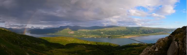 Cadair Idris and the Mawddach Estuary (Photo by Nanuls) Routes are rated using the British Adjectival Grading System. Technical grades are only given to climbs graded adjectively as Hard Severe (HS) or above. Where the sources differ in their grading I have opted to list the highest quoted grade only, as I don’t want to mislead anyone about the seriousness of any of the routes. A conversion table of international climbing grades by SP member Corax is available HERE! Be aware that this is a trad climbing venue and that bolting is strictly prohibited. |
|
| ||||||||||||||||||||||||||||||||||||||||||||||||||||||||||||||||||||||||||||||||||


In addition to these routes, a single bouldering problem has been recorded at V6 6b on the left arête of the white slab just over the top of the upper tier. |
Mountain Conditions
This section displays the mountain conditions for Snowdonia, of which Barmouth Slabs is part. Click on the widget for maps and further information. This Snowdonia weather forecast is generated by the Met Office Weather Widget |
When to Climb and Essential Gear
The most reliable conditions are in the summer, but the low altitude of the crag may make it a viable option in winter when the area’s higher routes are too wet to be enjoyable. The gear needed depends entirely on the routes you plan to do. Easier routes will only require a moderate rack, while harder routes will require a something more comprehensive; a good compliment of friends or other camming devices will certainly help. Double 50 metre ropes should serve well on all routes. |


Getting There
Take the A496 west towards Barmouth at the roundabout on the A470 at Llanelltyd (SH 715 194) just north of Dolgellau (SH 728 179). Travel along this for around 10 miles until you reach Barmouth (SH 613 156). As you enter the town, the road takes a sharp left, and coming off it is a small road leading to the Abermaw Hotel (SH 619 156). Follow this around the hotel and continue all the way until you reach the car park for the 'Panorama Walk' (SH624 166). Park at the car park. Just opposite the car park is a turning for a small road which leads up a hill. Follow this to the crag (SH619 164), which will come into view shortly after crossing a metal gate. |
Red Tape and Access
 This warning is still painted on the rock. It no longer applies (Photo by Nanuls) This warning is still painted on the rock. It no longer applies (Photo by Nanuls)No red tape here! The slabs have a history of access problems, and up until recently climbers had to pay a small fee to access the crag. However, since the introduction of the Countryside Rights of Way (CRoW) Act (2000), the area has become open access land meaning that climbers can now access the crag at all times without restriction. See the BMC's Regional Access Database for more info. Although unlikely it's worth checking the countryside access map provided by the Countryside Council for Wales (CCW) regarding whether or not any restrictions on movement in the area are in place. |
Camping and Accommodation
There’s an almost unlimited supply of accommodation within the Snowdonia National Park so it would be inappropriate to list it all here. For budget accommodation it’s worth checking out some of the following sites:Youth Hostel Association in Wales For more local listings check www.barmouth-wales.co.uk. |


Maps
|
| Navigation Maps Ordnance Survey 1:25k Explorer Series OL 18 Harlech, Porthmadog & Bala/Y Bala Ordnance Survey 1:50k Landranger Series 124 Porthmadog & Dolgellau Harvey Map Services 1:25k Rhinogs/Rhinogydd Harvey Map Services/BMC 1:40k Snowdonia South Road Maps |
Guidebooks
|

External Links
 Cadair Idris (Photo by Nanuls) Cadair Idris (Photo by Nanuls)Government Bodies and Official Organisations Snowdonia National Park Authority Association of National Park Authorities Royal Commission on Ancient & Historical Monuments in Wales Hiking, Climbing and Mountaineering Organisations and Companies British Mountaineering Council Plas y Brenin National Mountain Centre Weather Tourist Information North Wales Tourism Partnership Local Information from Gwynedd.com Local Information from Snowdonia Wales Net Travel Welsh Public Transport Information Accommodation Youth Hostel Association in Wales Maps and Guidebooks Cordee Travel and Adventure Sports Bookshop Wildlife and Conservation |