
|
|
Mountain/Rock |
|---|---|
|
|
45.90261°N / 10.77700°E |
|
|
Trentino |
|
|
Hiking, Mountaineering, Scrambling |
|
|
Spring, Summer, Fall, Winter |
|
|
6191 ft / 1887 m |
|
|
Overview
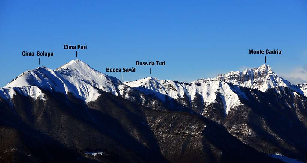
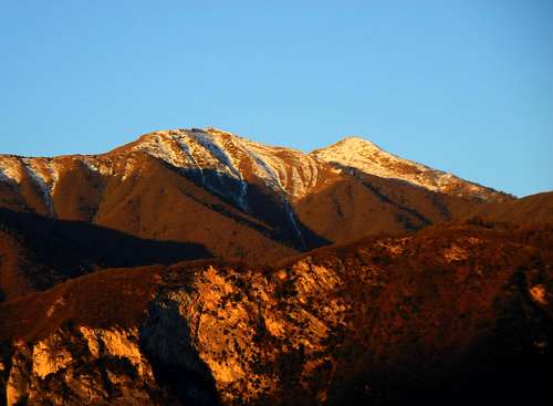
Cima Sclapa 1887 m
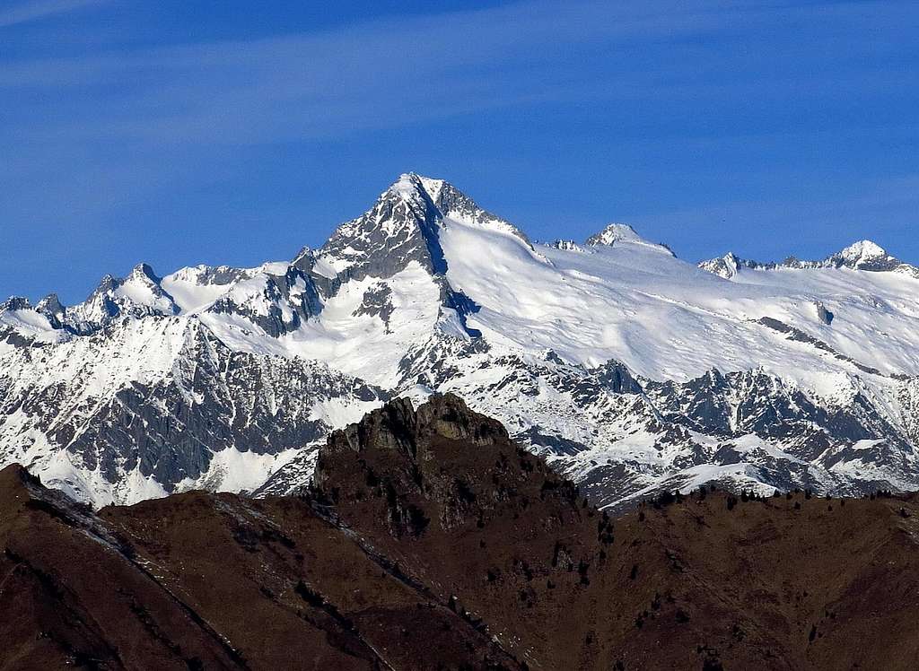
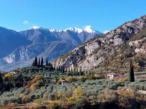
Cima Sclapa 1887 m is a montain belonging to the Prealpi Bresciane and Gardesane, in the subroup of the Alpi di Ledro, a varied pre-Alpine area playing a buffer role between the Garda territories, which enjoy a semi-Mediterranean climate, and the alpine mountains of the Adamello group. Cima Sclapa overwhelms the Lago di Ledro in the homonymous valley. It's a little-known mountain, located on the orogtraphica left side of the Val di Ledro, often climbed in succession with the nearby Cima Parì. In fact both mountains are located on a beautiful ridge overlooking the Ledro lake and this ridge joining the two peaks is an exceptional panoramic point over the Ledro Valley and the lake, as well as numerous surrounding mountains. Moreover the view extends from the Verona plain (Po Valley) to the Dolomites with the Sella group, the Brenta Dolomites, and the high peaks of the Adamello and Presanella. The panorama over the 360° horizon is really great!
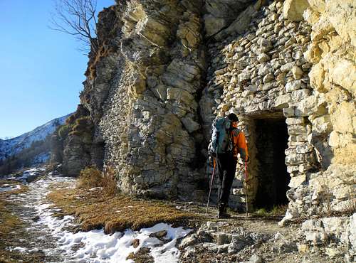
Another great reason of interest is the fact that this two mountains are located within an area that was the theatre of World War I, because here it ran the border between the Kingdom of Italy and the Austro-Hungarian Empire. The itineraries proceed among the testimonies of WWI, like barracks, fortifications, deposits, trenches.
Getting There
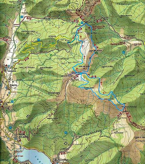
Cima Sclapa can be summited starting from Bocca di Trat 1587 m or from Bocca Dromaè - Mezzolago (longer). The two itineraries have a different road access.
Road access to Bocca di Trat
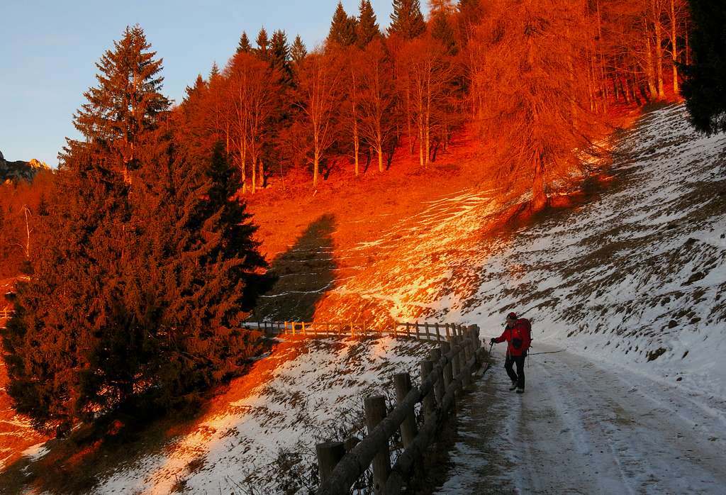
From Riva del Garda take the road to Val di Ledro and pass the two tunnels, entering the valley and skirting the Lago di Ledro. Reach Pieve di Ledro, located at the end of the lake, where you must leave the main road and turn to right to Val Concei, getting to the small village of Lenzumo. At the end of Lenzumo turn to right again (signposts Rif. Nino Pernici), taking a 7 km. mountain road which rises with several hairpins to Malga Trat m. 1502 (about 50 km from Rovereto). Actually the road is forbidden in its last 500 meters, so leave your car in an obvious pull-out on the right side of the road before Malg Trat.
Road access to Bocca Dromaè from Mezzolago
From Riva del Garda take the road to Val di Ledro and pass the two tunnels, entering the valley. We pass the village of Biacesa reaching the Lago di Ledro just in Molina di Ledro. The road continues along the Northern shore of the lake, reaching the small village of Mezzolago. Here we must leave the main road and turn to right on a narrow asphalt road with a signpost indicating "Bed and Breakfast". The road passes the last houses of Mezzolago and rises up the valley as far as the ban that prohibits the further continuation by car (resort Alta Valle - altitude about 822 m). Parking lot.
Route from Malga Trat across Cima Parì
Cima Sclapa from Malga Trat
Difficulty: F (Alpine scale) in winter condition, otherwise EE
Difference in level: 500 m from the road to Malga Trat
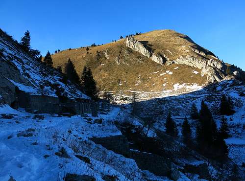
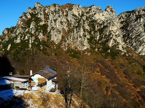
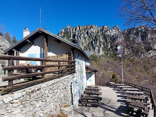
From the parking continue on the dirty road reaching the alp called Malga Trat m. 1502 in a few minutes. Take the path 413 rising inside the wood and getting to the large saddle of Bocca di Trat m. 1587. Turn to right to reach soon the Nino Pernici shelter m. 1601 (20 minutes from Malga Trat), lying in a fine location with good views to the rocky summit of Mazza di Pichea and Lago di Garda.
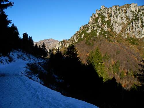
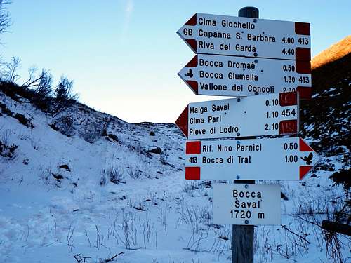
Continue beyond the hut, following the level path 413 skirting the Dorsale di Seaoi along a slope at first wooded, then grassy, to arrive ahead of the barracks of the First World War dominated by the imposing Cima Parì. From the barracks turn immediately to right, getting to Bocca Savàl m. 1740 in 1 minute (1 hour from the hut Nino Pernici).
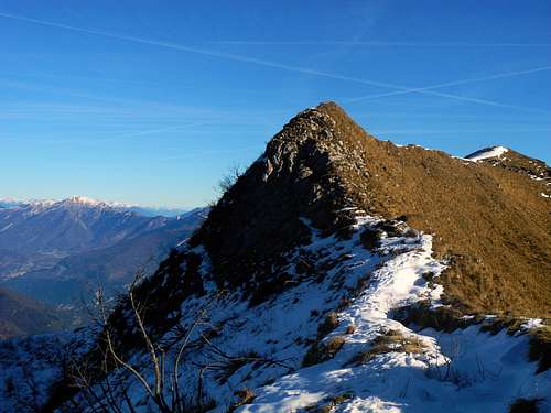
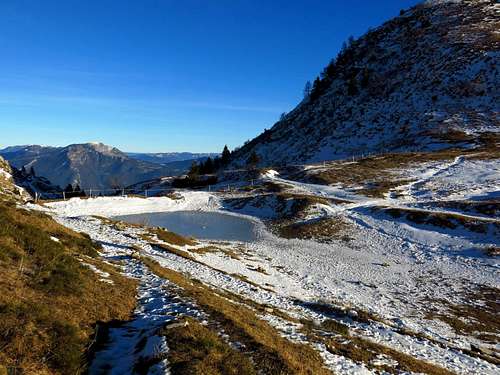
At the pass, near a tiny pond surrounded by a fence, turn sharply to the left to follow a trail that goes at first directly along the Western slopes of the mountain, then with a long diagonal upward to the right reaches a shoulder - little cairn – at the base of the ridge that rises towards the summit. We walk along this ridge with superb views over Lago di Ledro just on the right below us, reaching the summit cross.
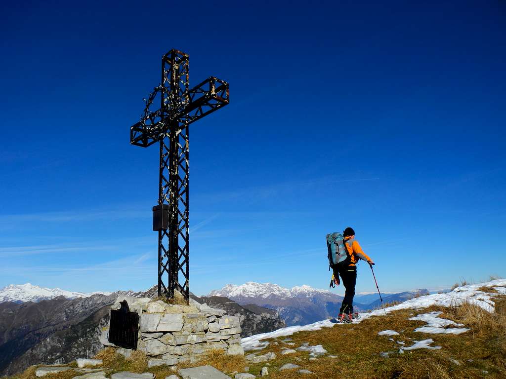
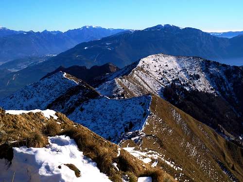
The view is superb on Ledro Lake, Garda Lake, Monte Stivo, Monte Bondone and Monte Altissimo di Nago to the right, the Sella Group and the Brenta Dolomites to the North, the nearby and wild Monte Cadria and the superb coastline of the Adamello-Presanella range to the West.
From the summit of Cima Parì proceed to the South-East along the summit ridge, with clear remains of the WWI trenches, along an itinerary a bit exposed and mainly downhill, with only a last brief ascents to reach the nearby Cima Sclapa m. 1860.
The view is superb on Ledro Lake, Garda Lake, Monte Stivo, Monte Bondone and Monte Altissimo di Nago to the right, the Sella Group and the Brenta Dolomites to the North, the nearby and wild Monte Cadria and the superb coastline of the Adamello-Presanella range to the West.
Descent - From the summit of Cima Sclapa descend to the North (left) along a steep slope to gain the path 413 (mostly flat) skirting the North sides of Cima Sclapa and Cima Parì and reachs the WWI ruins near Bocca Saval (old Austrian military hospital). From here to Malga Trat and the parking lot. At this point you can follow in the direction of Bocca di Trat and Rifugio Pernici, then to Malga Trat and the parking lot along the same ascent route.
An alternative descent route in order to make a complete loop without ever returning on the upward itinerary may be to reach the small pond near Bocca Saval lying below the West side of Cima Parì. Just in front of it take the right path that - after gaining with a short climb a ridge - descends on the wooden opposite side. From here a good trail reachs directly Malga Trat.
Route from Malga Trat across Bocca Dromaè
Cima Sclapa from Malga Trat across Bocca Dromaè
Difficulty: F (Alpine scale) in winter condition, otherwise EE
Difference in level: 500 m from the road to Malga Trat
From the parking continue on the dirty road reaching the alp called Malga Trat m. 1502 in a few minutes. Take the path 413 rising inside the wood and getting to the large saddle of Bocca di Trat m. 1587. Turn to right to reach soon the Nino Pernici shelter m. 1601 (20 minutes from Malga Trat), lying in a fine location with good views to the rocky summit of Mazza di Pichea and Lago di Garda. Continue beyond the hut, following the level path 413 skirting the Dorsale di Seaoi along a slope at first wooded, then grassy, to arrive ahead of the barracks of the First World War dominated by the imposing Cima Parì. From the barracks turn immediately to right, getting to Bocca Savàl m. 1740 in 1 minute (1 hour from the hut Nino Pernici). From here continue stright on the path 413 skirting the slopes of Cima Parì to get Bocca Dromaè 1693 m. Turning sharply to the right start to climb the S ridge of Cima Sclapa, gaining the summit in about 30 minutes.
Route from Mezzolago
Cima Sclapa from Mezzolago
Difficulty: F (Alpine scale) in winter condition, otherwise EE
Difference in level: 1065 m from Alta Valle
Bocca Dromaè can be approached also from Mezzolago with a much greater elevation gain. From the parking lot in the locality Alta Valle at 822 m follow the forest road them the path leading to Bocca Dromaè. From here same itinerary as the previous point.
Red Tape
No fees no permits required
When to Climb
All year round – In winter conditions the climb requires the use of axe and crampons
Where to stay
Different possibilities of accomodation in Val di Ledro. Along the route from Malga Trat we find the Rifugio Nino Pernici m. 1601.
Meteo
Meteo Arpa Lombardia
Meteo Trentino
Guidebooks and maps

"Prealpi Bresciane" by Fausto Camerini - Collana Guide dei Monti d'Italia, CAI-TCI
"Guida alle Alpi di Ledro by F. Torchio - E. Gardumi, Panorama, Trento, 1995
Garda-Trentino map scale 1:30.000
Alto Garda e Ledro map scale 1:25000, Kompass