
-
 3846 Hits
-
 81.18% Score
-
 13 Votes
|
|
Mountain/Rock |
|---|---|
|
|
45.83764°N / 10.70617°E |
|
|
Trentino, Lombardy |
|
|
Hiking, Scrambling |
|
|
Spring, Summer, Fall, Winter |
|
|
6407 ft / 1953 m |
|
|
Overview
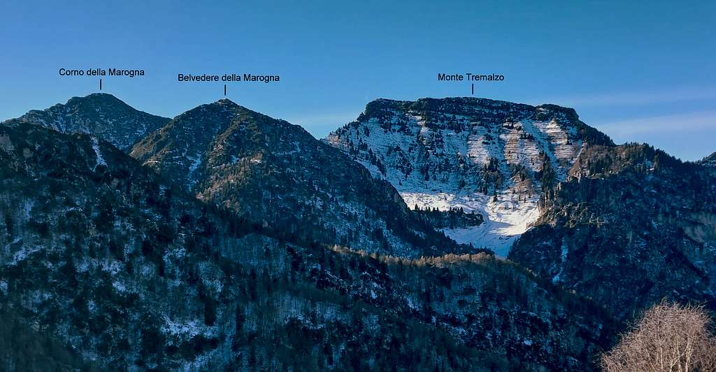
Corno della Marogna 1953 m
On the border between the provinces of Brescia and Trento, along the ridge between the basin of Tremosine and Val di Ledro, there is an impervious peak, the Corno della Marogna, whose Southern slope overtops steeply with an incredible number of rocky spiers the bottom of the valley, which then descends to Vesio. The Trentino side -looking towards Passo Tremalzo - is less harsh and from there it starts the standard route to climb the summit.
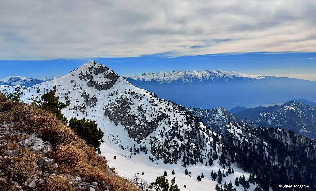
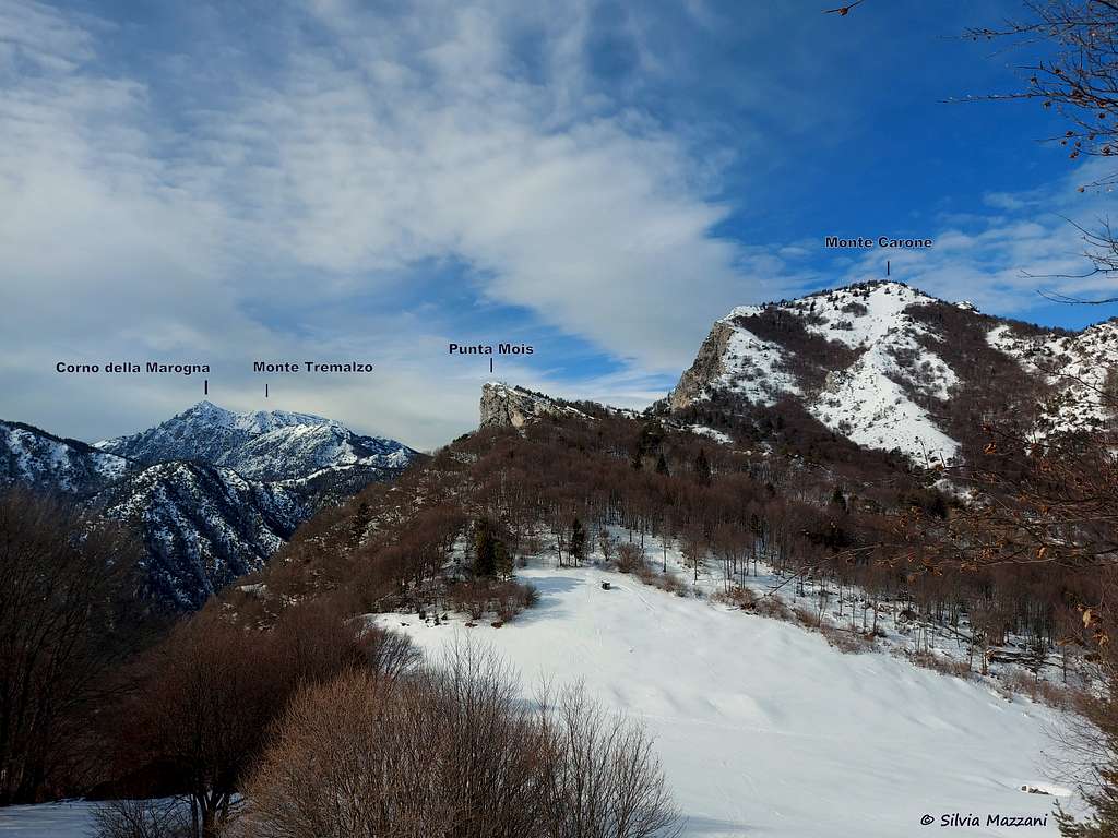
Corno della Marogna belongs to the Prealpi Bresciane e Gardesane, Tremalzo chain, situated at the head of the Valle S. Michele. Together with the nearby Monte Tremalzo, Corno della Marogna forms a couple of important summits, exceeded by altitude only by Monte Caplone, also located within the Parco Regionale Alto Garda Bresciano, an impervious and scarcely anthropized area where the mountains often require long approaches. Corno della Marogna and Monte Tremalzo form an exception, thanks to the possibility to drive up to Passo Tremalzo at 1665 meters above sea level, from which the two mountains are accessible with a short ascent but interesting ascent.
The summit of the Corno della Marogna offers a spectacular view of the Adamello-Presanella groups, the Brenta Dolomites and the Western Dolomites, Monte Baldo and the lakes of Garda and Ledro. The area is also particularly interesting from the point of view of the existing flower species, with different endemisms.
The summit of the Corno della Marogna offers a spectacular view of the Adamello-Presanella groups, the Brenta Dolomites and the Western Dolomites, Monte Baldo and the lakes of Garda and Ledro. The area is also particularly interesting from the point of view of the existing flower species, with different endemisms.
Getting There
Road access
From Riva del Garda we follow the state road that leads to Val di Ledro through two long tunnels. After the village of Biacesa the road reachs the Lago di Ledro near the village of Molina. The road runs along the northern shore of the lake, reaching Pieve di Ledro, then Bezzecca, Tiarno di Sopra and Tiarno di Sotto. We are finally at a second smaller lake on the left of the road: it is the Lago d'Ampola, a protected biotope due to its particular flora and fauna. Immediately after we leave the main road, to turn left at the signpost "Passo Tremalzo". The road rises with numerous hairpin bends reaching the Passo Tremalzo in little more than 10 kilometers. Just over the pass near the Rifugio Garda 1702 m. the road is closed to the motor vehicles. On the right we can leave the car in a large parking lot.
Normal route from Refuge Garda
Corno della Marogna from Rifugio Garda
Summit elevation: 1953 m
Difficulty: E
Difference in level: 250 m from the refuge
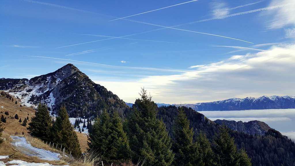
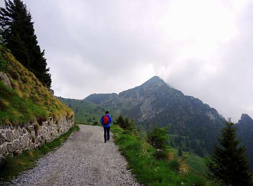
We begin to walk along the road closed to traffic by the ban on transit. Towards the northeast, a short distance away, the landscape is dominated by the great shape of the Corno della Marogna characterized by slopes covered in mugo pine with calcareous outcrops that give the mountain a wild and alpine look. We walk on an almost level path passing through meadows and pastures, pointing in the direction of the already visible saddle that separates the Corno della Marogna from the Tremalzo mountain, more to the left.

|

|
Shortly we reach the saddle called Bocca di Val Marcia (m 1790). We keep, for a short distance, the gravel road now uphill. The track makes an evident hairpin bend and then crosses diagonally upwards at the foot of a series of limestone cliffs. A little further on, the road enters an artificial tunnel carved into the rock. The ascent path to the Corno della Marogna separates to the right, a few meters before the tunnel. The traces are not very evident as they are not marked and without signs: in case of difficulty in finding them you can choose another solution, even simpler. You go through the tunnel and at the exit always on the right it starts an obvious trail rising between the vegetation to the summit. It should be noted that the crossing of the tunnel leads to a change of slope.

|

|
Descent: the return is done reversing the same route. During the descent it's possible a brief digression to reach the nearby summit called Belvedere della Marogna.

Red Tape
Cars are not allowed beyond the Refuge Garda.
Hiking grades of difficulty
T - Turistico (Tourist): Itineraries on wide, clear and well worn paths, sometimes on mule tracks or gravel roads. The routes are never exposed, don't give any orientation problems and don't exceed 2500 meters of altitude. Suitable also for children
E - Escursionisti (Hikers): Itineraries on marked trails, even narrow and with possible steep and impervious sections. They are never exposed and don't give any orientation problems. They can tread different kinds of ground, such as forests, gravel, meadows, pastures, easy rocks, etc.). They form the majority of the trails that wind up in the mountains and require a certain habit to walk; you need equipment suitable for the altitude and resistant footwear with soles suitable for rough terrain
EE - Escursionisti Esperti (Experienced Hikers): Itineraries for hikers with experience and good knowledge of the mountain. Some of these paths may have exposed sections, however brief, which require firm foot and no dizziness. They require the ability to adapt to particular terrain, such as steep grassy slopes or stretches of rocks with difficulties that can reach the 1st degree of the UIAA scale. They can also reach high altitudes (3000 m or more). Sometimes they may include unmarked sections, requiring a good sense of orientation. Snow slopes are possible, however which can be overcome without specific mountaineering gear (rope, harness, crampons, ice-axe)
EEA - Escursionisti Esperti con Attrezzatura (Experienced Hikers with equipment - The same as EE, in addition these routes require the use of via ferrata equipment (lanyards, harness, carabiners, heat sink, helmet). This kind of itineraries range from the trails with short easy and not much exposed sections, previously equipped with fixed ropes and iron pegs, to the true and more difficult Via Ferratas climbing on rocky walls or on aerial ridges and ledges, previously equipped with long stretches of iron ropes, iron steps, ladders without which proceeding would constitute a real climbing. It is necessary to know how to use the technical equipment and have a certain habit of exposure and mountaineering terrains.
Nature and flora
This group of mountains is a nice destination for botanical trips. During the spring, in addition to the various and most common species of flora, you can find some endemic species, like the Paederota bonarota, the Primula spectabilis, the Silene elisabethae.

|
 on Corno della Marogna")
|

|
When to Climb
All year round. Winter ascents requires snowshoes or an ice-axe and crampons in the presence of ice.
Accomodation
Several possibilities of accomodation in Val di Ledro.
Meteo
Guidebooks and maps

"Prealpi Bresciane" by Fausto Camerini - Collana Guide dei Monti d'Italia, CAI-TCI
Maps
"Alpi di Ledro - Tremalzo" - LagirAlpina sheet 16 - 1:25.000