
|
|
Mountain/Rock |
|---|---|
|
|
45.83628°N / 10.79604°E |
|
|
Trentino |
|
|
Hiking, Mountaineering |
|
|
Spring, Summer, Fall, Winter |
|
|
4337 ft / 1322 m |
|
|
Overview
Monte Guil m. 1322
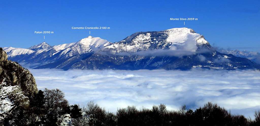
Monte Guil m. 1322 is a mountain belonging to the Prealpi Bresciane e Gardesane, located nearby the border between Lombardy and Trentino counties, and closely overlying the Western shore of Lago di Garda, which it dominates with exceptional views. Monte Guil is aligned along a ridge formed by different peaks, starting from Cima Al Bal, called the Pregasina Ridges. It's the Southernmost summit of this ridge and it's frequently climbed starting from Pregasina as the last summit along this ridge. It is advisable to climb this long ridge starting from late spring, anyhow in the absence of snow on these airy and exposed ridges.
An alternative interesting way suitable to climb the mountain also in wintertime is the route starting from Pregasina and leading towards Malga Palaer, Passo Rocchetta and Passo Guil. From here the summit of Monte Guil can be climbed following the easy ridge - South-West oriented - starting from Passo Guil.

|

|
Getting There
Two main itineraries to climb Monte Guil, starting from Pregasina or from Prè di Ledro.
Road access to Pregasina: from the Brennero autoroute exit Rovereto Sud and take the road to Arco and Riva del Garda. From Riva del Garda follow the road to Val di Ledro, which is reached through two long tunnels. Some hundred of meters after the second tunnel, you find on the left the narrow but paved road leading to the village of Pregasina 532 m. Leave the car in the small parking lot below the church.
Road access to Prè di Ledro:from the Brennero autoroute exit Rovereto Sud and take the road to Arco and Riva del Garda. From Riva del Garda follow the road to Val di Ledro, which is reached through two long tunnels. At the exit of the tunnel, continue along the main road, pass the village of Biacesa and shortly after turn left onto the road to Prè di Ledro 488 m. Leave the car in the village.

|

|
Route: Monte Guil from Pregasina
Monte Guil from Pregasina via Malga Palaer and Passo Rocchetta
Summit quote: 1322 m
Difficulty: E
Difference in level: 800 m from Pregasina
Time required: 4 hours round trip
Starting point: Pregasina m 522


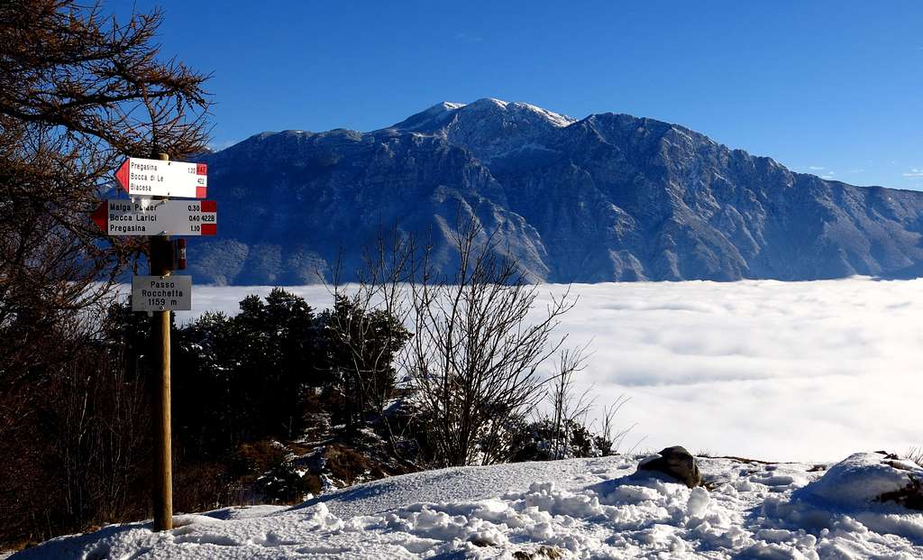
The route starts from the church of St. George in Pregasina 532 m, a hamlet of Riva del Garda. From the church take to the left the track towards Passo Larici, Malga Palaer and Passo Rocchetta (path n. 422B), soon entering the forest after few bends and getting a crossroad after few minutes. Ignore the right track and continue along the trail inside the forest getting after about 40 minutes to the wide saddle of Bocca Larici 881 m. From the saddle continue to the right along the mainly horizontal track following the signpost to Malga Palaer and reaching the clearing where it is located the shelter in a fabulous position under Cima Al Bal and Cima Nara.
Once reached Malga Palaer clearing turn Southward - to the left in your travel direction - following the path 422B, a variant that allows to reach in quick ascent inside the wood the beautiful scenic spot of Passo Rocchetta 1159 m.From the wonderful Passo Rocchetta take a path in the South direction starting near a characteristic rock pinnacle. Don't follow the path descending near the pinnacle, but head to right following a good trail running along the eastern slopes of Cima Guil reaching Passo Guil 1208, a wide saddle below the South-West ridge of the mountain from which it opens a fine view towards Monte Carone (signpost "Prati di Guil").
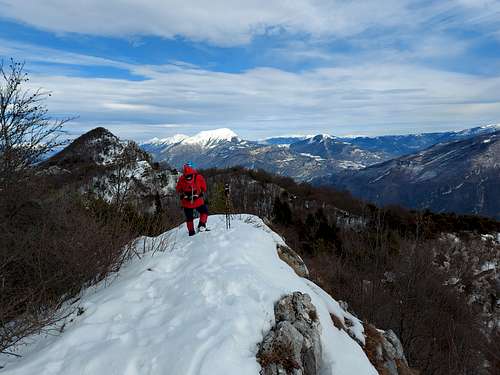
Hence make a sharp turn to the right (Northward) and start climbing along the easy ridge leading to the summit in about 15 minutes. It opens a 360° wide spectacular view over the surrounding peaks, near and more distant.
Descent: reversing the same route

|

|

|

|
Italian version
Il percorso inizia dalla chiesa di San Giorgio in Pregasina 532 m, frazione di Riva del Garda. Dalla chiesa prendere a sinistra il sentiero verso Passo Larici, Malga Palaer e Passo Rocchetta (sentiero n. 422B), entrando subito nel bosco dopo alcune curve. Dopo pochi minuti si arriva ad un bivio, dove si ignora il sentiero sulla destra e si prosegue lungo il sentiero nella foresta arrivando dopo circa 40 minuti all'ampia sella di Bocca dei Larici 881 m. Dalla sella si prosegue a destra lungo una strada sterrata prevalentemente in piano seguendo le indicazioni per Malga Palaer e raggiungendo la radura dove si trova la baita in una posizione favolosa sotto Cima Al Bal e Cima Nara.
Una volta raggiunta la radura di Malga Palaer, dirigersi verso Sud - a sinistra - seguendo il sentiero 422B, una variante che consente di raggiungere in rapida salita nel bosco il bellissimo punto panoramico del Passo Rocchetta 1159 m. Da Passo Rocchetta si continua in direzione Sud verso il vicino caratteristico pinnacolo roccioso. Non seguire il sentiero che scende vicino al pinnacolo, ma prendere più a destra un buon sentiero che traversa semi-pianeggiante lungo i pendii orientali di Cima Guil raggiungendo il Passo Guil 1208 m, un'ampia sella sotto la cresta sud-ovest della montagna da cui si apre una magnifica vista verso Monte Carone (cartello "Prati di Guil").
Quindi svolta a destra (verso nord) e inizia a salire lungo la facile cresta che porta alla vetta in circa 15 minuti. Vista spettacolare a 360° sulle cime circostanti, vicine e più distanti.
Discesa: seguire lo stesso percorso di salita
Route: Monte Guil from Pregasina across the Creste di Pregasina
Pregasina Ridges round trail
Summit quote: 1376 (Cima Nara)
Difficulty: EE
Difference in level: 850 m from Pregasina, longer develope
Time required: 6-7 hours round trip
Starting point: Pregasina m 535
See here on SP the full description of this route: Pregasina Ridges round trail
Route: Monte Guil from Prè di Ledro
Monte Guil from Prè di Ledro via Malga Vil and Passo Guil
Summit quote: 1322 m
Difficulty: E
Difference in level: 840 m from Prè di Ledro
Time required: 4/5 hours round trip
Starting point: Prè di Ledro m 488
Parked the car in the small parking lot of the village, cross the bridge over the Ponale stream and take the steep concrete road, marked SAT n. 421, which with a beautiful walk in the wood leads to the locality Leano, a charming group of houses scattered on a wide meadow.

|

|
Just before the hamlet at a fork take the left branch - shorter and more direct - and continue on a mule track in the wood, then pass between two narrow rocky walls (called Bocche di Vil) getting to Malga Vil 1109 m. Just beyond the shelter there is a second fork, here take the left branch - the right path "Agostino Maroni" leads to Monte Carone - leading shortly to the beautiful meadows of Passo Guil.

|

|
On the left of the signpost climb up directly on steep meadows to reach after 5 minutes the locality Prati di Guil (signpost). Hence make a sharp turn to the left (Northward) and - as described in the previous route - start climbing along the easy ridge leading to the summit in about 15 minutes. It opens a 360° wide spectacular view over the surrounding peaks, near and more distant.
Descent: reversing the same route
Italian version
Parcheggiata la macchina nel piccolo parcheggio del paese, attraversare il ponte sul torrente Ponale e prendere la ripida strada in cemento, contrassegnata SAT n. 421, che con una bella salita nel bosco conduce alla località Leano, un affascinante gruppo di case sparse su un ampio prato.
Poco prima della frazione ad un bivio prendere il ramo sinistro - più corto e più diretto - e proseguire su una mulattiera nel bosco, quindi passare tra due strette pareti rocciose (chiamate Bocche di Vil) arrivando a Malga Vil 1109 m. Poco oltre il rifugio si trova un secondo bivio, qui prendere il sentiero a sinistra - il sentiero a destra "Agostino Maroni" conduce al Monte Carone - che sale in breve tempo ai bellissimi prati del Passo Guil.
Sulla sinistra del cartello si sale direttamente su ripidi prati per raggiungere dopo 5 minuti la località Prati di Guil (cartello). Si svolta quindi a sinistra (verso nord) e - come descritto nel percorso precedente - si inizia a salire lungo la facile cresta che porta alla vetta in circa 15 minuti. Si apre una vista spettacolare a 360° sulle cime circostanti, vicine e più distanti.
Discesa: seguire lo stesso percorso
Red Tape
No permits, no fees required
Hiking and scrambling scale
T - Turistico (Tourist): Itineraries on wide, clear and well worn paths, sometimes on mule tracks or gravel roads. The routes are never exposed, don't give any orientation problems and don't exceed 2500 meters of altitude. Suitable also for children.
E - Escursionisti (Hikers): Itineraries on marked trails, even narrow and with possible steep and impervious sections. They are never exposed and don't give any orientation problems. They can tread different kinds of ground, such as forests, gravel, meadows, pastures, easy rocks, etc.). They form the majority of the trails that wind up in the mountains and require a certain habit to walk; you need equipment suitable for the altitude and resistant footwear with soles suitable for rough terrain.
EE - Escursionisti Esperti (Experienced Hikers): Itineraries for hikers with experience and good knowledge of the mountain. Some of these paths may have exposed sections, however brief, which require firm foot and no dizziness. They require the ability to adapt to particular terrain, such as steep grassy slopes or stretches of rocks with difficulties that can reach the 1st degree of the UIAA scale. They can also reach high altitudes (3000 m or more). Sometimes they may include unmarked sections, requiring a good sense of orientation. Snow slopes are possible, however which can be overcome without specific mountaineering gear (rope, harness, crampons, ice-axe).
EEA - Escursionisti Esperti con Attrezzatura (Experienced Hikers with equipment - The same as EE, in addition these routes require the use of via ferrata equipment (lanyards, harness, carabiners, heat sink, helmet). This kind of itineraries range from the trails with short easy and not much exposed sections, previously equipped with fixed ropes and iron pegs, to the true and more difficult Via Ferratas climbing on rocky walls or on aerial ridges and ledges, previously equipped with long stretches of iron ropes, iron steps, ladders without which proceeding would constitute a real climbing. It is necessary to know how to use the technical equipment and have a certain habit of exposure and mountaineering terrains.
When to Climb
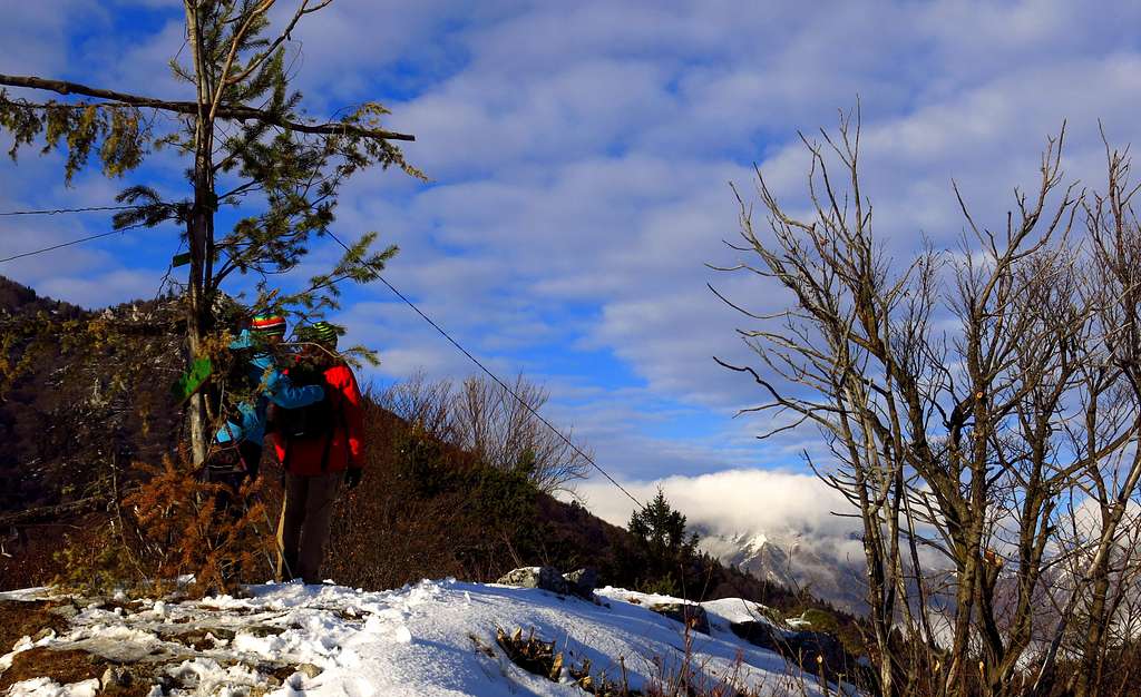
All year round, but summer months may be very hot. Be aware that in wintertime - in presence of snow and ice - Creste di Pregasina may become more difficult. The best advisable winter itinerary is through Passo Rocchetta and Passo Guil.
Accomodation
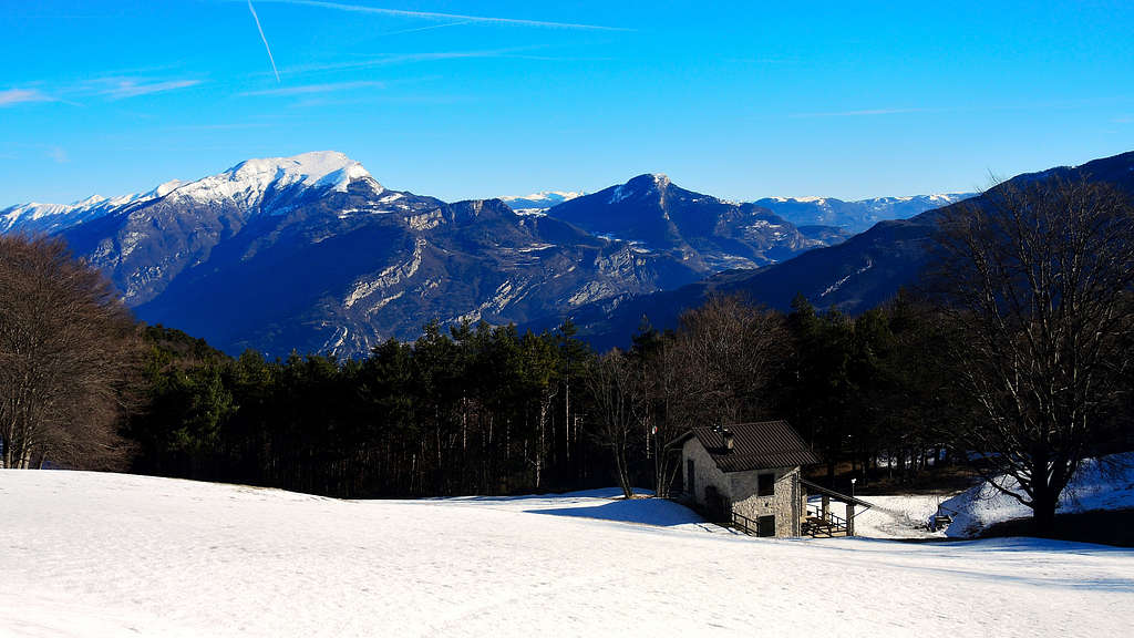
Several possibilities of accomodation in Riva del Garda, Val di Ledro and Pregasina
Bibliography
Maps:
KOMPASS sheeet 071 – Alpi di Ledro Valli Giudicarie 1:50.000
LAGIRALPINA sheet 016 - Alpi di Ledro - Tremalzo 1:25.000