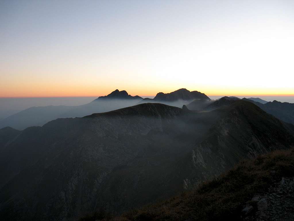
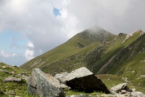
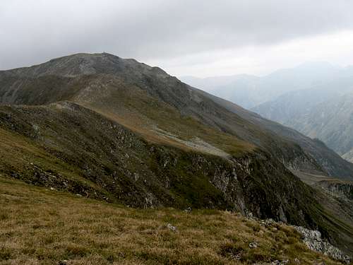
The main ridge of the Făgăraş never drops below 2,000 m over a distance of approximately 50 km
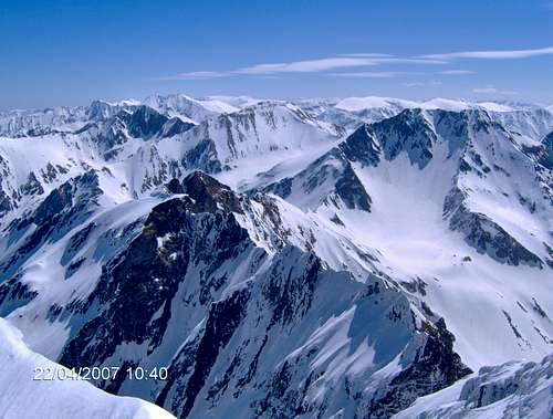
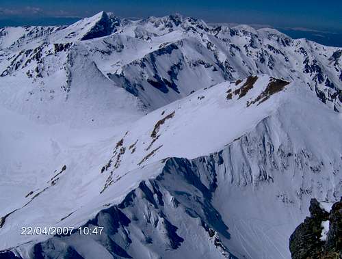
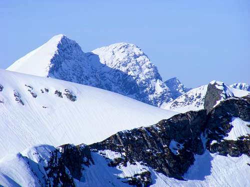
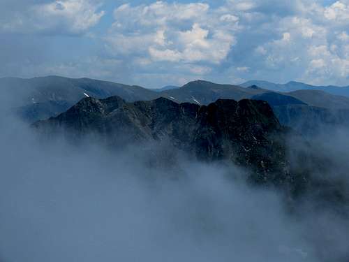
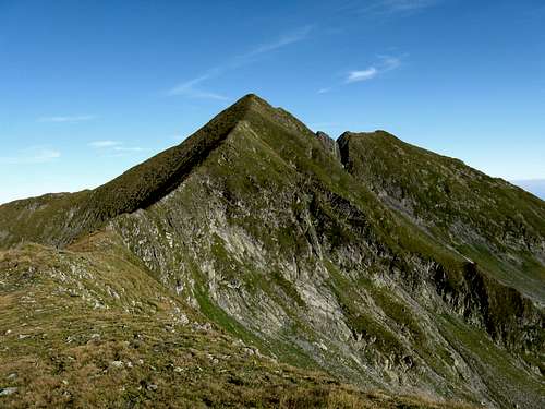
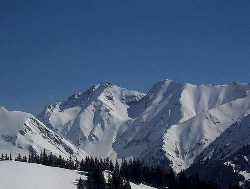
Lespezi-Călţun (left) and Negoiu (right of center) - the crown of the Western Făgăraş
The Făgăraş Mountains belong to the South Carpathians and are one of the most impressive mountain ranges in Romania. They are the country's highest and largest mountains, covering an area of 3,000 square kilometers. Across the Carpathians, there is only one mountain range which is higher than the Făgăraş, namely the Tatra Mountains which rise at the opposite, northern end of the Carpathian arc. The main ridge of the Făgăraş forms a massive spine, which extends west to east in a fairly straight line for more than 70 kilometers - from the valley of the Olt River to the Piatra Craiului and the Iezer ranges. It never drops below 2000 m over a distance of about 50 km. In the Făgăraş sit eight of Romania's fourteen peaks rising above 2500 m. There are also at least 42 peaks whose elevations fall within the 2400-2500 m brackets. The highest peak of both the Făgăraş Mountains and Romania is called Moldoveanu and rises to 2544 m in the heart of the Făgăraş. But no less renowned than Moldoveanu is Negoiu: rockier, reigning in the west, at 2535 m the second highest summit in Romania.
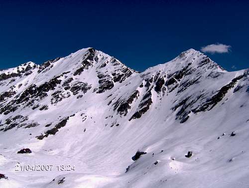
Moldoveanu (left) and Viştea Mare (right) - photo by Adrian.Scurtu
Negoiu - the second highest
A Romanian poet Lucian Blaga overwhelmed by the beauty of the Făgăraş Mountains wrote: "God, please stop the clock with which you measure eternity." The awe-inspiring, wild scenery - a sea of magnificent peaks, endless ridges, deep valleys, narrow crests and picturesque tarns - prompted the French scientist Emmanuel de Martonne to refer to the Făgăraş Mountains as the Transylvanian Alps. This nickname is more often used, however, for all of the South Carpathians. The Făgăraş Mountains form the bulk of a little bigger mountain group which is named after them and which contains the Făgăraş proper and a couple of mountains a bit farther south: the Coziei Mountains and the Iezer Mountains. In fact, the latter can be thought of as part of the Făgăraş proper. On the other hand, among the extremely long lateral ridges branching off the main ridge to run southward there are two that are sometimes listed as separate mountain ranges: the Frunţii Mountains (the ridge sent south by Negoiu) and the Ghiţu Mountains (a ridge branching off not far from Moldoveanu). They can be easily located on the map as they have become separated by a big dam called Lacul Vidraru. The Făgăraş is formed mostly of metamorphic rocks, such as gneiss and schists. In few places thin layers of limestone can be found. The relief of the mountains was shaped by Pleistocene glaciers, hence the U-shaped valleys divided by jagged crests. In the northern valleys the glaciers were up to five km long. On the other, southern side the Valea Rea glacier had a lenght of nine km.
The westernmost part of the main ridge that rises over 2400 m. It has three peaks which bear the same name plus a number. The western summit, Ciortea 1 is the highest, but the others also exceed 2400 m. The rocky north face of the massif forms a fine cirque, in which sits Avrig Lake.
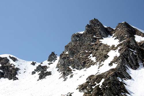
West from this peak extends Custura Sărăţii, along with Strunga Dracului and Strunga Ciobanului a bit further west, the most difficult (UIAA I, partly fixed with chains) and surely exciting for the hiker stretch of the main ridge trail.
Negoiu
2535
The second highest mountain in Romania, located on the main ridge in the western, jagged part of the Făgăraş, notorious for unstable weather.
Often considered to be the sub-summit of Lespezi, it towers over Călţun Lake.
Lespezi
2517
Standing just south of the main ridge, the peak can be seen as the main summit of the Călţun-Lespezi massif. Accessible from the Transfăgăraşan Road via a trail marked with red dots, connected with the main ridge trail via a stretch of blue stripes.
On Muchia Buteanu, the ridge running north from Vânătoarea lui Buteanu. Due to easy access via blue stripes from Bâlea Lake, the peak may be the most popular with hikers of all of the peaks lying well off the main ridge, whereas the upper stretch of Muchia Buteanu is quite popular with rock climbers.
Vânătoarea lui Buteanu
2507
In the central part of the mountains, just near the Transfăgăraşan Road. It is said to turn bluish-black when a storm is approaching.
On the section of the main ridge extending west from Vânătoarea lui Buteanu, which is popular with rock climbers. The main ridge trail skirts this section from the south.
Muşeteica
2448
The highpoint of the huge lateral ridge running south from Arpașu Mic.
On the main ridge between Fereastra Zmeilor and Arpașu Mare.
Arpașu Mare
2468
On the main ridge between Arpașu Mic and Podragu.
Podragu
2462
On the main ridge west of Arpașu Mic, Podragu is surrounded by pretty tarns.
Viştea Mare
2527
The lower summit of Moldoveanu, with less than 30 meters of prominence (on the right in the photograph), sitting on the main ridge.
Moldoveanu
2544
The main summit of the highest mountain in the Făgăraş as well as Romania, just south of the main ridge. The massif can be easily recognized from afar thanks to its characteristic, trapezoid shape. It is surrounded by peaks with elevations above 2400 m, so it cannot be seen from the north foot of the Făgăraş Mountains. It was known as Viştea Mare until the second half of the 19th century, when it was named Moldoveanu, perhaps to celebrate the creation of Romania as a result of a union of Wallachia and Moldavia.
Găleșescu Mare
2471
The highest summit between Viştea Mare and the summits of Urlea and Dara in the east.
Colţul Bălăceni
2286
It is a short spur sent by the main ridge north, into the head of the Sâmbăta - one of the major valleys in the eastern Făgăraș. The crag is one of the most handsome in the mountains, with rock climbing routes up to grade 5B on the Romanian scale (UIAA V).
Dara
2500
Along with nearby Hârtopu, it forms the Făgăraş's easternmost massif that is up to the 2500 m mark.
Hârtopu
2506
Just south of Dara, in the gentler, grassy part of the Făgăraş Mountains.
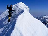
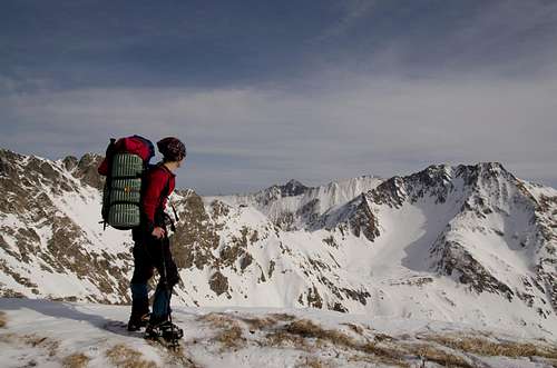
Mountaineering
Trekking
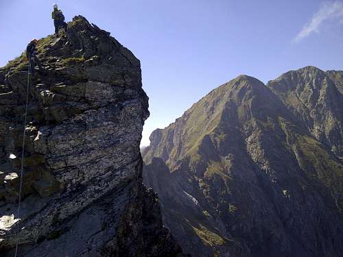
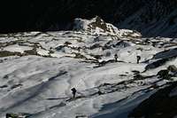
In summer, the Făgăraş Mountains are a paradise for backpackers, who usually attempt to trek along the main ridge. Such a trek takes 5 to 7 days, most people are carrying a tent. On days of inclement weather - virtually unavoidable in these mountains, usually swept by high winds and often battered by storms - shelter can be sought in one of the few rudimentary refuges (see Huts and Refuges), of which the refuge by Lake Călţun is the most popular. The most difficult, chain assisted section of the marked trail running along the main ridge is near the peaks of Şerbota and Negoiu in the western part of the Făgăraş. This part of the mountains, especially the surroundings of Negoiu and Vânătoarea lui Buteanu, is more jagged (and readily accessible from Bâlea Lake), hence more popular with rock climbers and mountaineers too. Especially the northern spurs - wild, cut off from the crowds, shattered, abrupt, partly vegetated – can make for memorable climbs which can be graded up to 3B (Romanian scale). A relatively easy (UIAA grade III or perhaps IV) but pretty attractive route with the famed Rabbit Ears, runs along a stretch of the main ridge over the summits of Vârtopel and Arpăşel. Although generally lack of rocks such as granite results in technical climbing in summer being somewhat limited, impressive crags with difficult routes do occur also in the eastern part of the Făgăraş, Colţul Bălăceni being a case in point.
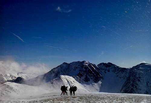
In winter, a wider area offers many a breath-taking mountaineering option, and the traverse of the main ridge is quite an endeavor. Along a route of over 70 km you will be slogging along a wild ridge with many tricky cornices, and you will have to traverse many places where the avalanche danger is high. In February 1972, a German-Czechoslovak team succeeded in doing the traverse of the highest and rockiest part of the main crest, covering thirty-six summits at above 2300 m. The feat took them as much as 12 days. As far as skiing is concerned, there is plenty of terrain for skiers of various skill. Good, natural slopes can be found near the following huts: Urlea, Sâmbăta, Turnuri, Podragu, Capra, Bâlea, Negoiu, Bârcaciu, Capra. Ski alpinism will be cool on the north-south crossings, there are plenty spots for extreme skiing, while ski touring on the southern ridges you will be practically cut off from civilization.
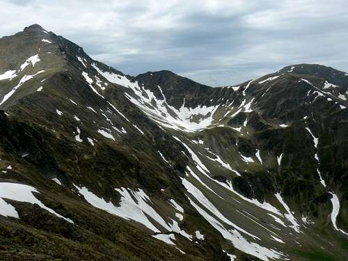
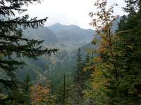
The northern slopes of the Făgăraş Mountains, facing Transylvania, are shorter and steeper, whereas the lateral ridges and valleys branching south of the main ridge drop toward the sunny Muntenia more gradually, being up to 30 km long. Therefore, they are deserted and wild - very few hikers have roamed the area.
The western part of the Făgăraş seen from Moldoveanu (the main ridge right, the long south ridges left)
When To Go & Climate
If you are a hiker you should come in summer. Early autumn can also be a wonderful - besides being colorful - time, but all this varies between years. As for the summer, August seems to be best, July tends to be very rainy. Some summers have been kind of horror: hurricane force winds, frequent thunderstorms, torrential rains, freezing weather. You'd better be careful when planning your trip. You must realize that a walk-up from the foothils to the main ridge takes at least 10 hours. It is good to start the ascent early in the morning, when the weather conditions are favourable. In winter and spring, the risk of avalanches is usually high.
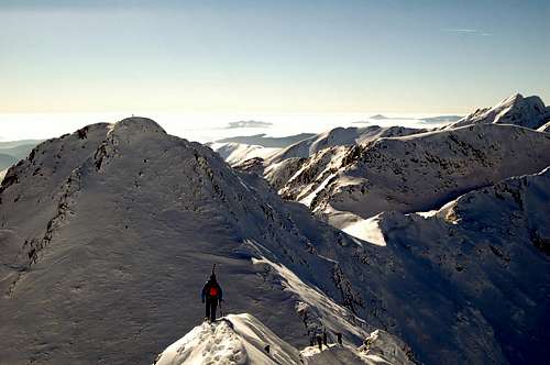
13 July 2009 (worthy of a click: mini-TR inside) - photo by kovacsgaborpal
The climate of the Făgăraş Mountains is alpine and is harsher than the climate of most of the mountain ranges the Carpathians are made up of. The average temperature, the intensity of the winds and the level of precipitation depend on the altitude and the orientation of the mountain faces. The Făgăraş Mountains are characterized by the highest amount of rainfall, which reaches an annual 1400 mm per year.The average yearly temperature in the alpine regions (above 2000 m) is -2°C. Encountering patches of snow in mid-June is not a rare thing. Across the Carpathian Mountains, the most frequent avalanches occur in the Făgăraş. The most deadly accidents in Romania's mountains have been registered here.
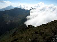
The climate of the Făgăraş has its peculiarities determined by the size of the mountain range and the west-east orientation of the main ridge. The north slopes block the cool, wet air coming from the Atlantic and from the north of Europe, and the south slopes block the Mediterranean and tropical air, which leads to the natural timberline (bear in mind that centuries of grazing have lowered it considerably) running much higher on the southern flank. This is an area where we can watch the enchanting cascades of surging fog, which makes the heights seem endless, envelops the rocks in a mysterious shawl, and then unexpectedly opens a window on the world below, where the green meadows are bathed in sunshine. In contrast to the rockier northern valleys, the southern slopes - grassy and descending more gently - have favored an intensive pastoral life.
Lakes
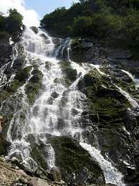
Cascada Bâlea
Thousands of shining pearls
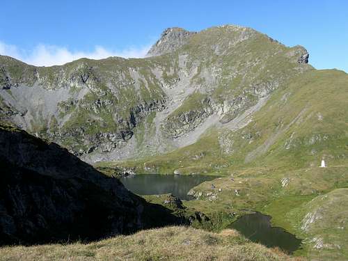
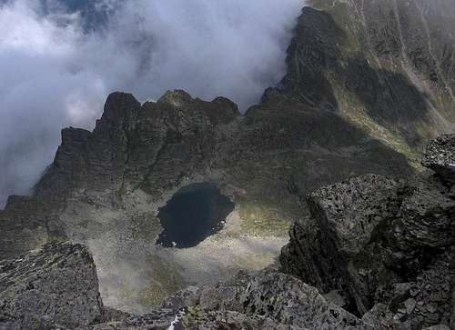
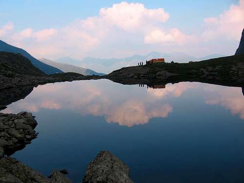
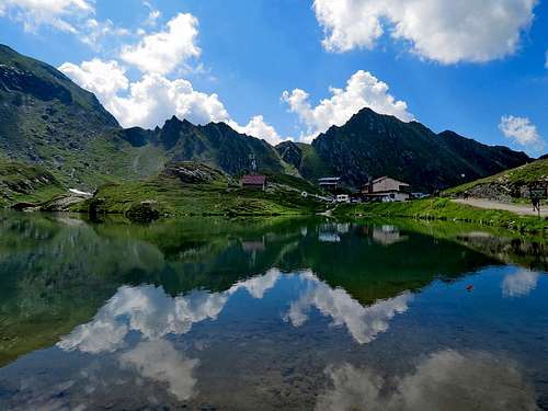
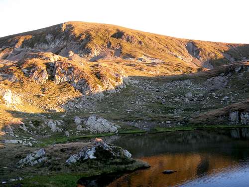
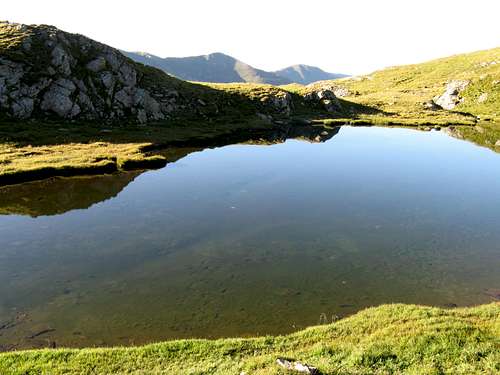
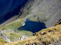
The Făgăraş has the densest river network of all the mountain ranges in Romania. The most popular waterfall is Cascada Bâlea. The mountains also boast numerous lakes, or rather tarns - these true jewels of nature, often referred to as the pearls of the mountains. To some they resemble mirrors scattered at valley heads - emerald green, dark blue or black in color - that enhance mountain scenery greatly. They are precious relics of the past epoch when the valleys were filled with glaciers, which gouged the rock under their cold bodies. The tarns of the Făgăraş, full of splendor and magnificence, are also sources of crystal-clear water, which, nevertheless, must be boiled before drinking. The largest natural lake in the Făgăraş is Lacul Bâlea (46 acres), Podragu is the deepest (15.5 m), Mioarelor is situated at the highest elevation (2282 m), whereas Călţun might be the prettiest.
In the western part of the Făgăraş, at the foot of Ciortea (2400 m)
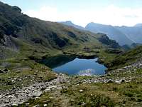
Călţun
2135
0.8
12
In a cute cirque in the west-central part. Lespezi-Călţun-Negoiu Peaks at about 2500 m form a magnificent background.
Bâlea
2030
4.7
11.35
The biggest lake in the Făgăraş Mountains, a tourist honeypot, located in the middle part of the main ridge by the Transfăgărăşan Road.
Capra
2249
1.8
8
A little east of Bâlea Lake, under Vânătoarea lui Buteanu.
Podu Giurgiului
2220
0.2
3
In the central-eastern part surrounded by Arpaşu Mare and Mircii peaks (2460 m)
Podragu
2110
2.8
15.5
The deepest of the lakes, sitting in a cirque in the central part of the range.
Iezerul Triunghiular
2160
0.45
12
In the Rea Valley, the eastern part of the mountains, just under Moldoveanu-Viştea Mare massif
Urlea
2194
2
4.5
In the eastern part near Urlea peak (2473 m)
Mioarelor
2282
0.3
2
The highest lake, encircled by a massive spur with Dara and Hârtopu summits (2500 m)
Flora & Fauna
The diversity of vegetation cover is determined by altitude.
Rhododendron
Dianthus glacialis
Saxifraga
Campanula
Lower montane zone reaches 1200 meters in elevation. Mean annual temperature is 4-6°C and the vegetation cover is formed by deciduous forests. Various species of flowers can be found here: creeping bellflower Campanula rapunculoides, matragon lily Lilium martagon, Trifolium alpestre, globe-flower Trollius altissimus or autumn crocus Colchicum autumnale
Upper montane zone begins at 1200 m and extends up to 1500 m. It is a domain of the coniferous forest. On the south slopes of the mountains, the upper borders of both deciduous and conifer forests runs 150-200 meters higher than on the steeper and colder north slopes. Open moist meadows are the best habitat for orchid species.
Subalpine zone stretches from 1500 to 2000 m. It is the domain of dwarf mountain pine and common juniper. From the floristic point of view, it is the most interesting habitat. In spring it is covered by enchanting carpets of crocuses. The mountain cornflower Cyanus montanus and the mountain garlic grow here. Allium montanum. The typical representative of this zone is the Carpathian rhododendron with its red shining flowers.
Alpine zone in the Făgăraş Mountains begins at 2000 m and reaches the highest peaks. The alpine pastures are covered by sedges. It is the best habitat for some extremely rare species of flora - relics from the Ice Age, such as Dianthus glacialis. Among other important species are the alpine bellflower Campanula alpina, Primula elatior, Hieracium alpinum, Leontopodium alpinum, Aconitum and Saxifraga.
In the Făgăraş Mountains, the flora is richest in the subalpine and alpine areas. In comparison with other mountains, the Făgăraş boast the largest number of endemic species of flowers which can't be encountered anywhere else in the world.
Fauna of the Făgăraş Mountains is typical of the high mountain zone. The most representative animal of the highest, alpine areas is the Carpathian chamois (Rupicapra rupicapra carpatica). Many populations of this subspecies occur throughout the Transylvanian Alps. Carpathian chamois are slightly bigger than their relatives in the Alps. As a species, the chamois is still common and not threatened. However, several subspecies are on the IUCN's Red List of Threatened Animals. There have been a number of successful reintroductions.Another animal typical of the Făgăraş Mountains is the marmot. Unfortunately, this largest squirrel species is on the verge of extinction. Among the big birds of prey that soar over the mountains are the eagle and the vulture. There is also the big forest game: the Carpathian brown bear, the deer and the wild boar. As for the bears, however, their population is relatively small (fewer than a hundred individuals) compared to some other Carpathian mountains. Most of them still keep away from humans and don't constitute such a big threat as the depraved bears of the Bucegi Mountains.
Carpathian chamois
Alpine accentor
Golden eagle
Red Tape, Camping & Hazards
Because the Făgăraş Mountains are not a National Park yet, you can pitch the tent practically everywhere.There are only a few nature reserves in the Făgăraş Mountains, namely: the area around Lake Bâlea, the clearing with daffodils near Vad, the hunting reserve in the Arpaşul Valley and the fossils reserve near Turnul Roşu. Although the Făgăraş Mountains are home to many unique species of the Carpathian animals and plants, the number of nature reserves isn't big yet.
Bears (they're not as much of a problem as in the Bucegi Mountains since they're not depraved by tourists yet): Try to put up your tent above timberline, don't keep food inside, check out the following link to find out how to behave if you meet a bear
Adders (a bite shouldn't kill you unless you are allergic but serum will be necessary)
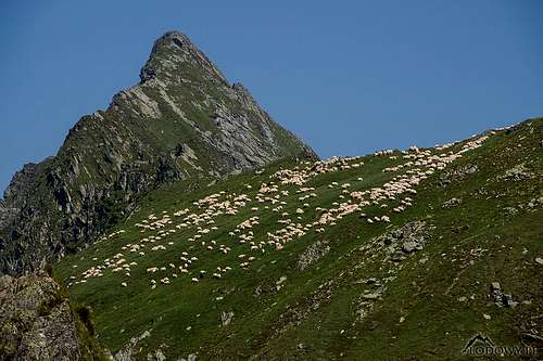
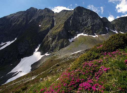
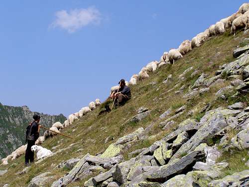
Not always this peaceful, not always the shepherds around - photo by yamesu
Mountain Huts & Shelters
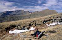
The main ridge of the Făgăraş Mountains is completely free of any manned refuges. However, there are several shelters.
Shelter
Elevation (meters)
Nearby Peaks
Nearest source of water (minutes)
Capacity (persons)
Location
Berevoiescu
2190
Berevoiescu peak (2300 m)
Easternmost Făgăraş, 800 m from Peak Berevoiescu Mare
Situated at 2136 m, Podragu Hut is the highest tourist hut in the Făgăraş Mountains.Located at 2044 m, Paltinul Hut is the best known hut just near the Transfăgăraşan road.
Hut, elevation in meters
Nearby Peaks
Nearest Train Station/DN
www/e-mail
Telephone/Mobile
Remarks
Suru, 1450
Suru (2283 m), Tătarul (1890 m)
Sebeşul de Sus
0723 201 410
Rebuilt near the ruins of the old hut, another smaller hut nearby.
Most of the routes start from the DN1 highway between the cities of Sibiu and Făgăraş. On the south side most routes begin at Curtea de Argeş, although there are two which run from the Olt Valley up the western reaches of the mountains and there is an eastern route which runs west from the foot of the Piatra Craiului Mountains, namely from Plaiul Foii Hut, accessible from the town of Zărneşti (railway station).
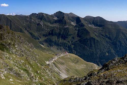
In the early 1970s the Transfăgăraşan Road was built between Arpaşu de Jos - Bâlea Waterfall - Lake Bâlea - Vidraru Artificial Lake - Curtea de Argeş. This second highest road in Romania is 90 km long and at an altitude of 2042 meters turns into a tunnel dug under the main crest of the Făgăraş Mountains. Due to severe weather conditions, the road is only passable in the summer period (approx. 3 months a year). Between Cascada Bâlea Hut (1234 m) and Lake Bâlea (2030 m) a cable car runs almost all year round.
Children refers to the set of objects that logically fall under a given object. For example, the
Aconcagua mountain page is a child of the 'Aconcagua Group' and the 'Seven Summits.' The
Aconcagua mountain itself has many routes, photos, and trip reports as children.
Parents refers to a larger category under which an object falls. For example, theAconcagua mountain page has the 'Aconcagua Group' and the 'Seven Summits' asparents and is a parent itself to many routes, photos, and Trip Reports.


 70870 Hits
 95.18% Score
 51 Votes
 Mountaineering
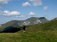 Trekking
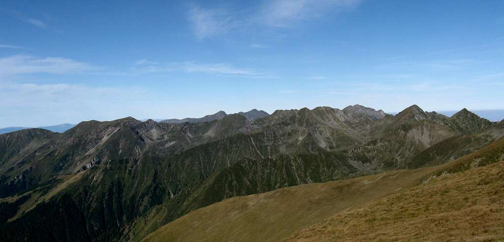


 Cascada Bâlea


 Rhododendron
 Dianthus glacialis
 Saxifraga
 Campanula


 Not always this peaceful, not always the shepherds around - photo by yamesu
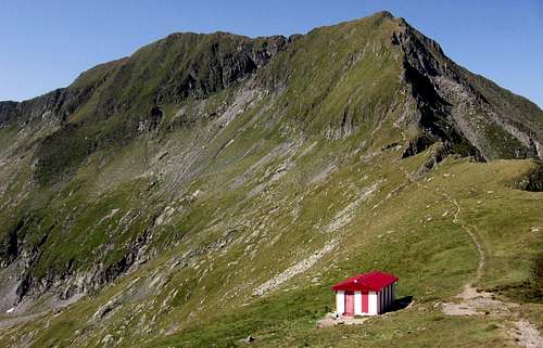
 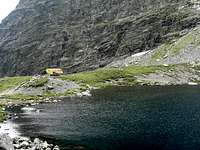 Călţun Refuge
 Podragu Hut
 Paltinu Hut
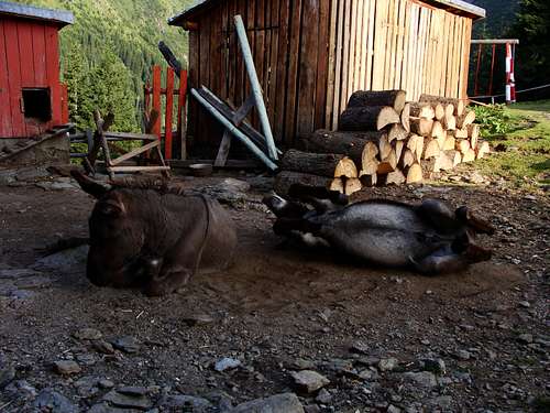 Friends from Negoiu Hut - photo by vegareve


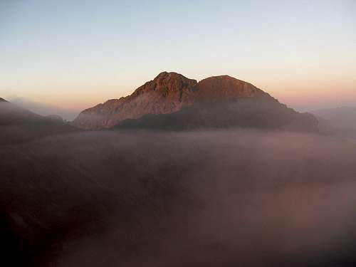
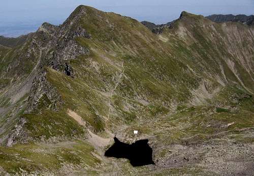
 From N
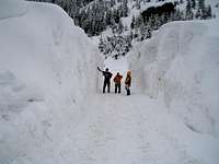
 Lespezi and Negoiu towering over Vidraru Dam photo by TheCrow
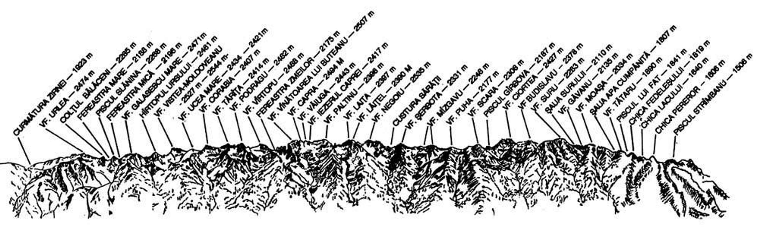

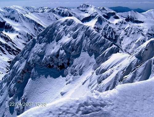
 Scara (2306 m) in winter sunshine
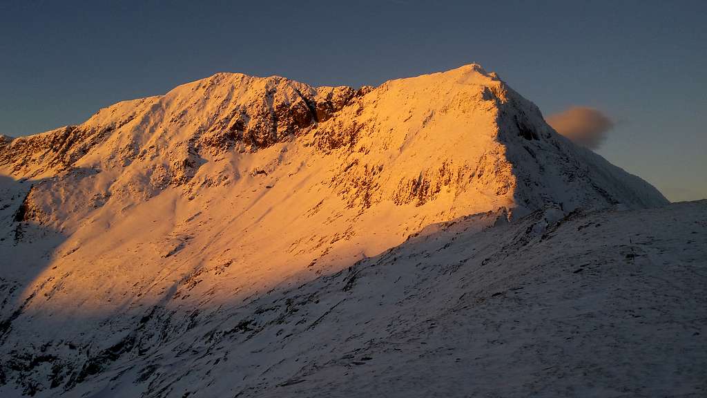
 Early morning sunlight
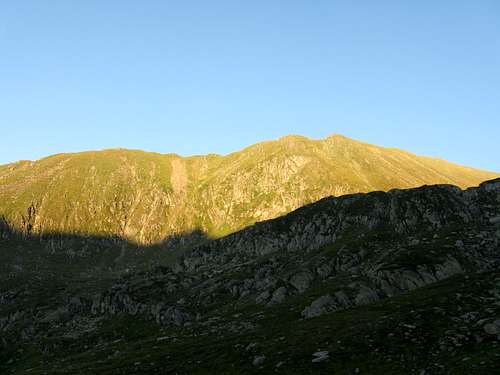
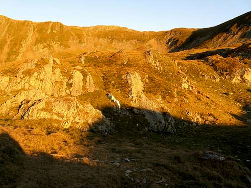
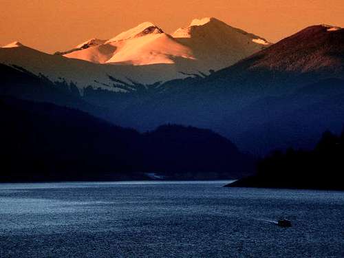
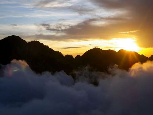

dorucalinciobanu - May 19, 2014 1:01 pm - Voted 10/10
Additions1. Best online free downloadable resources (Guidebook - Romanian - 6 vols. & Map - 2012): http://www.romania-natura.ro/node/24 2. Best weather forecast for Făgăraș mts.: http://freemeteo.ro/weather/muntii-fagaras/7-days/list/?gid=678498&language=english&country=romania
LukZem - May 21, 2014 10:11 am - Hasn't voted
Re: AdditionsThanks a lot.