
-
 7579 Hits
-
 88.61% Score
-
 27 Votes
|
|
Mountain/Rock |
|---|---|
|
|
36.60788°N / 118.13335°W |
|
|
Inyo |
|
|
Sport Climbing |
|
|
Spring, Summer, Fall, Winter |
|
|
4820 ft / 1469 m |
|
|
Overview

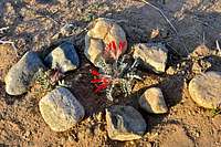 Protecting native plants
Hoodgie Wall is a rock formation in The Alabama Hills in the outskirts of Mount Whitney in the Sierra Nevada Range.
Hoodgie Wall is one of the formations in a grouping of rocks in the northern reaches of the Movie Road. These formations which include The Loaf, Truffle Tower and Mon Cherrie are bunched together to provide a number of fun and memorable routes for at least half a day of climbing. The Loaf is by far the largest of the group, and it will challenge your route finding ability just to get to its base. In contrast to The Loaf, Truffle Tower is the shortest in height and extremely easy to get to. Mon Cherrie is practically attached to Truffle Tower.
After Shark's Fin, Paul's Paradise and a few others, Hoodgie Wall may easily be considered as one of the most popular formations in the Alabama Hills. This formation is ideal for warm weather climbing as it's northwest facing and in the shade for a good part of the day. Being in the shade, however, did not make this formation desirable to climb. The moderate nature of the climbs and the height of the wall were the main contributing factors.
Routes description
 half way up Ankles Away, 5.8
 main face, left side
There are four routes on the main face and one on the satellite formation to its left, east side. The satellite formation isn't quite as high as the main wall, but the one route on it is definitely worth doing. This route is called Leonosphere, a bolted face rated 5.7. The opening move is rather difficult and a bit funky, but once you are past this move, you are going for a ride to the anchor bolts. The route is steep, but the holds are excellent.
The best route of the entire formation is a solid 5.8 called Ankles Away on the left side of the main wall. The main difficulty comes in the middle of the first half of the route. Past this crux, between the third and the fourth bolts, you will have many great holds and ample bolts to clip all the way to the top and the anchor bolts.
On the right side of the main face there is another bolted route called Hoodgie, rated 5.7. Be forewarned, regardless of the low rating climbing this route is risky. The entire route has only four bolts, with the first one so high off the deck it's hard to see from the bottom. You do not want to lose it on this route. If you are dying to do a crack route, there is one of those here too. A wide crack separates the main face from the satellite formation. Considering the rough nature of the rock here, I would not recommend this crack route.
Select Routes of Hoodgie Wall
 Leonosphere Leonosphere |  Select routes of Hoodgie Wall Select routes of Hoodgie Wall |  |
List of the select routes
Select Routes of Hoodgie Wall | |
| A | Leonosphere, 5.7, bolts, anchor |
| B | Ankles Away, 5.8, bolts, anchor |
| C | Hoodgie, 5.7, RUNOUT, only 4 bolts, anchor |
How to get there
From the town of Lone Pine, California, on Highway 395 take Whitney Portal Road at the only traffic light in town. Drive 2.7 miles west on this road to intersect Move Road. Turn right onto the Movie Road. This road is paved for a short distance then it turns into a dirt road. The first dirt road to intersect the Movie Road heads for Shark's Fin. Drive about a mile to where Movie Road makes a sweeping turn to the right. Just before reaching this turn you will see a dirt road intersecting from the left. Take this dirt road and stay on the right until you see a very large blackened boulder/cave. Park here. Looking in the direction of the west you will see Hoogie Wall a one minute walk away.Camping
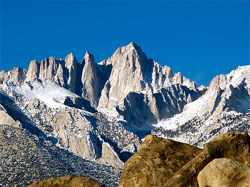 Mount Whitney
If you don't mind driving another fifty miles, there are many campgrounds along Bishop Creek just to the west of Bishop. There are also many places in The Buttermilks area that are close to a creek that are suitable for camping. Please do not camp in The Buttermilks bouldering area. That area is very crowded and is suffering from the impact unregulated camping has caused.
The following links should help finding a good campsite
Horton Creek Campground
Rock Creek Canyon
Inyo National Forest
Bishop Creek and vicinity camping