
-
 6194 Hits
-
 87.31% Score
-
 24 Votes
|
|
Mountain/Rock |
|---|---|
|
|
36.58523°N / 118.11126°W |
|
|
Inyo |
|
|
Sport Climbing, Toprope |
|
|
Spring, Summer, Fall, Winter |
|
|
4580 ft / 1396 m |
|
|
Overview
 Passion, 10d
 Chalk The Monkey, 11d
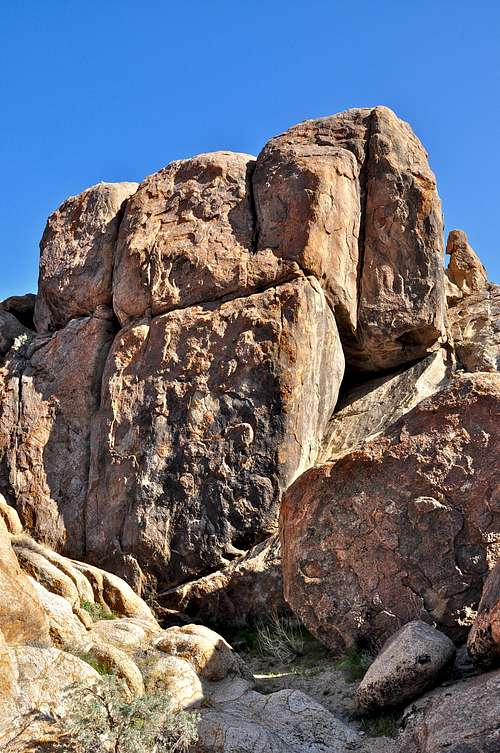
Peter Gabriel Cliff is a rock formation in the Gunga Din area of the The Alabama Hills on the outskirts of Lone Pine Peak in the Sierra Nevada Range, California.
Amongst several dozen movies produced using the Alabama Hills rock formations and backdrop of the high Sierras, one stands out most prominently. That movie is Gunga Din, produced in 1938. The area known as Gunga Din was used extensively in production of that movie and the passage of time has not allowed this association to fade into obscurity.
The entire Gunga Din area is surrounded by rock formations such as Rocky Top and Temple of Kali. Peter Gabriel Cliff is a sixty foot formation a short distance down the hill from the main Gunga Din area. Although the largest rock formation in the area, Rocky Top, was explored and climbed as early as the mid 1980s, Peter Gabriel Cliff was ignored for its climbing potential for decades. During the 1990s and 2000s a new burst of energy was put into developing many of the Alabama Hills formations including the subject of this page, Peter Gabriel Cliff.
Peter Gabriel Cliff is not as popular as some of the nearby formations such as The Candy Store, Whitney Cave or Alabama Dome, but if you are looking for a little seclusion away from cars and roads this can fill the ticket very nicely. The formation is northwest facing and stays cool for most of the daytime hours.
Although not perfectly vertical, Peter Gabriel Cliff is considered steep, at least, by the Alabama Hills standards. A prominent wide crack runs the entire sixty foot height up and down this rock. There are four bolted routes with their own anchors. The easiest and the most enjoyable route is called Wanting Contact, rated 10a. The remaining routes are, more or less, out of the reach of most climbers. It is, however, not very difficult to top rope the rest of the routes after leading the 10a route. The base is narrow and sandy, but nice and flat. it's a good idea for the belayer to wear a helmet as there is very little room on the base to duck.
List of the routes on Peter Gabriel Cliff
Route of the West Wall of Hall of Horrors, west face | |
| 1 | Passion, 10d, bolts, anchor |
| 2 | Wanting Contact, 10a, bolts, anchor |
| 3 | Sledgehammer, 10c, bolts, anchor |
| 4 | Chalk The Monkey, 11d, bolts, anchor |
Topo of the routes
 Wanting Contact, 10a Wanting Contact, 10a |  Peter Gabriel Cliff Peter Gabriel Cliff | Chalk The Monkey, 11d |
Getting There
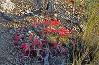 Flowers on the base
How to get to Peter Gabriel Cliff
From the town of Lone Pine on HWY 395 drive about three miles on Whitney Portal Road to intersect Horseshoe Meadow Road. Turn left onto Horseshoe Meadow Road and drive about a mile to just before the last grouping of rocks where you will see a wide turnout into a wide and flat area. Turn left here and stop to read the history of the movie Gunga Din on a plaque. Drive down the bumpy dirt road for a few hundred feet to a much wider flat area surrounded by rock formations. This is the Gunga Din area. You can park here or drive a little further down the same dirt road to another small flat area where you can turn around and park. Looking down the hill and to the right you cannot miss Peter Gabriel Cliff another few hundred feet away.
Camping

Although many parties camp within the parking areas of the Alabama Hills, this practice is highly discouraged. The area suffers from mismanaged campsites and blackened caves. There are two campgrounds very close to the Alabama Hills. Lone Pine Campground is further up the road on Whitney Portal Road, and Tuttle Creek Campground is within a few miles up Horseshoe Meadow Road.
If you don't mind driving another fifty miles, there are many campgrounds along Bishop Creek just to the west of Bishop. There are also many places in The Buttermilks area that are close to a creek that are suitable for camping. Please do not camp in The Buttermilks bouldering area. That area is very crowded and is suffering from the impact unregulated camping has caused.
The following links should help finding a good campsite
Horton Creek Campground
Rock Creek Canyon
Inyo National Forest
Bishop Creek and vicinity camping