
-
 967 Hits
-
 78.27% Score
-
 9 Votes
|
|
Mountain/Rock |
|---|---|
|
|
50.67503°N / 115.06556°W |
|
|
Trad Climbing |
|
|
Summer, Fall |
|
|
8136 ft / 2480 m |
|
|
Overview
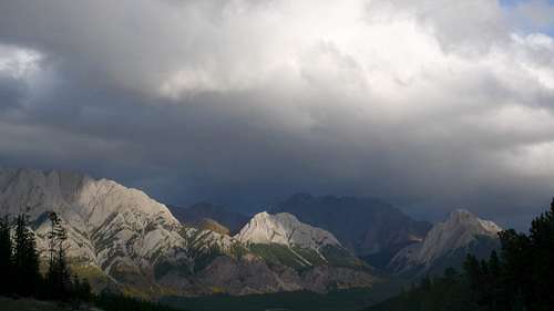
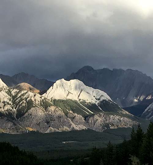
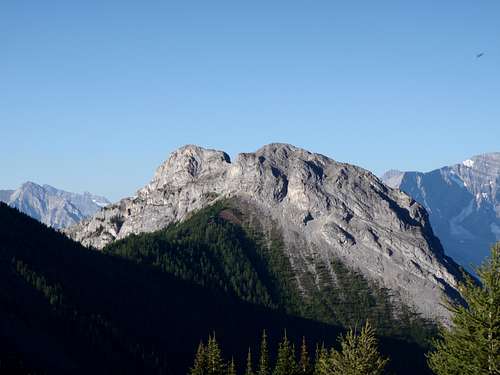
Along the western edge of the Opal Range, above Pocaterra Creek and Kananaskis River, there is a nearly continuous ridge line, broken by a few perpendicular deep cut creeks. These deep creeks isolate several named highpoints (Gap Mountain, Mount Wintour, King Creek Ridge and Grizzly Peak), but one impressive feature, Opoca Peak (GR 368155), sees little attention and lacks an official name or local name.
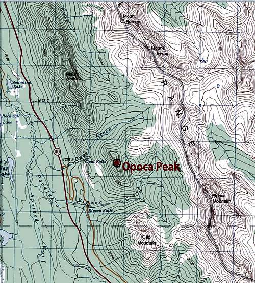
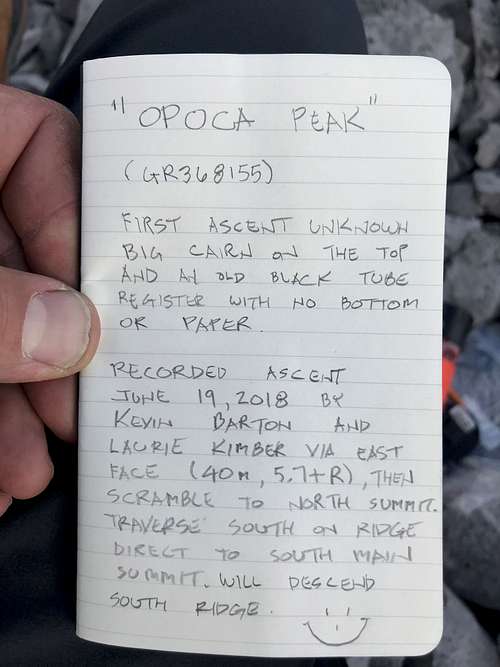
Opoca Peak (GR 368155) is the name I applied to this highpoint that divides the drainage between Opal and Elpoca Creeks. This interesting low peak sits in between Mount Wintour and Gap Mountain. The col between Opoca Peak and East Opoca (Elpoca Creek Hill) provides approximately 120 metres of prominence to the summit of Opoca Peak and about 90 metres of prominence to East Opoca; there is about 1 kilometre of isolation between these highpoints. The elevation summit of Opoca Peak reaches about 2480 metres (8,135 feet).
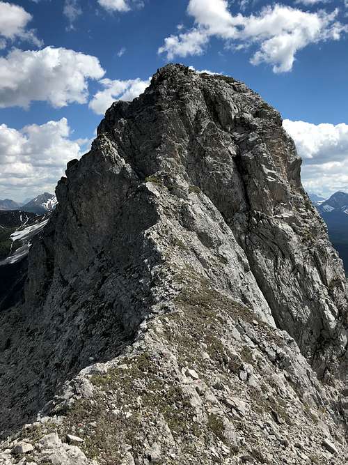
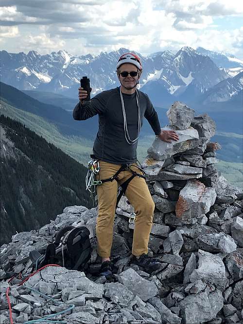
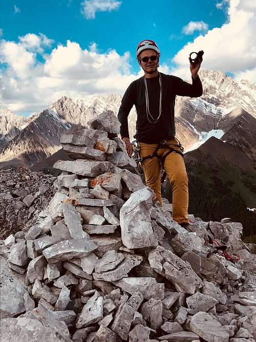
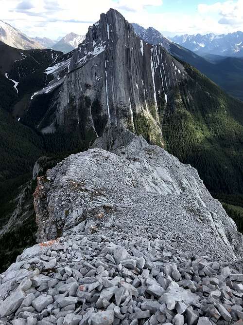
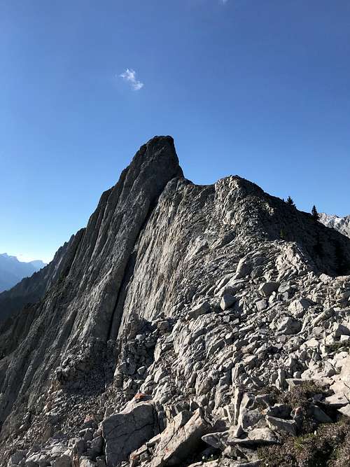
Opoca Peak has two summits, with the southern highpoint being slightly higher. No official record of a first ascent, but summit highpoint has had a large summit cairn, easily visible, for years.
Getting There
Best vehicle access from Canmore/Banff or Calgary is via the Trans Canada Highway, then south along Highway 40. From the intersection of Highway 40 (Kananaskis Trail) and Highway 1 (Trans Canada Highway) travel south towards Kananaskis Lakes. From the 1 / 40 intersection travel south 54.5 km to the Valleyview road turnoff.
A portion of Highway 40 is closed for wildlife protection during the winter/spring. From December 1 to June 15 Highway 40 is closed from the Kananaskis Lake turnoff to the intersection of Highway 940, near the Highwood River. This closure is about 5 km north of the Valleyview road trail head. A bike or ski approach can make short work of this distance.
Red Tape / Camping and Bivouacs
Peter Lougheed Provincial Park is a popular and busy recreation area hectic with front country users in the summer months. Off the beaten track areas, like Opal Creek, are easy to find and often very wild, usually providing a solitary experience.
Important Red Tape Update. As of June 2021, a mandatory user fee will be in place for Kananaskis Country - 90$ for an annual pass or 15$ for a day pass.
More information: https://www.alberta.ca/kananaskis-conservation-pass.aspx
A fee is required to enter, park or hike in Peter Lougheed Provincial Park. Within Peter Lougheed Provincial Park, backcountry camping, including bivouacs for climbing, are only allowed in designated campsites. There are no backcountry campgrounds in Opal, King or Elpoca Creeks.
Up to date information about Peter Lougheed Provincial Park available at: Peter Lougheed Provincial Park
Approach
Opal Creek intersects the old Valleyview road just above Highway 40. The Valleyview road was recently closed to vehicle traffic to protect Grizzly Bear habitat. This old paved road is gated about 200 metres after leaving the main highway, park alongside the old road. Hike pass the gate, approaching the Opal Creek bridge.
Two options exist for accessing the flatter section of Opal Creek above the steep waterfall, both require some plodding up steep scree slopes. The approach I have used most often is describe here. Just before the bridge, turn left, north, onto the north bank of Opal Creek. Just off the pavement, the trail follows the north bank a very short distance (10 metres or so) then the trail climbs steeply out of the creek and heads north, just above the creek. After a short distance in the trees, the trail rises along the steep north bank of Opal Creek. Follow this obvious and well worn trail up to the scree slopes below the cliff band that forms Opal Falls. The obvious trail continues in the scree, heading north, below the cliff band for about 400 metres to the base of wide and loose gully that breaks the cliff band. Bash up loose dirt and rock into the narrowing gully, as you near trees on the right, head towards them for more solid ground. Once above the rocky rib on your right, work your way up low angle rock and scree into the trees above. An excellent, well worn trail begins above in the trees, first on the narrow crest of a rocky rib. This excellent trail heads up Opal Creek on the north bank for about 1 kilometre.
After the obvious trail ends, there are intermittent game trails, but the bush is light and it is easy to approach the north east side of Opoca Peak. Once you round the north end of the Opoca Peak, stay in the Opal Creek drainage, heading east to get a view of the col east of Opoca Peak. Pick the easiest line, with the fewest trees, to reach the col.

When to Climb
Typical Canadian Rockies situation; best conditions for a high elevation alpine rock route is July to early September. Often the route will hold snow into early July, so August is best month to have dry conditions.
Route Description
East Face and traverse, 5.7+ R, Alpine III
I have attempted this peak several times before success on the East Face. Kicked off the South Ridge by an overhanging 5.9 step that has zero protection options and rained/snowed off the East Face twice before.
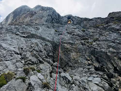
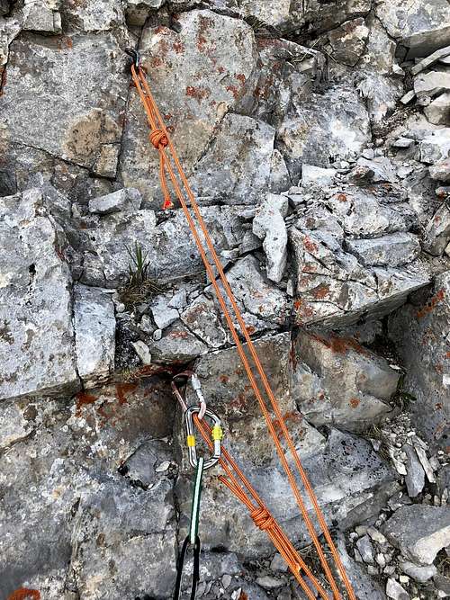
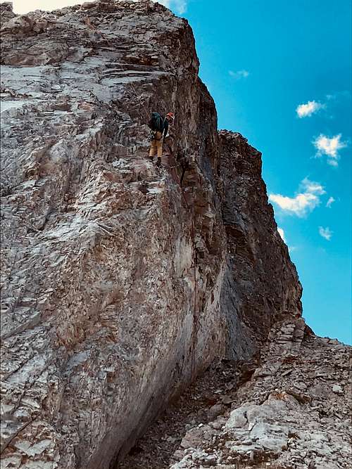
On June 19, 2018 Laurie Kimber and I tried to gain the low end of the North West end of the East Face, but solid 5.7 without protection had me bailing. Up to Col (shared with Elpoca Creek Hill) then high up on the easy slope against the East aspect where we traversed North (climbers right) about 35 metre on an exposed 4 th class traverse to the bottom of a bay for our piton belay station. This bay was wet with dripping water, but likley only spring melt wetness.
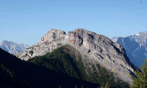
Laurie led a scrappy 5.7+ pitch with basically no pro. 40 metres to a piton station at the base of a scree bowl. From the station about 100 metres vertical of easy scrambling gains the north summit.
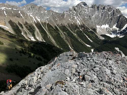
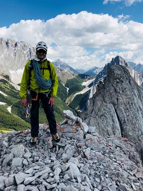
From this vantage point the mini Col to south summit looked easy, which was a pleasant surprise (I was imagining the low point on the North Ridge of Mt. Wintour). The final steep ridge step to the South summit block looked difficult, but turned out to be 4 th class exposed scramble. Yeah the summit! Huge summit cairn but the black tube register had no bottom and no paper. Still don’t know who did the first ascent.
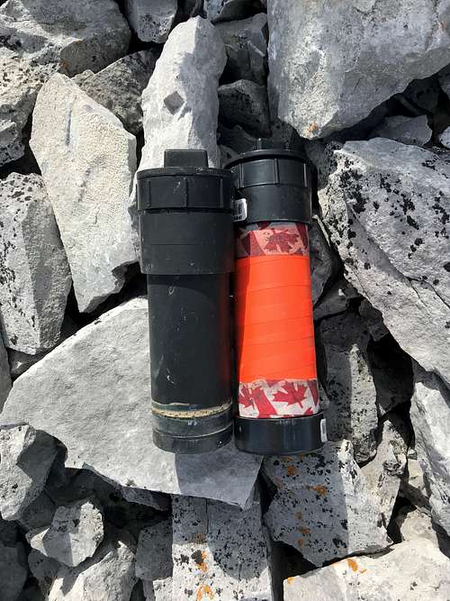
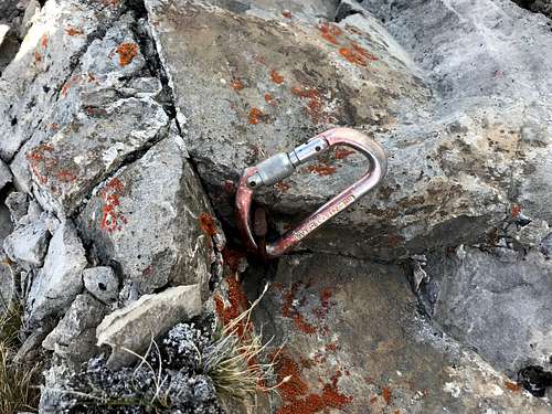
Easy descent down the South Ridge until above the steep step than kicked Laurie and I off before. I found a single piton with an old locking biner. Banged in another piton then rapped to easy ground.
Simple walk down lower south ridge, we traversed below the impressive tall wall facing highway 40 to stay out of the bear closure; pack to Elpoca day use area and then back to the truck. Beautiful day out, happy to get this summit.
External Links
Chillaxed Alpine Climbing in the Canadian Rockies
http://alpinesoft.blogspot.com/2018/06/