
|
|
Mountain/Rock |
|---|---|
|
|
46.33685°N / 9.66419°E |
|
|
Mountaineering, Trad Climbing, Sport Climbing |
|
|
Spring, Summer, Fall |
|
|
9413 ft / 2869 m |
|
|
Overview
The Piz Balzet is a 2869 meters tall granite mountain located in Bergell, Switzerland. Standing just on the eastern edge of the Albigna reservoir it is clearly visible when driving down from the Maloja-pass to the north and from the campsite at Vicosoprano. Seen from this (its western) side the Balzet is an imposing picture; very steep slabs fall off into the valley and several ridges make their way to the well defined summit. A different picture entirely is presented when the mountain is viewed from its southern side; from this side there are no steep drops to valley floors far below. Instead, it is 'merely' a summit in the ridge leading up to the Piz Bacun (3244m).Looks aside it is the climbing which has made the Balzet a popular goal for the many climbers that visit the area. The most popular route is without a doubt the South Ridge; an easily accessed climb on good granite of approximately eight pitches and not exceeding 4a in difficulty.
The route most climbers making their way up to the Albigna dam see first however is the WSW-Ridge also known as the 'Albigna Geist' (Albigna Ghost). So called because takes you alongside and above a set of features in the rock which resemble a human face. This route on the WSW ridge is far longer than the south ridge, is more difficult and requires more alpine rock experience. It is however a rewarding climb.
 The Balzet is immediately to the right of the dam, this is its less impressive southern aspect.
Getting There
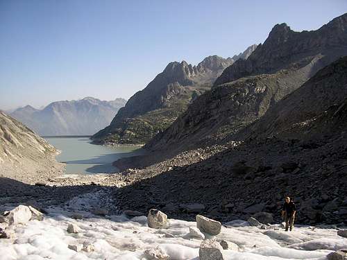
As with many of the mountains and routes near the Albigna lake the easiest access to take the cablecar up to the lake. Alternatively it is also possible to walk up, should your climbing ethics keep you from using cablecars. The footpath starts just along the main road above the cablecar station at Pranzaira. Follow the signs marked 'Cab. Albigna SAC' and the red-white-red markings.The footpath takes you through pine forests to emerge into the open underneath the north ridge of the Spazzacaldeira. It is well marked and besides causing a good sweat on warm days poses no problems or dangers. A walk up to the cablecar station at the foot of the dam takes about 2 - 3 hours. The cablecar costs 18CHF for a return ticket (approx. 12 Euros) and takes about 15 minutes.
Having arrived at the foot of the Albigna dam by foot or mechanical means, follow the path up to the top of the dam and, if attempting the 'Geist', walk accross it to the foot of the Balzet. The Albigna Geist route is reached by immediately traversing left across boulders and scree upon reaching the eastern (Balzet) end of the dam.
To get to the south ridge, follow the well marked trail up to the Albigna hut and continue along the path that takes you above the hut, heading towards the south ridge once you have passed the small Piz dal Pal which stands between the hut and the Balzet.
Red Tape
No red tape stands between you and the Balzet.Camping
The aforementioned Albigna hut offers a nice and clean place to put your head down and keeps you well provided for with good meals. It is also very centrally located and thus makes a good place from wich to explore the many climbs the area has on offer. For those who prefer sleeping under the stars there are also bivouacing oppertunities aplenty and water can easily be got at the cablecar station.Down in the valley the nearest campsite to the cablecar station is located just outside of the small town of Vicosoprano and is called Camping Mulina.
 A nice bivouac spot.
 The Albigna hut
External Links
The Albigna hutCamping Mulina