Overview
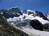
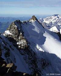
![]() North Side of Piz Scerscen in August 2001 - Photo by Rahel Maria Liu
North Side of Piz Scerscen in August 2001 - Photo by Rahel Maria Liu |
|
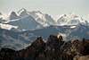
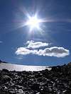
![]() | ![]() | ![]() | ![]() | ![]() |
| Bernina Group at sunrise | Piz Scerscen - North Side | Italian Route - South Side | View from Italian Side | Italian Normal Route |
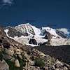
During a long time the Piz Scerscen (pronounced: cherchen, 3971 m) did not have any name because it has been seen as part of Piz Bernina. But indeed it is a big massif on its own with rock on the South (Italian) side and firn and ice on the North (Swiss) side. It goes from SW to NE, from the Porta da Roseg to the Bernina.
The ascents from the Swiss side are altogether in firn and ice and quite difficult, especially the N flank with its hanging glaciers, which falls down with ice faces and ice breaks to the Vadret da Tschierva. The ascents from the Italian side are mostly rockclimbs.
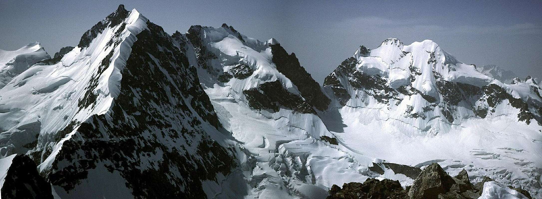
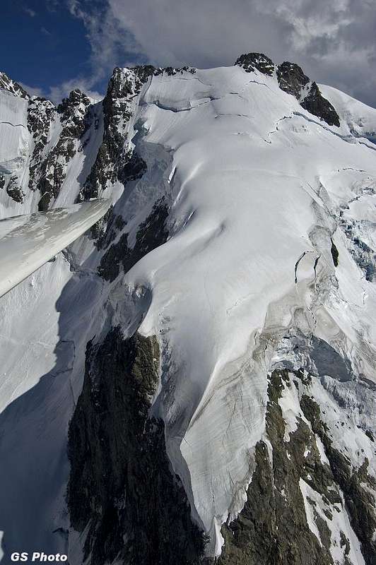
Swiss Side - Bernina Group central range from North (Photo by gabriele)
![]() Crast'Alva (Biancograt), Monte Scerscen and Piz Roseg north walls from the summit of Piz Morteratsch Crast'Alva (Biancograt), Monte Scerscen and Piz Roseg north walls from the summit of Piz Morteratsch |
On the Swiss map, the Piz Scerscen is marked with 5 points:
3781 m: The first rock tower between Porta da Roseg and P. 3875.
P. 3875 m: The 'Schneehaube' with its little white firn cap, which is immediately noticed from people watching from the Swiss side. The rock ridge has become a firn ridge.
3971 m (SAC)/3967 m (Vanis): This main summit is a free located rock tower, seen from the Piz Bernina.
3954 m: This E summit is reached from the main summit via a small, almost horizontal ridge.
3895 m: On this point is a widely visible tower, which is located in the Fuorcla Scerscen, a saddle, to which the ridge has been going down.
Historical notes
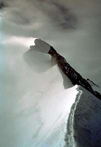
The Piz Scerscen got its name when people become interested in the Ice Nose (Eisnase). It was climbed for the first time in summer 1877 (22th of Septemer)
by Paul Güßfeld with the guides Graß and Capat. It got directly famous and is a standard ice tour till today.
The nose is an ice break of the huge high firn plateau. In 1870, Heim and Güßfeld measured an absolute height of 60 meters. Ulrich Wieland,
one of the most famous ice climbers of the 1930s estimated 100 meters in 1929, 30 m of it with 90°. Other people even estimated it still higher
and as overhang. Erich Vanis, who climbed it 1958, thought, that it was about 50 to 60 meters high and with an average steepness of about 50°.
The main reason why it has been estimated easier in later times is probably the advance of technical aid (crampons and ice screws)
which lets the climbers belief that it is not as difficult as the first climbers thought.
For the Routes compare the section Routes Overview below.
Getting There
PIZ SCERSCEN - Bernina Group - Swiss Side and Italian Side
North Side - Piz Bernina, Piz Scerscen, Piz Roseg (Photos by Rahel Maria Liu)
South Side - Piz Roseg, Piz Scerscen, Piz Bernina (Photos by gabriele)
To the Piz Scerscen:
You come from the Tschiervahütte: cross the glacier in direction of the W foot of Piz Umur, from there you go the steeper snowflank up and on the
glacier along the W side of Piz Umur.
You come from the Rif. Marinelli-Bombardieri.
To the Tschiervahütte:
You reach the hut from Pontresina: on foot (1h), by mountainbike (to rent at Roseg-Inn) or with coach (reservation by phone necessary!)
to the Roseg-Inn (1999) in Roseg valley. You only have to follow the wide road.
From Roseg-Inn, you cross the river via a bridge and go along the river till the way goes up over the hangs. You follow the way all the time and reach
in 2 h the Tschiervahütte.
You reach Pontresina by train or car on the road no. 29 from Samedan. You reach Samedan on the road no. 27 either from the NE (Zernez, via road no.
28 from Davos in the N or from Bozen in the E) or from the SW from St. Moritz. To St. Moritz a few kilometers on the road no. 27
from Silvaplana (and the Lago di Como). To Silvaplana, you can come also from the N from Chur on the road no. 3. To Chur: On the A13
from the N from the Bodensee.
Infos
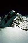
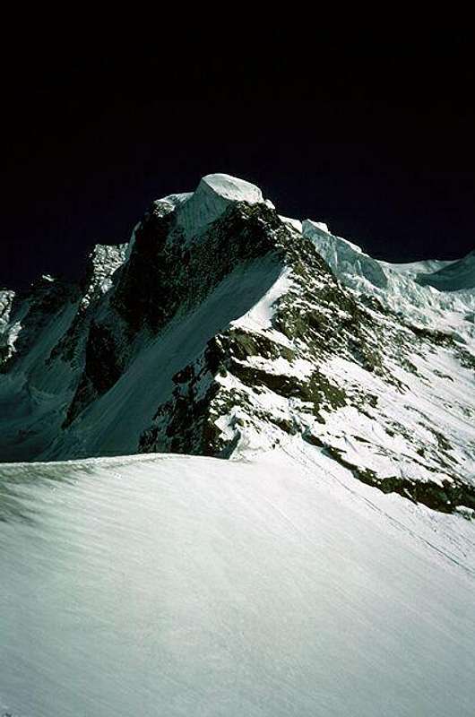
* NW Ridge with the Ice Nose (Photos by Bernhard Sauer and Helmut Dodel)
| |
| NW Ridge with the Ice Nose/Eisnase in the center | NW Ridge like a kingfisher (Eisvogel) |
Phone-numbers:
Coacher (for reservation): 0041/81/8426057
Roseg-Inn: 0041/81/8426445
Touristinfo (Pontresina): 0041/81/8388300
Internet: www.pontresina.com
WEATHER
CAMPINGPLACE
There is a camping ground in Morteratsch, 10 min. by train from Pontresina.
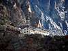
Accomodation
![Piz Bernina (on the right) in...]() Bernina on the right in the twilight - Photo by magico81 Bernina on the right in the twilight - Photo by magico81 |
Maps&Books
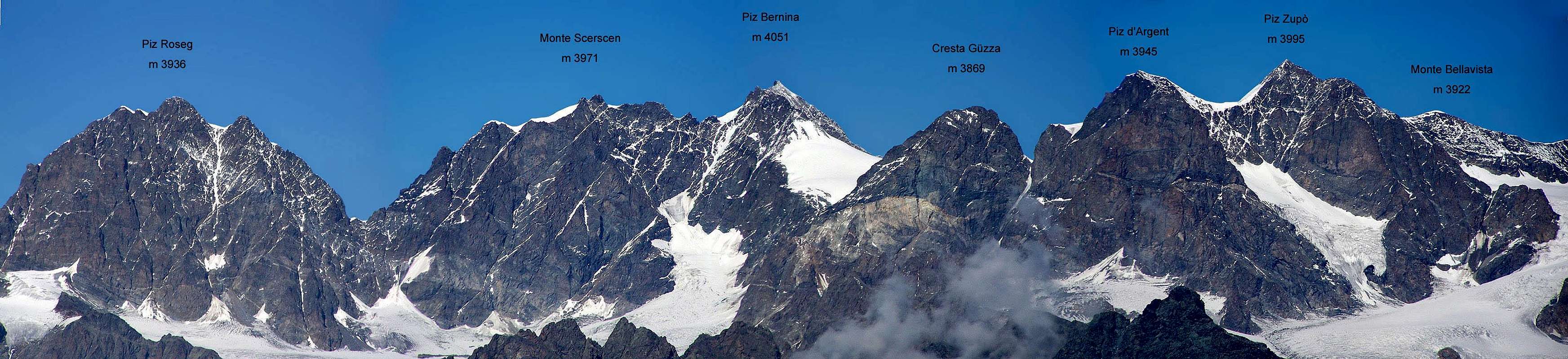
| Biancograt - Piz Bernina - Piz Scerscen and Ice Nose - Piz Roseg - Piz Aguagliouls - La Sella - Piz Glüschaint - La Muongia (Photo by selinunte01) |
1:25000 no. 1277 Piz Bernina
1:25000 no. 1257 St. Moritz
1:50000 no. 268 Julierpaß
Dav-shop
Hikr.org - Piz Scerscen
UKC - Bernina
4000er - Karte
Piz Scerscen - Panorama
Piz Scerscen - Panorama 2
Piz Scerscen - Gr3000.ch mit Kartenausschnitt
BOOKS
Pierino Giuliani, SAC Alpinführer: Bündner Alpen 5, Bernina-Massiv, 2006.
Erich Vanis, Im steilen Eis. Munich 1980. ISBN 3-405-12158-2
Walther Flaig, DAV-Gebietsführer: Berninagruppe. 1997.
Edwin Schmitt/Wolfgang Pusch, Hochtouren Ostalpen. Bergverlag Rother, München 2015.
Helmut Dumler/Willi P. Burkhardt, The High Mountains of the Alps.
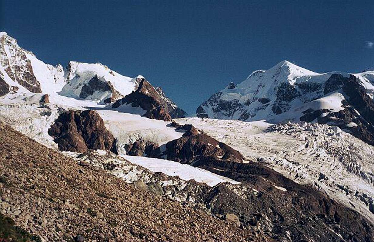
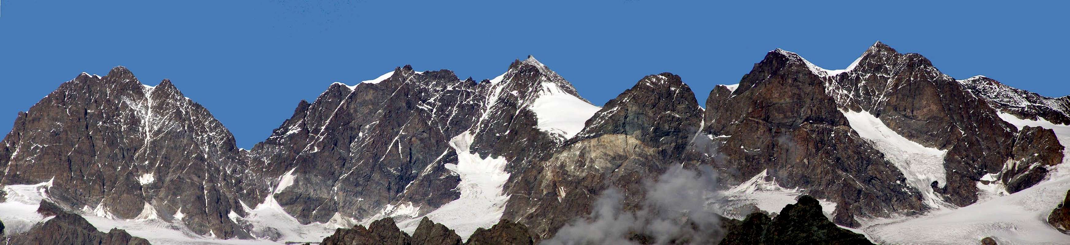
![]() Panoramic View of Piz Scerscen - Photo by Henk van den Akker
Panoramic View of Piz Scerscen - Photo by Henk van den Akker |
Routes Overview
From the Swiss Side:
N flank:
SS, 8-10h from Tschiervahut (today scarcely ever climbed and not recommendable, even not as descent when having climbed up the Ice Nose) (SAC)
NW ascent Ice Nose (Eisnase):
S, 6-7h from Tschierva Hut (SAC)
700 hm (face), 40°-45°, at the Ice Nose till 60° (1-2 rope lengths), 3-4 h (from the Fuorcla da l'Umur) (Vanis)
* Photos by Rahel Maria Liu and Bernhard Sauer
WNW flank
SS, 8-10h from the Tschiervahütte
From the Italian Side:
SE flank:
ZS, III-IV, 6-8 h from Rif. Marinelli (SAC)
S Face:
ZS, III-IV, 7-8h from Rif. Marinelli (SAC)
SW couloir:
ZS, 6-8 h from Rif. Marinelli (SAC)
Traverse from SW to NE (Piz Bernina):
S, III-IV, 6-8 h from Porta da Roseg (SAC)
*
Climber's Logs
Link MountainArea
![]() | MountainArea |
4000er - Gipfel - Piz Bernina
* On the way to the Ice Nose and Piz Scerscen - Photos by Bernhard Sauer, Marlenka, Rahel Maria Liu and from Ulrich Prinz
North Side - Piz Bernina, Piz Scerscen, Piz Roseg (Photos by Rahel Maria Liu)
South Side - The Giants of Lombardia: Piz Roseg, Piz Scerscen, Piz Bernina (Photos by gabriele)
Google Map


 21128 Hits
 93.81% Score
 44 Votes
 North Side of Piz Scerscen in August 2001 - Photo by Rahel Maria Liu


 Crast'Alva (Biancograt), Monte Scerscen and Piz Roseg north walls from the summit of Piz Morteratsch
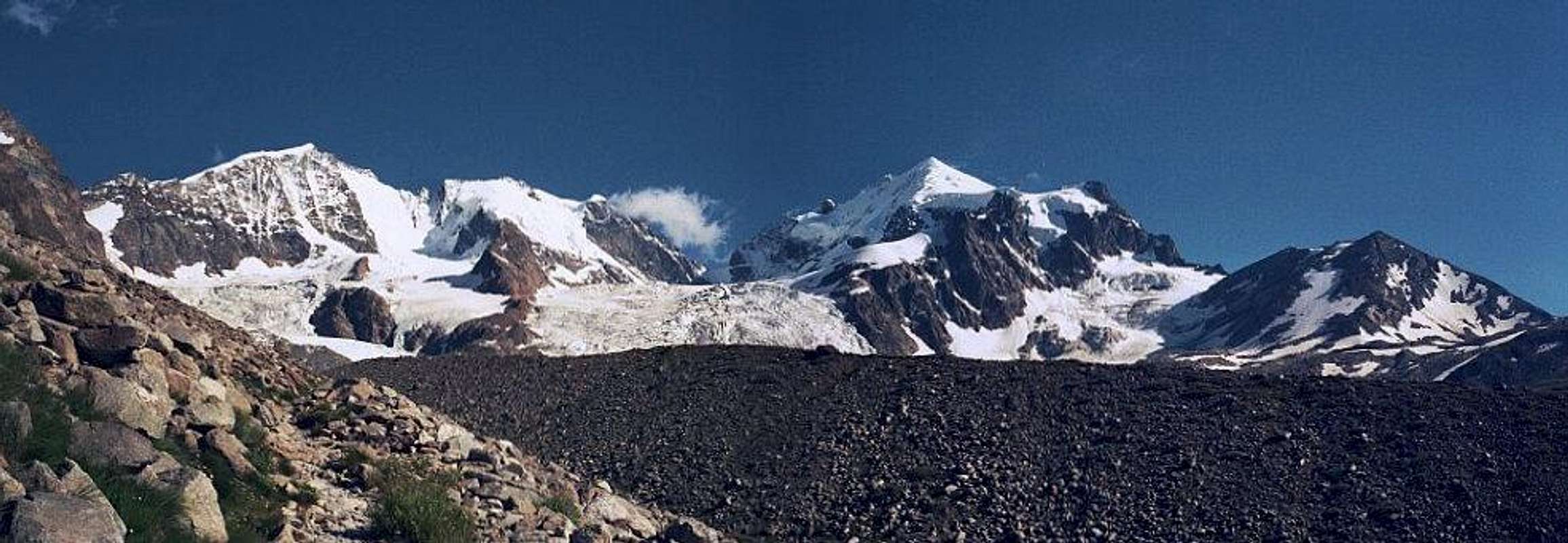
 Bernina on the right in the twilight - Photo by magico81

 Panoramic View of Piz Scerscen - Photo by Henk van den Akker