
-
 3324 Hits
-
 88.19% Score
-
 26 Votes
|
|
Mountain/Rock |
|---|---|
|
|
41.79048°N / 9.26477°E |
|
|
Corsica-Corse |
|
|
Trad Climbing, Sport Climbing |
|
|
Spring, Summer, Fall |
|
|
3579 ft / 1091 m |
|
|
Overview
Geographical classification: Corsica - Corse > Bavella Massif > Punta Paliri
Punta Paliri or Punta di l’Anima Dannata 1091 m
This charming peak is a perfect pyramidal tower rising isolated and well individualized in the Paliri Chain of the Bavella Massif, very close to the fine milieu of the little Refuge Paliri, a bucolic and charmed place, through which it passes the GR 20, the famous long trail crossing the Corsica island from North-West to South-East.
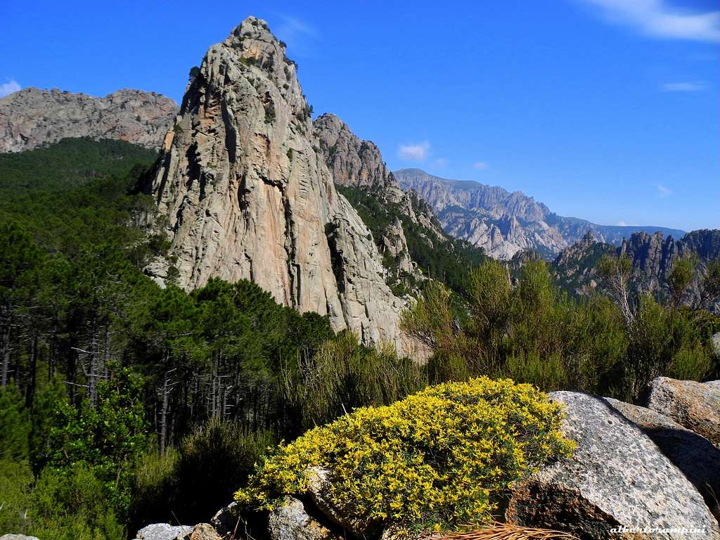
Named Punta Paliri by Fabrikant, one of the greatest expert about the Corsican mountain ranges, the tower is also called with the fanciful name of Punta di l’Anima Dannata, which means “damned soul peak” in Corsican dialect. This curious name is referred to an ancient legend telling about the ghost of a young woman wandering and crying on the summit. It shows three main faces right for climbing: the compact and sunny SE face, the W face with the Normal route and the shady North Face, cut by some ascending rocky ledges, on which are nowaday present seven climbing routes. On the sunny South-East - a 150 m. high face – in more recent years have been realized some short but excellent climbing routes on great granite.

|
|
Getting There
Access to Corsica
The magnificent island of Corsica-Corse, l'Ile de Beauté (the Island of Beauty) belonging to France but much closer to Italy, can be easily approached by plane (airports both in Bastia on the Eastern coast and Ajaccio on the Western coast) and by ferry-boat from Livorno and Savona italian ports. The most convenient destination in Corsica to visit the Bavella area, one of the wildest region of the island, is the airport of Bastia if you’re getting there by plane; the same Bastia port if you’re getting there by ferry-boat. The main entrance into Bavella Massif is Col de Bavella m. 1211
Road access to Col de Bavella
- From Bastia (Corsica Eastern coast) follow the road RN 198 to Solenzara; a few kilometers before getting to in Solenzara turn to left, taking the road D268 to Bavella Pass (km. 130 from Bastia).
- From Aiaccio (Corsica Western coast) follow the road RN 196 to Petreto, then the road N852 to Aullene, Quenza and Zonza (km. 90 from Aiaccio).

|

|
Walking approach to Refuge de Paliri m. 1055
From the Auberge – Gite d’Etape “du Col de Bavella”, situated 500 m. to Bavella Pass along the Solenzara (NE) side of the road D268, follow the forest road starting just behind the hut and joining the GR20 trail; the road descents to reach another forest road, crossing a stream. Follow it for a short distance (about 150 mt.), then turn to right following again the GR20. The trail rises across a “pino laricio” forest and reachs Finosa Pass mt. 1195; from here the trail goes down to the beautiful Paliri Hut m. 1055 (water, guarded in summer). 1,30 hours from the “Gite d’Etape”.
Nature and climate
Nature is wild and peculiar; in Corsica we can find more than the 5% of authoctonous kinds of flower and plants, in addition to authoctonous fauna. On the contrary, several kinds of animal current inside Mediterranean countries are away from Corsica, like squirrels and vipers.
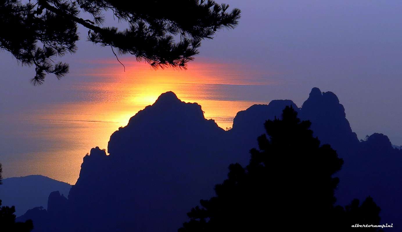
Dawn at Col de Bavella - Sun mirroring on the sea
Climate is the typical one of the mediterranean middle-mountain areas situated at these latitudes: often very hot in summer and with cold and snowy winters; Spring, early summer and early Fall are the better seasons to climb. Due to Bavella closeness to the sea, winds are often stronger how much they are at the same height in the Alps. Rainfall sometimes are important and dangerous when joined with strong winds. On the contrary, sometimes we can find some long periods of drought.
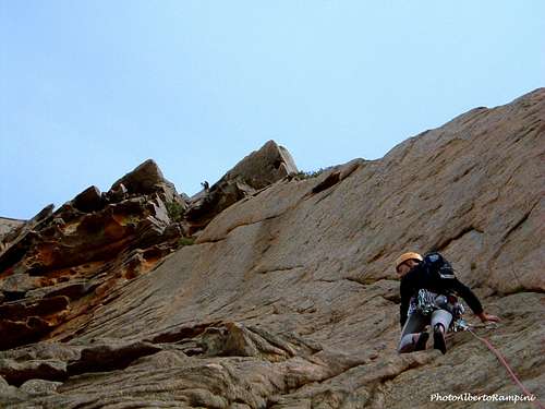
Punta Paliri - Route "La fille qui m'accompagne"
Punta Paliri - "La fille qui m'accompagne" - French scale
Difficulty: TD-, French 6a+ max, 5c obbl.
Length: 130 m
Exposure: SE First ascent: D. Allemand - S. Gadais april 2001
Starting point: Col de Bavella or Refuge Paliri
A brief but fun and nice route on excellent granite. The climb is worthwhile and the environment is superb. Equipped with bolts. Some litle and medium friends useful to integrate the last pitch.
Approach from Refuge Paliri - from the shelter follow the GR20 towards Conca. After about 15 minutes leave the main path and head to left, crossing the slopes (cairns) and joining the peak.

|

|
Route report
L1 - A fun pitch on excellent granite, 5c
L2 - A great sustained climb on a beautiful slab, 6a+
L3 - An incredible pitch climbing some red "tafoni", 5c
L4 - On easier ground reach a tree below a corner-crack. Climb it getting to the summit.
Descent: from the summit head to West to find the first anchor 20 meters below the summit. Abseiling on the West face (2 x 40 meters) reach the bottom of the wall
Other routes
South-East Face
- Vomara
- L'Omu di Mull
North Face
- Solo hélicoidal
West Face
- Normal Route
- Diedre W
- Arete W
Red Tape
Bavella Massif is a wonderful world, a well preserved environment, but delicate at the same time, situated inside the Parc Naturel Régional de Corse - Parcu di Corsica. Free camping and bivouac are not allowed and fires are strictly forbidden. Maximum care is required to keep for the future this extraordinary environment.

|

|

|
Where to stay

Near Punta Paliri it's situted the nice Refuge Paliri. Alternatively there are different opportunities of accomodation on Bavella Col and surroundings.
COL DE BAVELLA
-Auberge du Col de Bavella – Hotel and Gite d’Etape Auberge du Col de Bavella
-Les Aiguilles de Bavella – Gite d’Etape Gite d'Etape Les Aiguilles de Bavella
ZONZA
– Hotel L’Aiglon, Hotel de la Terrasse, Hotel Incudine - Residence Le Mouflon d'Or
- Municipal Camping of Zonza, Camping La Riviere (Road to Quenza), Camping Bavella Vista (Road to Quenza)

|

|
Two equipped campsites along the road D 268 between Solenzara and Bocca di Larone:
- Camping U Ponte Grossu
- Camping U Rosmarinu
When to climb
Best season to climb Punta Paliri goes from April to middle October.

Meteo
Guidebooks and maps
- Guidebooks
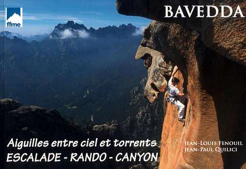
“Bavedda – Aiguilles entre ciel et torrents: Escalade, Rando, Canyon” by Jean Louis Fenouil and Jean Paul Quilici - FFME
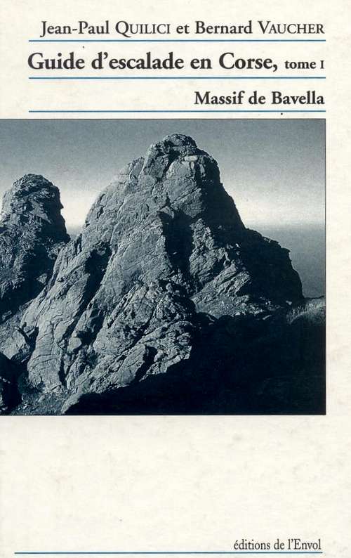
“Guide d’escalade en Corse” Vol. I Massif de Bavella by Jean Paul Quilici – Bernard Vaucher
Map IGN 4253 ET “Aiguilles de Bavella – Solenzara”
|
|

|