
-
 4126 Hits
-
 77.48% Score
-
 8 Votes
|
|
Mountain/Rock |
|---|---|
|
|
46.60071°N / 11.29280°E |
|
|
Download GPX » View Route on Map |
|
|
Hiking, Skiing |
|
|
Spring, Summer, Fall, Winter |
|
|
6604 ft / 2013 m |
|
|
Overview
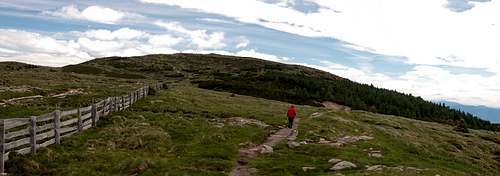 Stoanerne Mandln seen from the north-west Stoanerne Mandln seen from the north-west |
The largest but lowest of the subgroups of the Sarntal Alps / Monti Sarentini takes the whole western branch of the Sarntal horseshoe. Locally called Tschögglberg (or Tschöggelberg, Italian: Monzoccolo) it consists of a very broad ridge, which stretches from Bozen / Bolzano in the south to Kreuzjöchl above the ski runs of Meran / Merano in the north. The ridge gradually rises from little more than 1000m in the south to 2111m at its northernmost outpost, Karkofel / Monte delle Vacche. The whole ridge can be hiked in one day but at 18km length and more than a thousand metres of elevation gain the day will be a long one, especially if you have to return to base on foot.
Tschögglberg / Monzoccolo is an old cultural landscape. Four communities can be found near its top: Jenesien / San Genesio in the south, Vöran / Verano, Mölten / Meltin and Hafling /Avelengo in the east. A road crosses over the ridge but most of it is reserved for local inhabitants as well as the Tschögglbus bus line. There are numerous inns, especially in the southern part, which together with easy access from the two big cities makes the area very popular for hikers. The European long distance trekking trail E5, which crosses the Alps from Oberstdorf to Verona traverses the whole Tschögglberg / Monzoccolo ridge in its central part.
 |  |  |
Geologically, Tschögglberg / Monzoccolo mainly consists of Rhyolite, the so called Bozener Quartzporphyr. Created in the Perm era about 275 - 285 million years ago the Rhyolite forms a giant slab of up to 2000m thicknes and covering 4000 square kilometres of area. The slab ends north of the Tschögglberg / Monzoccolo area as well as the Ritten /Renon Group on the opposite side of the Sarntal Alps horseshoe. There it culminates in mighty Villandererberg / Monte Villandro, itself an impressive proof of the thickness of the slab.
 |  |  |
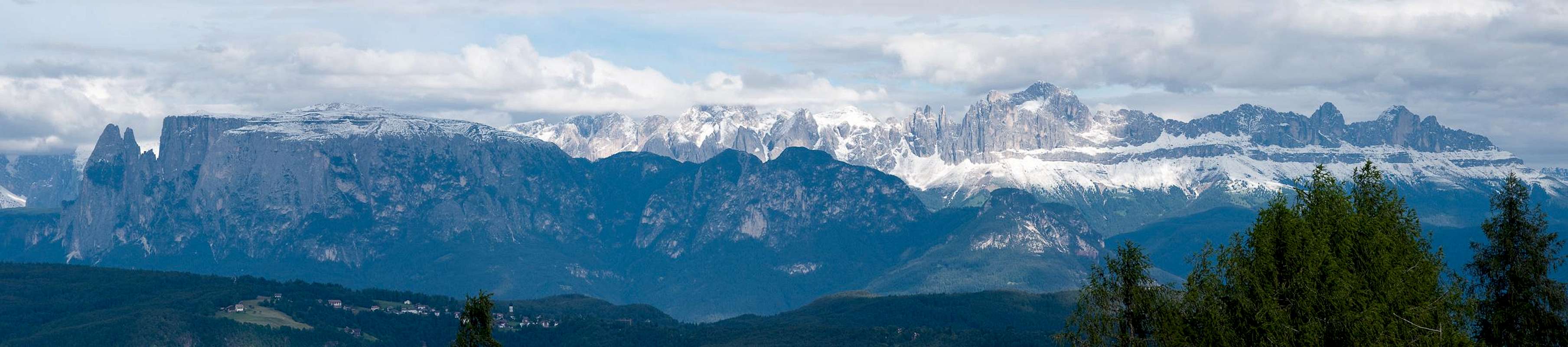
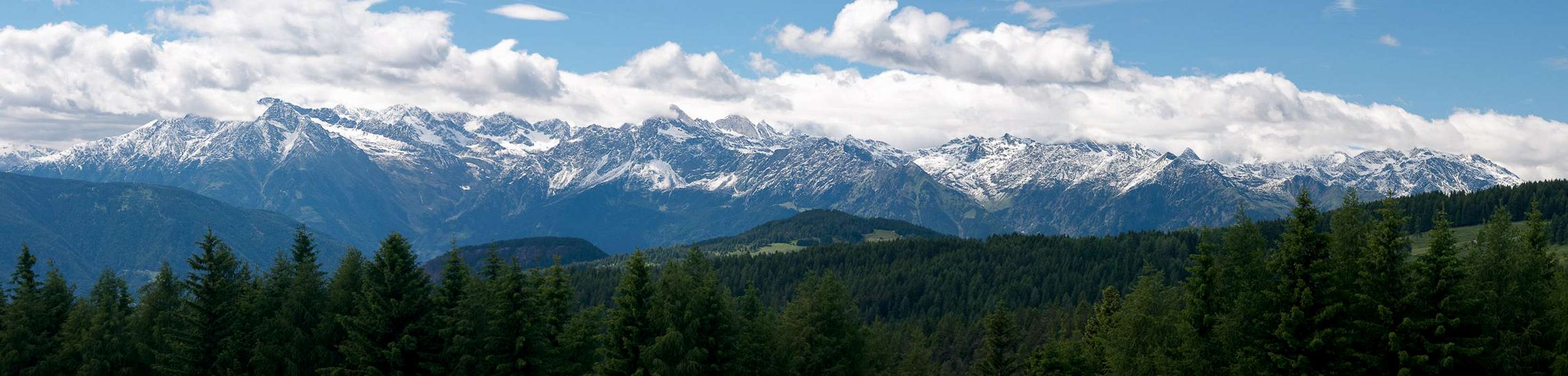
The southern part of Tschögglberg / Monzoccolo, south of Langfenn / Lafenna is the famous meadow and pasture area of Salten / Salto. Often surrounded by larch trees, the meadows offer wonderful and scenic views of the mountains around. The northern summits reach close to or more than 2000m and are the only places well above the timber line, where you have excellent views towards the northern Sarntal Alps / Monti Sarentini, the Ortler / Ortles Group as well as the Ötztal Alps.
Finally a list of summits of Tschögglberg / Monzoccolo, listed south to north:
- Schwarzeck / Dosso Nero (1525m)
- Dorfer Nock / Dosso (1840m)
- Möltner Joch / Malga di Meltina (1734m)
- Salbenberg / Monte Salve (1498m)
- Stoarnerne Mandln (Schöneck) (2003m)
- Vöraner Joch / Monte di Verano (1932m)
- Kreuzjoch / Giogo della Croce (2086m)
- Karkofel / Monte delle Vacche (2113m)
- Maiser Rast / Riposo di Maia (2026m)
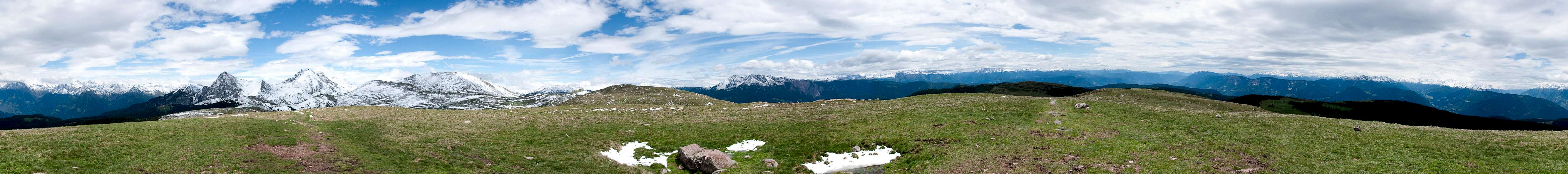
Summit Panorama Kreuzjoch
  |
Getting There
 |
The nearest international airports are Innsbruck in Austria and Verona in Italy. The following itineraries are given from these starting points. Luckily from both airports the route finding is quite easy
- From Innsbruck
- Simply take the Brenner Motorway A13(Austria) / A22 (Italy) south to Bozen / Bolzano in the south of Tschögglberg.
- For the eastern part take SS508 into Sarntal / Val Sarentino.
- For the western part take SS38, direction Meran / Merano.
- For a hike across the whole of Tschögglberg take the road to Jenesien / San Genesio
- From Verona
- Take Motorway A22 (Brenner Motorway) northward until you reach Bozen / Bolzano.
- Take SS505 or SS38 for the eastern or western parts of Tschögglberg, respectively.
Red Tape
 Haflinger horses, a breed raised on Tschögglberg
There is no red tape to speak of. The area, especially the lower regions in the south and inside Sarntal Valley are used for extensive cattle grazing. Moreover many of the pastures are privately owned. While the regular hiking trails through private land can be used freely (you are actually encouraged to do so) be sure not to stray too far from them. Apart from this the usual rules apply - leave plants and animals, take your refuse, keep dogs on leash, close gates etc.
Accommodation
 The hamlet Langfenn in the centre of Tschögglberg
Weather Conditions
 |
Maps & Books
Maps
- Digital Maps
- Regular Maps
- Sarntal/Val Sarentino
Kompass Map WK 056
1:35.000
ISBN: 3-85491-340-0
- Bozen / Bolzano
Kompass Map WK 54
1:50.000
ISBN: 3-85491-061-4
- BOLZANO-RENON / BOZEN-RITTEN-TSCHÖGGLBERG
Tabacco Map 034
1:25.000
- MONTI SARENTINI / SARNTALER ALPEN
Tabacco Map 040
1:25.000
- Sarntal/Val Sarentino
Books
- Bozen-Salten-Schlern
Kompass Guidebook WF953
Kompass Verlag
ISBN: 3-85491-406-7
- Rund um Bozen
Helmut Dumler
Rother Verlag
ISBN: 3-7633-4267-2