Overview
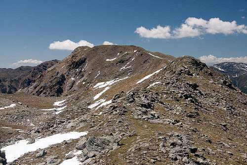
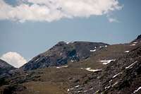
![Hurlerspitze / Monte Corlo]() Hurlerspitze on the traverse from Gentersbergspitze Hurlerspitze on the traverse from Gentersbergspitze |
is a mountain close to the centre of the panoramic
Gentersbergkamm / Cresta Ganda, a ridge, which stands in the middle of the horseshoe shaped
Sarntal Alps / Monti Sarentini. Like its neighours,
Hurlerspitze / Monte Corlo is not exactly among the highest mountains around but thanks to the location, it is an excellent lookout peak, a story the pictures on this page will confirm. In fact, everywhere on the Gentersbergkamm crest you have two view ranges: in the middle distance the mountains of the Sarntal Alps horseshoe form a circle around you while farther off the glaciated Stubai and Zillertal Alps are the second line of sight.
However, access is long. All trailheads are separated from the summits on the ridge by more than 1000m of elevation difference. Thus only few hikers attempt the traverse. Most either turn around at Durnholzer Jöchl or after reaching one of the endpoints of the ridge Karnspitz / Cima di Quaire in the north-east or Radelspitze / Cima Rodella in the south-west. The remainder (and main part) of the ridge remains solitary. Thus,
Hurlerspitze / Monte Corlo is never climbed alone but rather as part of the Gentersbergkamm-Traverse. The traverse, on the other hand,, takes a long day to complete and you will have to be on time for the bus which only at few times per day serves the section between Astfeld / Campolasta and Durnholz / Valdurna.
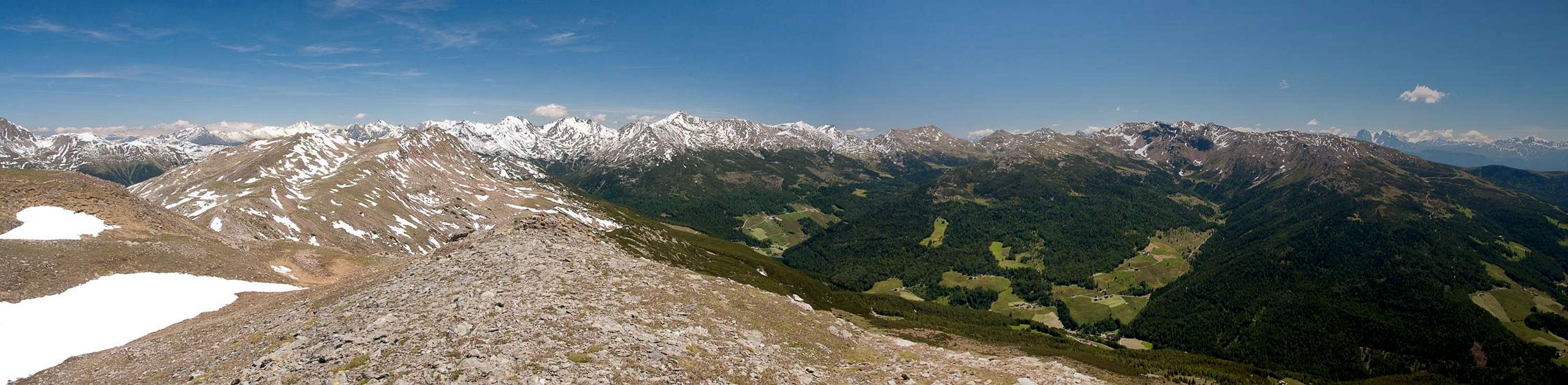
![Stubai Alps Main Ridge]() Stubai Alps Main Ridge Stubai Alps Main Ridge |
![Wilde Kreuzspitze]() Wilde Kreuzspitze Wilde Kreuzspitze | ![Hochfirst]() Hochfirst Hochfirst | ![Hochferner, Hochfeiler and Hoher Weißzint]() Hochferner, Hochfeiler, Weißzint Hochferner, Hochfeiler, Weißzint |
![Gschnitzer Tribulaun]() Pflerscher Tribulaun Pflerscher Tribulaun | ![Olperer]() Olperer Olperer | ![Unterberg and Hochwart]() Unterberg, Hochwart Unterberg, Hochwart |
has a broad back which connects it to the remainder of the Gentersbergkamm Ridge. While on the north-western side a harmless slope goes down to
Penser Tal / Val di Penes, on the south-eastern side a drop of 200m leads to a balcony, from which a similar slope goes down into Durnholzer Tal / Valdurna. Its connection to the north-eastern neighbour
Gentersbergspitze / Monte dei Masi is a broad ridge, while to the south-east a big profound saddle separates it from
Kollmannspitze / Monte Colma. From this saddle there are escape routes from the ridge into the valleys below though they are never used but in times of emergency. The reason is the dense vegetaion of dwarf pines, which covers the balcony underneath the summit, which is rather tough to bushwhack through.
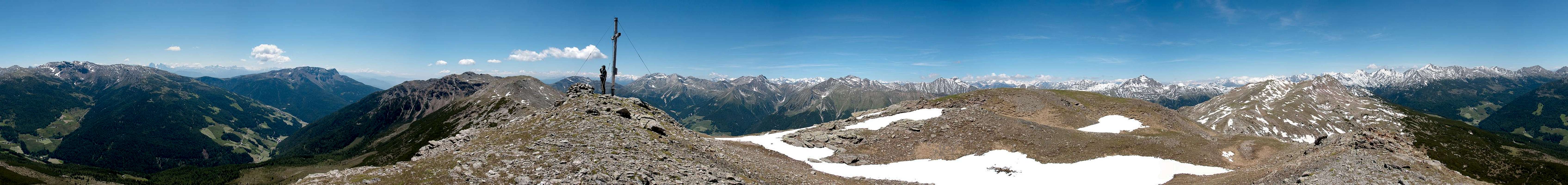
360° Summit Panorama
360° summit panorama from Hurlerspitze / Monte Corlo |
Getting There
There are two reasonable trailheads for
Hurlerspitze / Monte Corlo, one at
Durnholz / Valdurna one in
Pens / Penes, both in
Sarntal / Val Sarentino
- Durnholz / Valdurna trailhead
- Take Brenner Motorway A22 to Bozen / Bolzano
- Drive through the city, following signs to Sarntal / Val Sarentino on SS508
- At Astfeld / Campolasta turn off onto SP137, direction Durnholz / Valdurna. You have to park outside the village and will be charged a fee of 3€.
- For Pens / Penes stay on SS508 until you reach the village. You can also reach the village from Sterzing / Vipiteno across Penser Joch / Passo di Penes (also SS508).
Red Tape
Sarntal Alps in front of Zillertal Alps |
There is no red tape in this area. Except for a few sheep and goats the area is not used for farming. In
Durnholz / Valdurna you will have to pay a fee of 3€ for parking.
Accommodation
Klausen / Chiusa
Bozen / Bolzano
Weather Conditions
Maps & Books
Maps
- Digital Maps
- Regular Maps
- Sarntal/Val Sarentino
Kompass Map WK 056
1:35.000
ISBN: 3-85491-340-0
- Brixen / Bressanone
Kompass Map WK 56
1:50.000
ISBN: 3-85491-063-0
- Bozen / Bolzano
Kompass Map WK 54
1:50.000
ISBN: 3-85491-061-4
- BOLZANO-RENON / BOZEN-RITTEN-TSCHÖGGLBERG
Tabacco Map 034
1:25.000
- MONTE SARENTINI / SARNTALER ALPEN
Tabacco Map 040
1:25.000
Books
- Bozen-Salten-Schlern
Kompass Guidebook WF953
Kompass Verlag
ISBN: 3-85491-406-7
- Rund um Bozen
Helmut Dumler
Rother Verlag
ISBN: 3-7633-4267-2

 3917 Hits
 82.48% Score
 15 Votes
 Hurlerspitze on the traverse from Gentersbergspitze
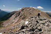

 Stubai Alps Main Ridge
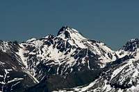 Wilde Kreuzspitze
 Hochfirst
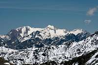 Hochferner, Hochfeiler, Weißzint
 Pflerscher Tribulaun
 Olperer
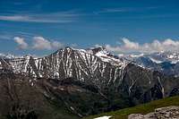 Unterberg, Hochwart