
|
|
Mountain/Rock |
|---|---|
|
|
39.55790°N / 106.1961°W |
|
|
12522 ft / 3817 m |
|
|
Overview
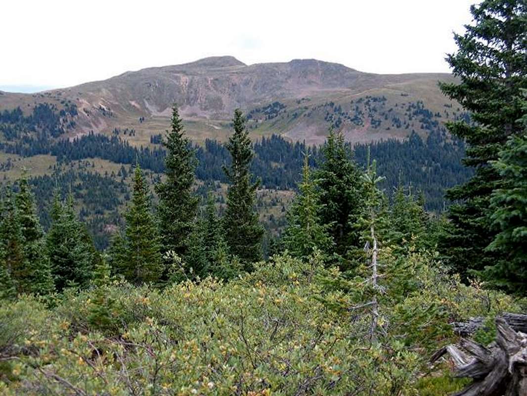
(left) Uneva and (right) Point 12380 ft
Uneva Peak rises above the 10666 ft Vail Pass on Interstate Highway 70 west of the city of Denver. From Vail Pass, a 12380 ft point to the south of the summit of Uneva appears as the highest point and can be easily mistaken for the summit of Uneva.
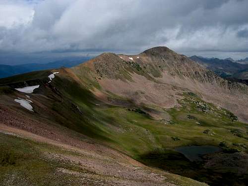
Uneva, along with two other 12ers to the south of it: Point 12363 ft and the 12242 ft Sneva Peak, form the southern tip of the Gore Mountain Range. Unlike the rugged peaks that form much of the Gore Range, Uneva and its neighbors are gently sloped and are easily accessed. The only steep slopes on Uneva will be found to the east of it dropping down into a high valley that is bound by Uneva and the two mentioned 12ers. This valley can be reached via long hikes from Officers Gulch or North Ten Mile Creek Trail on I-70 near the town of Frisco. The easiest and most direct route to the summit of Uneva, however, starts at Vail Pass.
The trail from the Vail Pass will take you through a Pine forest to the remains of an old logging road near Corral Creek where a beautiful meadow along with old tree stumps point to logging activity in the past. Above the tree-line, the road/trail ends in an alpine bowl at the base of Point 12380 ft. This bowl is covered with a dense growth of grasses and flowers. Above the bowl you will find your own way to the top of Point 12380 ft and then the summit of Uneva. Please be ware that this route will involve trampling the tundra. In late summer, you might be able to follow the dry stream-beds but this will probably not be possible earlier in the season. If you are aware of more “mountain friendly” routes, please let me know.
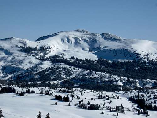
From the summit of Uneva Peak you will have great views of many of the nearby mountains including those of the Gore, Ten Mile, Sawatch, Front and other ranges. Vail Pass can not be seen from the official summit but it comes into view a very short distance below the summit. Parts of Dillon Reservoir as well as I-70 as it descends west of The Eisenhower Tunnel will be in good view. The summit register indicates that this mountain is sometimes climbed as frequently as a few times a week. In winter, the mentioned trail/road below Uneva will serve as a good place for cross country skiing. Except for loud trucks and motorcycles, the noise of the highway will be barely audible on the summit.
 |
 |
 |
 |
 |
Getting There
From downtown Denver, drive roughly 80 miles west on I-70 to Exit 190 at Vail Pass. This exit leads only to a rest area, a dirt road known as “Shrine Pass Road” and a very short spur road to the Black Lakes. Hiker’s parking is well-signed and is separate from the rest area.
 |
 |
 |
 |
 |
Red Tape
This area falls in the Eagles Nest Wilderness. No permits or fees are required for day hikes.
 |
 |
 |
 |
 |
When To Climb
Easiest in summer. Cross country skiing possible in winter.
 Uneva Peak
Camping
Camping/Lodging available in nearby communities.
 Uneva Peak
Mountain Conditions
Click for forecast for the Gore Range.
Vail Pass Cam.