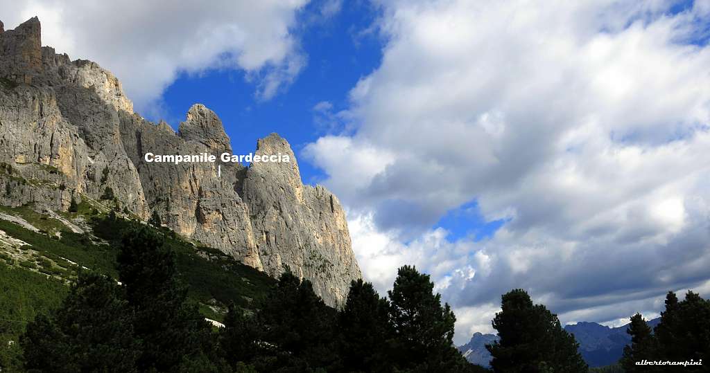
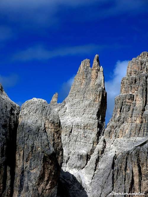
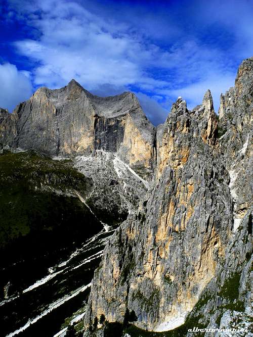
Campanile Gardeccia is a fine tower belonging to the Catinaccio Group, subgroup Dirupi di Larsecand overlooking from the North the wide basin of Gardeccia. It’s the last peak situated on the ridge, facing South-West, running down from Pala di Mezdì and separating the spire called Guglia del Rifugio (on the left) from the deep gully of Pala di Mezdì (on the right). Campanile Gardeccia counts some interesting climbing routes; amongst these routes, one of the most fine and frequently climbed is the route Hendrina, running on the South face of the tower.
Campanile Gardeccia and Dirupi di Larsec
Getting There
The starting point to approach the peak is Pera di Fassa, located in the homonymous Val di Fassa.
Road access to Pera di Fassa - from Trento follow the Brennero Motorway towards North, exit Egna-Ora and take the road S51 towards Fassa Valley, getting to Cavalese, Predazzo, Moena and Pera di Fassa (48 km. from Egna-Ora).
- from Bolzano follow the Brennero Motorway towards North, exit Prato all’Isarco and take the road to Carezza Lake, Passo Costalunga, Fassa Valley.
Campanile Gardeccia
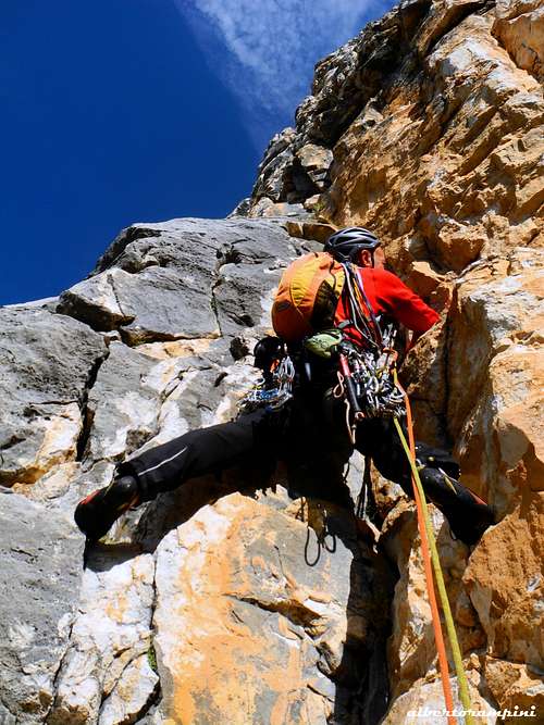
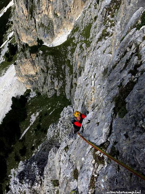
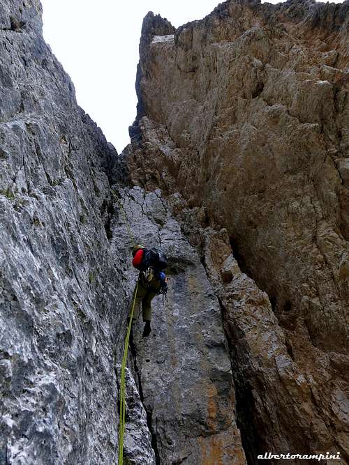
Pinnacle along the route Hendrina
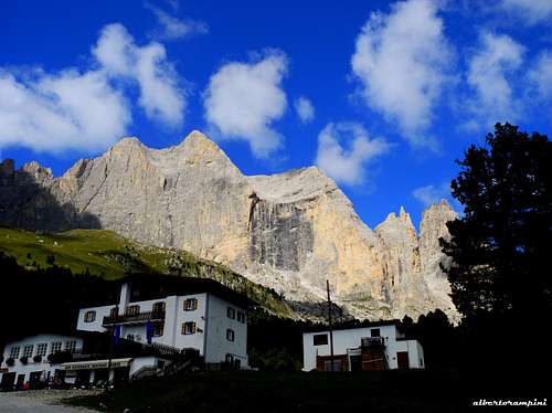
Approach to Gardeccia
The road from Pera di Fassa to Gardeccia is open to private vehicles as far as the little hamlet of Soial. A minibus service is available from the chair-lift station in Pera di Fassa; frequent departures both from Pera and Gardeccia. Otherwise the chair-lift in Pera di Fassa will lead you to the Ciampedie upper station. From here 40 minutes by walk to reach Gardeccia basin.
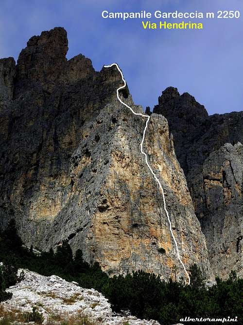
Hendrina route report
Campanile Gardeccia South Wall – Via Hendrina report (UIAA scale)
Summit altitude: m 2310 Difficulty: Alpine D+, UIAA max V+ Route length: 250 m Exposure: South First ascent: Gino Battisti, Dante Colli 1980 Starting point: Gardeccia m. 1950
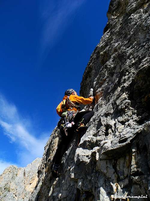
A classic exposed climb on good rock with a few fine pitches
Hendrina unmistakable starting corner
A grey wall on Hendrina
Via Hedrina topo
Walking approach
- From Gardeccia m. 1950 take the Larsec path towards Passo delle Scalette, reaching after few minutes the bottom of a debris. Near a dwarf pine leave the main path and rise along the steep slopes heading to the well visible tower. A less steep approach is the following: cross the little bridge before Rifugio Gardeccia, follow for about 50 meters the dirty road to Vajolet Hut, then leave it, cross the stream to the right and take the path “Bepo de Medìl”. Follow this trail as far as a scree on the left. Don’t cross the scree but leave the main trail, heading to the right and rising a grassy slope (cairns) getting the base of Pala di Mezdì. Skirt the bottom of the wall to the right (East) following some cairns, reaching the starting point of the route, located on the highest point of the scree below an open corner.
Punta Emma and Vajolet Towers
Airy climb on route Hendrina
View over the stunning Pala di Socorda
Route report
L1 – Climb an open dihedral, where it closes head to left with a hard move - difficult to understand - and continue to climb up another dihedral on the left, getting to the belay. V and V+, 28 m.
L2– Up again the fine dihedral V, 45 m.
L3 – Another pitch up the dihedral IV, 30 m.
L4 – Slanting left , then directly and finally heading right to reach a good belay on a shoulder (cairn). IV, 40 m.
L5 – Slanting left reach a little ridge. II, 15 m.
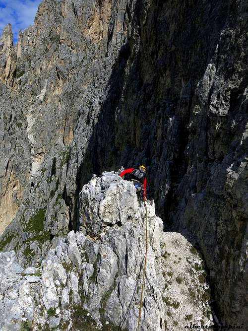
Small pinnacle on route Hendrina
Summit view
Rapping down Campanile Gardeccia
L6 – Climb the ridge, aggirare some spires on the right and belay near a rocky saddle at the bottom of the upper vertical wall III, 35 m.
L7 – Follow a fine grey corner and belay under a huge yellow roof. IV+, 30 m.
L8 – With exposed climb slanting right skirt the roof, at the end climb directly a vertical edge with good holds, then more easily reach the summit.
Descent: follow easily the summit crest for about 40 meters, downclimb for a few meters to the left (To Gardeccia side), reach a small saddle and descend to the opposite side. Near a huge boulder appearing like a bridge between two pinnacles there is the first abseil anchor. 3 abseils lead inside a scree gully. Follow it reaching the base of the wall and skirt it to the left rocks, getting to the starting point of the climb.
Other routes
Other interesting routes - UIAA scale
South wall
- Via delle Pignatte D, mainly UIAA IV, max UIAA V-, 130 m. - Don Tita Soraruf 1940
SW wall
- Via Luisa D+, mainly UIAA IV+, max UIAA V, 170 m. - G. Battisti and E. Lampugnani 19-8-1980 - Via Prima Luna TD-, UIAA IV, V, V+, 200 m. - Antonio Bernard, Alessandro Gogna, Ivan Fuligni 19-8-2005 - L’ultimo sole (SW wall and SW ridge) TD-, UIAA IV, V, V+, VI- (a short move)- Alberto Rampini, Stefano Righetti 25-9-1983
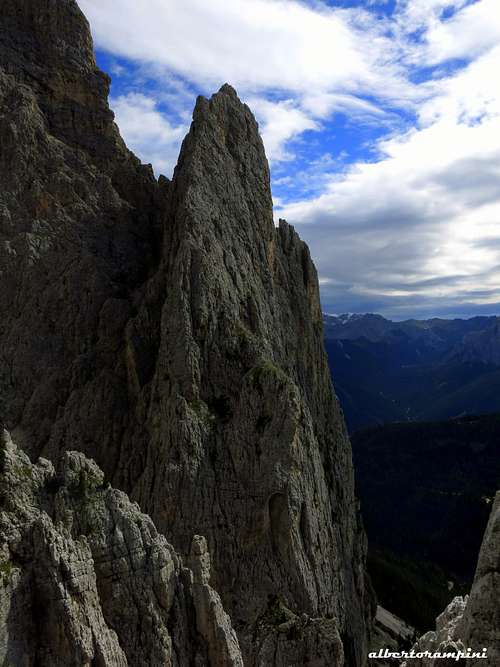
Wild world of Dirupi di Larsec from Campanile Gardeccia
Catinaccio and Vajolet from the summit
Natural parks
Campanile Gardeccia is located inside the Natural Park Sciliar-Catinaccio and Latemar. This area, shared between the provinces of Bolzano and Trento, is one of the nine mountain systems of the Dolomites acknowledged as UNESCO World Heritage Site. More info about Dolomiti Unesco World Heritage can be found here:
The area is one of the most important systems worldwide for the study of the stratigraphy of the Triassic, in reason of the plenty of fossils on Alpe di Siusi, the relationship between carbonate and volcanic sediments, and the fact that the outcrops are easily accessible. Catinaccio, with the stunning Vajolet Towers, forms a series of peaks and sharp needles showing the movement of an island which sank into the sea 240 million years ago.
Red Tape
No particular restrictions in climbing and hiking. The road starting from Pera di Fassa to Gardeccia is open to the private cars as far as the small hamlet of Soial. Private cars beyond Soial are not allowed.
Parents refers to a larger category under which an object falls. For example, theAconcagua mountain page has the 'Aconcagua Group' and the 'Seven Summits' asparents and is a parent itself to many routes, photos, and Trip Reports.


 5824 Hits
 85.87% Score
 21 Votes