-
 14056 Hits
-
 86.37% Score
-
 22 Votes
|
|
Mountain/Rock |
|---|---|
|
|
46.19897°N / 114.24156°W |
|
|
Ravalli |
|
|
Hiking, Scrambling |
|
|
Spring, Summer, Fall |
|
|
5921 ft / 1805 m |
|
|
Overview
Route type – HikeElevation – 5,921'Class level – Class 1Length of time required to complete route – less than half a dayGoat Mountain is a squat, often-overlooked, mountain which lies between Ward Mountain (to the south) and Downing Mountain (to the north). Appearing insignificant to most, its diminutive size may be the reason so few bother making the climb to the top. There is one man, however, who claims this mountain as his own, Mario Locatelli.
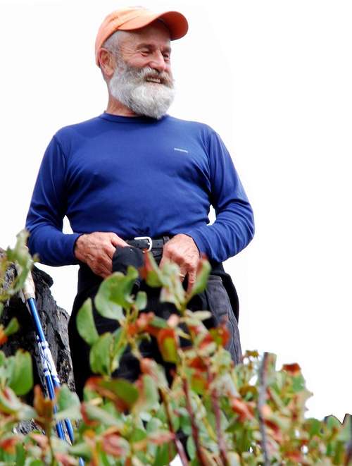
Referred to as "the mountain goat" by those in the know, Mario is a mountaineer of legend in the Bitterroot Valley. During the 35+ years he has lived in the valley, Mario claims to have hiked every drainage in the Bitterroots and hiked/climbed every ridgeline between Lolo and Nez Perce Passes, from the Bitterroot Valley to the Idaho border and beyond. Standing about 5' 4", at first glance, most don't consider Mario to be capable of accomplishing such feats. But a few minutes conversation and a closer look at his ropey muscles, will convince you this rock-hard 74 year old has done what he claims, and more.
For years, Mario has used Goat Mountain to keep fit. He told me that when he was "young" (early 60s) he timed his climbs from the trailhead to a specific Ponderosa Pine tree (which he proudly pointed out) just short of the eastern-most highpoint (and the end of the maintained trail).
"I'd start my stopwatch, then run as fast as I could up the trail. When I reached this tree, I slapped the trunk with my left hand before stopping the watch. My fastest time was about 29 minutes. I must of been about 63 then. ‘Course I can't do that now days. Too old, I guess," Mario said.
Back in "those days" Mario used to hike however far he needed to gain at least 1,500' of elevation in a day. He did that 5 or 6 days a week. Now, according to him, he's "slowing down" and only manages such a regimen 3 or 4 days a week.
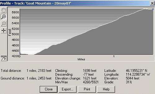
The hike he's used more than any over the years is up Goat Mountain. Though a short distance, 1.4 miles, it gains 1,698'. That's a good test for anyone, especially if you try to cover it in 29 minutes. (After the first couple of thousand times, Mario said he lost count.)
Over the years, Goat Mountain and its steep trail have gained in popularity. It's likely that hundreds have now hiked up "Mario's Trail" a time or two, though none so quickly or as often as "The Mountain Goat."
Getting There
From the stop light at Hwy 93 and Golf Course Road on the south side of Hamilton, MT, drive south on Hwy 93 about 3.5 miles. Turn right (west) onto Roaring Lion Road (531). The pavement ends about 1.9 miles after leaving Hwy 93. Continue to the intersection with FR 1134 in another .6 miles (2.5 miles from the highway).
Veer right (north) and drive less than a quarter of a mile to the parking area and stock unloading ramp. There is parking for 6-8 vehicles. There are no restroom facilities.
Area Restrictions (Red tape)
The routes up Goat Mountain and along Sawtooth Creek pass over or along private property. Be sure to respect the property owners' posted warnings and requests.
Camping
The first several miles of the east-west ridge of Goat Mountain is Forest Service land but not official Wilderness. The appropriate rules apply. So far I haven't seen any places I would “want to” camp along the ridgeline, though there are places one could camp if pressed.
The Route
The route to the first and eastern-most highpoint on Goat Mountain is very straightforward. The trail begins at the stock unloading ramp and proceeds due east. After dropping a few feet to a bridge which crosses Roaring Lion Creek, the trail splits. The right fork is the Sawtooth Creek Trail, the left, the Goat Mountain Trail.
The Goat Mountain trail begins gaining elevation, immediately and quickly. Though the trail is not marked with blazes, unless there is snow cover, the route is clearly discernable and not easily missed.
As you near the yet-unseen highpoint which is hidden by plant growth, the elevation gain per amount of distance covered declines substantially. At that point you have only a few hundred yards to go before reaching the highpoint, a big pile of broken granite blocks.
The Goat Mountain Ridgeline
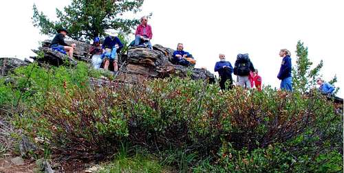
The east-west ridgeline of Goat Mountain is between eight and nine miles long. The highest point (8,505') on the ridge is near the western end.
One of the ways to reach it is by hiking/climbing along the ridgeline continuing past the above-described route. Be advised, that the route is very rocky, broken, and difficult, with plenty of Class 3 and 4 climbing. There are some sections which some consider to be quite exposed and Class 5. According to Mario, it's doable (he did it when he was "younger") but not the easiest way to reach the highpoint of the ridgeline.
When to go
This route is usable any time of the year, though snow and ice will make travel more difficult.
Essential gear
This is not an especially long route, but there is plenty of steep terrain, on rock and under forest cover. It also includes some side-hill hiking. All these are hard on the feet and ankles. Good sturdy footwear is a must; otherwise standard hiking gear is all that's required.
Carry plenty of liquid. After leaving the trailhead there is no water along the trail.
This route can be used at any time of the year. Current weather conditions will dictate the gear you need.
Route Statistics
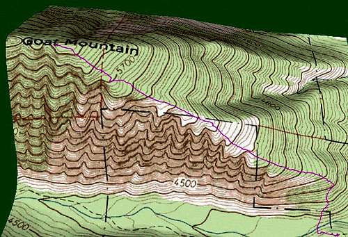
Gain – 1,698'
Distance – 1.4 miles (one way)
