-
 29922 Hits
-
 85.75% Score
-
 21 Votes
|
|
Mountain/Rock |
|---|---|
|
|
46.00175°N / 114.34285°W |
|
|
Ravalli |
|
|
Hiking, Mountaineering, Scrambling, Skiing |
|
|
Spring, Summer, Fall, Winter |
|
|
9624 ft / 2933 m |
|
|
Overview
Latitude & Longitude – 46.00175 N / 114.34285 W
Elevation – 9,624’
Route Type – Scramble
Class Level – Class 3, 4
Length of Time Required to Complete Route
- One or more days
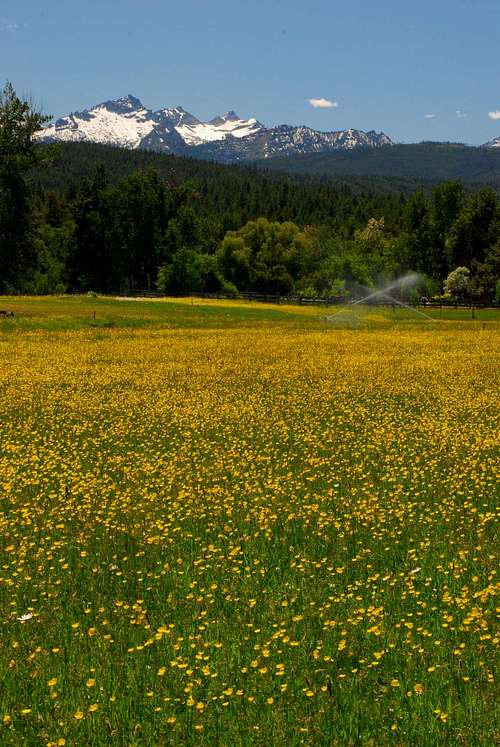
The Como Peaks are a group of three highpoints situated above and to the south of Little Rock Creek Lake. They are referred to by the locals as The Three Sisters. The west peak is the highest at 9,624', the middle peak 9,530', and the east peak the shortest at 9,485'. Although these three very recognizable peaks can be seen from many points throughout the Bitterroot Valley, few have made the effort to climb them. These summits are a long way from any trailhead and there are no established ascent trails.
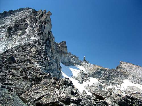
Even during the hottest of summers, the Como Peaks cirque is likely to retain snow fields well into August. There is small a rock glacier high in the north-facing cirque, just below the west peak. Several small streams flow from high in the cirque even when all snow appears to have melted away. They provide a welcome source of water to climbers.
Lake Como
A sign near the Lake Como Dam reads:"Como Dam was build in 1909 by a local development company. The dam raised the level of natural Lake Como, named (by Father Ravalli) for the Italian lake located in the Alps. Construction crews used explosives to clear the land, steam shovels, horses, and steam engines to move the earth to place the embankment. Today, these building techniques and remnants of the construction camp, quarry, and railroad bed, remind us of the rich history of the Bitterroot Valley."
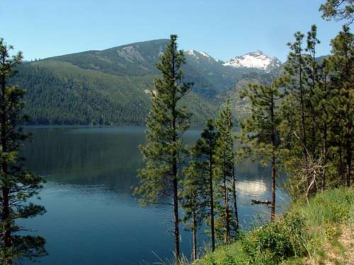
"In June 1992, Lake Como was drained under emergency conditions when Como Dam was determined to be in danger of failure. The dam had been monitored since 1984, when the Bureau of Reclamation and the Bitterroot Irrigation District identified seepage problems, possibly initiated by the 1983 Mount Borah earthquake. The contracting, design, and construction phases were done at a feverish pace to repair the embankment in time for the 1993 spring runoff. Before the spillway modifications were initiated in 1994, non-Federal funding was secured to raise the height of the Como Dam and increase storage in Lake Como. Safety modifications were funded with federal tax money, 15 percent of which will be repaid by the irrigators. The State of Montana funded construction of the enlargement from fishing license fees and Federal Sport Fishery Restoration Funds. Vital support and funding design work were provided through local community efforts."
"In 1994, Como Dam was raised just over 3 feet to store an additional 3,000 acre-feet of water. This water will improve river conditions for fish in the dry summer months. The five groups mentioned above and the Bitterroot Valley community pooled their efforts to increase storage of this precious resource."
"Lake Como stores water for many uses. Irrigated land grows a variety of important crops including wheat, grains, corn, potatoes, alfalfa, and pasture for livestock. Lake Como has long been a favorite spot for outdoor recreation. Fish and wildlife benefit form the availability of water during the dry season."
Getting There
On US Highway 93 go about 12 miles south of Hamilton and turn right (west) onto Lake Como Road. Follow the road to a junction and turn left (south) toward the boat loading area just past the dammed end of Lake Como.
When the road turns to gravel, you should see a sign for FR 550 and the Little Rock Creek Trailhead. Follow FR 550 for approximately 3.5 miles (south and west) and a second road junction.
Take the slightly rough, single-lane road straight ahead (west, don't turn south) and follow it the short distance to the marked trailhead just before a sometimes-locked Forest Service gate.
There are parking spots for several vehicles but no restroom facilities.
Red Tape
There are no user fees for this area. The usual regulations for use of the National Forest and Wilderness areas apply.
Camping
As you near the Little Rock Creek Lake, there are several possible camp sites along the trail. Near the dam end of the lake even more camp sites are available. It should be noted that Little Rock Creek Lake gets plenty of visits by adventuresome souls during the summer months, especially on weekends. So, if you want a quiet place to camp, either visit during the week or camp away from the immediate area of the lake.
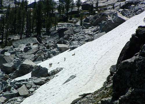
If your expedition will be several days long, and you're planning multi summit attempts, you might want to consider camping high in the Como Cirque. Water is available even during the hottest summers. The area is inhabited by Whitebark Pine, Larch, Mountain Heather, Marmots, and a few Mountain Goats. Plus the views are terrific. One word of warning; it's a long difficult trip from the trailhead to the upper portion of the cirque, so expect to take most of a day to reach it if you're carrying much gear.
Routes
See Middle-West Como Peaks Saddle for a detailed description.

