
-
 27020 Hits
-
 80.49% Score
-
 12 Votes
|
|
Mountain/Rock |
|---|---|
|
|
45.94123°N / 114.30986°W |
|
|
Ravalli |
|
|
Hiking, Mountaineering, Ice Climbing, Skiing |
|
|
Spring, Summer, Fall, Winter |
|
|
9586 ft / 2922 m |
|
|
Overview
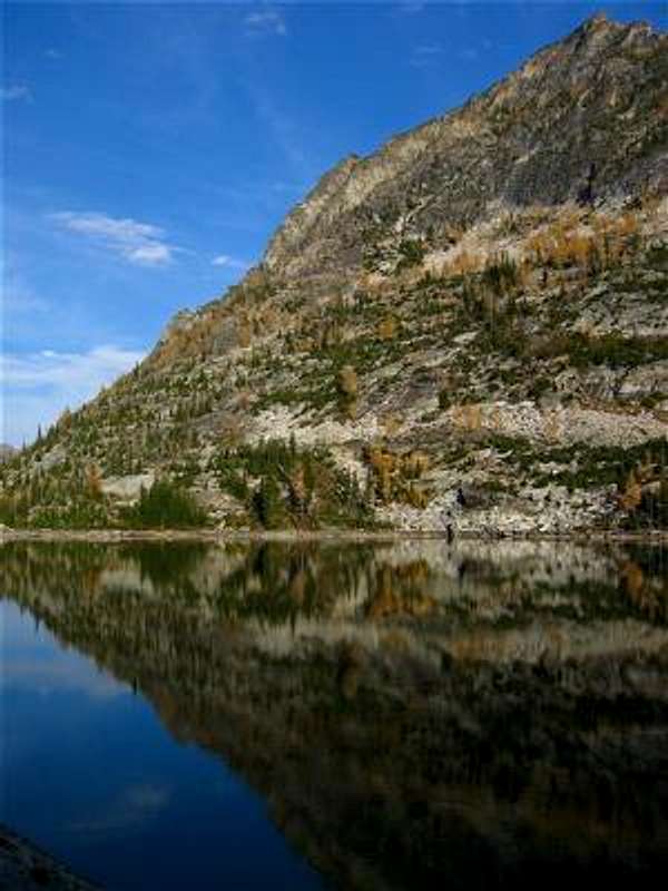
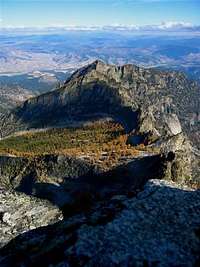
Sugarloaf and Tamarack Lake
Sugarloaf is a silent giant, looming over the southern Bitterroots in the Selway-Bitterroot Wilderness, seldom seeing visitors despite being visible from nearby Highway 93. (From the Trapper Peak information sign south of Darby, the peak is the pyramid visible on the right skyline.)
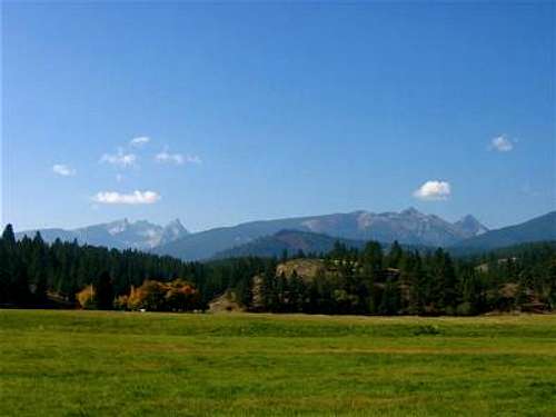
Sugarloaf from Hwy93
This mountain is lonely for good reason - the base of the mountain is over five miles from the nearest trailhead in the Selway-Bitterroot Wilderness and there aren't any "good" ways to get on top. The result is a peak well worth the effort as well as providing most probable solitude even on weekend ascents.
Sugarloaf is probably most often viewed from the summit of Trapper Peak to the south, as none of the other close by peaks have trails to the top and often have rugged approaches.
Hart, Tamarack, and Chaffin lakes lie at the western base of Sugarloaf and appear to provide good fishing as well as excellent scenery and campsites. The hike to the lakes is relatively easy and is a great place to take someone on an easy backpacking trip.
Getting There
Sugarloaf is about 80 miles south of Missoula, Montana, west of US Hwy 93 in the Bitterroot Mountains.
Most parties will approach the mountain from Chaffin Creek.
Directions:
Drive south on Hwy 93 from Darby, MT for about 4.5 miles. Turn right (south) onto the West Fork Road (473). Go only about 100 yards, then turn right(southwest) onto Tin Cup-Chaffin Road (no sign).
Continue for about 2.8 miles to an unmarked junction and stay to the right (continuing westward). Drive for a little over a mile to the trailhead which is located at a right-turning switchback. The trailhead will be on your left (west).
The south side of the mountain is adjacent to the trail-less North Fork of Trapper Creek, and considering the poor character of the rock, ascents from this side are probably rated "X" (suicidal) and are extremely unlikely.
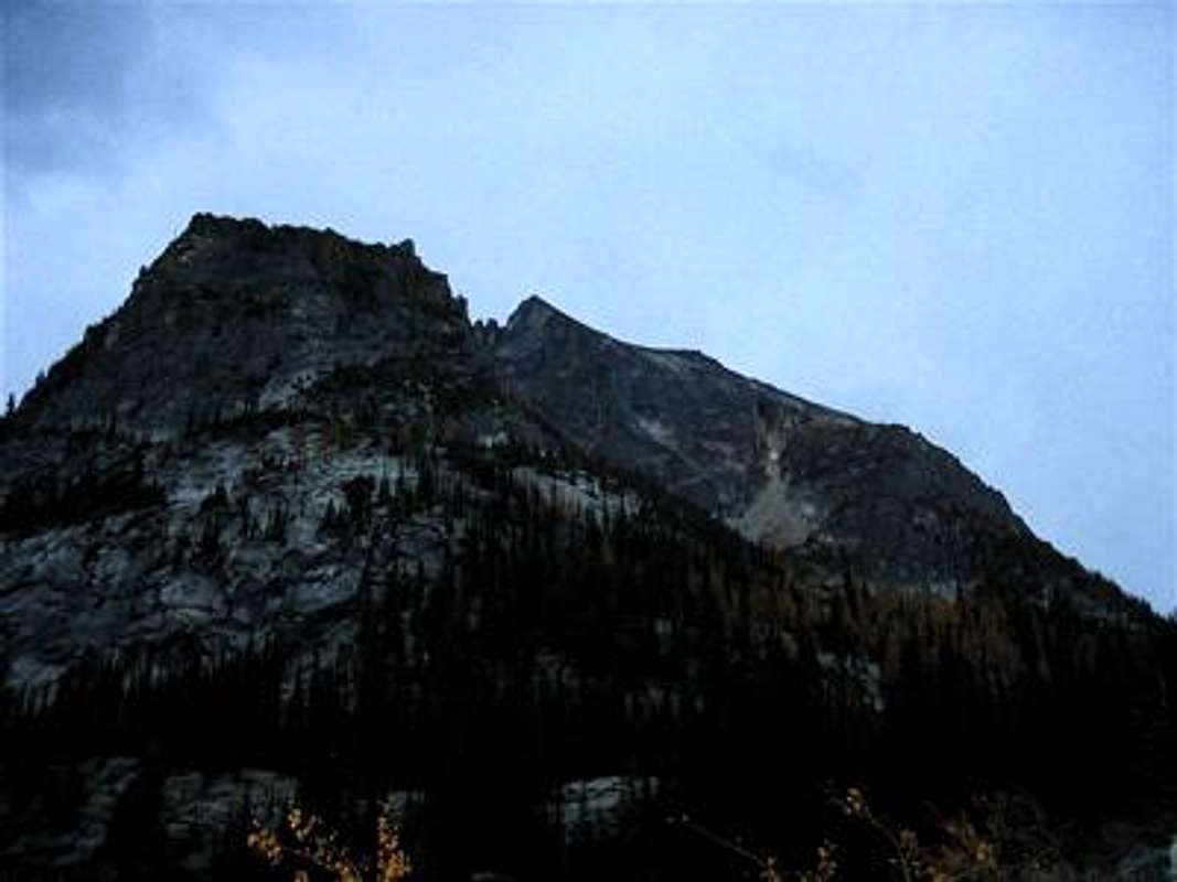
![Access route]()
head for the couloir
Due to the presence of only one obvious route to the summit, it will be discussed here. (If someone else wants to post an entirely different route, I will move this route description to its own page.)
Pat Caffrey's 1986 "Climber's Guide To Montana" suggests that one travel to Tamarack Lake, start up the northwest slopes, and "expect to take ages finding the correct route." Don't do it! If you make it to either lake, you've gone too far.
I assure you that this route is not only straightforward and obvious every step of the way, it looks like the only variation of a sub-fourth class (scrambling) route.
From the Chaffin Creek Trailhead, hike 3 miles of easy trail to the base of the climb. As you hike, locate Sugarloaf on the left and start looking for the north face couloir. This is your target; one will head directly for the couloir.
Leave the trail and bushwhack toward the large, open basin that lies below the summit on the north. As you climb into the couloir, depending on conditions, exit right on easy third class terrain. Above this, rock-hop on extremely loose and steep talus to the summit. Alternatively, on snow the couloir makes a great snow climbing route and "extreme" ski. The summit slopes are possibly more stable under good snow cover. Chaffin Creek provides an easy, albeit flat, ski egress.
There is no camping at the trailhead, otherwise there are ample sites along many sections of the trail. At Hart and Tamarack Lakes there are numerous sites which are highly recommended due to the excellent scenery, fishing, and solitude.
![Its a DOG route]() Dog route!!
Dog route!!
Western Montana Avalanche Center Forecast (December through March only!)
National Weather Service in Missoula
National Weather Service Automated Surface Observation Stations (SNOTEL, RAWS, etc)
Local Web Cams:
Ridgeway Pharmacy Webcam in Stevensville This webcam is user controllable!! You can zoom, tilt, etc. A great tool!
USFS Airquality Webcam near Stevensville shows area around Little and Big St. Joseph peaks, Gash Point, etc. Gives a good idea of the area weather.
Bitterroot SNOTEL sites:
Saddle Mountain, 7900', near Lost Trail Pass
Nez Perce Camp, 5650' west of Darby
Twin Lakes, 6400', near Lost Horse
Lolo Pass, 5240'
Route Description
head for the couloir
Pat Caffrey's 1986 "Climber's Guide To Montana" suggests that one travel to Tamarack Lake, start up the northwest slopes, and "expect to take ages finding the correct route." Don't do it! If you make it to either lake, you've gone too far.
I assure you that this route is not only straightforward and obvious every step of the way, it looks like the only variation of a sub-fourth class (scrambling) route.
From the Chaffin Creek Trailhead, hike 3 miles of easy trail to the base of the climb. As you hike, locate Sugarloaf on the left and start looking for the north face couloir. This is your target; one will head directly for the couloir.
Leave the trail and bushwhack toward the large, open basin that lies below the summit on the north. As you climb into the couloir, depending on conditions, exit right on easy third class terrain. Above this, rock-hop on extremely loose and steep talus to the summit. Alternatively, on snow the couloir makes a great snow climbing route and "extreme" ski. The summit slopes are possibly more stable under good snow cover. Chaffin Creek provides an easy, albeit flat, ski egress.
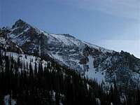 north couloir in March north couloir in March |
 north couloir in October north couloir in October |
 summit slopes summit slopes |
|
|---|---|---|---|
 east ridge east ridge |
 summit ridge summit ridge |
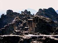 summit ridge summit ridge |
Here is a YouTube video of a skier's point of view, in the north couloir:
Red Tape and Camping
The first several miles of the trail is Forest Service, the remainder of the hike is within the Selway-Bitterroot Wilderness. Typical Wilderness regulations apply.There is no camping at the trailhead, otherwise there are ample sites along many sections of the trail. At Hart and Tamarack Lakes there are numerous sites which are highly recommended due to the excellent scenery, fishing, and solitude.
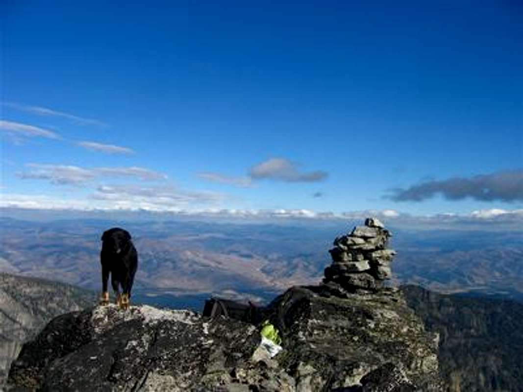 Dog route!!
Current Route Conditions
Weather and Avalanche Conditions:Western Montana Avalanche Center Forecast (December through March only!)
National Weather Service in Missoula
National Weather Service Automated Surface Observation Stations (SNOTEL, RAWS, etc)
Local Web Cams:
Ridgeway Pharmacy Webcam in Stevensville This webcam is user controllable!! You can zoom, tilt, etc. A great tool!
USFS Airquality Webcam near Stevensville shows area around Little and Big St. Joseph peaks, Gash Point, etc. Gives a good idea of the area weather.
Bitterroot SNOTEL sites:
Saddle Mountain, 7900', near Lost Trail Pass
Nez Perce Camp, 5650' west of Darby
Twin Lakes, 6400', near Lost Horse
Lolo Pass, 5240'