
|
|
Mountain/Rock |
|---|---|
|
|
46.51410°N / 114.2983°W |
|
|
Ravalli |
|
|
Mountaineering |
|
|
Spring, Summer, Fall, Winter |
|
|
9282 ft / 2829 m |
|
|
 |
|---|
The South Heavenly Twin, at 9,282 ft. is a huge way back peak that rises 4500 feet above the Big Creek, and Kootenai Creek drainages, and high above the Bitterroot valley. It is separated from its shy twin North Heavenly, 9,243 by a saddle or col that drops to @ 8950 ft.. S Heavenly can only be seen from a very short section of Hwy. 93 at Victor, and N Heavenly Twin cannot be seen at all from the valley floor. In fact good views of either of the twins are very hard to come by, as the trees along the trails obscure the peaks until you are well to the west, and several miles back in.
 N. and S. Heavenly Twin, as seen from the trail to Big Creek Lake. 6/07
Or if you are across the Bitterroot valley in the Sapphire Mountains.
 A nice view from Corvallis Hill. Photo by thephotohiker.
 The Heavenly Twins are usually climbed in a traverse from either N. to S. or vice versa, and are accessed by Kootenai Creek on the N. and Big Creek/Beaver Creek on the S and N respectfully. Another alternate approach is to climb St. Marys peak, and bear almost due west on a long ridge with many steep notches that have turned back unprepared hikers. Moderately long trail approaches, miles of cross country travel, and 4th and 5th class climbing make these peaks a formidable challenge to the ambitious peak bagger/alpinist.
The traverse is a huge undertaking, at very nearly 20 miles, with half of it off trail, on steep and exposed terrain. Very fit climbers can count on at least an 18-20 hour push if planning to do it in a day. Most parties however count on a bivy, somewhere along the off trail sections.
The cirques and valleys, aretes and buttresses of the Bitterroot Mountains were carved from solid granite plutons that rose from deep in the Earths crust, the result of the oceanic plates subduction under the continental crust, approximately 85 million years ago.
 Plate Subduction makes for great climbing!
The peaks of the Bitterroot Mountains were almost completely covered by the continental ice pack glaciers during the last ice age, the resulting scouring and sculpting are readily apparent. Even though the glaciers were carving up the granite of the Bitterroot batholith, as opposed to the much softer limestone of the GNP area, the results are nearly as dramatic. There are many miles of steep and smooth granite slabs that glisten in the cirques, which lead to vertical granite walls that rise several hundred feet in height, the evidence of glacial scouring is all around you.
These mountains are still being eroded by the effects of wind, ice, and avalanche.
 Avalanche debris in the approach chute to the S. Heavenly Twin.4/05
 Gaining the upper E. ridge, S. Heavenly Twin.4/05
Approaches
 Area Overview of N.and S. Heavenly Twins. 11-24-07
From theBig Creek, trail head,which sits at @3845 ft., hike 4.5 miles of good trail to @ 4800 ft of elevation, where a large avalanche chute on the N. side of the trail will provide accesses to the South face of S. Heavenly.
 Looking back down to Big Creek from about 1/3 of the way up S. Heavenly Twin.4/05
From the Kootenai Creek trail head, at an elevation of 3560, hike for @7.0 miles to the elevation of 5200 ft. Here you will need to look for a log jam or other way to cross the creek, then look for a scree field that is coming down from a well rounded ridge. Finding this scree is crucial to a reasonable way up the ridge, which is mandatory, as the bushwhacking is near impossible on the drainage bottom and its hill sides. Steep slopes, scrub cedar, mountain ash and slide alder will all impede your progress. Hopefully you will have better luck finding this ridge than the party I led did, if you do, there is relatively smooth while very steep access to the N. ridge of N. Heavenly peak. 2,000ft. of elevation is gained in the first .75 miles, then the angle lessens as you gain the rocky ridge top. the next 1.5 miles gains another 2,000ft. to the summit of N. Heavenly.
 Kootenai Creek Approach. Google Image, please do not vote.
Another clue for finding the correct ridge line, is to count the major ridges from the wilderness boundary @2.5 miles up the trail, the N. ridge of the N. Twin is the 4th very large rounded ridge line to the S.. All of these ridges look similar, especially in cloudy conditions, so counting might be your best clue along with elevation. When I attempted this traverse, I crossed the creek one drainage early, and it set in motion a series of events that kept us from summiting the N. Heavenly Twin, and completing the traverse.
From theSt Mary peak trail head, at 6850 ft, climb the well worn trail @3.5 miles to the summit of St Marys Peak, 9351 ft. . From here, head cross country almost due W. through a saddle @7500 ft. and then gain the "Disappointment Ridge" line that heads predominately W. towards the S. Heavenly Twin. This is an aptly named ridge, as it has several large gendarmes that will need to be skirted, and the last one leads to some tricky down climbing on the S. side to access the dominate notch just before the summit of S. Heavenly. There is a lot of exposure on this ridge, and unprepared teams can be thwarted with their goal within arms reach.
 Overhead view of S. Heavenly Twins Approaches. 11-24-07
The attraction of this approach is the higher trail head, but there is still over 2 miles of off trail climbing/hiking, and significant elevation loss and gain. This approach allows for an "out and back" attempt, rather than a traverse between drainages.
An alternate non technical approach is a class 3 route up the S. Heavenly via Beaver Creek, which is a tributary of Big creek, flowing in at about 5.5 miles and @5050Ft. This is a major tributary that flows in from the N., and is impossible to miss even in the fog. Follow the creek on its E. side to a basin at @ 6500 ft, here you will see a very long slope to the east that leads directly and steeply to the S. Heavenly Summit. This is also the safest descent route when doing a N. to S. traverse. The bushwhacking on the first 1000 vertical feet up from the confluence is thick and steep, and the most difficult part of this approach.
Descent
The descent from the S.Heavenly Twin can be done two ways, reverse the climbing route from the notch on the E. ridge, by down climbing and raping @600 vertical feet of 5th class terrain, or to take the W. slope down into the basin of Beaver Creek.The Descent into the saddle between the S. and N. Twins is relatively straight forward and only 3rd class if you are doing the traverse from S. to N.
The Descent from the N. Twin is via the north ridge, resist any temptation to leave the ridge top until you can look directly down into the Kootenai Creek drainage, and see the trail. As I said in the approach section, the bushwhacking on the sides and bottoms of these drainages is brutal, and no matter how tight your clothes, you will have cedar needles in the crack of your unmentionables.
When doing the traverse from the N. to S., the descent from the N. Twin into the saddle is 4th class travel down granite slabs, not overly difficult, but exposed.
 The heavily corniced saddle between the N.& S. Heavenly Twins.
Necessary Gear
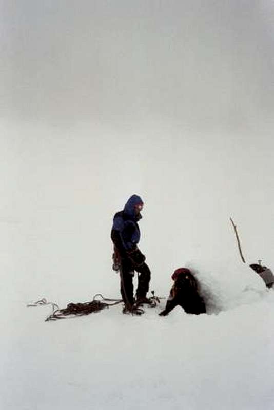
Depending on the season, you might need a light alpine rock rack to 2 inches, extra slings to girth hitch trees, ice screws, pickets and a fluke, harness, 50-60 meter alpine rope, ice ax, third ice tool, crampons, avalanche transceiver, shovel, and probe. For a summer ascent, a confident team might bring a light alpine rock rack with gear to 2 inches, slings, rap rings, webbing, harness, and twin 30 meter alpine ropes.Of course inclement weather can and does strike the Bitterroots during all seasons, so be prepared to fend off nasty weather by bringing sufficient layers, sturdy shoes, gaitors, bivy gear, and for 3 seasons, be very wary of avalanche hazard.
 Weather's on the Way! 4-05
Camping
The Lower .5 mi section of trail from the Kootenai Creek trail head is on private property, and thus no camping is allowed. There is a national forest campground at the Bass Creek trail head one drainage to the north.The Big Creek, and Kootenai Creek valleys are narrow and deeply cut by the creeks. There is also dense undergrowth along the creeks, this makes camping spots kind of hard to find. None will be secluded until you get 3 or 4 miles up the trail, and the valleys get a little wider.
Most of the approaches and routes are within the Selway-Bitterroot Wilderness Area, and there are no restrictions or permits required for camping.
Leave No Trace ethics should be your modus operandi, leave nothing but footprints, take nothing but memories [and pictures].
Disclaimer
My knowledge of the N. Heavenly Twin, is limited, and comes from 2 failed attempts at its summit, I have been very high on both its N ridge, and the saddle between the summits, but conditions on both attempts prevented me from achieving the summit. Thus I am only listing this page for the S. Heavenly Twin, in hopes that I, or another SP member will achieve the N. summit, and put up its much deserving page. May your days in theBitterroot Mountains be plentiful.
Important Links
Current WeatherCurrent Avalanche Conditions
Bitterroot National Forest
Photo Credits
Thanks thephotohiker for letting me use your images.If you have images of the Twins, N. and/or S., please do not hesitate to attach them!
If it is ok to incorporate them into the text, "pm" me at; T Sharp, and I will be glad to work them in.