-
 9636 Hits
-
 81.18% Score
-
 13 Votes
|
|
Mountain/Rock |
|---|---|
|
|
45.94895°N / 114.34769°W |
|
|
Ravalli |
|
|
Hiking, Scrambling, Skiing |
|
|
Spring, Summer, Fall |
|
|
9238 ft / 2816 m |
|
|
Overview
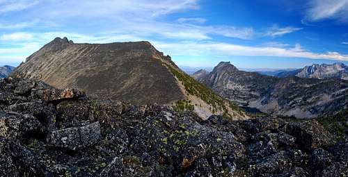
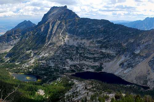
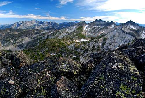
Route Type – Scramble Elevation – 9,238’ Class Level – Class 2+ or 3 Length of Time Required To Complete Route – One or More Days I freely admit that the Chaffin Creek Drainage is one of my favorite areas. Surrounded by some of the highest terrain in the Bitterroot Mountains, the west end of the canyon where Chaffin Creek originates has no "pass" – as do most other Bitterroot Drainages – over which long-established trails wander as they connect the backcountry areas of Montana and Idaho. This area is truly isolated. The rim around Chaffin Canyon contains six highpoints over 9,000 feet, possibly more than any other cirque in the Bitterroots. This remoteness and the lack of a "through trail" have contributed to the fact that only one of the 9,000’ summits currently has an official name, Sugarloaf Peak. In one sense that’s too bad, because the lack of easily-recognizable peak names means the area’s summits attract little attention. Then again it could be considered very good, because the lack of easily-recognizable peak names means the area’s summits attract little attention. One of those unnamed peaks, Point 9238 sits just off (west of) the south ridge to The Shard, whose summit at 9,883 feet is the third highest summit in the Bitterroots. I call this unnamed summit Chaffin Point for the three reasons:
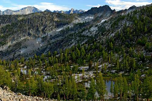
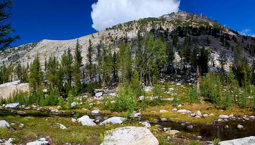
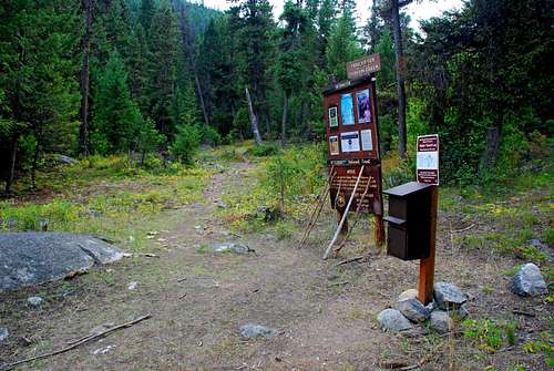
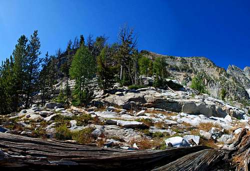
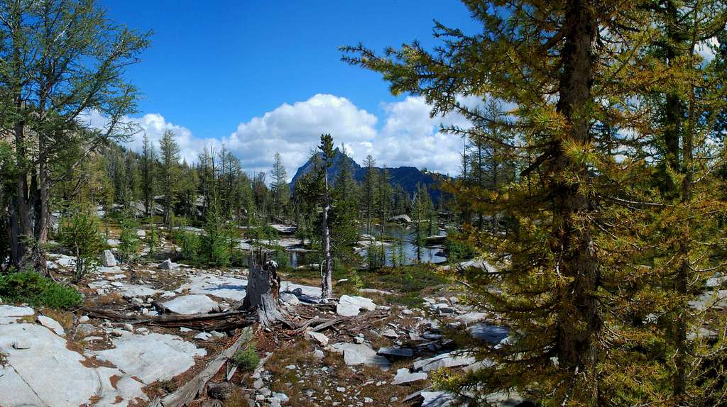
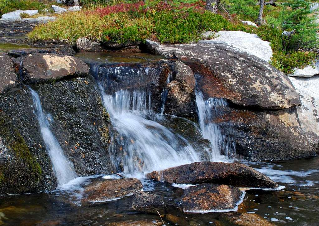
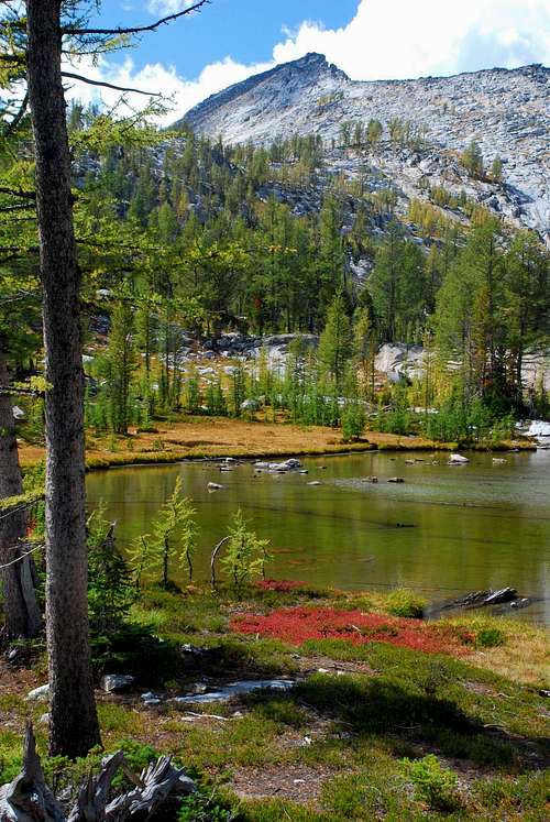
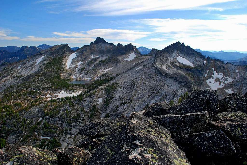
Reaching Chaffin Point is not an especially easy task and doing so is a reasonably difficult accomplishment. One of the things which makes a climb of Chaffin Point worthwhile is passing through the most beautiful hanging cirque I have yet to visit in the Bitterroot Mountains. Situated at the extreme western end of Chaffin Canyon and almost one thousand feet above Chaffin Lake, this area is home to a string of tarns connected by rippling streams and small waterfalls, referred to by a few of my friends as "The String of Pearls." Covered in low-growing grass with small groups of Alpine Larch and Whitebark Pine spread throughout, some locals call this hanging garden, Shangri-La. It is one of the best backcountry high-camp areas around, so I certainly won’t disagree with their assessment. Unless you’re full of energy, the best way to experience Chaffin Point may be to make your visit a multi-day affair. Camp in the beautiful hanging cirque (8,400’) before climbing Chaffin Point. And while you’re at it, summit one or more of the other 9,000’+ peaks within one mile of your camp. Chaffin Creek is named for Alex of John S. Chaffin who homesteaded on the creek in 1880. Getting ThereDrive south on Hwy 93 from Darby, MT for about 4.5 miles. Turn right (south) onto the West Fork Road (473). Go only about 100 yards, then turn right (southwest) onto Tin Cup-Chaffin Road (no sign). Continue about 2.8 miles to an unmarked junction and stay to the right (continuing westward). Drive for a little over a mile to the trailhead which is located at a right-turning switchback. The obvious trailhead will be on your left (west). There used to be only limited parking space, but during the summer of 2008 the Forest Service added a new parking area for several more vehicles. There are no restroom facilities. Area Restrictions (Red tape)Around 2.75 miles from the trailhead, the Chaffin Creek Trail passes into the Selway-Bitterroot Wilderness Area. From that point on wilderness rules and regulations apply.CampingThe most popular spots for camping are near the three most-visited lakes in the drainage, Hart, Tamarack, and Chaffin Lakes, with Hart being the most popular of all (probably because it’s the closest to the trailhead).The best camping spots though are the area around the Chaffin High Lakes in the upper portion of the cirque above and northwest of Chaffin Lake. This area is more difficult to reach than the three lower lakes, is seldom-visited, and pristine in nature. If you camp there, please keep it unspoiled. The Route
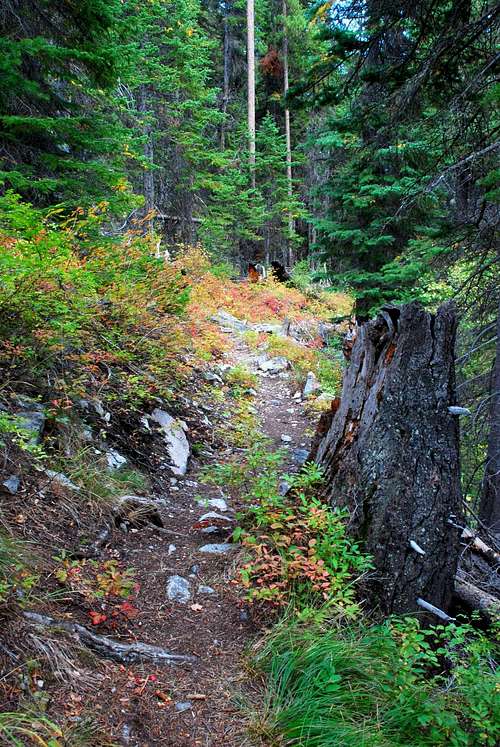
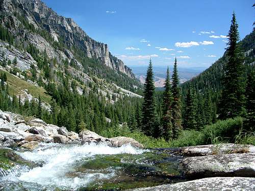
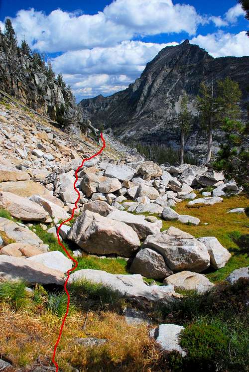
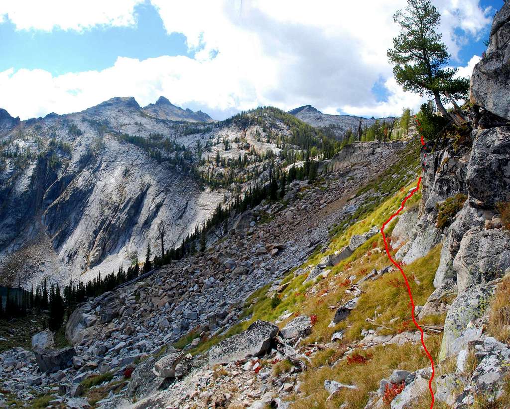
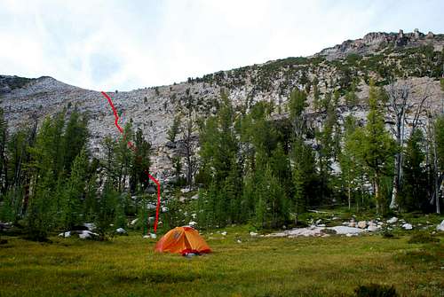
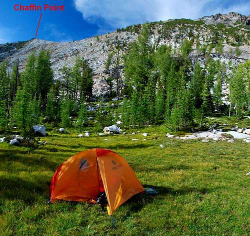
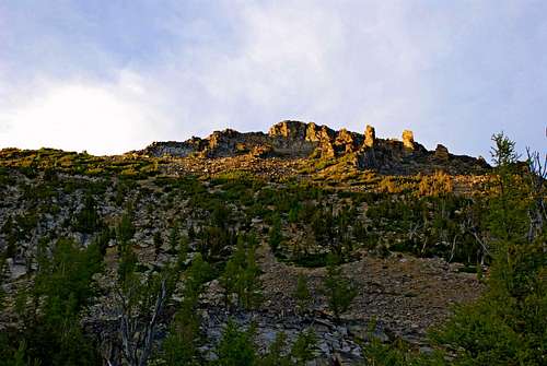
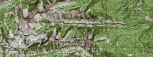
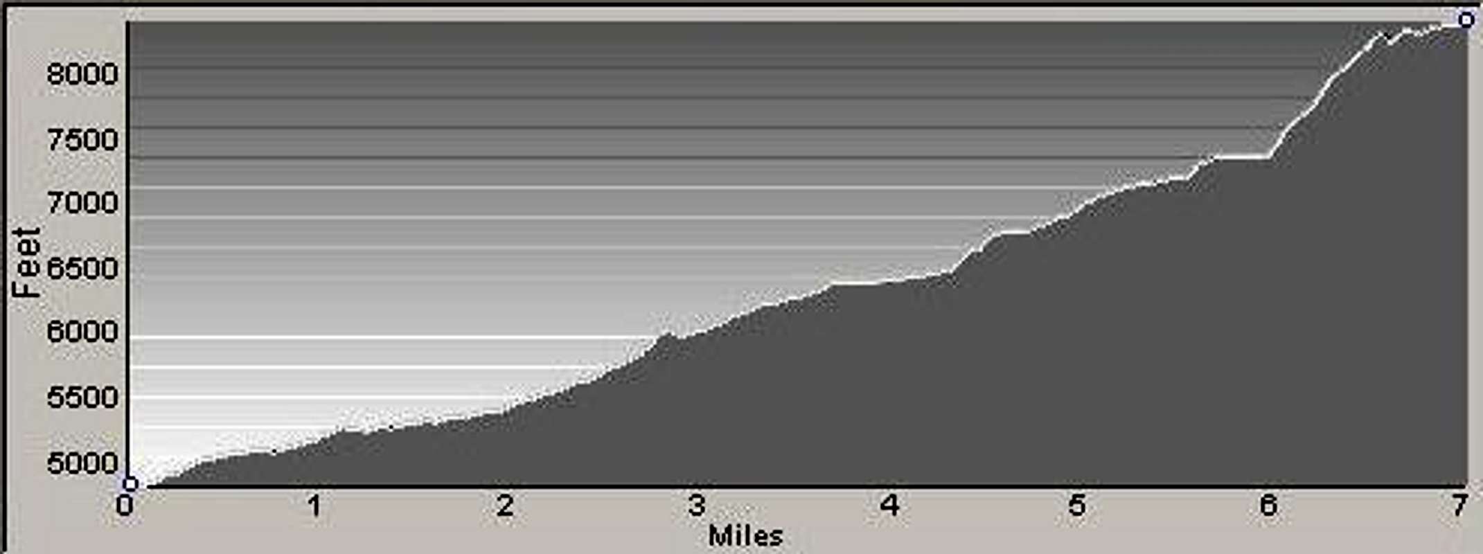
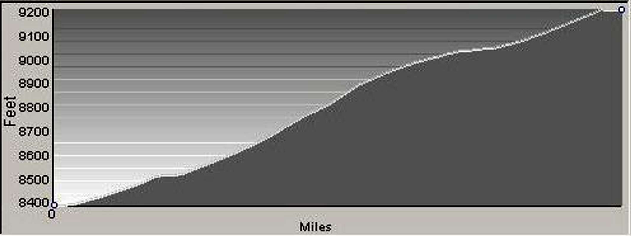
Approach - Chaffin Creek Trailhead to Chaffin High Lakes From the Chaffin Creek Trailhead, head west through some stately ponderosa pine and douglas fir along a well-used trail. The recently maintained trail stays just north of Chaffin Creek as it makes its way westward along the bottom of the drainage. For the Bitterroot Mountain area this trail is gentle as it gains just over 1,800’ of elevation in the first 4+ miles. Then the fun begins! At about 4.3 miles the trail finishes a series of switchbacks up the north side of the drainage and reaches an elevation of approximately 6,750’. The area is on a grass-covered moraine just south of and below the largest gully up the north side of the canyon (45.95584 N / 114.30217 W). From this point the trail proceeds slightly downhill for a short distance as it approaches a crossing of Chaffin Creek. Note: This crossing of the creek is on slab granite through the upper portion of a falls and can be extremely dangerous during high water. Be very careful! In fact, if there is high water, the best bet is to go off-trail and climb uphill above the falls along the north side of the stream until you find a safe place to cross. Then backtrack along the south side of the creek until you find the trail. It’s better to walk a little farther than to risk your life. About a mile after the first crossing of Chaffin Creek Falls, and, after crossing it once more, you will reach Hart Lake. Make your way along the north side of the lake on a trail which is not quite as nice as the one which brought you to the lake. As the trail goes around the lake, the route turns in a more southwesterly direction. You should see an obvious ridge which begins near the west end of Hart Lake, and, as it rises, goes southwest before curving more directly west. Begin your ascent of this ridge (a mile and a half from Chaffin Creek Falls) on the more gradual incline north (right) of its crest. Ignore any existing trails and pick a line up and over a mixture of slab rock, grass, and trees. Work your way toward the ridge crest which you should reach at an elevation of around 7,800’ (45.94469 N / 114.32832 W). Hike upward, staying close to the crest of the ridge as it begins curving north-northwest. Shortly after reaching 8,200’ (45.94605 N – 114.33355 W), leave the crest and go almost directly west toward the base of some cliff-bands (45.94569 N / 114.33619 W) along the ridge to your right. You want to stay below (to the left) the cliffs until you reach a more gradual incline. You should be close to 8,350’ after passing the cliffs. Note: I have tried beginning the traverse lower on the ridge (about 8,100') which allows a track across more talus and less grass. Unfortunately it also takes you across more scree. Of the two tracks, I prefer the higher traverse beginning just below the cliff-bands. Continue traversing toward a low-point (it looks like a very shallow saddle) to the west. This is the entry point to a hanging cirque containing several small lakes, an area I call The Chaffin High Lakes. When you attain the saddle (beside an outlet stream) you will be greeted by a very open forest of larch and whitebark pine. There are multiple places to set up a base-camp for a multi-day summit assault. I consider this Chaffin High Lakes area to have the very best back-country camping in the Bitterroots. From a spot just north of the first, and lowest, Chaffin High Lake, you can easily spot Chaffin Point on the ridge-crest. From your position, simply look northwest at the ridge-crest. That "bump" on the crest is your destination. About 800’ above the first High Lake, it’s not a particularly difficult climb. Climb over mostly stable talus (there are a couple small patches of scree, but they’re not too bothersome) toward the low point just east of Chaffin Point. Pick your own line, but be aware there is one small gully which runs about halfway up the ridge. Once you can pick it out, simply climb upwards around its top end. Doing so will keep you from having to expend extra energy climbing in and out of the depression. Once you reach the ridge-crest, turn west and walk the short distance to the summit. From the High Lakes to the summit requires only Class 2 or 2+ climbing and should take less than an hour, even if you stop several times to take pictures. Descend by the same route. Note: It is possible to follow the connecting ridge from Chaffin Point southward to West Chaffin Peak (point 9340). This route is at least Class 3 (Class 4 if you climb over all the rock outcrops instead of going around) and is over stable talus and granite blocks. The easiest route moves off and on the ridge-crest multiple times to avoid rock outcrops and unnecessary exposure. Be advised that just past (south of) the saddle, the slab-granite on your left (east) is quite steep and affords few if any hand holds or foot placements. Stay on the ridge-crest or to its right (west) and don’t slip! One can also climb to the west summit of The Shard from Chaffin Point. Return to the saddle where you first attained the ridge. The easiest route (for your feet and ankles) stays just left (north) of the ridge until you’ve almost reached the wide flat top of The Shard’s south ridge at which point you begin to traverse in a more northern direction. Once you gain The Shard’s ridge, simply walk toward the summit which is now in sight, staying to your left (west) along the upper portion of the ridge. (See The Shard’s South Ridge Route for more details and pictures.) When To GoIt’s possible to visit this summit at any time of the year, though traveling over snow may increase the difficulty substantially in spots. Because the trailhead is at a rather low elevation (for the Bitterroots) it is generally accessible all winter.There are only a couple of spots along the maintained trail where there are signs of avalanche activity, none of them very recent. But the section of the route which traverses below the cliffs on the Shard’s southeast ridge is susceptible to avalanche and should be crossed only when the snow is well-consolidated. When covered with snow, this traverse requires an ice axe and crampons. Note: There are very few snow anchors around the Chaffin High Lakes in the upper portion of the cirque. Therefore I do not recommend entering the area when the snow is not well-consolidated. Some years that may include all of the winter months, which is not to say that during other years travel in the area will be safe. If you do attempt this summit during the winter, know how to read snow, be aware of current conditions, and stay extremely alert. Essential GearDuring the summer hiking season, only sturdy hiking boots and weather-appropriate clothing are required to reach this summit. If snow is present, then snowshoes or skis (with skins) may be required. Any traverse across The Shard’s southeast ridge on snow will require an ice axe and crampons.Carry plenty to eat and drink. Reaching (and returning from) this summit is considered a strenuous endeavor and not to be taken lightly. Route StatisticsAdditional Pictures |


