


-
 76047 Hits
-
 98.77% Score
-
 89 Votes
|
|
Mountain/Rock |
|---|---|
|
|
45.85283°N / 6.87281°E |
|
|
Mountaineering |
|
|
12591 ft / 3838 m |
|
|
Overview
 South Side of Grand Capucin - Photo by Antonio Giani South Side of Grand Capucin - Photo by Antonio Giani |
In memory of Rahel Maria Liu, the former maintainer of this page. Rahel died on the Innominata Spur to Mont Blanc in a snowstorm on August 24th, 2004.
 |
 |
 |
 |
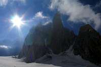 |
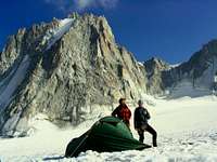
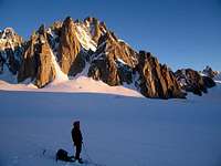
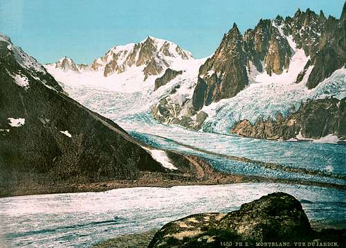
| On the glacier | View of Mont Blanc | Bivouac | UFO above Mont Blanc | Grand Capucin |
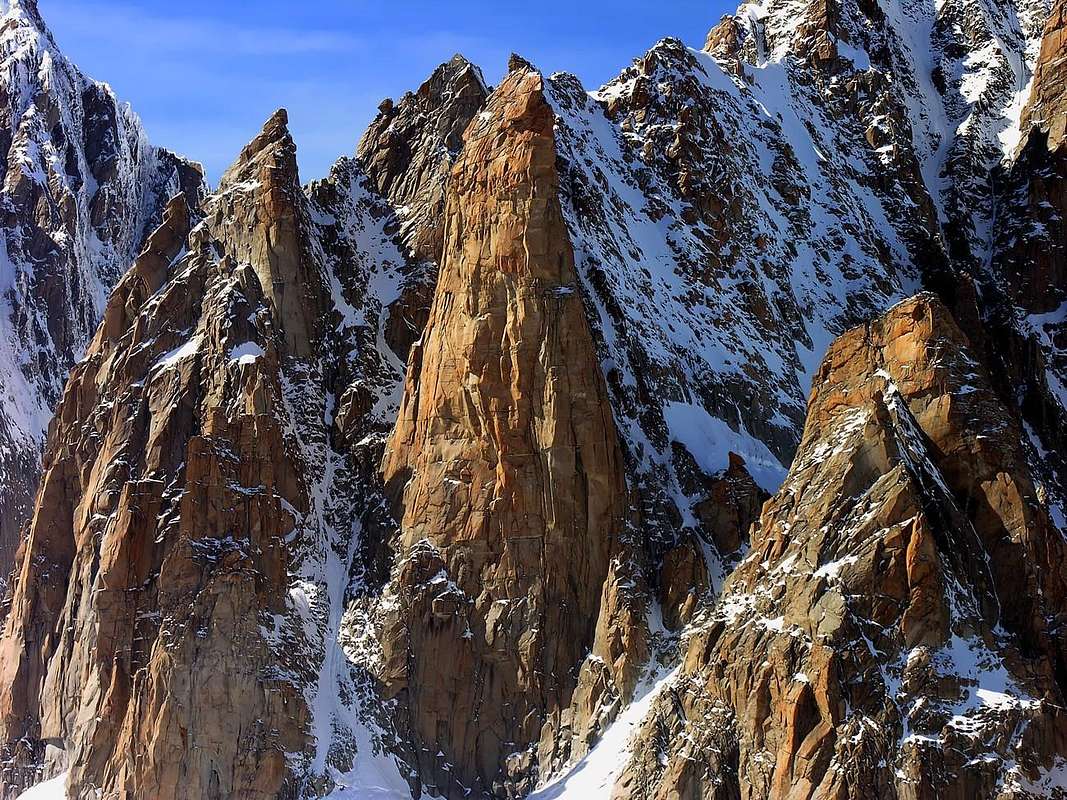
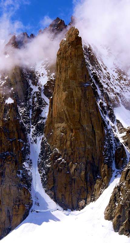
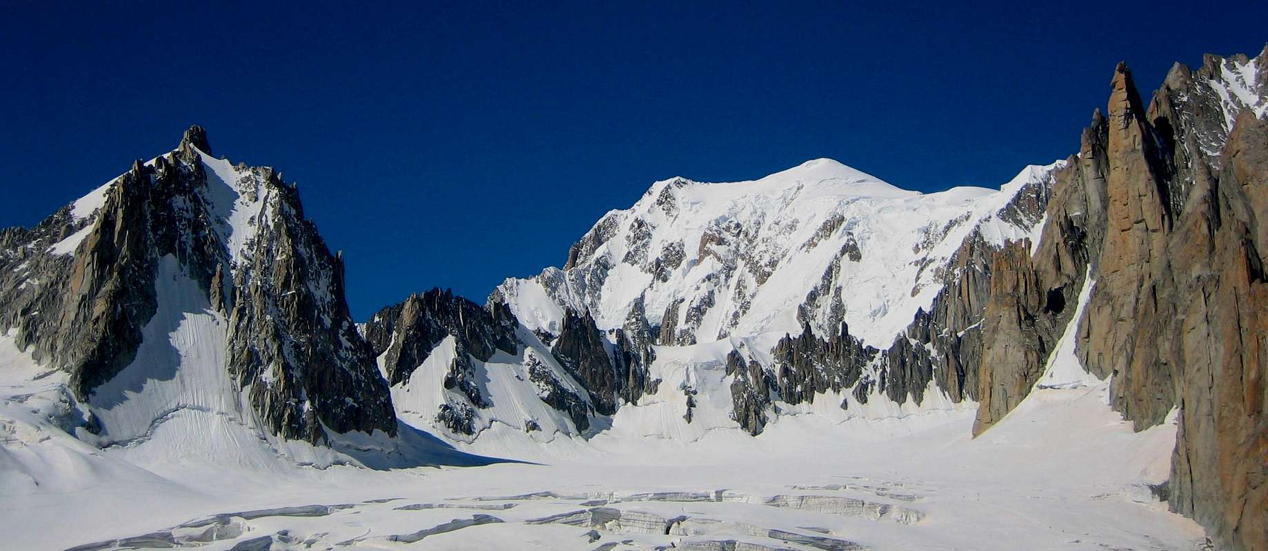
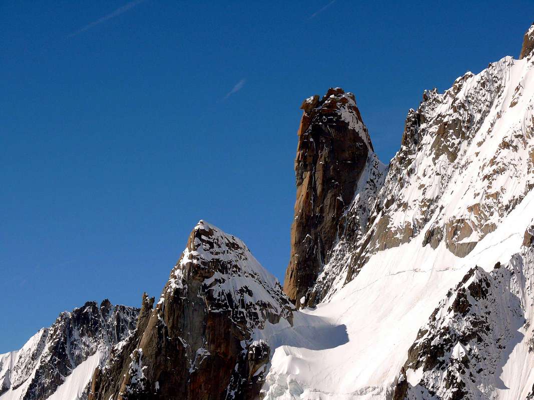
GRAND CAPUCIN - a red granite tower on the Gèant Glacier
-
The Grand Capucin is an extraordinary red granite tower in the Mont Blanc MASSIF. It has an E face rising steeply out of the Géant Glacier. The famous granite tower is an unique monolith in the Mont Blanc Area. The magnificent Grand Capucin is situated at the end of the east side of the Mont Blanc du Tacul. You can't miss it when you go from the Aiguille du Midi to the Rifugio Torino. It is a wonderful rock obelisk on the Glacier du Géant. Particularly noticeable are the rows of overhangs which at one time suggested it was unclimbable, but Bonatti found a winding route which goes over some of the overhangs, but in general works its way up between the great roofs; the climbing is quite literally, geometrically vertical, something quite exceptional on granite. Although its faces are not higher than 490 m and although the mountain can be seen only from the summits around, it has been interesting for rock climbers since 40 years.
*The famous Granite Tower Grand Capucin (3838 m) - Photos by Antonio Giani
 Grand Capucin Routes Grand Capucin Routes |
 The Red Tower The Red Tower |
GRAND CAPUCIN ROUTES (Photos by Antonio Giani)
- A= Blue Route "Elixir d'Astaroth". Difficulty ED+/6A/A2
- B= Red Route "Walter Bonatti". Difficulty TD+/V+/A1/A2
- C= Green Route "Eau et gaz à tous les étages". Difficulty ED+/6C/A3/A4/
- For the Routes compare the section Routes-Overview below.
*Historical notes
- After the first climbing through the E face, done by Walter Bonatti and L. Ghigo from 20th to 23rd of July 1951 (with the equipment of the 50ies ... respect!!), the Bonatti route has been the goal of extreme climbers for a long time. 1981 and later, there have been arranged very difficult sport climbing routes, which are the attraction to the climbers today. Besides the "Triple Directe", it is especially the route "Voyage selon Gulliver", which is interesting. The first ascent of the summit was undertaken by E. Augusto, Adolphe and Henri Rey and L. Lanier on 24. July 1924.
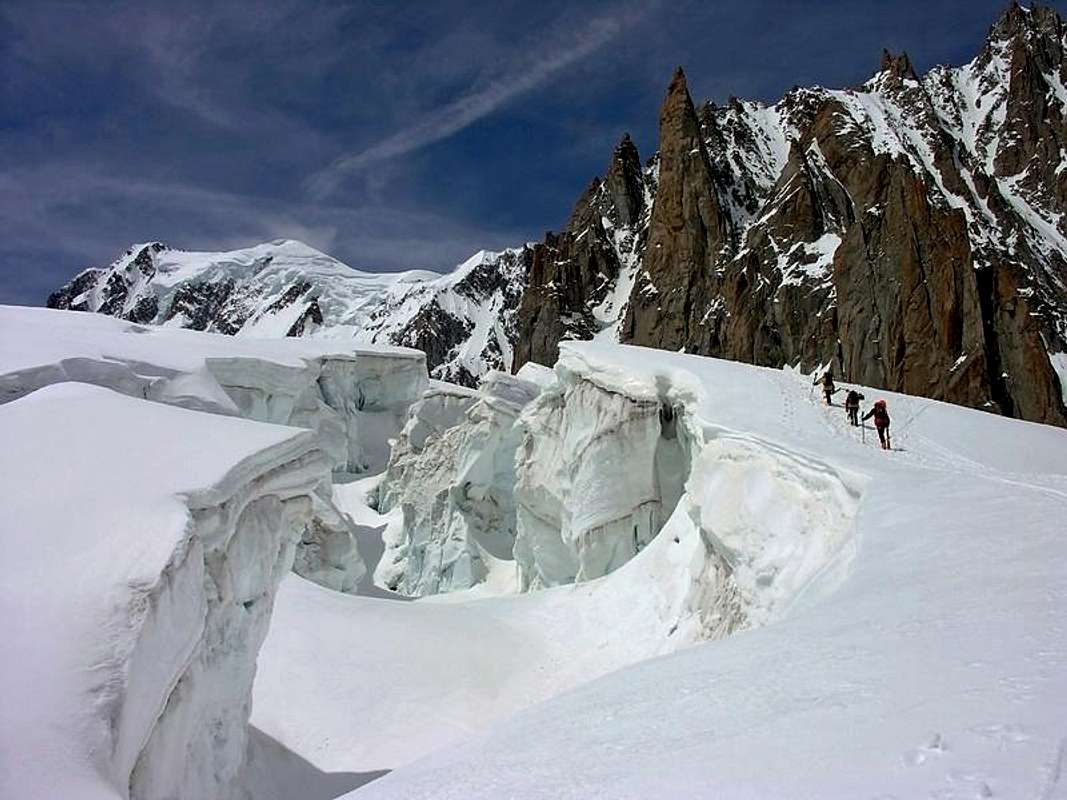 Deep crevasses between Rifugio Torino and the refuge Les Cosmiques - Photo by Besucher01 Deep crevasses between Rifugio Torino and the refuge Les Cosmiques - Photo by Besucher01 |
Crevasses, rockfall and bad weather
- There are deep crevasses in the area of the Géant Glacier. And falling stones on the fine rock routes to the summit of Grand Capucin are very dangerous. Pay attention to crevasses and stonefall! Sometimes the weather changes very quickly, a great and serious danger - to be caught on the summit in a heavy storm.
Getting There
 Walking on the Glacier du Géant - 2.8.2008 Photo by Hiltrud Liu Walking on the Glacier du Géant - 2.8.2008 Photo by Hiltrud Liu |
To the Grand Capucin (Cirque Maudit):
- You can come from the Refuge Les Cosmiques.
- You can come from the Rifugio Torino.
To the Refuge Les Cosmiques:
- In order to reach the hut, you need about 1/2 h from the Aig. du Midi. If you leave the cable car station via the bridge, you go to the South summit. On the firn ridge, you go down in SE direction of an even ridgeplatform; then turn right to the S and in SW direction below the S face of the Aig. du Midi. Pay attention to crevasses!
- You reach the Aiguille du Midi with cable car from Chamonix.
To the Rifugio Torino
- You reach the hut directly with the cable car from Entrève/Courmayeur (Italy).
- You can reach the hut directly also with the Helbronner cable car from the Aiguille du Midi (to Aiguille du Midi with the cable car from Chamonix).
- Or you go on foot from the Aiguille du Midi over the glacier du Géant (3 h): From the foot of the S face of the Aiguille du Midi you go on the almost even glacier to the Pointe Lachenal, turn left (E) to the glacier valley below the rugged E face of the Mont Blanc du Tacul. You go along this E face of the Tacul and the Pointe Adolphe Rey in order to loose only little height. Now you turn to the ESE to the Col des Flambeaux. From here in a few minutes to the Refugio Torino. It is a very beautiful glacier walk with 200 hm ascent. Difficulty: F.
- You reach Courmayeur through the Mont Blanc tunnel from Chamonix.
- You reach Chamonix with train, bus or car from Geneva or Martigny (Switzerland).
To the Cirque Maudit
- You reach the Cirque Maudit from the Aig. du Midi or the Ref. Cosmiques: From the foot of the S face of the Aig. du Midi you go on the almost even glacier to the Pointe Lachenal, turn left (E) to the glacier valley below the rugged E face of the Mont Blanc du Tacul. You go along this E face of the Tacul and the Pointe Adolphe Rey in order to loose only little height. Then you go either with a big detour to the north face of the Tour Ronde or quite directly up to the Col de Trident and the Cirque Maudit. Attention: Here are more crevasses!
- You reach the Cirque Maudit from the Rifugio Torino: From the Col du Géant near the Rif. Torino: You traverse the Col des Flambeaux and descend the glacier in direction of the Mont Maudit. Then you go along the Aiguille de Toule and the north face of the Tour Ronde to the Cirque Maudit which is built by the Arête de la Brenva, the Mont Maudit and the Mont Blanc du Tacul.
 Panoramic view of Grand Capucin - Photo by Rahel Maria Liu Panoramic view of Grand Capucin - Photo by Rahel Maria Liu |
- You reach the Chamonix Valley by train:
- From Martigny (Switzerland) via Vallorcine.
- From Geneva (airport) via Anncey (TGV till here) and St. Gervais.
- You reach the Chamonix Valley by bus:
- From/via Annecy, Geneva, Grenoble, Courmayeur, Aoste and Turin
- You reach the Chamonix Valley by car:
- From Geneva (from the NW) on the A40 till St. Gervais and from here on the N205.
- From Martigny (from the NE, Switzerland) via Vallorcine and the Col des Montets on the road no. N506.
- You reach the Val Ferret (Italy) by bus or car:
- From Chamonix through the Mont Blanc Tunnel from the NW. From Torino (from the SE) on the A5 via Villeneuve.
 North Side of Grand Capucin - Photo by Antonio Giani North Side of Grand Capucin - Photo by Antonio Giani |
Maps&Books
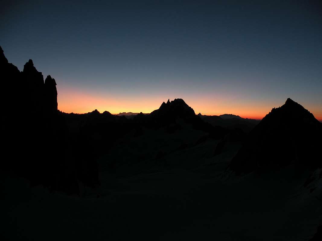
* GRAND CAPUCIN - E Face - N Face - Sunset - S Face - Photos by gabriele, om, Todo Vertical, ben jammin and as
 |
 |
 |
 |
 |
| East Side | North Side | Sunset | South Side | Mont Blanc glowing |
Institut Géographique National
- 1:25000 no. 3630 OT Chamonix - Massif du Mont Blanc
Instituto Geografico Centrale
- 1:25000 no. 165107 I.G.C. Monte Bianco
Kompass
- 1:50000 Kompass - Massiccio del Monte Bianco Valle d'Aosta Sentieri e Rifugi
Instituto Geografico Centrale
- 1:50000 no. 4 - I.G.C. Istituto Geografico Centrale Torino Massiccio del Monte Bianco, Torino, 1998
L'Escursionista
- 1:25000 no. 1 - Monte Bianco Courmayeur, Edizioni Rimini 2004
Institut Géographique National
- 1:100000 no. 53 - grenoble mont-blanc parc national de la vanoise
Monte Bianco MAP
- 1:30 000
*Grand Capucin - Maps (Photos from Alberto Rampini and Silvia Mazzani)
 |
 |
 |
Mappa Courmayeur cartina hikr.org/map Hikr.org - Courmayeur
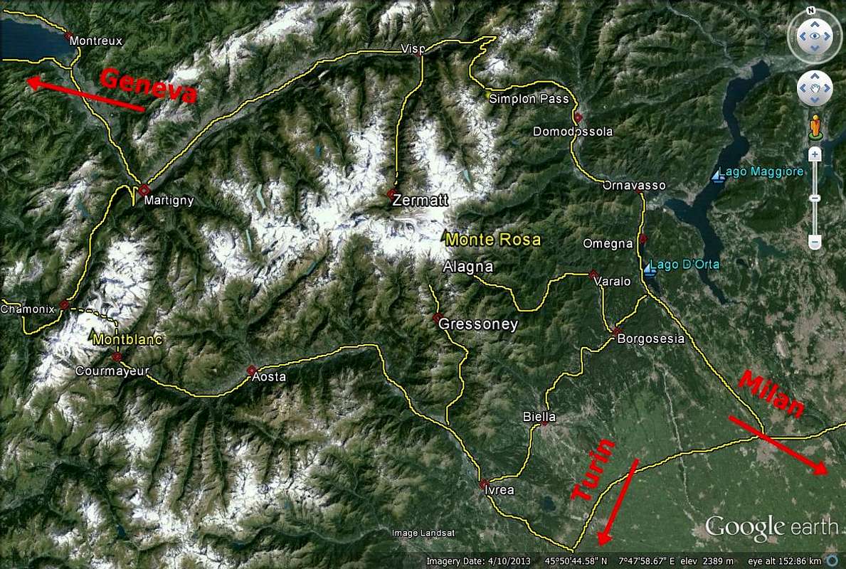
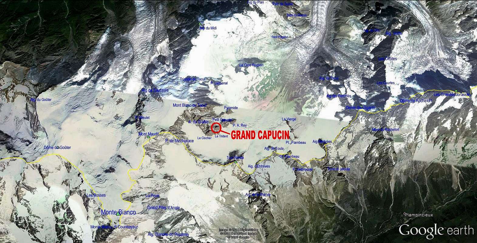 Google earth Grand Capucin - Photo from Antonio Giani Google earth Grand Capucin - Photo from Antonio Giani |
Books
Hartmut Eberlein
- , Mont-Blanc-Gruppe. Gebietsführer für Bergsteiger und Kletterer, 2000 or 2012.
Hartmut Eberlein
- , Mont-Blanc.
Helmut Dumler/Willi P. Burkhardt
- , The High Mountains of the Alps.
Gaston Rébuffat
- , The Mont Blanc Massif. The 100 Finest Routes. London 1996. ISBN 1-898573-03-4.
Lindsay Griffin
- , Mont Blanc Massif, Vol. 2 - Published Alpine Club (2002).
Lindsay Griffin
- , Mont Blanc Massif, Vol. 1 - Published Alpine Club - London (1990).
Gino Buscaini
- , MONTE BIANCO, Vol. I, Guida dei Monti d'Italia, 1994.
Osvaldo Cardellina
- , 80 itinerari di Escursionismo Alpinismo e Sci Alpinismo in Valle d'Aosta. Ed. Musumeci, 1977 (in Italian); 1978 (in French).
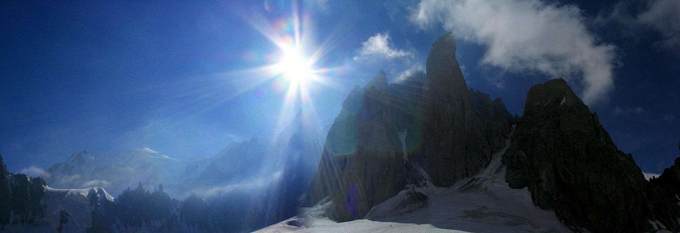
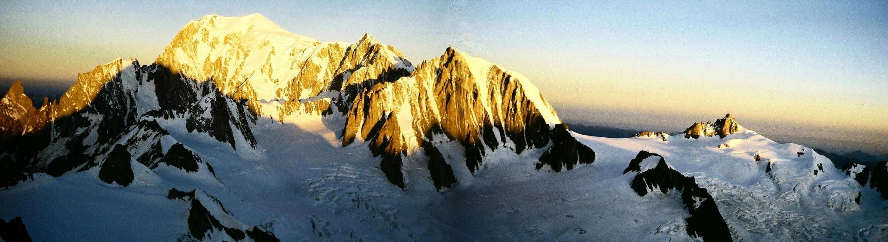 The mighty Mont Blanc - Photo by Rahel Maria Liu The mighty Mont Blanc - Photo by Rahel Maria Liu |
Infos
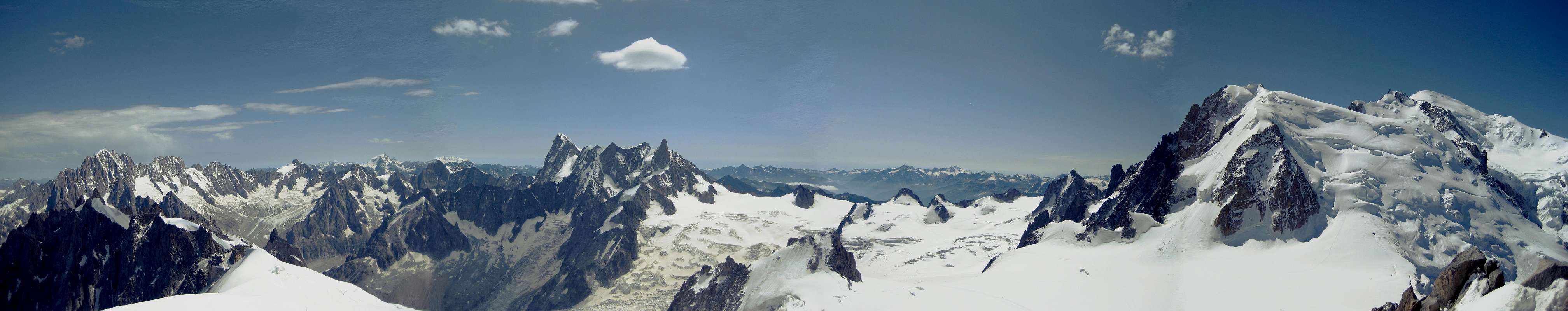 Aig. Verte - Aig. de Triolet - Rochefort Ridge - Grand Capucin - Mont Blanc du Tacul - Mont Blanc (Photo by Hiltrud Liu) Aig. Verte - Aig. de Triolet - Rochefort Ridge - Grand Capucin - Mont Blanc du Tacul - Mont Blanc (Photo by Hiltrud Liu) |
WEATHER INFOS
- Phone: 0033/836680274
- Snowinfo: 0033/836 681 020 (only in France)
ChamonixMeteo.itMeteowebcam Italy
GENERAL INFOS
Office de Haute Montagnes (OHM)
- Phone: 0033450 532 208
- in Chamonix
- Phone: 0033/450530088
ChamonixGuide Alpine CourmayeurSocietà Guide Alpine CourmayeurCourmayeur
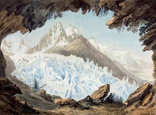
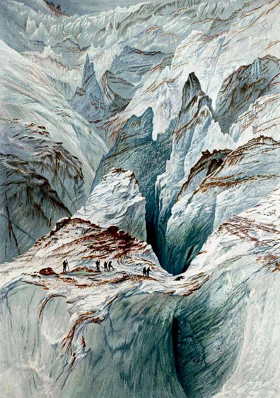 Mer de Glace - Elijah Walton - 1868
TRAIN CHAMONIX VALLEY
- Phone: 0033/450 53 1298 - 0033/8 36 35 35 35 - 0033/450530702 (Train station Chamonix)
BUS CHAMONIX VALLEY
- Phone: 0033/450 53 0555 - 0033/450 53 0115
CABLE CARS
ChamonixCourmayeurFunivie MONTE BIANCO
- Phone: 00390/165.846658, Fax 00390/165.842347
* Cable Cars and the Pano Gondola - Photos by Hiltrud Liu - om - Rahel Maria Liu
 |
 |
 |
 |
 |
 |
 |
 |
 |
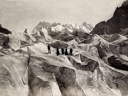
| Cable car 2007 | Shadow | Cable car 1967 | Géant Glacier | Pano Gondola | Glacier | Mer de Glace | Glacier | Séracs |
CAMPINGPLACES
- There are campingplaces in
- and
- No seasonal closure. There are big parking places in Chamonix and Courmayeur near the Cable Car ground station.
 Marquardt Wacher, Voyage de M. de Saussure à la Cime du Mont-Blanc, 1790 - Photo from ericvola Marquardt Wacher, Voyage de M. de Saussure à la Cime du Mont-Blanc, 1790 - Photo from ericvola |
Accomodation
 A contre-jour photo from the bivouac at the foot of the red Granite Tower - Photo by Rahel Maria Liu A contre-jour photo from the bivouac at the foot of the red Granite Tower - Photo by Rahel Maria Liu |
Les Cosmiques (3613 m)
 |
The refuge Les Cosmiques is situated on a shoulder between the Col du Midi and the SW ridge of the Aiguille du Midi (Cosmiques ridge). |
- 120 beds guarded from mid-February to mid-October phone: ++33(0)450544016
Rifugio Torino (3322m/3375m)
 |
The Rifugio Torino has 2 huts, the lower and older one and the upper, new one. Both huts are connected by a tunnel. |
- 180 beds guarded from mid-February to mid-October
Routes Overview
* GRAND CAPUCIN on the Glacier du Géant - Photos by Silvia Mazzani, Rahel Maria Liu, Hiltrud Liu and AlbertoRampini
 |
 |
 |
 |
 |
|
| Mer de Glace | Grand Capucin | Mont Blanc | Glacier du Géant | Good view |
Bonatti Route:
- VIII-, mostly VII with VII+ (passages), ED+, 6-12 h (Eberlein). ED, 490 hm, 10-20 h (Rébuffat).
* Photos
- by bruno.carbonne, Antonio Giani, Osvaldo Cardellina and ericvola
 |
 |
 |
 |
 |
 |
 |
 |
| Bonatti Route | Route | Tabou R | Nice Rock | Glacier | Descent | Bonatti young | E Face |
O Sole Mio (S face):
- VII+, mostly VI and VII. Passages VII-. ED. 280 hm, 6 h (Eberlein).
Swiss route (Voie des Suisses):
- VII, A 0 (1 passage), mostly V+ and VI. ED-. 280 hm, 6 h (Eberlein).
* Photos
- by Rahel Maria Liu, Bernhard Sauer, RobertoRampini
 |
 |
 |
 |
 |
 |
 |
 |
 |
| Swiss Route | Route | B Sauer | Climbing | Summit | Ascent | Old artif | Up | Crevasse |
Souire de l'Eté:
- VII, A 2, mostly VI and VI+. ED. 280 hm, 6 h (Eberlein).
Voyage selon Gulliver:
- VIII-, A 0 (swinging traverse), mostly VI+ and VII. ABO-. 300 hm, 6-8 h (Eberlein).
Flagrant Delire:
- VI+, A 4, mostly A 2 and A 3, ED+, 400 hm (you should plan a bivouac!) (Eberlein).
Elixier d'Astaroth:
- VII+, A 3, mostly VI and VI+, ED+, 400 hm (Eberlein).
Directe des Capucines:
- VII+, mostly VI+ adn VII-, passages A 0 or A 1 at the end, ED+, 400 hm, 10 h (Eberlein).
Triple Directe:
- VIII, mostly VII, ABO, 400 hm, 10 h (Eberlein).
Descent:
- Abseiling down, mostly through the route "O Sole Mio"
* * * * * * * * * * * * * * * * * * * * * * * * * * * * * * * * * * * * * * * * * * * * * * * * * * * * * * * * * * * * * * * * *
GRAND CAPUCIN ROUTES (Photo by Antonio Giani)
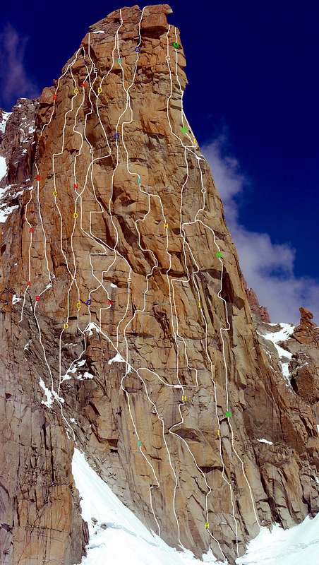 |
A= SSW Pillar - O sole mio route
|
Link MountainArea
* Glacier Dent du Géant - Mer de Glace - Ascent - Photos from om, Jean Antoine Linck, 1799, and Philippe Jullien, 1890
 |
 |
 |
 |
MountainArea |
- - Chamonix - France
- Courmayeur
- - Courmayeur - Itay
- Villa Cameron, località Villard de la Palud 1 Courmayeur (AO) Tel: 39 0165 897602 - Fax: 39 0165 897647.
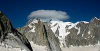
 * Panorama West Side of Grand Capucin - Rochefort Ridge and Tour Ronde (Photo by kiss Istvan) * Panorama West Side of Grand Capucin - Rochefort Ridge and Tour Ronde (Photo by kiss Istvan) |
Webcam&Google Map
- Aosta Valley
 Google Map - Photo from Markhallam Google Map - Photo from Markhallam |