
-
 5539 Hits
-
 84.27% Score
-
 18 Votes
|
|
Mountain/Rock |
|---|---|
|
|
45.85754°N / 6.88716°E |
|
|
Haute Savoie |
|
|
Trad Climbing |
|
|
Summer |
|
|
12648 ft / 3855 m |
|
|
Overview
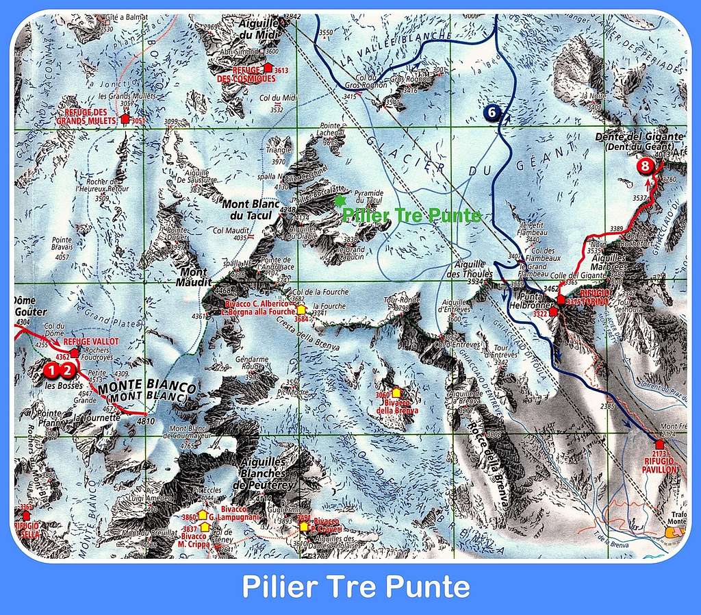
Geographical classification: Graie Alps > Mont Blanc Group > Pilier Tre Punte
Pilier Tre Punte 3855 m
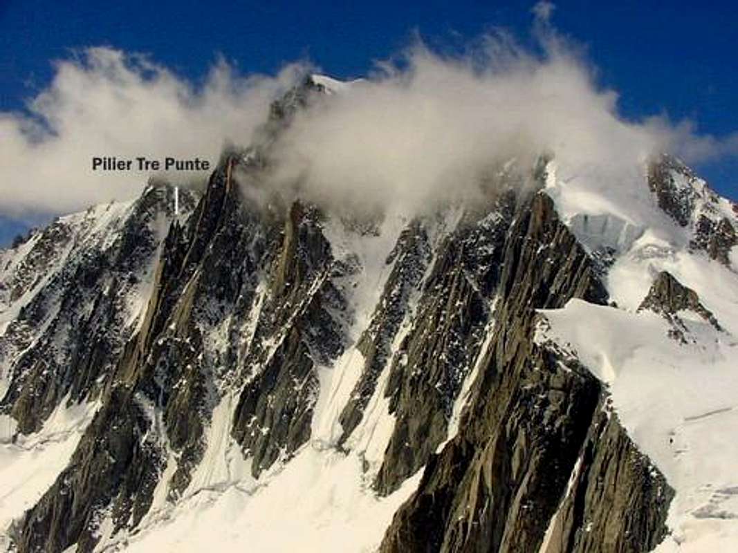
The stunning Mont Blanc du Tacul overlooks the Valleé Blanche with its complex Eastern face, along which there are many slender pillars of red granite interposed by several ice gullies, amongst which the obvious and wide Couloir Gervasutti. Amongst these pillars the Pilier Tre Punte or Pilier des Trois Pointes is a completely independent summit in shape of a majestic and slender pillar at the same time, close to this complex side, located between Couloir du Diable and Supercouloir and on the left of the nearby rock pillar named Pilastro Gervasutti. Pilier Tre Punte well-defined top, formed by three surprisingly sharp tips, from which its name, is clearly visible coming from the Col des Flambeaux, once passed the satellites of Mont Blanc du Tacul.
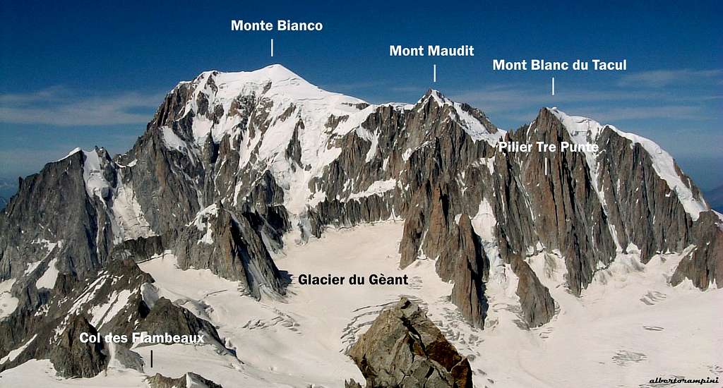
Monte Bianco and M. Blanc du Tacul seen from Dent du Gèant
Getting There
Pilier Tre punte may be approached both from Courmayeur (italian side) and Chamonix (french side), in both cases it is advisable - for a better acclimatization - to stay overnight at the shelters, Rifugio Torino on italian side, Refuge Cosmiques on French side.
Getting to Courmayeur
- From Turin and Milan: follow the A5-E25 Motorway and exit Courmayeur, reaching the hamlet of La Palud m. 1370
- From France: through the Tunnel of Monte Bianco
- From Switzerland: through the Great St.Bernard Tunnel or the Great St.Bernard Col or via Chamonix and Tunnel of Monte Bianco
From Courmayeur to Rifugio Torino
From Entrèves - La Palud take the cable-car leading directly to Rifugio Torino (exit second station, the first one is the middle Pavillion station, the third one is Punta Helbronner). Info: Funivie del Monte Bianco

|
")
|
Getting to Chamonix
- From Martigny follow the road leading to Switzerland – France border, then to Argentiere and Chamonix (44 km. from Martigny, 12 km. from the border).
- From Geneva follow the E25 Motorway to St. Gervais les Bains, then the RN 205 to Chamonix
- From Courmayeur take the Mont Blanc tunnel
From Chamonix to Refuge des Cosmiques In Chamonix take the Téléphérique de l’Aiguille du Midi.
Info: Compagnie du Mont Blanc. From the upper cable-car station descent the snow-slopes of Aiguille du Midi, gaining the glacier (Valleé Blanche); skirt Aiguille du Midi South face heading to the Refuge des Cosmiques.
Via Cavalieri - Mellano - Perego
Cavalieri - Mellano - Perego route report - UIAA Scale
Summit altitude: m. 3855
Difficulty: Alpine TD, UIAA V+ and A1
Climbing length: 400 m.
Equipment: partially equipped (some pegs along the pitches, equipped belays); nuts and friends needed
Time required: from 5 to 7 hours
Exposure: E
First ascent: Enrico Cavalieri, Romano Perego, Andrea Mellano, Beppe Tron 1959, august 13th-14th
Huts: Rifugio Torino m. 3375, Refuge des Cosmiques m. 3613
Starting points: Courmayeur m. 1224 or Chamonix m. 1030
A magnificent classic climb on the typical high class red protogyn granite of Monte Bianco, starting on slabs, then mainly on corners and cracks.
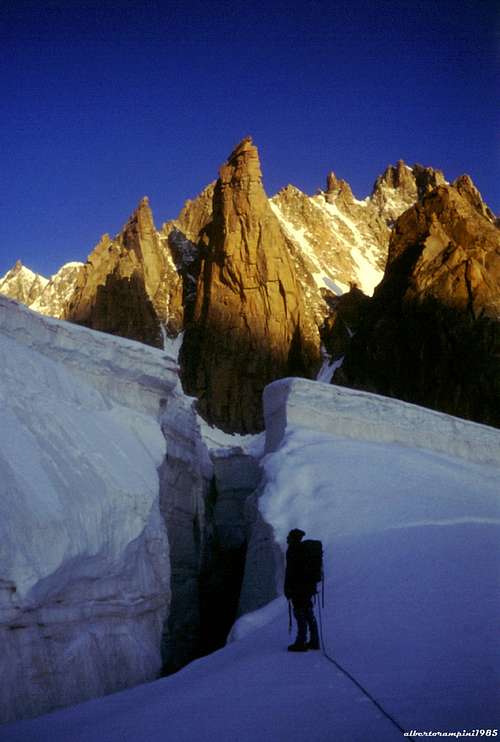
Approaching on Glacier du Gèant |
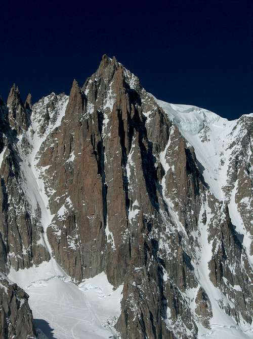
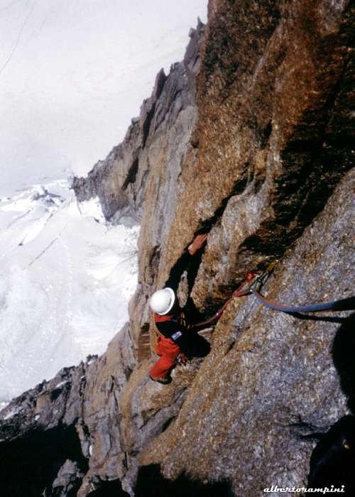
Detail of Tacul pillars |
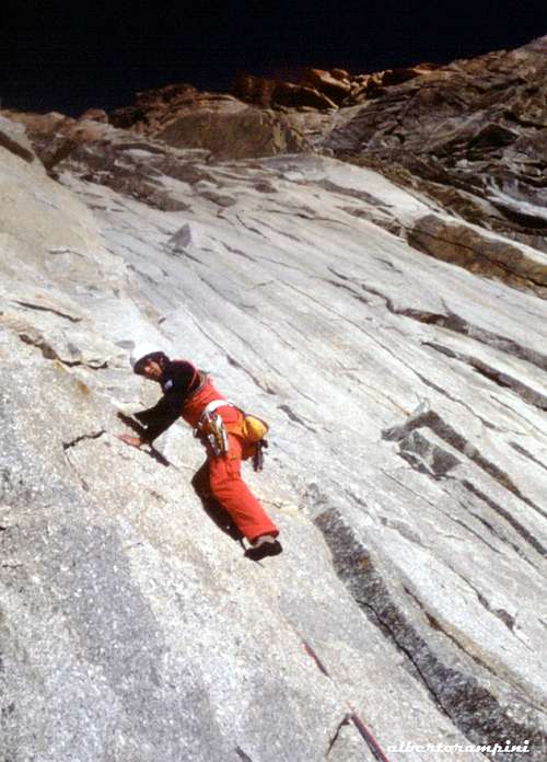
Grey slabs on Mellano-Perego |
Reddish cracks on Mellano-Perego |
Approach from Refuge Cosmiques - Cross the Valleé Blanche towards the Col du Gros Rognon, enter the Valleé Blanche, skirting on the right Pointe Lachenal and the huge East face of Mont Blanc du Tacul, reaching the combe before Pyramide du Tacul, at the base of the spur between Supercouloir on the right and Couloir du Diable on the left.
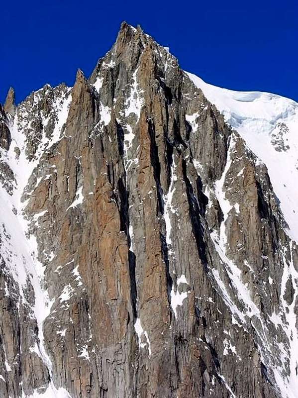
Detail of Pilier Tre Punte (the left one) - Antonio Giani
Route report
Attack about halfway between the lower rocks of the pillar and the Couloir du Diable. Head to a grey chimney-crack, V, 60 m., which allows to overcome the first vertical wall of the pillar and leads to the terraces below a yellow tower, where to the left it forks the Pilier du Diable. Slanting right for about 60 meters along an easy gully, then climb up grey slabs (V), coming out at the base of a wall of red slabs cut by some parallel cracks, which mark the climbing line. Climb a brief grey corner, V and A1, then a 10 meters slab, V. Directly for about another 10 meters, then traverse to the right and then climb directly another slabs, A1 and VI. Head towards two blocks, which are avoided on the right and overcome directly a slight overhang. Climb up some magnificent lengths in free climbing on excellent rock by following the right cracks, V. When the cracks become impassable, traverse left on a blade to take the adjacent left crack. Climb directly a short corner, and then directly again up to a large terrace at the end of the red slabs. (place of the first climbers' bivouac), IV+ and V. Overcome the grey slab above the terrace along a hard thin crack, slantingleft, A2 and V +, 25 m, then the next grey dihedral, barred by an overhang, A1, VI. Climb it to a narrow saddle and the block that forms the highest point of the pillar.
- Tobogan ED, 6b, 450 m. A great route on a beautiful and slender pillar, wrongly rarely attended.
Essential gear
Rope 2x60 m, helmet, quickdraws, a full set of friends and nuts; ice-axe, crampons and gear for the approach on the glacier are needed.Red Tape
No particular restrictions in climbing and hiking.Huts
- Rifugio Torino m. 3375 – C.A.I. Sez. di TorinoGuidebooks and maps
 |
 |
 |
- Guidebooks
“Le topo du Massif du Mont Blanc” Tome 2 by Michel Piola – Editions Equinoxe
"La chaine du Mont Blanc" Vol I - Lucien Devies, Pierre Henry - Guide Vallot “
"Mont Blanc Supercrack” by Lamberto Camurri and Giovanni Bassanini, 2012
“Monte Bianco” Vol. I by Gino Buscaini – Collana Guide dei Monti d’Italia CAI-TCI
- Maps
- Meridiani Montagne “ Monte Bianco” map 1:30.000
- Swiss Topo 292 Courmayeur
- IGN 3531ET St.Gervais Les Bains – Massif du Mont Blanc