


-
 110231 Hits
-
 96.47% Score
-
 60 Votes
|
|
Mountain/Rock |
|---|---|
|
|
45.85754°N / 6.88691°E |
|
|
Mountaineering, Trad Climbing, Ice Climbing, Big Wall, Mixed, Skiing |
|
|
Spring, Summer |
|
|
13937 ft / 4248 m |
|
|
Overview
This page will be kept in honour of the SP member Rahel Maria Liu, the former owner of this page, died on 25 August 2004 in a freak snowstorm on the Innominata Ridge (Southern side of Monte Bianco) at the age of 34.
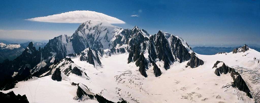
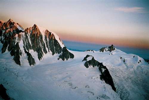
Mont Blanc du Tacul 4248 m
Mont Blanc du Tacul is one of the main summits belonging at Mont Blanc Group, together with Mont Blanc 4810 m, Monte Bianco di Courmayeur 4765 m, Mont Maudit 4465 m, Dôme du Gouter 4304 m, Aiguille de Bionassay 4025 m. Mont Blanc du Tacul is entirely located on the French side of the massif, between the Aiguille du Midi and the Mont Maudit. The summit is made up of two peaks: the Western peak, the highest, from which originates a northward ridge that forms the Northern shoulder 4130 m, and the Eastern peak. Check here the complete list of the 82 alpine Fourthousanders and the 46 minor summits: Club4000.
The mountain is located on the long succession of peaks starting with the Aiguille du Midi and rising to the main summit of Mont Blanc. Along this ridge it is located the 3 Monts Blanc route (Mont Blanc du Tacul, Mont Maudit and Mont Blanc), the finest route among the Normal ones to summit the Mont Blanc.
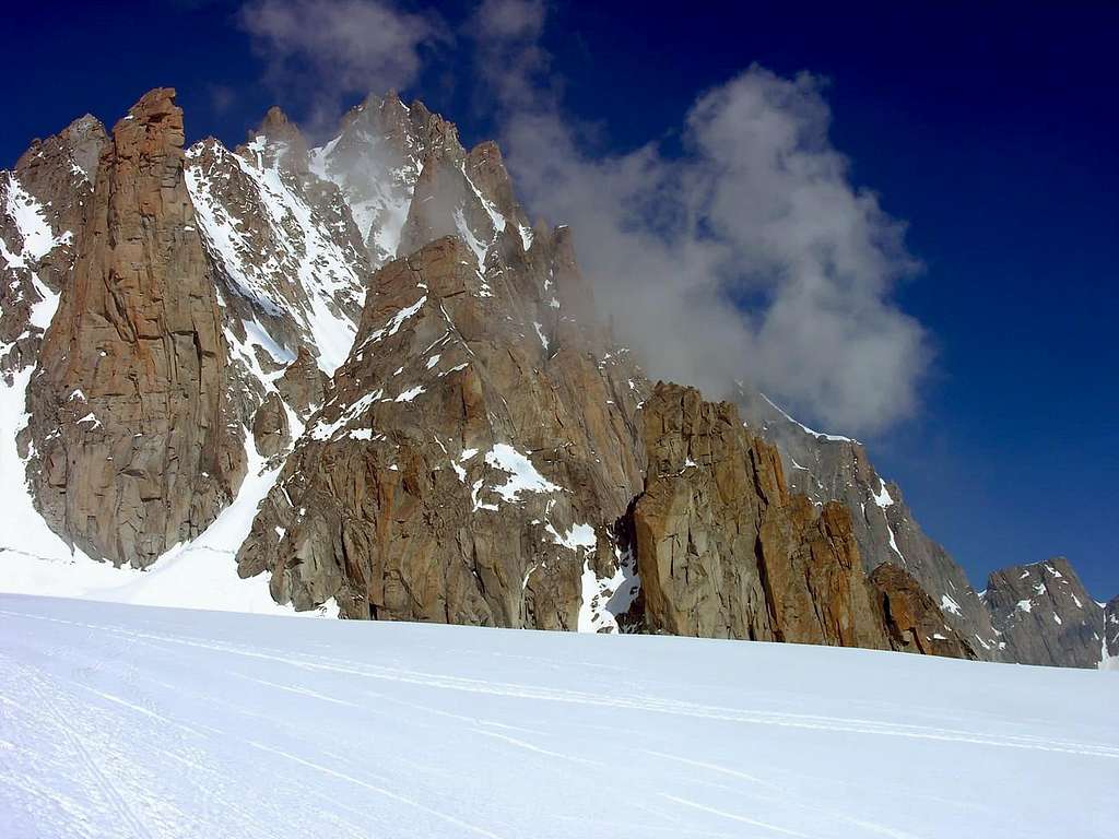
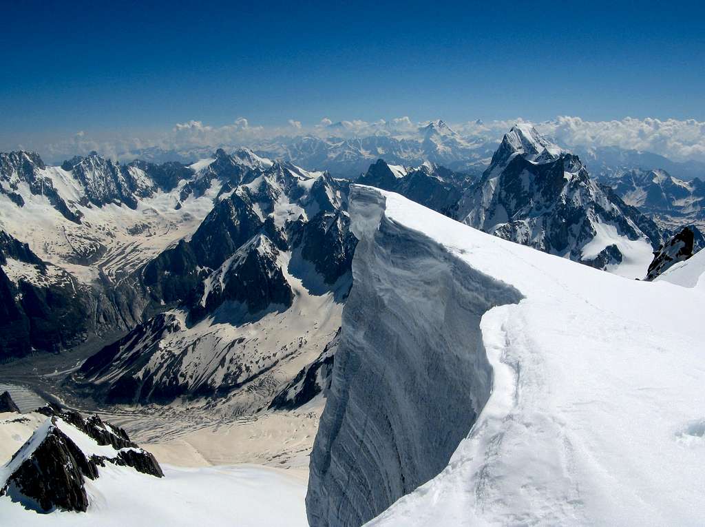
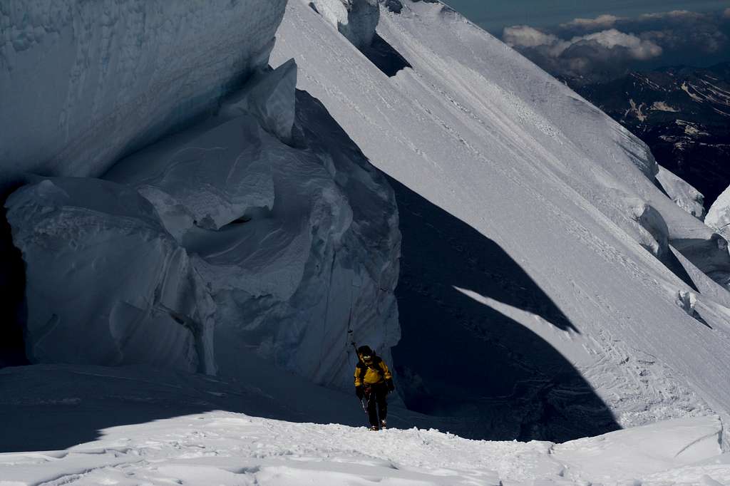
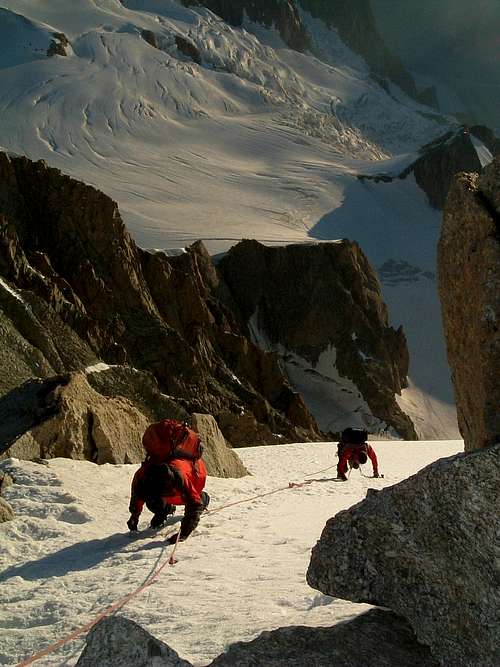
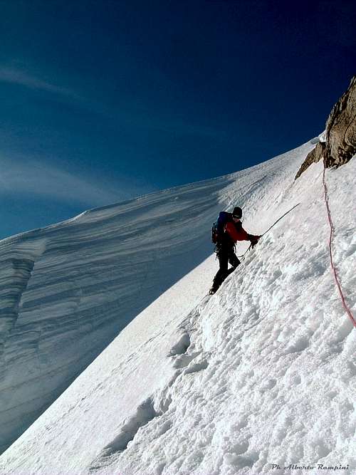
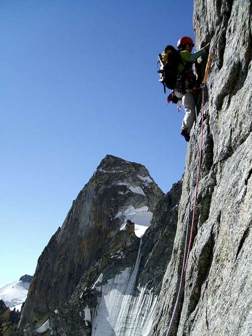
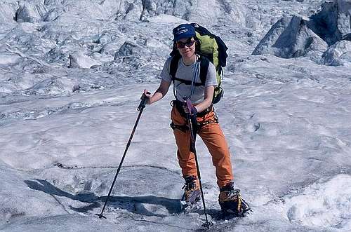
Mont Blanc du Tacul is a very complex mountain, full of walls, ridges, gullies, pillars, towers and gendarmes. The stunning Mont Blanc du Tacul overlooks the Valleé Blanche with its Eastern face. This sunny and magnificent East side is a complex, high and large slope showing towers, gullies and spurs interspersed with snow and ice gullies, absolutely fascinating. At its feet are located the so-called "satellites of Mont Blanc du Tacul", beautiful spiers characterized by excellent granite quality and therefore offering several and beautiful rock climbing routes. The Western side of the mountain is instead almost entirely covered by ice with a slope showing many crevasses and seracs. On this ice slope it runs the Normal route to the summit, a 3 hours of climb away from the Refuge des Cosmiques along the glacier on the NW side with variety of snow and ice types. From the Aiguille du Midi cable car you can reach the refuge by descending about 300 meters (45 mn). The route is not very long but it's necessary you take care of snow, seracs, and weather conditions.
It can become cold and windy in a very short time. In clouds it's not easy to find the route on the glacier and there are some big crevasses near Col du Midi. The way from col du Midi to the summit is at first a steep glacier walk with difficulty PD+. That is a reasonable difficulty for crevassed route. The second part of the ascent route to the "Epaule" is exposed: long steep snow/ice slope over some big serac cliffs. The last 30 meters to the summit are of ice and rocks and partially exposed over the steep East face. This route can be combined with the ridge ''Arete des Cosmiques '' on the Aiguille du Midi. Difficulty AD with rockclimbing III+.
Mont Blanc du Tacul is one of the most climbed peaks in Chamonix Valley because of its location along the 3 Mount Blanc route and its short access from the Aiguille du Midi cable car. Don't forget the objective dangers of this face (Snow or Seracs avalanches, crevasses, fog), especially when coming back late from long routes (Mt Blanc du Tacul East side, Mont Maudit routes, Mont Blanc 3M route, or Mont Blanc Traverse).
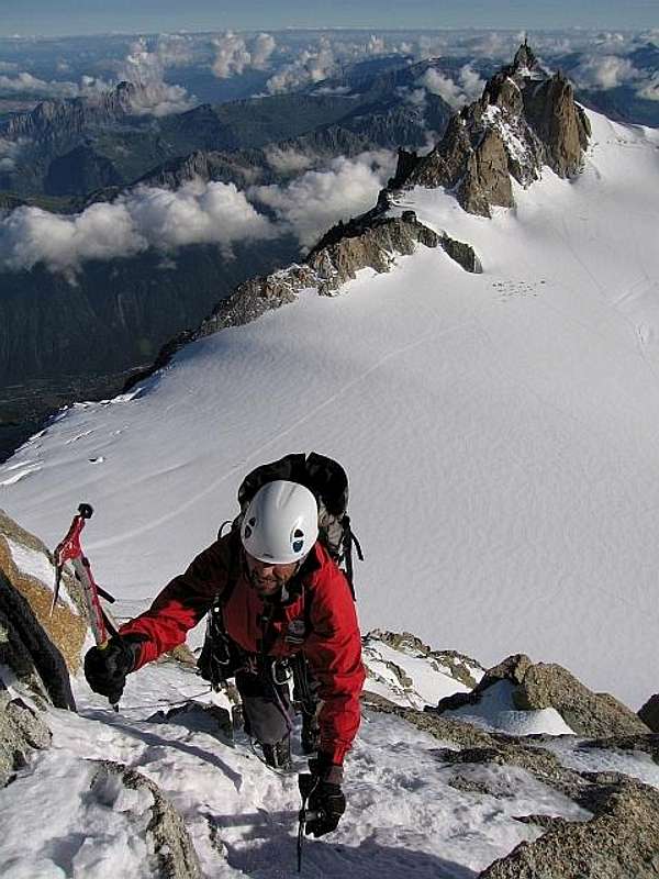
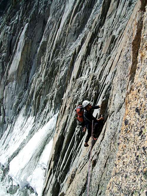
As told Mont Blanc du Tacul is also known in reason of it's steep and rock and ice East face (see routes and links for details). Below is a hint of the best classic routes of the East face:
- Couloir Gervasutti (800hm, 3450m to 4228m, D-, 2-8h, start from Cosmiques hut or Torino hut)
- Pilier Boccalatte (800hm, 3430m to 4248m,TD, 5-7h, start from Cosmiques hut or Torino hut)
- Pilier Gervasutti (800hm, 3400m to 4248m,TD, 7-10h, start from Cosmiques hut or Torino hut)
 |
 |
 |
 |
 |
Climbing history
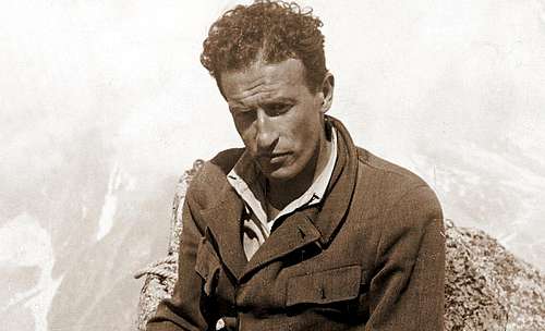
The first ascent of the peak was probably done by one or more members of the Hudson-Kennedy team in the year 1855, August 8th. Important and fine routes that have made the history of mountain climbing are the Couloir Gervasutti (Renato Chabod and Giusto Gervasutti, 1934 August 13th), the Pilier Boccalatte (Ninì Pietrasanta and Gabriele Boccalatte, 1936 August 28th) and the Pilier Gervasutti, attempted in the year 1946, September 16th by Giusto Gervasutti, who died in the attempt while abseiling because of bad weather. Several years later this pilier was climbed by Piero Fornelli and Giovanni Mauro in the year 1951, July 29-30 and dedicated to Gervasutti. Subsequently, numerous high-difficulty routes were realized both on rock and on ice, on the satellites and on the rock pillars and on the couloir glaciers of the East wall, among which several even in very recent years.
Getting There
You can reach Mont Blanc du Tacul both from Chamonix and Courmayeur
Approach from Chamonix
The best starting point to climb is Chamonix Mont Blanc, located on the French side of Mont Blanc, close to the entrance of Tunnel of Monte Bianco; the peak can be reached also from Courmayeur, in the Italian side of Monte Bianco, but the approach walk is quite longer.
You reach the Chamonix Valley by train:
- From Martigny (Switzerland) via Vallorcine
- From Geneva (airport) via Anncey (TGV till here) and St. Gervais
You reach the Chamonix Valley by bus:
- From/via Annecy, Geneva, Grenoble, Courmayeur, Aoste and Turin
You reach Chamonix by car from Switzerland:
- From Martigny follow the road leading to the Switzerland – France border, then to the village of Argentiere and to Chamonix (44 km. from Martigny, 12 km. from the border).
- From Geneva follow the E25 Motorway to St. Gervais les Bains, then the RN 205 to Chamonix
You reach Chamonix by car from Italy
- From Courmayeur through the Mont Blanc tunnel. Once getting to Chamonix take the Téléphérique de l’Aiguille du Midi. Info on COMPAGNIE DU MONT BLANC
Approach from Courmayeur
Another possible starting point is Courmayeur, lying in the Italian side of Monte Bianco, close to the entrance of Tunnel of Monte Bianco.
- From Turin and Milan: follow the A5-E25 Motorway and exit Courmayeur, reaching the hamlet of La Palud m. 1370.
- From France: through the Tunnel of Monte Bianco
- From Switzerland: through the Great St.Bernard Tunnel or the Great St.Bernard Col or via Chamonix and Tunnel of Monte Bianco.
Getting to Rifugio Torino
From Entrèves - La Palud take the cable-car leading directly to Punta Helbronner or Rifugio Torino (Rifugio Torino exit second station, the first one is the middle Pavillion station, the third one is Punta Helbronner).FUNIVIE DEL MONTE BIANCO
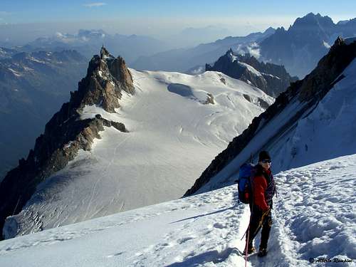
The approach from Rifugio Torino or Punta Helbronner to the route on the East side is done across the Glacier du Geant. The approach to the Normal route requires the complete traverse across the glacier to the Aiguille du Midi.
Approach to the route
1. To the Mont Blanc du Tacul
- You can approach from the Ref. Cosmiques/Biv. Abri Simond
- You can approach from the Rif. Torino or the upper Punta Helbronner
2. To the Refuge Cosmiques and the Bivouac Abri Simond
- You reach the Aig. du Midi with cable car from Chamonix. In Chamonix take the Téléphérique de l’Aiguille du Midi. Info on COMPAGNIE DU MONT BLANC
From the upper cable-car station of Aiguille du Midi you reach the hut in about 1/2 h. If you leave the cable car station via the bridge, you go to the Southsummit. On the firn ridge, you go down with SE-direction to an even ridgeplatform on the glacier. Then turn right to the S and SW-direction below the S-face of the Aig. du Midi. Pay attention to crevasses!
3. To the Rifugio Torino
- You reach Rifugio Torino or the upper Punta Helbronner directly with the cable car from Entrèves/Courmayeur (Italy). From Entrèves - La Palud take the cable-car leading directly to Punta Helbronner or Rifugio Torino (Rifugio Torino exit second station, the first one is the middle Pavillion station, the third one is Punta Helbronner). FUNIVIE DEL MONTE BIANCO Pay attention: The Helbronner-Aiguille du Midi cable car, traversing the Géant glacier, is mostly closed.
The approach from Rifugio Torino or Punta Helbronner to the routes on the East side is done across the Glacier du Geant. The approach to the Normal route require the complete traverse across the glacier to the Aiguille du Midi.
Routes Overview
The Mont Blanc du Tacul has altogether more than 40 different routes. Some of them are:
A. North-West flank
- Normal route PD+, 40°, mostly less, very fine glacier-tour with partly big crevasses! After new snowfall, avalanches also in summer are possible! 700 hm from Col du Midi, 2,5 h (Eberlein). See here on SP the full description: Mont Blanc du Tacul NW Flank Normal route
B. Triangle and North face (the order of the following routes: from W to E (according to Damilano/Perroux)
1. Chéré couloir:
- 80° (short passage), 70° (1 rope length), the rest 50°-60°, D+, short, interesting ice couloir, frequently climbed, 300 hm, 3-4 h (Eberlein)
- II 4. 350 hm, ice till 85° (Damilano/Perroux)
2. Goulotte du sérac : III 4. 180 m
3. Goulotte Perroux : III 4+, 5b, 350 hm, ice till 70°
4. Le temps est assassin : II 4. 350 hm, mixed
5. Eperon N. : III 4. 350 hm, ice till 50°
6. Contamine Mazeaud rectifiée : III 4. 350 hm, ice till 80°
7. Contamine Mazeaud : II AD+. 350 hm, ice till 65°
8. Directissime : III 4+. 350 hm
9. Gabbarou-Marquis : III 4. 350 hm, ice till 65°
10. Contamine Grisolles : II AD. 350 hm, ice till 60°
11. Petit Frounet : II D. 350 hm
12. Contamine-Négri : IV 2. 350 hm, ice till 70°
13. Voie diagonale : III AD+. 350 hm
14. Pibarot-ci, Pibarot-1à : V 4 à 5. 500 hm
15. La main dans le sac : V 5 à 6. 500 hm
16. La tête dans les Etoiles : V 5 à 6. 500 hm
17. Arête E : IV 2. 600 hm, ice till 70°
C. East Face (order of the routes from N to S according to Damilano/Perroux
1. Scotch on the Rocks: IV 7, M. 450 hm
2. Pinochio: IV 6+. 450 hm
3. Modica-Noury: III 5+. 500 hm
4. Gabarrou-Albinoni:
- III 4+, 500 hm, ice till 85 ° (Damilano/Perroux)
- IV, TD-, 600 hm, ice till 80°, mixed, very beautiful small ice couloir with some very extreme steep passages, 4-6 h (Eberlein)
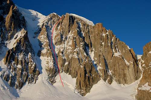
5 Hidden Couloir: III 4, 4c, 600 hm, ice till 80°, mixed
6. Direct climbing of the Hidden Couloir: IV 5. 200 m
7. Couloir Jaeger: II D. 600 m, ice till 60°, beautiful couloir
8. Couloir Gervasutti (classic climbing out to the right side/Terray-Lachenal) :
- D-, ice till 55°, average: 50°, famous ice tour, objectively dangerous because of rock and ice fall and avalanches, 700 hm, 2-6 h, also as "ski extreme" by people gone down (Eberlein)
- V D, 600 hm, till 55° (Damilano/Perroux)
8. Couloir Gervasutti (climbing out to the left side/Chabod-Gervasutti): V 1, 800 hm, ice till 60° (Damilano/Perroux)
9. Couloir Macho: IV 2, 800 hm, ice till 70°
10. Supercouloir:
- 85°, V+, maybe A1, ED-, famous tour with constant difficulty, best time in spring, 800 hm, 8-10 h (Eberlein)
- IV 5+, 5c/A1, 800 hm (Damilano/Perroux)
All information concerning the valuation of the routes' difficulty (except explicit reference to other books) according to Damilano/Perroux, Neige, Glace Et Mixte: Mont Blanc. Chamonix: Editions Ice, 1996. ISBN 2950986803. PP. 263-285.
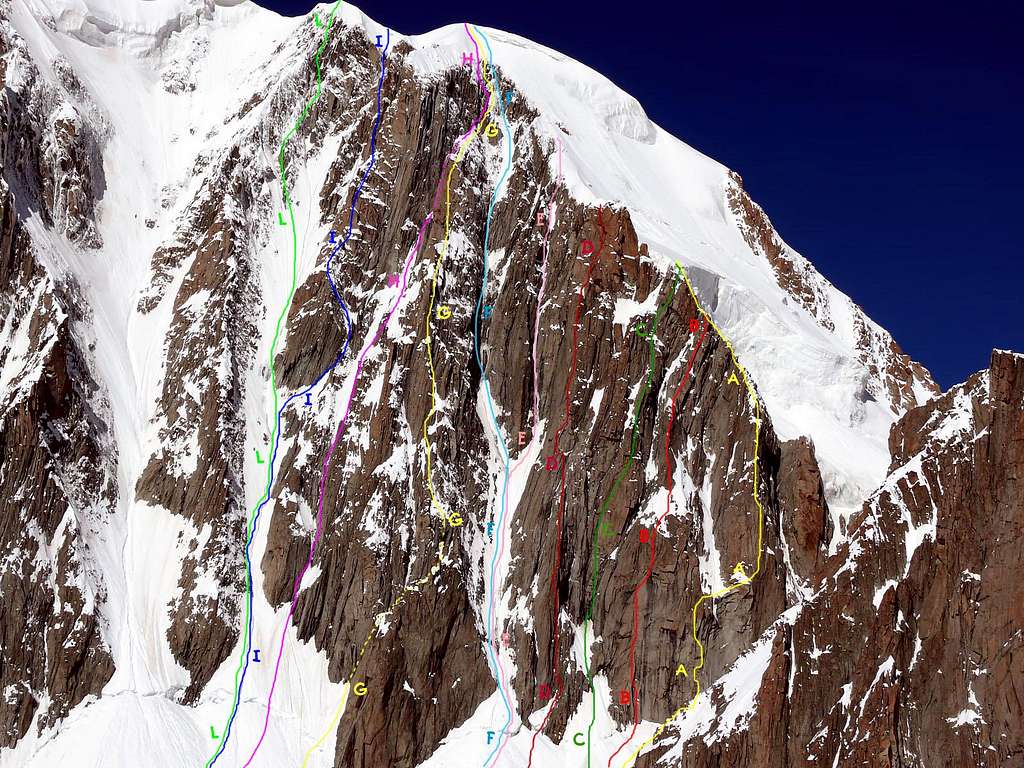
Mont Blanc du Tacul (4.248m), right route
A= Pilier du sérac (via Perroux), Jacques Olivier André, Godefroy Perroux and Philippe Pibarot, (Sep 1990). Difficulty IV°/V°+/A2/6A/TD+ Length: 350m. B= Pilastro di destra (via Damilano), Arnaud Boudet, François Damilano, Jean-Claude Siral and Jean-Luc Vanacher, (Aug 20th, 1990). Difficulty V°+/A0/6A/6B/ED- Length: 350m. C= Pilastro Hagenmüller-Koenig, Jean-François Hagenmüller and Serge Koenig, (Jul 1979). Difficulty V°+/VI°-/TD+ Length: 350m. D= Pilier Martinetti, Marc Martinetti and Christian Mollier, (Aug 23th, 1960). Difficulty III°/IV°/V°/V°+/VI°/TD+ Length: 450m. E= Goulotte Modica-Noury, Gilles Modica and A. Noury, (Jun 23-24th, 1960). Difficulty IV°/ED- Length: 550m. F= Couloir Gabarrou-Albinoni, J. P. Albinoni and Patrick Gabarrou, (Jul 05th, 1974). Difficulty V°/TD+ Length: 600m. G= Pillier Cecchinel, Walter Cecchinel and Charles Daubas, (Aug 11th, 1973). Difficulty III°+/IV°+/V°-/TD- Length: 650m. H= Couloir Griffin, S. Billane and Lindsay Griffin, (Dec 30-31th, 1973 and Jan 01th, 1974). Difficulty IV°/TD Length: 600m. I= Pilier Coreano, Paul Vance and Jaewonn Yu, (Jun 17th, 1977). Difficulty IV°/V°/V°+/TD Length: 300m. L= Couloir Jager, P. Barthélémy and Claude Jager, (Jun 12th, 1964). Difficulty D+ Length: 650m.
More Classic east face routes:
20. Pilier Boccalatte (Boccalatte-Pietrasanta 1936) D/TD - 800m
21. Pilier Gervasutti (Fornelli-Mauro 1951) TD/TD sup - 800m
22. Couloir du Diable and SE ridge (Boccalatte-Chabod 1930) D - 800m
D. South Face
Some almost forgotten routes starting from the Cirque Maudit, first climbed at the beginning of the last century (1902-1914)
further info are missing, should be "classic" high mountain routes.
 |
 |
 |
 |
 |
Glaciers: La Vallée Blanche and la Mer de Glace
The second longest glacier in the Alps after the Aletsch Glacier is descending from Mont Blanc du Tacul to the Chamonix Valley. Its highest part is named Glacier du Géant and Vallée Blanche (White Valley) and the part from ice fall to the end is named Mer de Glace (Ice sea).
Red Tape
There are no permits or fees required. There is no seasonal closure.
When To Climb
Mountaineering: from July to September
Ski-mountaineering: from March to June
Huts
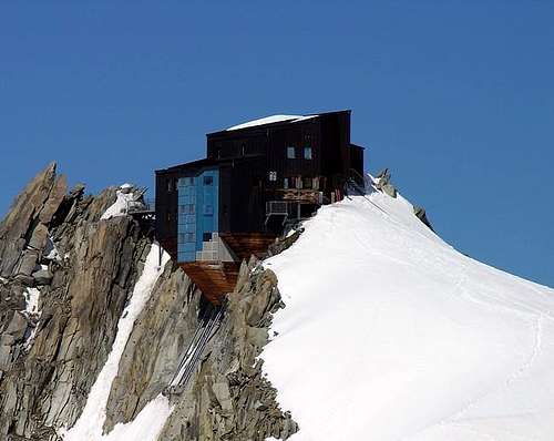
1. Ref. des Cosmiques (3613 m)
The Ref. des Cosmiques is situated on a shoulder between the Col du Midi and the SW-ridge of the Aig. du Midi (Cosmiques-ridge).
according to Eberlein (p. 52):
- 140 beds
- guarded from February till october
- phone: ++33(0)450544016
- internet: Rif. Cosmiques
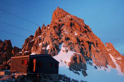
2. Abri Simond Bivouac
The Abri Simond Bivouac is situated just a few meters northern of the Ref. des Cosmiques, just at the beginning of the Arête des Cosmiques.
- 18 beds
- open in winter, when Ref. des Cosmiques is closed
- a few words: I can highly recommend this little bivouac hut of about 30 qm!!! I have stayed there for 1 week in winter (January/February). I promise you: Never in life, you will forget this experience ... when it is -30°C outside, and stormy with 120 km/h, without toilette of course, without heating, without light, without water of course, the hut never been cleaned, you almost poisoned with the vapours of the many gasoline stoves burning hours and hours .... well you must experience it by yourself .... one just cannot describe it!!!
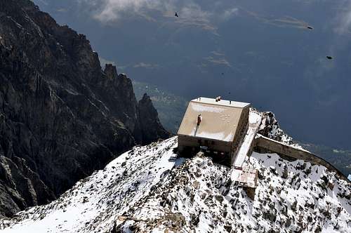
3. Rif. Torino (3322m/3375m)
The Rif. Torino has 2 huts, the lower and older one and the upper, new one. Both huts are connected by a tunnel.
The lower old one according to Eberlein(pp. 64-65):
- 70 beds
- serviced from October to June
- Tel. 00390/165/846484
the upper new one according to Eberlein (pp. 65-65):
- 170 beds
- serviced from June to September
- Tel. 00390/165/844034 (expensive)
Accomodation
Chamonix is a primary destination, offering various kind of accomodation (hotels, huts, gites, renting rooms). Numberless campsites are situated both in the Northern and Southern ends of the town.
Main campsites:
- Camping la Mer de Glace - Les Praz (3 km. North to Chamonix) +33(0)450534403
- Camping les Deux Glaciers - Les Bossons (3 km. South to Chamonix) +33(0)450531584
- Camping les Arolles - close to the centre of Chamonix - +33(0)450531430
- Camping les Cimes - Les Bossons (3 km. South to Chamonix) +33(0)450535893
- Camping les Marmottes - +33(0)450536124
- Camping Glacier d'Argentière - Argentière (8 km. North to Chamonix) +33(0)450541736
 |
 |
 |
General info
- Office de la Haute Montagne de Chamonix Phone +33 0450 532208 (9:00-12:00 & 15:00-18:00 during the summer) Office de Haute Montagne Chamonix
- Cable-car informations Phone +33 0450 532275 Compagnie du MontBlanc
- Office du Tourisme de Chamonix Phone +33 0450 530024 Chamonix Mont-Blanc
Meteo and Mountain Conditions
You can get excellent information about weather, conditions and routes at the "Compagnie des Guides de Hauts Montagnes" (cieguides-chamonix.com, tel: 50 53 00 88) or the "Maison de la Montagne" at the "place de l'Église" in Chamonix. Don't be afraid to step into their building, its common practice, people are constantly walking in and out. By no means you are expected to hire a guide when you visit.
2. GENERAL INFOS:
- Bureau des Guides in Chamonix: 0033/450530088.
- Office de Tourisme in Chamonix: 0033/450530024
- Office de Tourisme Argentière: 0033/450540214
- internet:
- www.chamonix.com
- www.courmayer-montblanc.com
- www.aiguilledumidi.com
3. TRAIN (CHAMONIX VALLEY):
- 0033/450 53 1298
- 0033/8 36 35 35 35
- 0033/450530702 (train station Chamonix)
- internet:www.cff.ch
4. BUS (CHAMONIX VALLEY):
- 0033/450 53 0555
- 0033/450 53 0115
5. CABLE CARS
- COMPAGNIE DU MONT BLANC 0033/450/533080
- FUNIVIE DEL MONTE BIANCO Tel. 00390/165.846658, Fax 00390/165.842347
Guidebooks and maps
"Monte Bianco Vol. 2" Guida Vallot by François Labande
"The Mont Blanc Massif - The 100 Finest Routes" by Gaston Rebuffat - London 1996
Map
3630 OT (Chamonix) Institut Géographique National - 1:25000
3531 OT (St Gervais) 1:25000
Books
- Damilano/Perroux, Neige, Glace Et Mixte: Mont Blanc. Chamonix: Editions Ice, 1996.
ISBN 2950986803 - Helmut Dumler/Willi P. Burkhardt, Viertausender der Alpen. 11th ed. Munich 1998.
ISBN 3-7633-7427-2
(to order at amazon.de) - Helmut Dumler/Willi P. Burkhardt, The High Mountains of the Alps. Seattle: The Mountaineers Books, 1994.
ISBN 0898863783
(to order at amazon.com) - Hartmut Eberlein: Mont-Blanc-Gruppe. DAV-Gebietsführer. 9th ed. Munich 2000.
ISBN 3-7633-2414-3
(to order at amazon.de) - Goedeke, Richard: The Alpine 4000m peaks by the Classic Routes. Birmingham: Menacha Ridge Press, 1997.
ISBN 0897321111
(to order at amazon.com) - Laroche/Lelong: Die Gipfel des Montblanc. Munich 1999.
ISBN 3-405-15693-9
(to order at amazon.de) - Michel Piola: Mont Blanc Topo Guide Vol. 1 (Rock). Published by Editions Equinoxe 1988. Distributed by Cordee £17.95
ISBN 904405281 - Michel Piola: Mont Blanc Topo Guide Vol. 2 . Published by Editions Equinoxe 1993. Distributed by Cordee £17.95
ISBN Unknown - Gaston Rébuffat: The Mont Blanc Massif. The 100 Finest Routes. London 1996.
ISBN 1-898573-03-4
(to order at amazon.de or at amazon.com) - Erich Vanis, Im steilen Eis. Munich 1980.
ISBN 3-405-12158-2
(to order at: online-buchvertrieb.de
Global views taken from Aiguille du Midi or from vallée Blanche cable car
 |
 |
 |
 |
 |
NW flank pictures
 |
 |
 |
 |
 |
N ridge and E face pictures
 |
 |
 |
 |
 |
Triangle du Tacul Pictures
 |
 |
 |
 |
 |
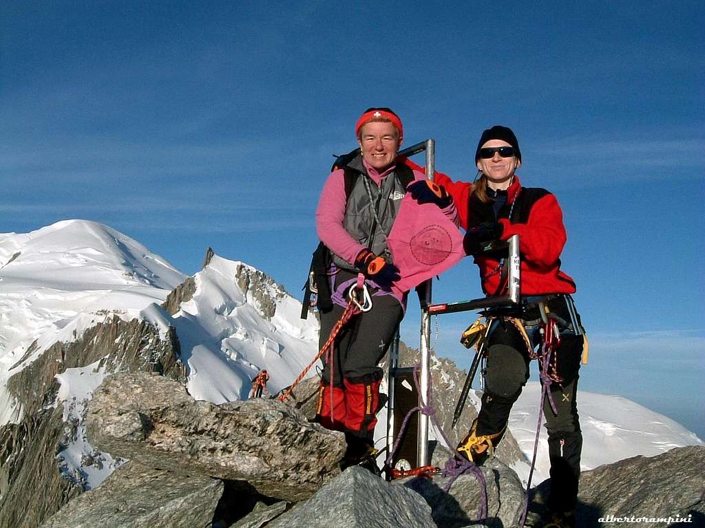
Summits pictures
 |
 |
 |
 |
 |
Panorama from summit
 |
 |
 |
Dedication to Rahel
This page has been build mostly by Rahel Maria Liu, an early SummitPost member died for hypotermia on 24-25 August 2004 after being caught in a freak snowstorm while attempting to climb the Innominata Spur on the Southern (Italian) side of Mont Blanc. She was only 34 years old.
Edward Allen, her climbing companion (a British climber known some days early), was saved by an helicopter of the Italian Rescue team. Rahel was a charter member during SP early days and her work here remains among the best of SP's collected contributions. Her knowledge and experience has made an impact on the world mountaineering community, and her warmth and friendship will be long remembered among her many friends and fellow members here at SummitPost. She will be greatly missed by us all. Continued maintenance of this page is in her memory.
External Links
- Mont Blanc interactive webcam
usefull for having nice panorama from home or weather live checking - General info on Chamonix valley
compilation of information about Chamonix - Aiguille du Midi Cable Car
Opening hours - Reservations - Mont Blanc du Tacul at www.4000er.de
Images, routes, coordinates and more information about the highest peaks of the Alps
Chucky - Sep 14, 2002 1:51 pm - Hasn't voted
Untitled CommentAccording to a sign I saw posted on Aiguille du Midi, at the exit to the "haute montagne" area, persons can set up tents pretty much any place they choose on the mountain, free of charge, provided the tents are up after sunset and down before sunrise. During the week of 10-13 September, 2002, I noted a number of tents up at "high noon," in the Col du Midi (3,532 meters). No one seemed to care and I certainly did not see anyone out there performing official duties, fining campers, or ordering them to depart the area.