|
|
Mountain/Rock |
|---|---|
|
|
41.45300°N / 106.517°W |
|
|
Carbon |
|
|
Summer, Fall |
|
|
10810 ft / 3295 m |
|
|
Overview
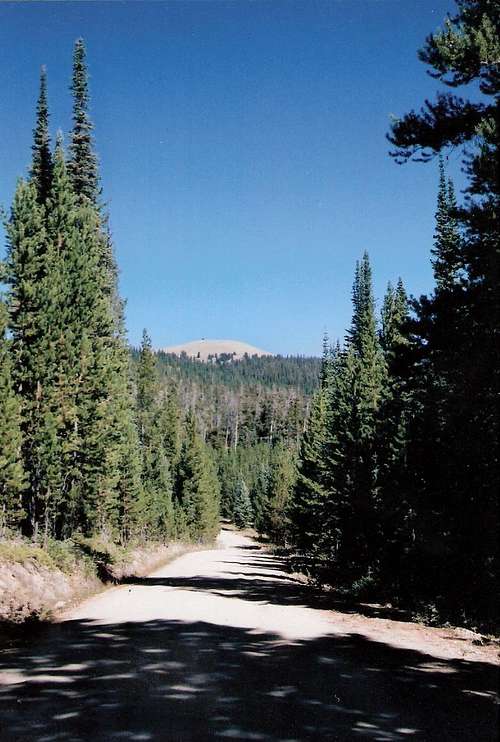
Kennaday Peak is on the Brush Creek-Hayden Ranger District of the Medicine Bow-Routt National Forests in southern Wyoming. It is the site of a manned fire lookout, the last fully functional lookout on the district. From Kennaday Peak there is a breathtaking 360-degree view of the surrounding mountains, including Medicine Bow Peak in the Snowy Range, and the vast Platte River Valley. The fire lookout welcomes visitors and has a photo display of other fire lookouts and firefighter gear.The first fire lookout on Kennaday Peak was built by the CCC in the 1930's and it was one of six in the area. In 1964 the present 15’x 15’ R-6 flattop with catwalk was built on a 10’ concrete block base.
Getting There
From Hwy 130 east of Saratoga turn north on the North Brush Creek Road (Road 100). After about 10 miles you'll come to Road 215. Turn left and on this road you can drive almost to the top of Kennaday Peak. This road is rough in spots so a vehicle with high clearance is recommended. A short walk then a short but steep flight of stairs gets you into the 14-foot-square glass observation room of the Kennaday Peak Lookout. From this vantage point far above the treeline, you can view a remarkable panorama.One can do a longer hike to the top, but there are no maintained trails. Forest Road 261 circles the peak to the north and may be a good starting point.
These Forest Service Roads are typically open from June/July through September/October.
Red Tape
No permits are needed to hike to Kennaday Peak. Please practice Leave No Trace ethics on your visit.Camping
Lincoln Park, Brush Creek, and Bow River Campgrounds are not far from Kennaday Peak. Link to Campground InfoExternal Links
Medicine Bow-Routt National ForestsNational Weather Service for Cheyenne Click on the map about 15 miles east of Saratoga for the weather near Kennaday Peak.
Etymology
Kennaday Peak, formerly called Bald Mountain or Old Baldy, was named after an early homesteader and forest ranger, Jack Kennaday.For More Info
Contact the Brush Creek Ranger Station:South Hwy. 130/230
PO Box 249
Saratoga, WY 82331
307-326-5258
The Brush Creek Visitor Center near the turnoff for Road 100 is open May through October. Here you can buy books and maps and see visitor information displays.


