
-
 8145 Hits
-
 82.47% Score
-
 15 Votes
|
|
Mountain/Rock |
|---|---|
|
|
38.94947°N / 78.33482°W |
|
|
Shenandoah |
|
|
2393 ft / 729 m |
|
|
Overview

Meneka Peak stands near the northern end of the Massanutten Mountains. Although it is overshadowed by its popular neignbor Signal Knob, Meneka Peak still gets a respectable amount of traffic. There are no shortcuts to the summit of Meneka; the routes to the summit are between 8 and 10 miles long and are often rocky. One of the routes goes over Signal Knob, where great views are available of the town of Strasburg and the mountains to the west. The other route allows for good views of the Massanutten Mountains to the east. It is also possible to combine a hike to Meneka Peak with a canoe trip down nearby Passage Creek.
Getting There

From Elizabeth Furnace: From Front Royal, drive west on Route 55 until reaching SR 678. Turn left onto SR 678 and follow it for 3.4 miles to the Signal Knob parking lot, which is on the right.
From the right (or north) end of the parking lot, hike on the orange-blazed Massanutten Trail for 3.4 miles to the white-blazed Meneka Peak Trail. Along the way, stop at the two overlooks and enjoy the views. Make a left on the white-blazed Meneka Peak Trail and follow it for 0.5 miles to the summit. There will be a campfire ring about 30 feet off the trail here on the right. The summit benchmark will be between the trail and the fire ring about 5 to 6 feet from the trail.
Follow the Meneka Peak Trail for 0.7 miles to the Tuscarora Trail. Turn left on the blue-blazed Tuscarora Trail, which leads back to the Massanutten Trail after 3.5 miles. Make another left on the Massanutten Trail and follow it back to the parking lot.
Round trip: 8.7 miles with an elevation gain of nearly 1,700 feet.
If you have a full day, it is possible to combine this hike with a canoe trip down Passage Creek. There are sites in the Elizabeth Furnace Recreation Area about 0.6 miles to the right of the Signal Knob Parking Lot where you can put your canoe into the creek. It is about 6 miles downstream to where you take your canoe out; rapids tend to be Class II and Class III.
 USFS Cabin |
 Point 2015 Point 2015 |
 Buzzard Rock |
From Little Fort Valley: From Front Royal, drive west on Route 55 until reaching SR 678. Turn left onto SR 678 and follow it to SR 771, where you make a right. Follow SR 771 until reaching a fork in the road. Bear right on FR 273, and after 0.6 miles, turn right on FR 66. Follow FR 66 until reaching the closed gate across the road. There are parking spaces for a few cars on the right side.
Start hiking past the closed gate on FR 66, which is also the orange-blazed Massanutten Trail at this point. After 1.9 miles, the Massanutten Trail separates from FR 66; bear left at this point. The trail rejoins FR 66 after another 0.6 miles. The blue-blazed Tusacarora Trail crosses FR 66 after an additional 0.3 miles. The trail has made a smooth and very gradual ascent up to this point; it becomes steeper and rockier afterwords.
Reach Signal Knob after 4 miles of hiking. Enjoy the views to the west and continue on the Massanutten Trail for an additional 1.1 miles. The trail is mostly level but quite rocky over this stretch. Make a right on the white-blazed Meneka Peak Trail and follow it for 0.5 miles to the summit. There will be a campfire ring about 30 feet off the trail here on the right. The summit benchmark will be between the trail and the fire ring about 5 to 6 feet from the trail.
Follow the Meneka Peak Trail for 0.7 miles to the Tuscarora Trail. Turn right on the Tuscarora Trail, which leads back to the Massanutten Trail after 0.7 miles. Turn left on the Massanutten Trail and follow it for 2.8 miles back to the parking lot.
Round trip: About 10 miles with an elevation gain of 1,300 feet.
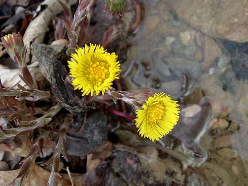
Flowers in Little Fort Valley
Red Tape
Meneka Peak and the routes to its summit are on public land in the George Washington National Forest. There are no fees or permits required for hiking or camping except at Elizabeth Furnace.
Camping
Free camping is permitted throughout the George Washington National Forest except in the immediate vicinity of picnic areas and a few other locations. Campsites are available at the summits of Meneka and Signal Peak. There are also campsites near the trail junctions of the Massanutten and Tuscarora Trails and the Meneka Peak and Tuscarora Trails.
Elizabeth Furnace Recreation Area has a large campsite with restrooms and picnic areas. The fee is $10 per night; contact the Lee Ranger District for further information.
When to Climb
Meneka Peak can be climbed nearly all year round. The hike can be particularly delightful from mid-October through mid-November because of the autumn colors. July and August are the worst months for heat, humidity, haze that limits views, and hostile little critters like ticks, yellowjackets, and mosquitoes. The best time for a summer hike is early in the morning.
Hiking should be avoided in the National Forest during the period in late November when it is permissible to hunt deer with modern firearms. In 2019, deer season runs from November 16 through November 30.
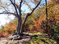
Change of Seasons
 |
 |
 |
External Links
George Washington National Forest- Lee Ranger DistrictThe Potomac Appalachian Trail Club maintains the trails in the Massanutten Mountains, and provides maps, guidebooks, and other information.
American Whitewater offers some more details about canoeing Passage Creek.