
-
 18598 Hits
-
 82.48% Score
-
 15 Votes
|
|
Mountain/Rock |
|---|---|
|
|
48.78348°N / 121.17195°W |
|
|
Download GPX » View Route on Map |
|
|
Hiking, Mountaineering |
|
|
Spring, Summer, Fall, Winter |
|
|
6728 ft / 2051 m |
|
|
Overview

Wind Blown Snow Slope
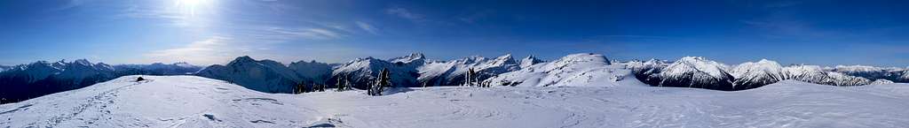
Stetattle Ridge Panorama : Taken Feb 18, 2010
 Snowfield Peak |  Crux during Summer |  Stetattle in Winter |  Looking East |  Excited to be Out |
Getting There

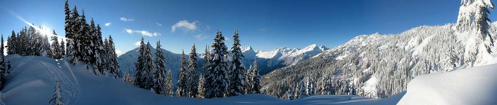
View from the Trailhead
Coming in from Seattle:
Drive North to Seattle until you get to Darrington which you get off at exit 208 to Arlington. Take a right onto highway 530 which goes into Arlington. From Arlington take a left briefly onto highway 9 which in a few seconds you'll then turn right back onto highway 530 (don't ask me why they have the road set up this way). Then continue heading East for 27 miles until you get to Darrington. In Darrington you'll see a shell gas station which you take a left (north) which continues highway 530 (to the right is the Mountain Loop Highway). Eventually you'll end up in Rockport which you should take a right onto highway 20. From here you'll pass through Marblemount, Newhalem, and then Diablo. Before crossing the bridge that goes over Gorge Lake you'll see a road called "Diablo Street" which you go down until you pass a little gate booth which you'll see a little area to park the car. There's a trail sign which the hike starts off going behind a house and then goes up.
Route Information
So you start off on a decently paved trail (although can have a lot of fallen over trees in early season) which has a few switch backs, but mostly traverses the mountain. For a few thousand feet your in the woods, eventually you want to leave the trail and enter onto the ridge.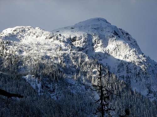
Mount Davis from the Trail
 Snowfield Peak |  Looking Towards Diablo Lake |  The Trail Starting Out |  Plowing through Snow |
In order to find the ridge in the first place you will notice that the trail stopped switch backing and will cross over onto the north Side of the mountain. Once your on the ridge keep following it which eventually it will go back down. Once you go back up in winter time this is considered to be the crux of the trip.
After the crux it's pretty basic to get to Stetattle ridge, you then follow along the ridge, you'll see a point where you can go two ways. On your right is the ridge that goes off to Sourdough Mountain, but go left if you want to go up Stetattle Ridge. The views as you go further in just get better and better, you keep hitting high points, it's point 6495 that is considered the true summit.
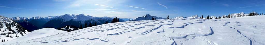
Wind Blown Slabs : Taken Feb 18, 2010
The View of Stetattle Ridge before the Crux
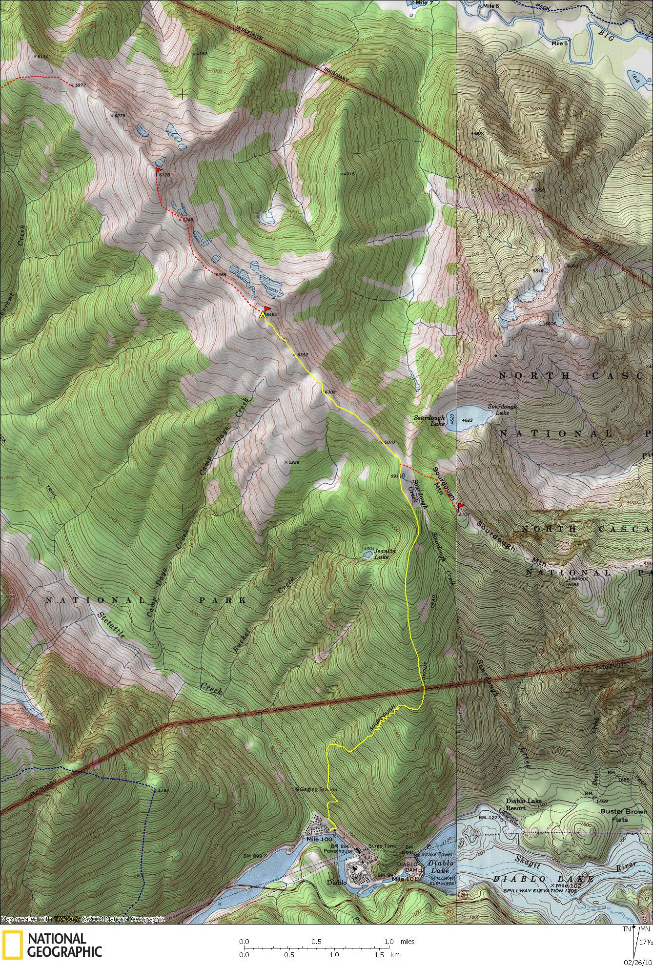
Topographic Maps
Here is a google maps view of the route which I drew up:
|
|
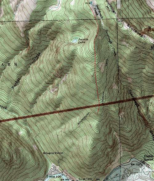

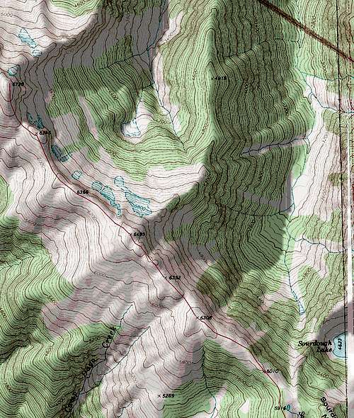
If you want the map all on one page here is a decent Topographic Map of the route.
When to Climb
The road is open all year round, and the ridge can be climbed most of the year. When avalanche danger gets very high it can be dangerous on the crux of the climb which I've set off snow slides and it might be a cornice depending when you go. In summer time it's a nice walk in the park.
Mountain Conditions
For Weather information check in with the Noaa Forecast.
For Avalanche forecast's check in with the North West Avalanche Center.
Be sure to check with Washington State Department of Transportation for road conditions, or NPS for additional road conditions.
Webcam View from the Visitor's Center, Newhalem,WA (yes it's constantly updated for the current conditions)

For Avalanche forecast's check in with the North West Avalanche Center.
Be sure to check with Washington State Department of Transportation for road conditions, or NPS for additional road conditions.
Camping
There are quite a few camping area's on the upper section of Stetattle Ridge. There are a few in the upper woods, and many spots along the ridge.
![Michael setting up Camp]()
Camping on a flat part of the Ridge
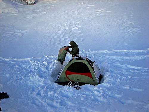
Camping on a flat part of the Ridge
Gear for the Hike

Using Trekking Polls

Melting Snow with the Stove

Snowshoeing though Snow
- Shell Jacket
- 2-3 Liters of Water Per Person
- First Aid Kit
- Map and Compass
Winter Gear:
- Ice Axe
- Crampons
- Sunglasses/Glacier Goggles
- Nylon Shell Pants
- Plenty of Warm Clothes
Overnight Gear:
- Tent/Bivy
- Sleeping Bag
- Ground Pad
- Water Filter/Tablets
- Stove, Fuel, Pot, and utensils (for cooking)
Optional Gear:
- Sun Screen
- Camera
- Trekking Polls
- GPS
Red Tape
A Northwest Forest Pass is needed at the trail head, and if your camping high up you should get a North Cascades Backpacking permit which is free. In later season there are many tarns up on Stetattle Ridge which is nice for filtering water.Wildlife and Flora
 Tiger Lillie |  Wild Red Plants |  Purple Flower |  Orange Flower |
 Ptarmigan in the Woods |  Toad on the Ridge |  Pink-Purple Flower |
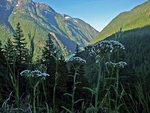
White Flower with Snowfield Peak in the Background
Sunsets and Sunrises
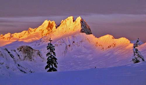
 Sunrise with Trees |  West McMillan Spire |  The Morning Sky |  Sunset over Mount Davis |
 Alpenglow on Sourdough |  Snowfield Peak during Sunset |  The Sun Rising |  Sunrise over Sourdough Mtn |
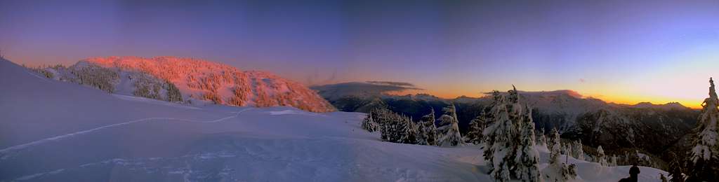
Sunset Panorama from the lower part of the Ridge
Golden Light on the Picket Range
External Links
Here's a few trip reports from nwhikers:
- Stetattle Ridge Sept 26-28 - Displays a set of nice photos during late September.
- Stetattle Ridge 10/1/2010
- Overnight trip on Stetattle 2/21/2010
- A few technical facts can be seen on Peakbagger.