-
 16511 Hits
-
 79.78% Score
-
 11 Votes
|
|
Mountain/Rock |
|---|---|
|
|
48.58875°N / 120.92657°W |
|
|
Hiking, Mountaineering, Scrambling |
|
|
Spring, Summer, Fall |
|
|
8332 ft / 2540 m |
|
|
Overview
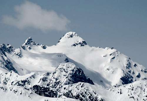
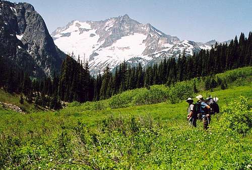
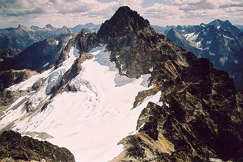
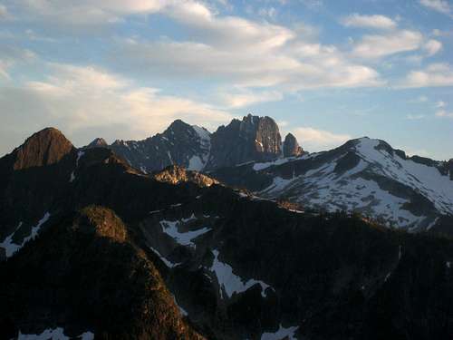
Cosho Peak (AKA "Ragged End") marks the final Bulger Peak on Ragged Ridge. Although the ridge extends considerably further to the west to Red Mountain and beyond, Cosho is typically the farthest climbers go using the Easy Pass approach. Located right in the heart of it all deep within North Cascades National Park, many high peaks can be seen from its summit including the Cascade Pass peaks and Baker to the west, The Pickets to the northwest and Glacier Peak to the south. The rarely visited Panther Creek valley lies directly below to the north.
Any way you look at it, approaching Cosho is a long trek. Many people agree that approaching via the Fisher Creek Trail after hiking over Easy Pass is the simplest way to approach despite the larger amount of elevation gain. Others will say the south side traverse along the entire Ragged Ridge is easier despite miles of sidehill walking and scrambling without a trail. Both options are very scenic and offer challenging ascents.
Getting There - Easy Pass Trailhead
Anyone looking to climb any of the Ragged Ridge Peaks should start at the Easy Pass Trailhead off High 20. This signed trailhead is located on the west side of the highway about 30 miles east of Newhalem.
From Seattle - Take I-5 north to exit 210 and follow WA 530 east to Darrington. Continue as it turns north and meets Highway 20 in Rockport. Turn right (east) onto Highway 20 and continue 8 miles to Marblemount where you can get a free backcountry permit at the ranger office located 1 mile off the highway on Ranger Station Road. Since the peaks along Ragged Ridge lie within the North Cascades National Park this is required. Continue along Highway 20 past Newhalem and look for the sign for the Easy Pass Trailhead roughly 30 miles past Newhalem.
From Winthrop - Drive west on Highway 20 41 miles to the Easy Pass Trailhead on the left.
Approach Options
1 - South Side Traverse via Easy Pass
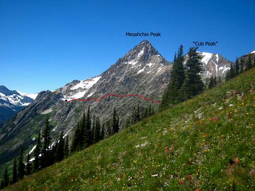
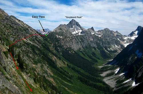
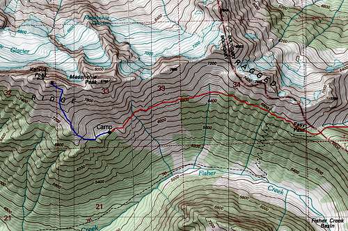
Begin on the trail as it quickly crosses Granite Creek on a very well-built log bridge, and then start climbing. The trail to Easy Pass is 3.6 miles long and gains 2,700 feet, but the trail is in excellent condition. It takes about 2 hours to reach the 6,550 foot pass which is a beautiful place with many larch trees and grassy meadows. Your goal is to get to the small basin at about 6,600 feet just south of Mesahchie Peak with a small knob next to it. I will call this the Ragged Ridge Camp. From Easy Pass it can be seen a mile and a half due west and snow typically lingers in this basin into August.
Begin contouring northwest at the 6,600 to 6,700 foot level along the south face of Kitling Peak. There is a series of small rocky ribs and gullies a short ways from the pass that you can traverse above on grassy terrain around 6,800 feet. After roughly an hour of sidehill traversing you will reach a large basin just south of the Mesahchie Col (the saddle between Mesahchie and Kitling Peaks). Traverse across this basin on softer ground and continue on a slight ascending traverse following small marmot trails and rocky ledges through the ribs and gullies. A nice grassy ledge follows the 6,800 foot contour. Just before you reach a larger stream with a small waterfall, descend steeply for 150 feet and cross the stream and continue past a couple more small ridges at which point you can descend 50 feet or so into the basin where you can set camp. There is an excellent water source draining this basin and depending on how late in the season you go, most of the flat spots may still be snow covered. Our tent was on a light angle since we didn't want to camp on snow.
2 - Fisher Creek Trail via Easy Pass
This approach starts out the same as above. Hike the 3.6 mile trail to Easy Pass however instead of leaving the trail and traversing at the 6,600 contour to Ragged Ridge Camp, descend down to Fisher Creek as the trail switchbacks 30 times and descends nearly 1,400 feet to Fisher Creek below. Follow the trail along the north side of the creek another 3 miles to the Cosho Camp at 3,880 feet. This is an excellent place to camp and with light packs, is an easy day from the trailhead.
Route Options
South Side Traverse/East Face Finish
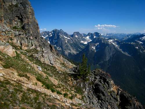
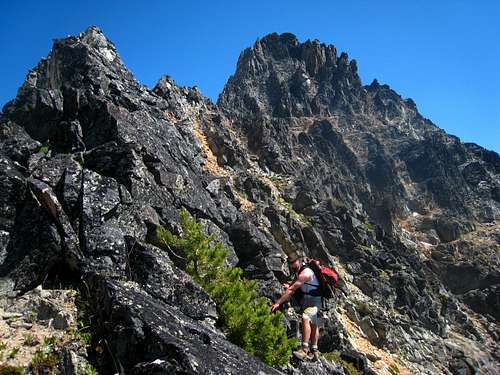
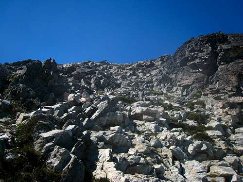
From Ragged Ridge Camp (See approach 1 above), ascend 200 feet to the small saddle immediately west of the 6,870 foot knob directly above camp. From here the going gets tougher. Ascend northwest to the 7,400 foot bench on the prominent ridge descending from the Katsuk Peaks' western summit. This 600 foot ascent involves tedious scree and a little 4th class scrambling for the final 100 feet to the bench. There are many ways to finish the final section whether up one of the gullies or ribs but I thought this was one of the cruxes of the climb. Now begins a very long traverse around the 7,500 contour. Traverse numerous ribs and gullies for about a mile until you reach a very wide talus filled gully dropping from near the saddle between Kimtah and Katsuk near the Grotesque Gendarmes. Immediately across this gully you will reach a prominent buttress where the gendarnes become visible just to the north and a large cliff below you. Negotiating this cliff is the crux of the traverse.
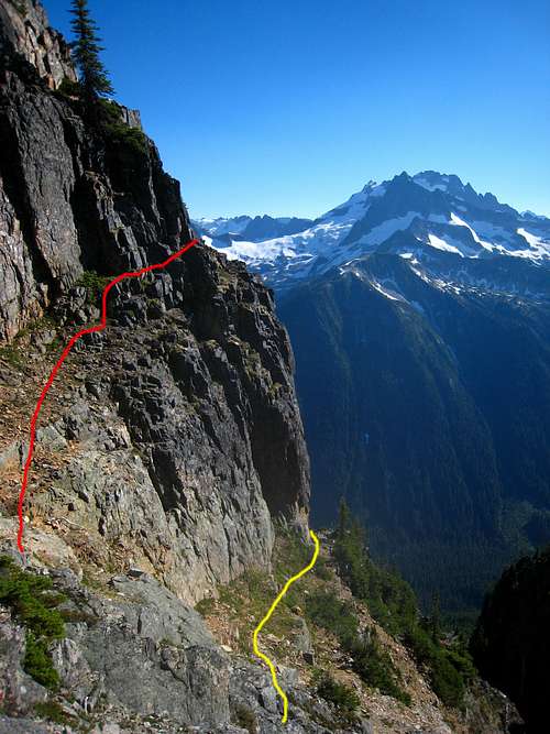
Descend about 150 feet down the buttress (Class 2+), locate a narrow gully and descend loose scree another 50 feet and round a corner to the right. Next locate a nice ledge leading to the talus below the cliff. This ledge can be used but a very airy step midway across looked very dangerous with killer exposure. Another option is to continue another 50 feet down the gully, cross over a small rib and cross an easier ledge to reach easy talus. It's about a 250-300 foot descent from where you first hit the buttress above. This crux is certainly 4th class (with exposure) regardless of the option you choose. Below is a photo showing the two ledge options seen from the return. These ledges cannot be seen going towards Cosho and must be found.
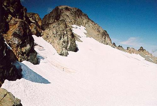
Once past, the terrain becomes easier once again. Make a slight ascending traverse to get back to the 7,200-7,300 foot contour and continue another mile past steep buttresses and gullies to meet the broad slopes just south of the Kimtah/Cosho saddle. Once south of the saddle, ascend 500 feet on loose talus to the 7,830 foot saddle. You will notice the southeast face of "Thieves Peak" directly above. Once at this saddle, grab your ice axe and hop onto the snowfield on the north side and ascend moderate snow northwest to 8,100 feet. Where the snow ends, climb 3rd class rock a couple hundred feet on the upper east face of the peak until reaching the summit. This final scramble is mostly on solid rock. Most people climb Kimtah and Cosho together however and ascend the south gully route on Kimtah and then make the 3rd class traverse down to the connecting saddle. Cairns mark this traverse. On the return back to Ragged Ridge Camp, the lower traverse can be made so you don't have to re-climb Kimtah.
Fisher Creek Trail/South Gullies/East Face Finish
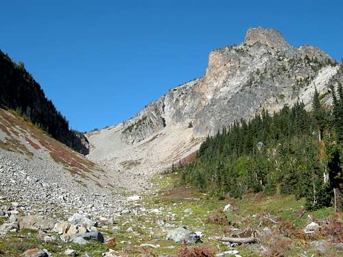
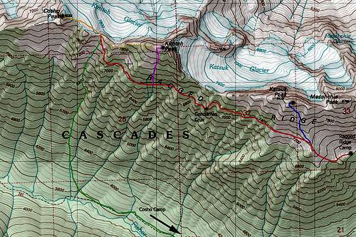
From Cosho camp using approach 2 above, continue west down the trail for 1 more mile and leave the trail at one of the gullies due south of the Cosho/Kimtah saddle. Begin ascending at 3,800 feet and hike up steep talus, grass and some solid rock for 4,000 feet to the 7,830 foot saddle. Some bushwhacking through trees and brush is required the first thousand feet. Once at the saddle, pick up the standard upper east face route shown in orange in the map below. Make sure you ascend the correct gully that takes you to the saddle and not the gullies just to the east which end on the west ridge of Kimtah.
Maps
Summit View

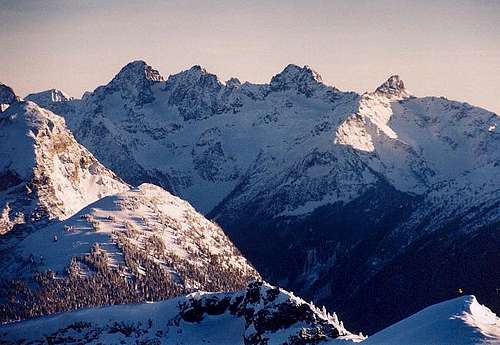
Cosho Peak Summit Panorama - From L to R - Goode, Storm King, Logan, Buckner, Boston, Forbidden and Eldorado
When to Climb
Katsuk Peak can be climbed any time of year however virtually no one climbs it when Highway 20 is closed for the winter. So it's best to climb when the road is open, typically between late April and late October or early November. I am sure the traverse to camp and the scramble up the gully would be very tedious under a fresh dusting of snow or if wet from recent rain. Consider going in good weather when everything is dry.
Camping/Red Tape
This peak lies within the North Cascades National Park therefore a free backcountry camping permit is required. Leave no trace of your visit and camp on durable surfaces. The best place to camp is in the 6,600 foot basin south of Mesahchie.


