
|
|
Mountain/Rock |
|---|---|
|
|
38.63303°N / 106.33304°W |
|
|
Chaffee |
|
|
Mountaineering |
|
|
Summer |
|
|
13070 ft / 3984 m |
|
|
Overview
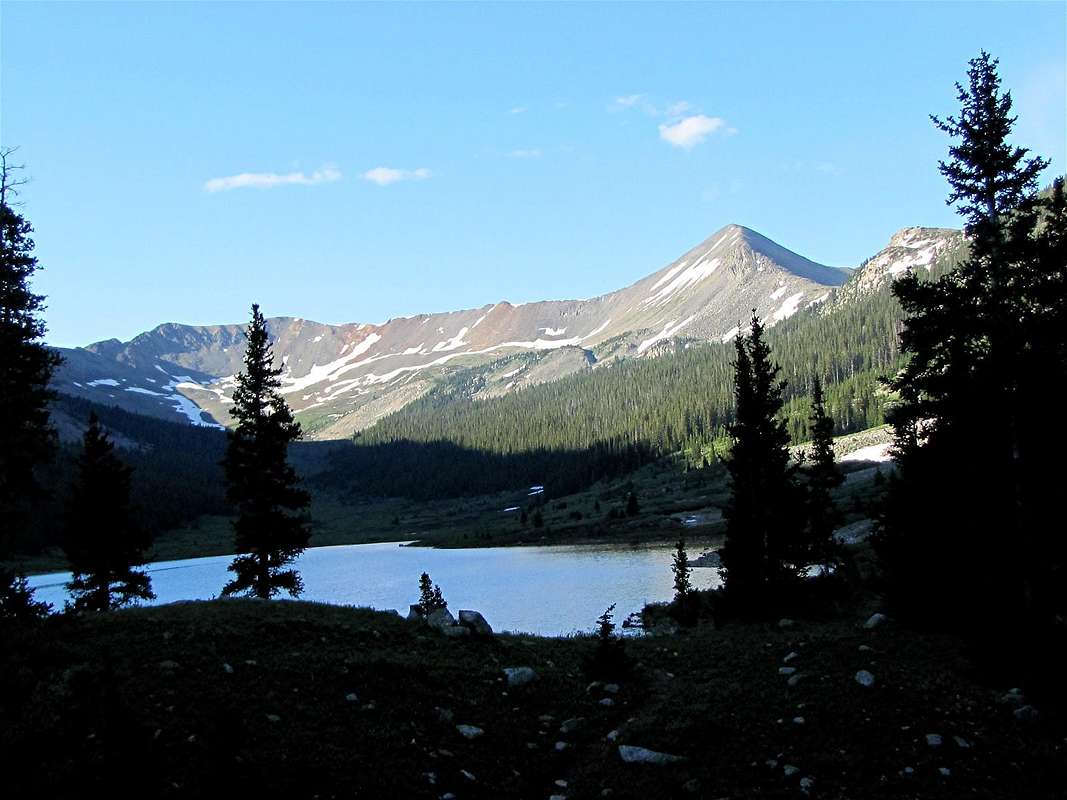
Peak 13070 ft & Grizzly Lake, NE Face
Rank: Peak 13070 ft is Colorado’s 595th highest ranked peak.

Peak 13070 ft & Pomeroy Mtn
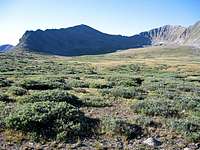
Peak 13070 ft & Pomeroy Mtn
Peak 13070 ft rises in the Sawatch Mountains of central Colorado near the ghost town of St. Elmo in Chalk Creek Valley. Peak 13070 ft is connected to the following peaks:
-Pomeroy Mountain to the southwest
-Chrysolite Mountain to the north
-Grizzly Mountain (indirectly) to the east
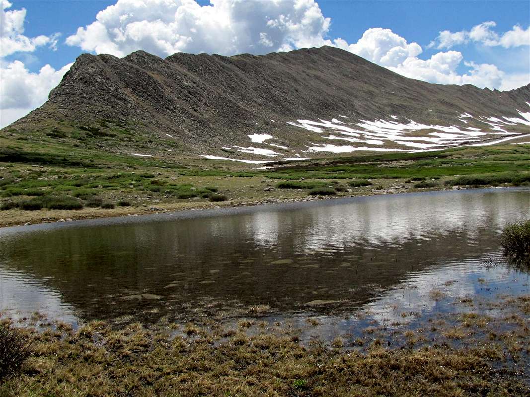
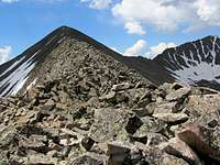
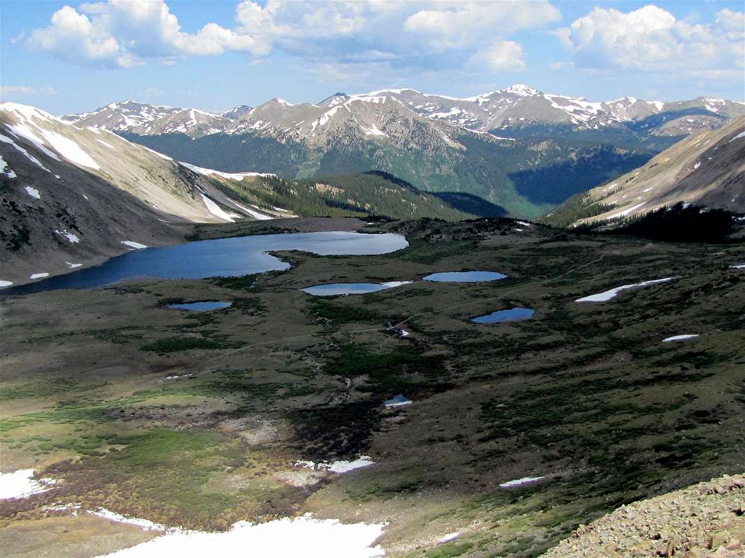
The beautiful Pomeroy Basin sits to the west and northwest of Peak 13070 ft. This basin houses the Upper and Lower Pomeroy Lakes (12250 ft & 12020 ft) plus a number of smaller ponds. A four wheel drive road starts in Chalk Creek Valley and goes up to end at a spot near the Lower Pomeroy Lake. From the end of the road, Peak 13070 ft can be climbed via its boulder covered northern ridgeline or western slopes.
An equally beautiful basin that houses the 11180 ft high Grizzly Lake (plus the smaller nameless Lake 12100 ft) sits to the east and northeast of Peak 13070 ft. A different four wheel drive road goes from Chalk Creek Valley to end at Grizzly Lake. From the lake, I was able to reach the summit of Peak 13070 ft but this required much bushwhacking (see Route page for details). I chose to descend via Pomeroy Basin.
Peak 13070 from near Lower Pomeroy Lake, NW face
 Peak 13070 ft & Pomeroy Mtn | 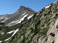 NE Face of Peak 13070 ft |  NE Face of Peak 13070 ft |
Getting There
 Peak 13078 ft & Grizzly Lake |  Bushwhacking | 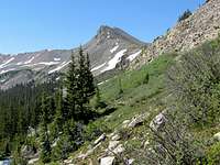 Bushwhacking |
Directions to Mary Murphy Mine/Pomeroy Lakes Road
From the town of Buena Vista drive 8 miles south on Route 285 to a place known as Nathrop and then turn west onto Route 162. Drive this road 15.3 miles to just before the ghost town of St. Elmo (the first 10 miles are paved and the rest is a well graded dirt road).
Turn left onto Route 295. This road is rougher but is still passable by most/any car (I prefer a high clearance SUV or similar vehicle). Continue 2.7 miles until you see a detour around an old decaying railroad bridge. Right after the detour, you will see a sign for the road to Mary Murphy Mine (& Pomeroy Lakes). This is your trailhead. Be ware that the detour around the railroad bridge is quite steep and rough and will probably require a four wheel drive vehicle. Without 4WD, you can start your hike just before the detour (only a few hundred feet longer).
Directions to the Grizzly Lake Road
From the town of Buena Vista drive 8 miles south on Route 285 to a place known as Nathrop and then turn west onto Route 162. Drive this road 15.3 miles to just before the ghost town of St. Elmo (the first 10 miles are paved and the rest is a well graded dirt road).
Just before turning left onto Forest Road 295 (to the ghost town of Hancock), you will see a parking area. If you plan to hike the Grizzly Lake Road, you must park here. To reach the Grizzly lake Road, hike onto Forest Road 295. The first road on the left goes to private property. The second left is Grizzly Lake Road. Distance from parking area is 0.40 miles.
Lower Pomeroy Lake
Red Tape
No fees or permits for day hikes. For other regulations, see the site for San Isabel National Forest.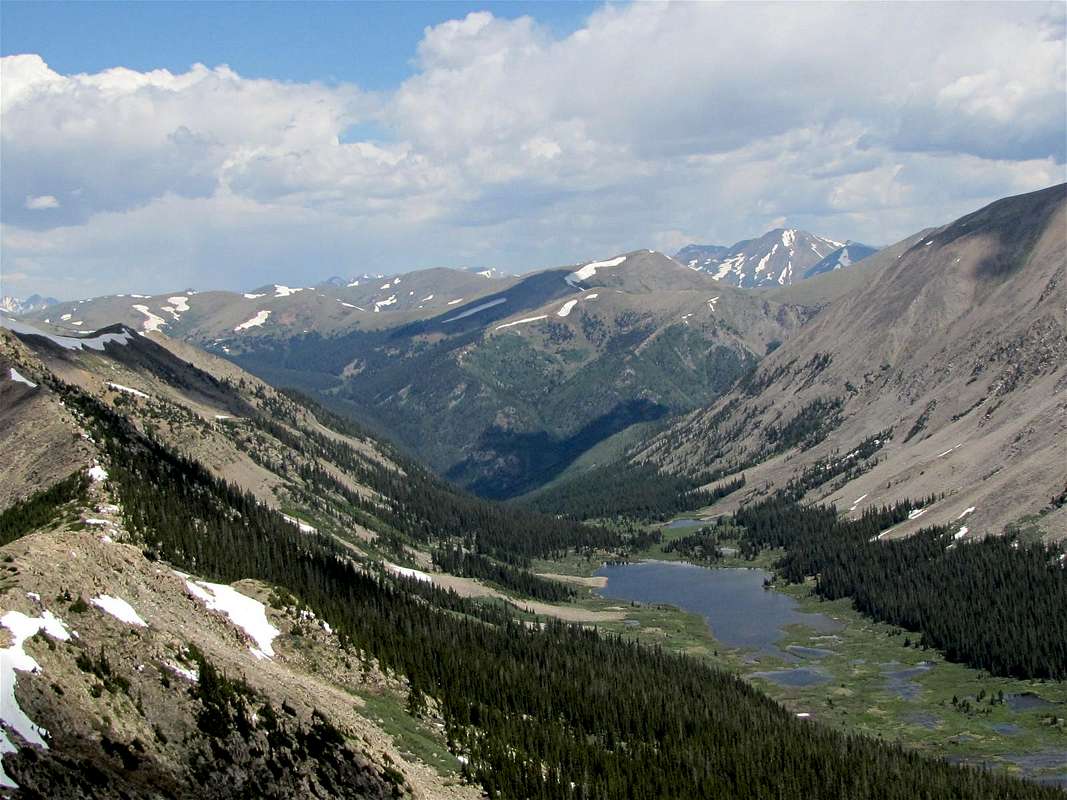
Grizzly Lake & Mt. Yale
Weather Forecast
See the forecast for the nearby town of Buena Vista.
Lake 12100 ft
External Links
Read about Driving Mary Murphy/Pomeroy Lakes Jeep Trail.Read about Driving Grizzly Lake Jeep Trail.

Upper Pomeroy Lake & Pomeroy Mountain