
-
 16589 Hits
-
 80.49% Score
-
 12 Votes
|
|
Mountain/Rock |
|---|---|
|
|
39.03070°N / 106.595°W |
|
|
Chaffee & Pitkin |
|
|
Hiking, Mountaineering, Scrambling |
|
|
Summer |
|
|
13780 ft / 4200 m |
|
|
Sawatch Range Overview
The Sawatch Range is referred to as the backbone of the continent. It runs 100 miles south from I-70 to Cochetopa Pass. Only three paved roads cross the range: CO 82, US 50 and CO 114. The Sawatch Range is usually divided into three regions: northern, central and southern. The Northern Sawatch is the smallest and receives the greatest amount of snowfall. The Sawatch Range is home to 129 peaks above thirteen thousand feet.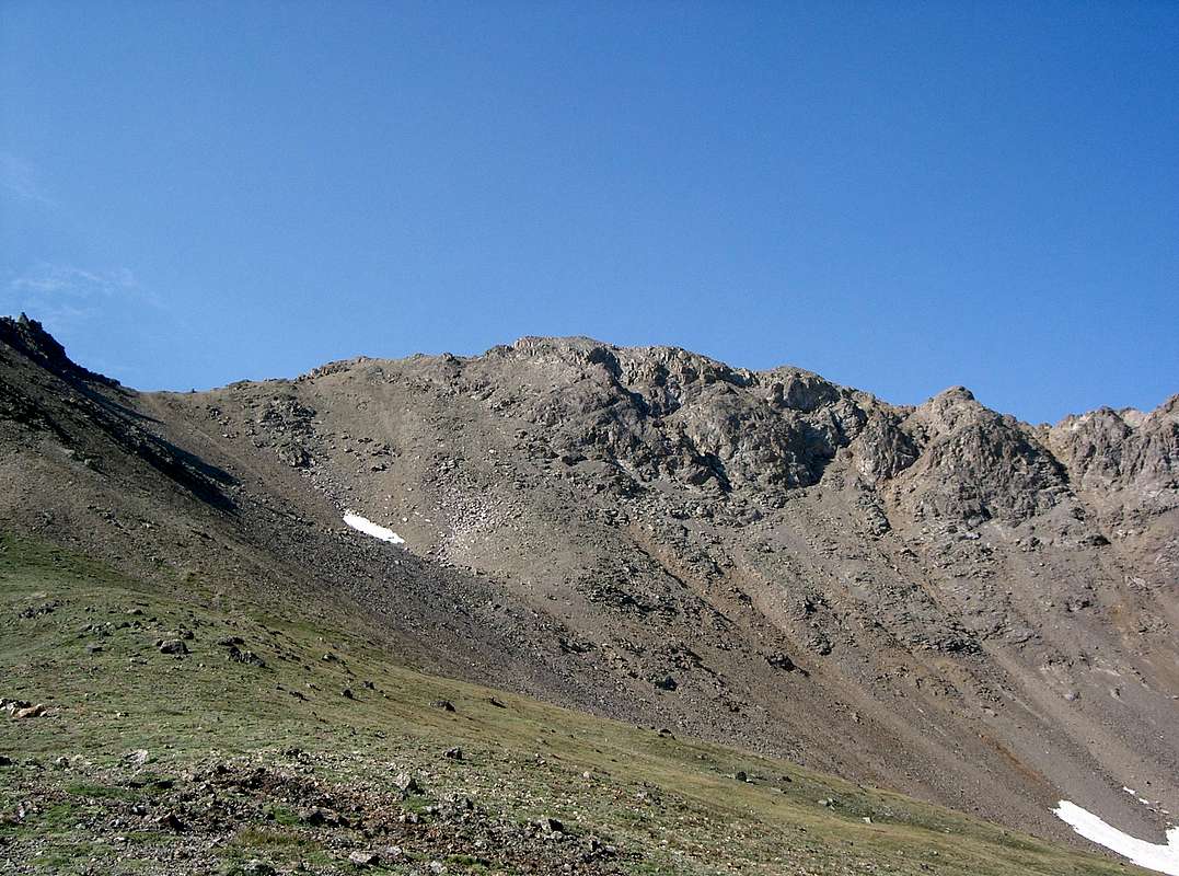
Garfield Peak from McNasser Gulch
Garfield Peak A Overview
Garfield Peak lies 0.8 miles south of centennial thirteener Grizzly Peak, the highest ranked thirteener in the state of Colorado. Garfield Peak is the 63rd highest thirteener in Colorado, 116th highest peak in the state of Colorado and the 147th highest peak in the contiguous United States. Garfield is the 10th highest peak located on the Continental Divide in Colorado and the 11th highest peak located on the Continental Divide in the United States. Due to Garfield Peak’s proximity to Grizzly Peak, they are commonly climbed together by an easy, but aesthetic ridge traverse.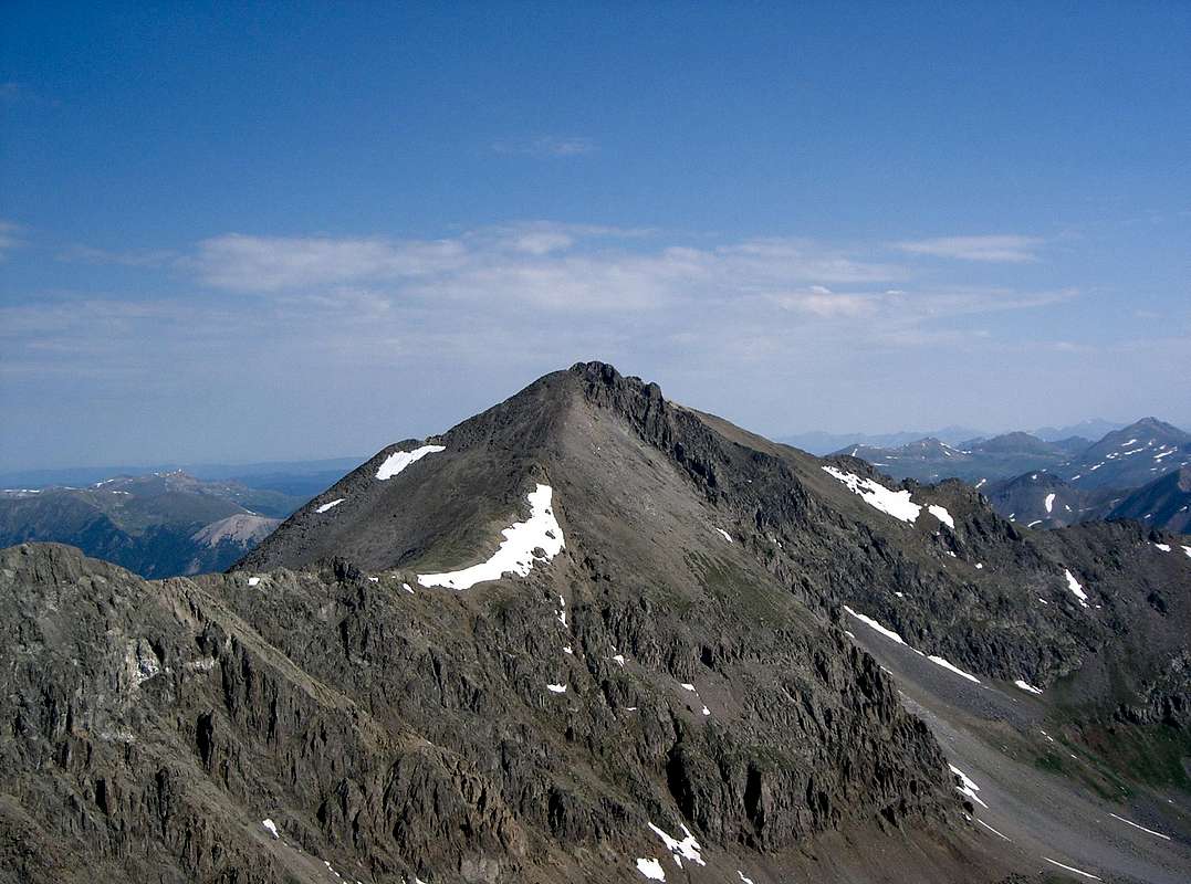
Grizzly Peak from Garfield Peak
Getting There
Garfield Peak is easiest accessed via McNasser Gulch. To reach the McNasser Gulch Trailhead, travel 14.5 miles west on Colorado 82 from US 24 or 9.2 miles east from Independence Pass. Turn south onto South Fork Lake Creek Road (FS 371). Go straight at 2.7 miles. The roadhead (FS 394) is at 3.3 miles and 10,740'. High clearance vehicles can travel up FS 394 an additional 1.2 miles to road closure at 11,360'.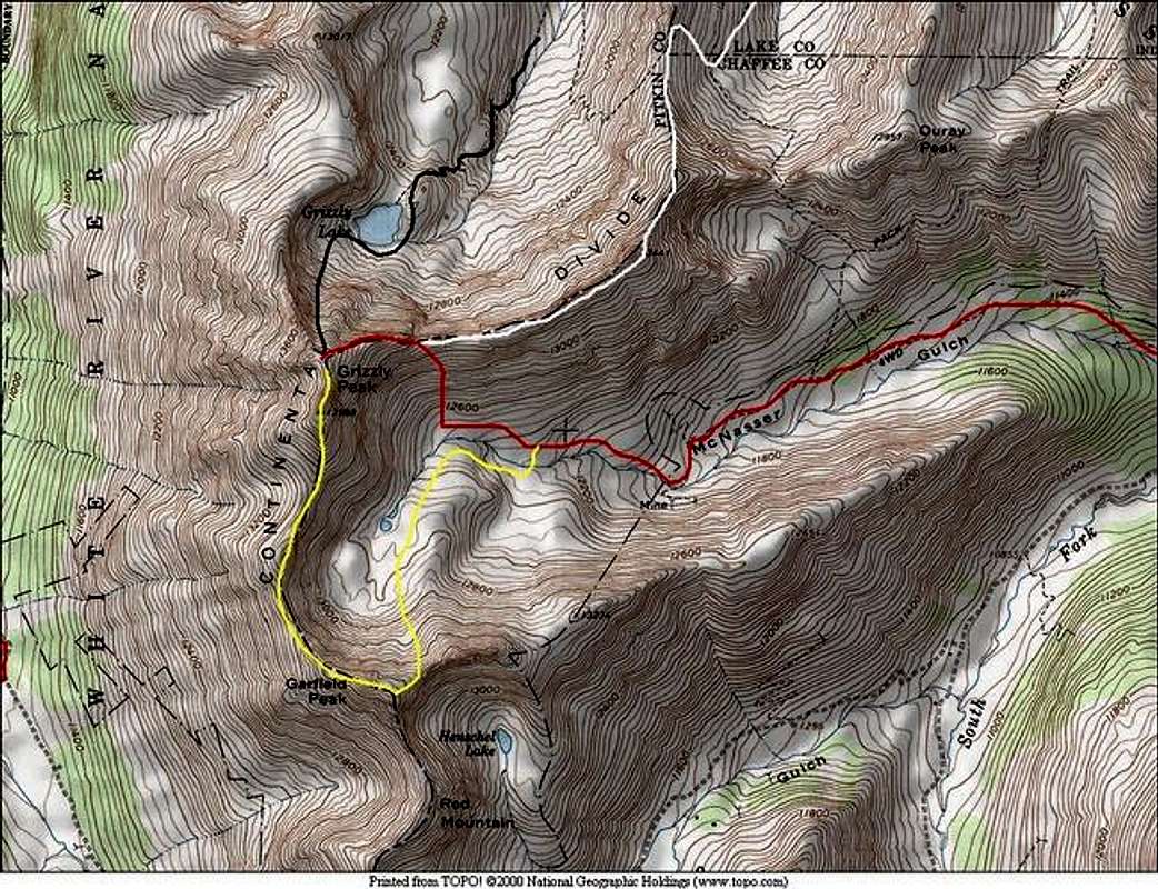
Garfield Peak’s East Ridge and Traverse to Grizzly Peak shown in yellow. Map: Kane
The easiest way to climb Garfield from McNasser Gulch is by its east ridge. The route page also describes the traverse from Garfield Peak to Grizzly Peak. This traverse has been described in the literature both from south to north (1) and north to south (2).
Red Tape
Garfield Peak is in the San Isabel National Forest.Leadville Ranger District
2015 North Poplar - Leadville, CO - 80461
Phone (719) 486-0749
Fax (719) 486-0928
Camping
Camp at the trailhead.External Links
Lists of JohnReferences
1. Colorado's Thirteeners: 13,800 to 13,999 Feet, From Hikes to Climbs2. Colorado's High Thirteeners: A Climbing & Hiking Guide