|
|
Mountain/Rock |
|---|---|
|
|
38.66658°N / 106.34493°W |
|
|
Chaffee |
|
|
Mountaineering |
|
|
Summer |
|
|
12822 ft / 3908 m |
|
|
Overview
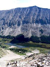
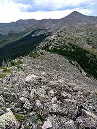
Chrysolite Mountain rises on the south side of the Chalk Creek Valley in the Sawatch Mountains of central Colorado. To the north, the steep scree covered slopes of Chrysolite drop more than 2500 vertical feet to reach the Chalk Creek. To the east and west, steep scree slopes go down to Grizzly Lake (11200 ft) and Pomeroy Gulch respectively. To the south, Chrysolite has a long and gentle boulder covered ridgeline that give rise to many false summits. This ridgeline slowly descends to a minimum of 12100 ft before it ascends again to create Peak 13070 ft (to the northeast of the 13151 ft Pomeroy Peak).
The word “Chrysolite” refers to a precious mineral (see link below). Evidence of late 19th and early 20th century mining can be found around Chrysolite Mountain, however, it appears that precious metals (and not chrysolte) were mined. The most notable of these mines is the Mary Murphy Mine (see link below) on the western slopes of Chrysolite Mountain. Today, visitors can see the decaying remains of the buildings and an aerial tramway used to transfer the minerals from the mine.
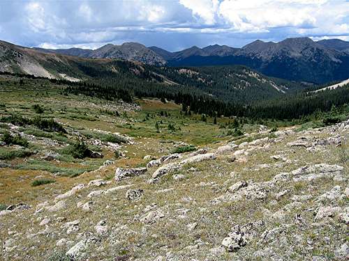
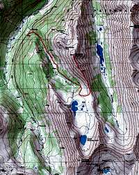
Chrysolite Mountain can probably be climbed by hiking up a Jeep Trail on the north side of the mountain that goes to the Iron Chest Mine (see link below). A more scenic option is to follow a Jeep Trail from the bottom of the Chalk Creek Valley to reach a huge alpine basin at around 12000 ft. This beautiful basin houses the Pomeroy Lakes and sits at the base of Pomeroy Mountain and Peak 13070 ft. From the basin, you will gain the gentle southern ridgeline of Chrysolite. Fun boulder hoping will get you past the false summits and to the top of Chrysolite Mountain.
Dwarfed Pine Trees:
On the nadir of the ridgeline between Chrysolite Mountain and Peak 13070 ft, at an elevation of 12100-12300 ft, you will find a beautiful forest of dwarfed and odd shaped pine trees clinging to life among the boulders. From the ridgeline, you can see Grizzly Lake on one side and the Pomeroy Lakes on the other.
Weather
See the forecast for the town of Buena Vista, CO.External Links
Read about chrysolite stone.Read about Mary Murphy Mine.
Read about Mary Murphy/Pomeroy Lakes Jeep Trail.
Read about Iron Chest Mine Jeep Trail.


Eleutheros - Sep 18, 2007 4:37 am - Hasn't voted
"Sawatch", not "Wasatch"Hi Nader. Just thought I'd point out that you stated the mountain is in the "wasatch mountains of central colorado" in your opening paragraph. Best, E
nader - Sep 18, 2007 9:27 am - Hasn't voted
Re:Thanks for bringing it to my attention. Corrected.