-
 32229 Hits
-
 86.37% Score
-
 22 Votes
|
|
Mountain/Rock |
|---|---|
|
|
45.86540°N / 6.89680°E |
|
|
Alta Savoia |
|
|
Mountaineering, Trad Climbing |
|
|
Summer |
|
|
11853 ft / 3613 m |
|
|
Overview
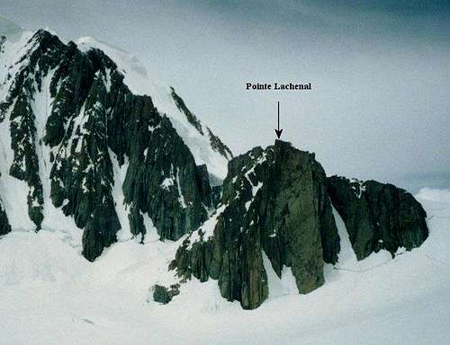
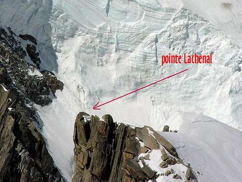
Pointe Lachenal 3671 m
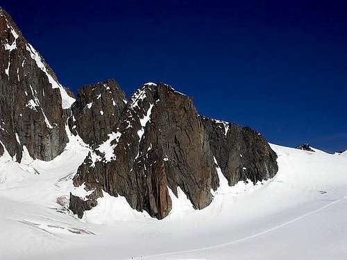
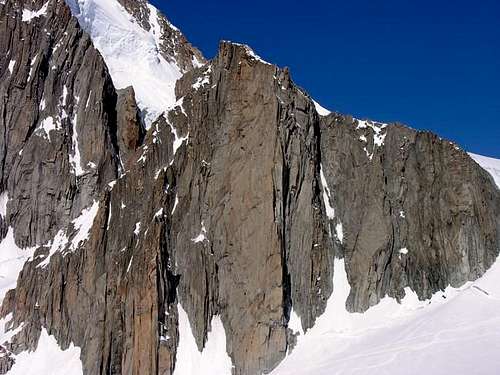
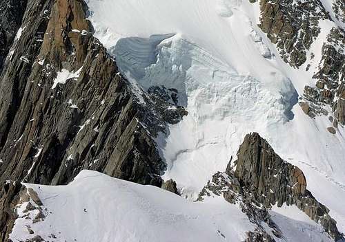
Pointe Lachenal 3671 m is a fine granite rock tower located in the Mont Blanc massif, offering a offering a wide range of wonderful rock climbing routes from UIAA V+ to VII+ and upwards, on the magnificent granite of its SE face, in a superb alpine setting next to Mt. Blanc du Tacul, above the Glacier du Geant. Easily accessible from the Aiguille du Midi cable car, it also offers a short Normal route on a glacier and a ridge crossing on mixed terrain, perfect for one-day round trips up high for acclimatization.
History
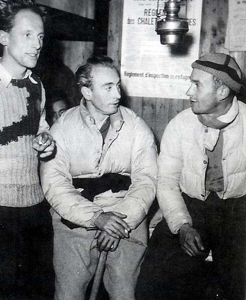
This peak was named in honor of the famous alpinist and alpine guide Louis Lachenal (1921 - 1955). Born in Annecy, after the World War II he became a guide and ski instructor in Chamonix. With the great Lionel Terray he formed a formidable and legendary party, very fast and able to face the greatest alpine itineraries of the moment: North of the Eiger, North of the Grandes Jorasses, NE of Pizzo Badile, Via Cassin.
In 1950 he took part in the French expedition to the Annapurna; together with Maurice Herzog he was the first man to reach the summit of a 8000s, but the tribute that he had to pay was very heavy: ample and widespread freezing at the hands and above all the heels that were partially amputated. He was awarded the Knight's Cross of the Legion of Honor. After 3 years of calvary, he succeeded with great effort of will to resume the work of Alpine guide and ski instructor. In 1955, 27th November, Louis Lachenal died on the Glacier du Géant disappearing on skis inside a crevasse.
Getting There
The closest starting point to approach Pointe Lachenal is the town of Chamonix, where to get the departure point of the Aiguille du Midi cable car.
Road access to Chamonix
From Switzerland
- Starting from Martigny: follow the road getting to the Switzerland – France border, pass the border, getting to the village of Argentière (37 km. from Martigny, 5 km. from the border), then Chamonix.
- Starting from Geneve: follow the E25 Motorway to St. Gervais les Bains, then the RN 205 to Chamonix
From Italy
- From Aosta follow the E25 Motorway to Courmayeur, then enter the Mont Blanc Tunnel, getting to Chamonix (65 km. from Aosta) Walking approach from Aiguille du Midi From the Aiguille du Midi telepherique upper station descend to the Col du Midi, cross the Col and descend the small slope between the Gros Rognon and Pointe Lachnal then make your way towards the SE face. One hour in descent from Aiguille du Midi; one and a half hours for the ascent back to Aiguille du Midi Station.
Another starting point is the town of Courmayeur (italian side). This approach is considerably longer, but allows you to reach the mountain directly from Italy.
From Courmayeur take the cable car La Palud-Punta Helbronner. We start to walk on the glacier, following the track that is normally well traced and obvious. The itinerary involves a difference in height (uphill) of about 200 meters. The trajectory of the track, fairly straight, undergoes some small changes year after year, depending on the crevasses, especially in the middle of the crosswalk. We arrive near the Aiguille du Midi.
Normal route to the three summits
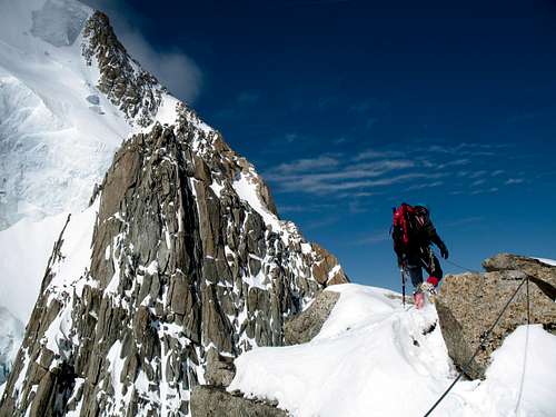
An easy and short ascent in a spectacular environment, useful as an acclimatization climb or an alternative in case of bad conditions of the other climbs of the district. Slopes on moderate ice, at most and only for a short distance around 50°, otherwise 40°. The views are as said really spectacular on the surrounding glaciers and on the surrounding peaks.
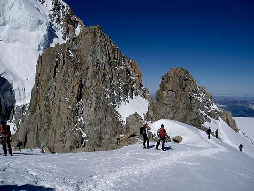
Route report
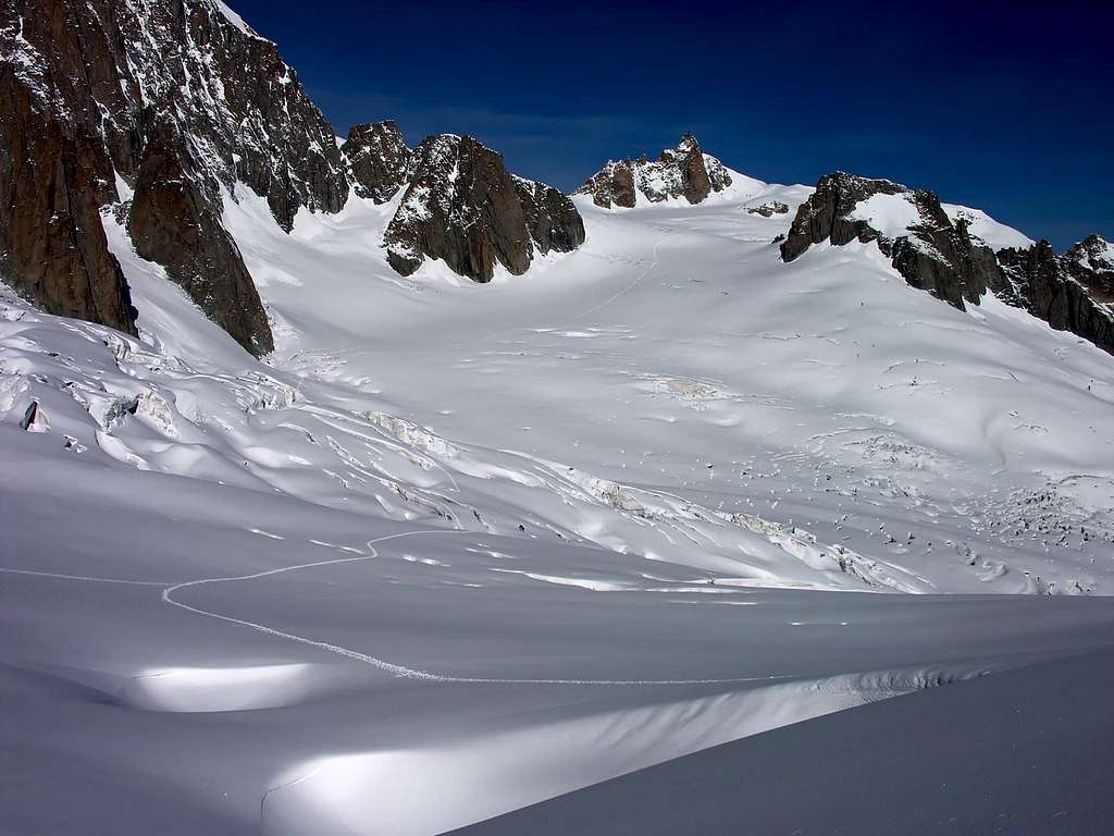
From the tunnel that leads to the outside of the Aiguille du Midi station, go down the snowy ridge first slightly steep and then, towards the hill below, less sloping. to the right to reach the glacial basin below the east face of the Aguille du Midi. You walk slightly downhill towards the Mont Blanc du Tacul; abandoned the track that rises towards it bends to the left passing at a distance from its large rocky triangle pointing towards the three points to climb. You pass under the tips and climb the slope (45 °) to the left to reach the snow-capped peak east (3626 m) from which you follow the easy ridge to the right coming under the rocks of the central point; now the easy rocks (II) can be climbed on mixed terrain for about twenty meters, thus arriving at the eastern tip (3633 m).
After descending the latter, follow the path back down to the base of the slope from which you can still retrace the traces of approach for a short distance and, choosing the best point, cross to the left passing under the western tip. Once you reach the base of the slope, you climb it (35/40 °), arriving at the end of the ridge that runs a few meters to the left, thus touching the west tip (3671 m), the highest.
Rock climbing routes overview
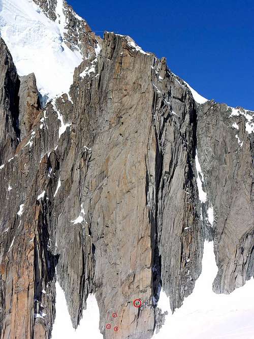
Here is a small list of the more than 25 listed routes on Pointe Lachenal:
Contamine UIAA VII+ if 50 meter crack is free-climbed; aided the UIAA rating drops to a V/V+; 250 meters
Harold et Maude UIAA VII+ 250 meters
Marylène UIAA V+/VI- 220 meters
Red Tape
No particulary restrictions in climbing and mountaineering.
Leaving the tent up on the glacier after sunrise is offically prohibited. The reason for this is largely an attempt to reduce the environmental impact on the area but also to make the landing of helicopters (in the case of rescues) safer and easier for all involved.
When to climb
These routes are best climbable in summer. If you have the necessary equipment to cross the Glacier du Geant in early spring and late winter, they are also supposed to be quite climbable during these periods, if the rock is dry.
Huts
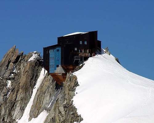
Refuge des Cosmiques 3613 m – 143 beds. Winter-hut (12 beds) Situation: Mont Blanc group, Col du Midi Owner: Company guides of chamonix Open: from 01/03 to 01/10/2018 Size: 143 persons + 12 in the winter-shelter
Abri Simond near the refuge
Getting there: from Aiguille du Midi cable-car upper station; Phone +33450544016 It is also possible to bivy also in the Abrì Perroux, a wooden hut perched on the rocky spur under the Cosmiques shelter. Otherwise bivy on the Col du Midi in a tent. Perfectly legal
Camping in Chamonix
CHAMONIX >>L'ile Des Barrats 185 Chemin de I'ile des Barrats 04 5053 5144 Open from 8/5-1/10 53 sites 3 star
>>Les Rosieres 121 clos des Rosieres 04 5053 1042 open from 7/2 - 30/9 127 sites 3 star
>>Les Arolles 281 chemin du Cry 04 5053 1430 15/6 - 30/9 30 sites 2 stars
>>Les Molliasses Chemin a Batiorert 04 5053 1681 open 1/6 - 15/9 164 sites 2 stars
LES PRAZ
La Mer De Glace 200 Chemin de la Bagna 04 5053 0863 or 04 5053 4403 www.chamonix-camping.com open 10/6 - 15/9 150 sites 3 stars
LES BOIS
Les Drus BP 30 04 50 53 4920 open 28/3 - 30/9 70 sites 2 stars
ARGENTIERE
>>Glacier d' Argentiere 58 Chemin des Moillettes 04 5054 1736 or 04 5054 0373 open 15/5 - 30/9 80 sites 2 stars
LES BOSSONS
>>Les Deux Glaciers 80 rte des Tissieres 04 5053 1584 open 15/12 - 15/11 135 sites 3 stars
>>Les Marmottes 140 Chemin des Doux 04 5053 6124 www.camping-lesmarmottes.com open 15/6 - 30/9 100 sites 3 stars
>>Les Cimes 28 route des Tissieres 04 5053 5893 http://www.campinglescimesmont... open 1/6 - 30/9 100 sites 2 stars
>> Les Ecureuils Chemin des Doux 04 5053 8311 open 1/4 - 30/9 45 sites 2 stars
>>Les Verneys 180 route des Tissieres 04 5053 1584 open 1/6 - 15/9 70 sites 2 stars
>> Le Grand Champ 04 5053 0483 open 1/5 - 10/10 100 sites 1 star
Useful information
Office du Tourisme de Chamonix - Phone +33 0450 530024
Office de la Haute Montagne de Chamonix - Phone +33 0450 532208
Compagnie du MontBlanc Cable-car informations Phone +33 0450 532275
Meteo
Guidebooks and maps
"Monte Bianco" vol. 2 - Guida Vallot
Map
3630 OT (Chamonix) - Institut Géographique National - 1:25000
SP Links
For full info about Chamonix, see the Mont Blanc Group page on SP.


