
-
 2858 Hits
-
 78.27% Score
-
 9 Votes
|
|
Mountain/Rock |
|---|---|
|
|
41.16510°N / 105.37702°W |
|
|
Hiking, Trad Climbing, Scrambling |
|
|
Spring, Summer, Fall |
|
|
8460 ft / 2579 m |
|
|
Overview
Glen Dome is one of the smaller formations in Central Vedauwoo but one of the easiest to locate with just a description but no pictures (this page has both, though). Its summit has excellent views in all directions.
One can attain the summit in one of four ways. There are three trad routes, and there is a hiking/scrambling route on the northeast side. Thus, climbers can make a nice outing by ascending one of the technical routes and then walking off. Not many people seem to climb here; the two harder routes have poor protection and the easiest one appears to be largely ignored because there are longer routes at the same grade located closer to parking lots.
All three technical routes are on the south face of Glen Dome.
- Glen's First Name (5.4)-- One pitch. Ascend an obvious crack on the left side of the face and then use one of a variety of options to top out.
- Water Streak (5.7 R)-- One pitch. Goes up the slab between two water streaks and then into a left-facing dihedral. Protection is bad until the dihedral.
- Chalking Nervously (5.6 X)-- I actually was not aware of this route until I started writing this page. See here for details. It is two pitches.
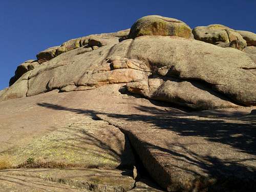
Glen Dome
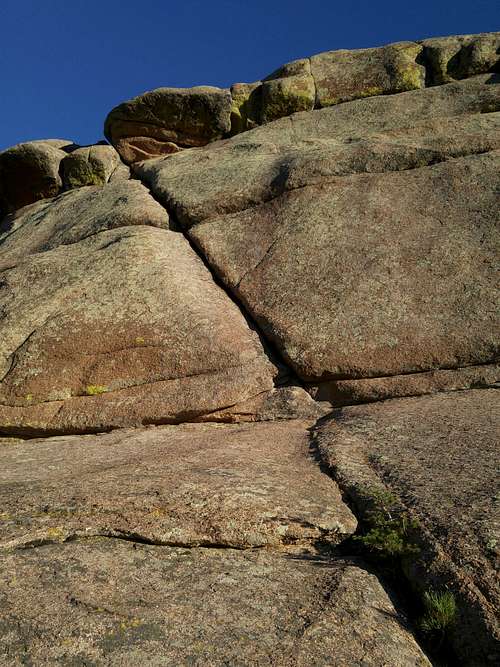 Glen's First Name (5.4) | 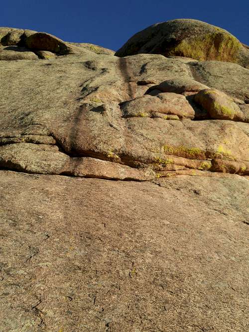 Water Streak (5.7 R) |
Getting There
From I-80 between Laramie and Cheyenne, leave the highway at Exit 329, marked for Vedauwoo. This is about 16 miles from Laramie. Take Vedauwoo Road east and drive 1.2 miles before turning left onto a well-signed road for the Vedauwoo Recreation Area. Stop at the self-pay station and then proceed. Signs point you to the campground, picnic areas, and trailheads. The trailhead to use for accessing this crags is Box Canyon.
Hike up the trail. Glen Dome comes into plain view to the north quite soon. Follow the trail and then hike to the base.
Vedauwoo Road is usually clear of snow by May and sometimes as early as April.
The hike in takes 10-15 minutes.
Red Tape
The self-pay fee was, I think, in September 2016, $5 per vehicle per day. Passes are accepted.When to Climb
May through October are best.Camping
There is a 28-site campground in the recreation area. It is first-come, first-served and fills quickly on weekends in good weather. Vault toilets and drinking water are available, though in July 2014 the water wasn't flowing or I was just at the wrong pump. The camping fee was $10 per night in July 2014. Closed during the winter, the campground is usually open by the beginning of June.There is a lot of dispersed camping available nearby, with some restrictions (for example, postings prohibit camping too close to the turnoff for the recreation area).