
-
 6652 Hits
-
 81.18% Score
-
 13 Votes
|
|
Mountain/Rock |
|---|---|
|
|
41.16606°N / 105.37564°W |
|
|
Trad Climbing, Bouldering, Scrambling |
|
|
Spring, Summer, Fall |
|
|
8621 ft / 2628 m |
|
|
Overview
On USGS topo maps, Turtle Rock is the whole "massif" that is the centerpiece of Central Vedauwoo, and it makes sense that the trail circumnavigating it is called Turtle Rock Trail.
However, climbers recognize several of the crags of this complex by individual names, which adds some flavor to the area but, more importantly, helps with the sorting of routes.
The "real" Turtle Rock is the highest point of the complex, slightly higher than Old Easy.
A note about the elevation: Turtle Rock has an interpolated elevation of 8620'. So does Old Easy. Since Turtle Rock has been determined by sight level to be a little higher, I've put the elevation at 8621' so it properly lists on the parent page as the higher peak.
If you're going to climb at Vedauwoo, you should get Heel and Toe: The Climbs of Greater Vedauwoo, by Skip Harper and Rob Kelman. The Mountain Project page for Vedauwoo is free to use and has a lot of information, but unless you already know Vedauwoo or know exactly what you're looking for, it's hard to navigate. But the book, with all its photos and diagrams, really helps make sense of the area.
Another good source of information on the area is Vedauwoo.org. Also, try the Forest Service site, though it's not good for climbing information.
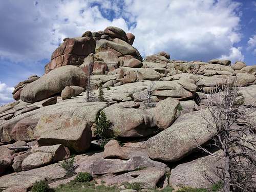
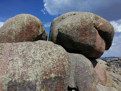
Vedauwoo is famed for its off-width cracks (and larger than that) and its rough granite. Just about any source on the area that you find will warn you to use tape or be prepared to bleed if you are doing technical climbs. Quite often, people recommend kneepads and/or long pants and sleeves as well.
Please add route pages or detailed information about the climbing routes on this peak!
Getting There
From I-80 between Laramie and Cheyenne, leave the highway at Exit 329, marked for Vedauwoo. This is about 16 miles from Laramie. Take Vedauwoo Road east and drive 1.2 miles before turning left onto a well-signed road for the Vedauwoo Recreation Area. Stop at the self-pay station and then proceed. Signs point you to the campground, picnic areas, and trailheads. The best trailhead to use for accessing the crags is Box Canyon.
Vedauwoo Road is usually clear of snow by May and sometimes as early as April.
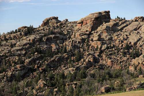
Turtle Rock and Hassler's Hatbox
Route Information
Approach
Head up the Box Canyon Trail. After a bridge, leave the trail and scramble up to the saddle between Turtle Rock and Friction Tower (the formation to the right), or hike a bit northeast and then clamber/scramble up the southwestern slopes of Turtle Rock.
Rock Climbing
Three climbing areas are at Turtle Rock. In order of distance from the trailhead, they are Land of the Rising Moon, Hypertension Cirque, and Heartbreak Hotel.
My edition of the Harper-Kelman guide, which is a 1998 printing, covers 8 routes at Rising Moon and 6 at Heartbreak Hotel. Most of them are trad routes. Difficulty levels range from 5.4 to 5.12c. It does not include Hypertension Cirque but has one of its climbs, Hypertension, listed with Heartbreak Hotel.
As of this page's creation date, the MP page linked to in the overview had 7 routes for Rising Moon, 3 for Hypertension Cirque, and 2 for Heartbreak Hotel.
 Land of the Rising Moon | 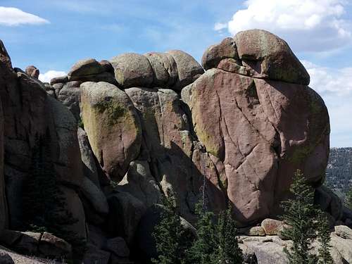 Hypertension Cirque |
Summit Boulder
If you're a peakbagger or a list-chaser, you'll likely be disappointed to know that Turtle Rock's summit boulder is definitely technical from all sides. My comfort level for free soloing hovers around 5.4, and the boulder, though only about 20' high, looks definitely harder than that. However, I am less comfortable with face climbing than I am with cracks, so it could be that the difficulty of this boulder is less than I think. But I don't really think so.
Someone signing the climbing log for this page posted a link to a Lists of John page that puts the highpoint at 5.9.
Elevation gain to the summit is about 400', and distance is no more than a mile.
Turtle Rock Summit Boulder
Red Tape
The self-pay fee was, I think, in July 2014, $5 per vehicle per day. Passes are accepted.
Camping
There is a 28-site campground in the recreation area. It is first-come, first-served and fills quickly on weekends in good weather. Vault toilets and drinking water are available, though in July 2014 the water wasn't flowing or I was just at the wrong pump. The camping fee was $10 per night in July 2014. Closed during the winter, the campground is usually open by the beginning of June.
There is a lot of dispersed camping available nearby, with some restrictions (for example, postings prohibit camping too close to the turnoff for the recreation area.
Brian Kalet - Sep 17, 2014 1:21 pm - Hasn't voted
ElevationTurtle Rock is higher than Old Easy; this was confirmed using a sight level. Also, Turtle Rock has an interpolated elevation of 8620'.
Bob Sihler - Sep 17, 2014 6:33 pm - Hasn't voted
Re: ElevationThanks, Brian. The map I was using for these pages makes it impossible to discern the 8600 contour on Turtle Rock, and the highest apparent one is the 8560. This was strange because from both peaks, I could have sworn Turtle Rock was slightly higher, and that was my impression from other points as well. Now I've checked a different map and see that TR does indeed have the 8600 line. I've got some editing to do now.