
|
|
Mountain/Rock |
|---|---|
|
|
46.45000°N / 13.44000°E |
|
|
6197 ft / 1889 m |
|
|
Overview
Geographical structure: Eastern Alps > Julian Alps > Vis and Montaz group.
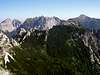
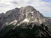
Iof di Sompdogna is the small mountain above the pass Rudni vrh (Sella di Sompdogna) and it connects the Montaz/Iof di Montasio (2753m) on the south side with the ridge on the north side where are the mountains: Iof di Miezegnot / Poldanasnja spica (2087m),
Monte Piper / Pipar (2069m) and Due Pizzi (2008m). It is not soo important mountain but it is very nice place with the amazing view on the whole Vis and Montaz group. Specially on the north face of Montaz. Iof di Sompdogna is properly the additional of the wild Zmajev (Dragoon) ridge that comes from the Montaz. The ridge goes on two parts on the mountain Krnicni turn/Torre Carniza (2041m). The first ridge goes to the left on the wild and hardly approachable tower Torre Alba (1772m). The second ridge goes on the Iof di Sompdogna.
Iof di Sopmdogna is the good goal for the short ascents. You can easily reach it from the pass Sella di Sompdogna ( 1286m) or from the hut Riffugio ili Grego (1389m). This two approaches goes on the top over the N slopes and both are marked. The second possibility is from the Val Saisera and then over the route that goes to the bivouac Stuparich (1578m) and then on the croosing you follow the route to the Iof di Sompdogna and you reach the top from the west side. This route is also marked.
In good Winter you could also ski from the top of Iof di Sompdogna on the pass Sella di Sompdogna.
 |  |  |  |
Getting There
The approach valley to the Western Julian Alps will probably be the highway through Val Canale (Udine - Tarvisio).
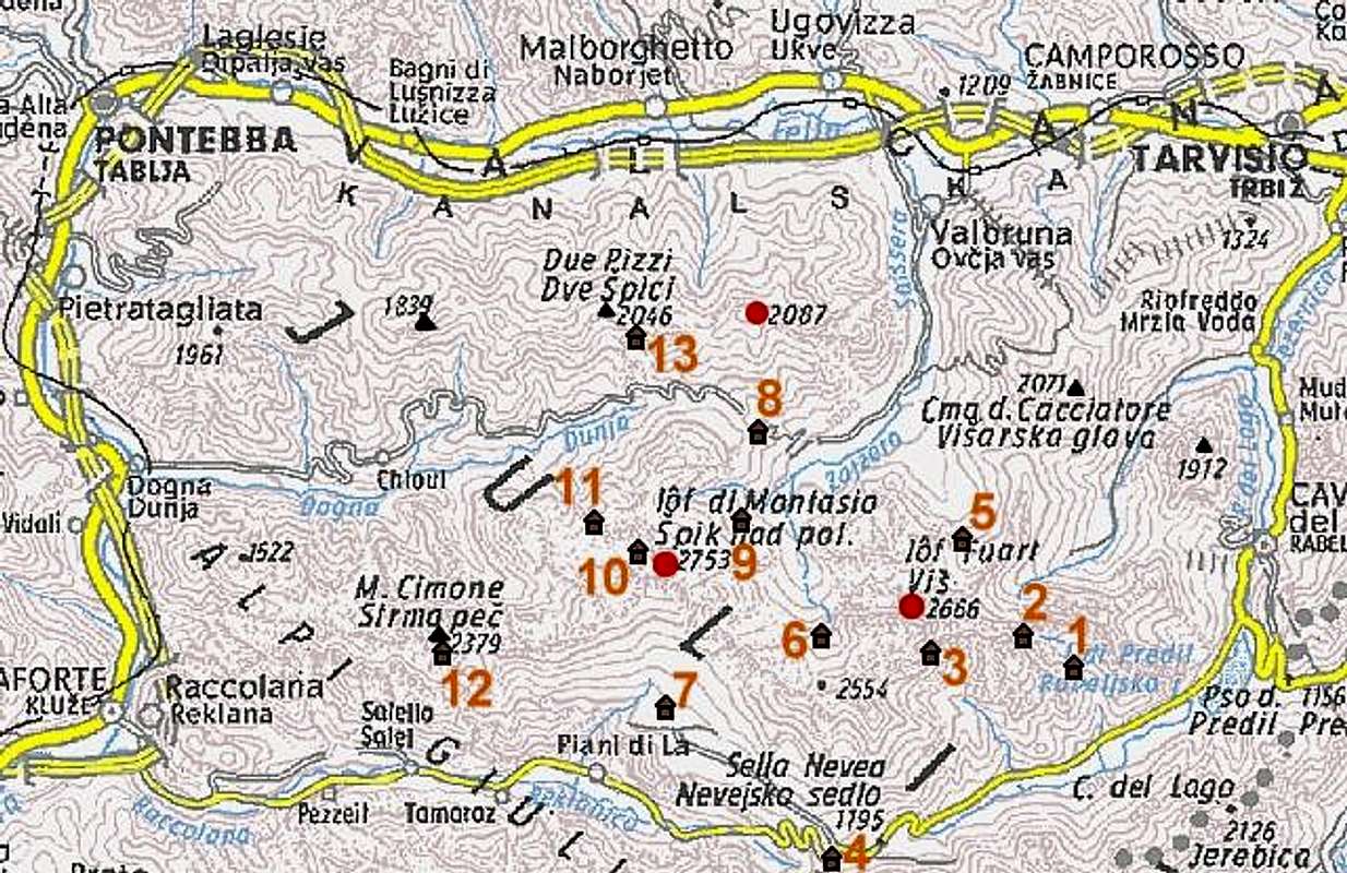
For the ascent you must deter from the highway in the village named Dogna and travel 18 km through the Dogna valley to Sella di Somdogna (Rudni vrh pass), 1398m. The other possibility is exiting the highway in Valbruna (5 km west of Tarvisio) and driving south into the Valbruna (Zajzera) valley. The road ends on an alpine meadow on the altitude of 1000 m, from where you reach Sella di Sompdogna in one hour.
Tarvisio can also be reached from east, from Slovenia (from the Sava valley or over the Predel (Predil) pass and of course also from north, from Austria (from Villach or from Gailtal over the Nassfeld Pass).
Maps:
 |  |
Routes overview
There are also some other possibilities that go over the hunting routes but I leave you that you discover them on yourself.
 |
Red Tape
No limitations or special permits.
When To Climb
We can ascend on Iof di Sompdogna in whole year. The best time is in Autumn when the days are shorter and the heat is not too powerful. For skiing be careful on avalanches. In snow time I suggest you the north approach.
 |
Camping
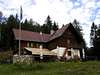
The summit can be climbed in one day. If you plan more days in these mountains, one possibility where to spend a night is Rif. Attillio Grego (parking place 400 m below it in Valbruna or on Sella di Somdogna, 1398m, 15 minutes away), 1398 m. It has 44 beds and a winter room with 4 beds. Tel.: 0428 60111.
Bivacco Carlo Stuparich (bivouac), 1587m on the south side, belo the north face of Iof di Montasio/Montaz.
In Val Canale there is a camping place near Tarvisio
 |